Majors Place, Nevada facts for kids
Quick facts for kids
Majors Place, Nevada
|
|
|---|---|
 |
|
| Etymology: Used to be known as Major Woods, named for the Major J. W. Woods, owner and operator. | |
| Country | United States |
| State | Nevada |
| County | White Pine |
| Elevation | 6,489 ft (1,978 m) |
| Time zone | UTC-8 (Pacific (PST)) |
| • Summer (DST) | UTC-7 (PDT) |
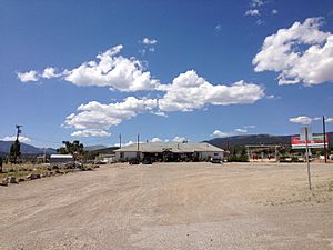
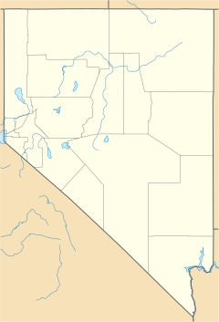
Majors Place is a small, undeveloped area in White Pine County, Nevada. It's known as an "unincorporated community." This means it's a place where people live, but it doesn't have its own local government like a city or town.
Contents
Where is Majors Place Located?
Majors Place is found where three important roads meet. These roads are U.S. Route 6, U.S. Route 50, and U.S. Route 93. This makes it a notable spot for travelers.
What Can You Find There?
Even though it's a small place, Majors Place has some services. You can find a restaurant and a bar there. It also offers two hotel rooms and an RV park for people traveling through.
A Look at the History of Majors Place
This area has had a few different names over the years.
Early Names of the Area
In 1933, the spot was called Connors Station. A few years later, in 1938, it was known as Conners Station. These names were used before it became Majors Place.
The Story Behind Connors Pass
Majors Place is located east of a place called Connors Pass. This pass was named after Colonel P.E. Connors. He was an important figure who helped set up Fort Ruby. Another spelling, Conners, might have come from a Mrs. Conners.
See also
 In Spanish: Majors Place (Nevada) para niños
 | Kyle Baker |
 | Joseph Yoakum |
 | Laura Wheeler Waring |
 | Henry Ossawa Tanner |


