Juab Valley facts for kids
Quick facts for kids Juab Valley |
|
|---|---|

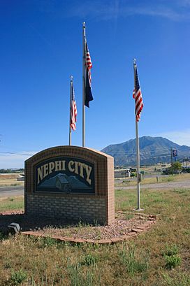
Eastern Juab Valley in southern Nephi, with Mount Nebo in the distance, June 2007
|
|
| Length | 40 mi (64 km) |
| Width | 6 mi (9.7 km) |
| Geography | |
| Location | Juab County, Utah |
| Communities |
List
|
| Borders on |
|
| Rivers | |
| Lakes | Sevier Bridge, Chicken Creek and Mona |
The Juab Valley is a long valley, about 40 miles (64 km) long, located in Juab County, Utah, United States. It sits on the eastern edge of the county.
Contents
Exploring Juab Valley's Location

This valley is in a part of Utah with many mountains and valleys. To the northeast, you'll find the Wasatch Range. The San Pitch Mountains are to the southeast.
The northern part of Juab Valley touches the southern edge of Utah Valley. It also borders Goshen Valley to the north-northwest. The valley stretches mostly from north to south.
The city of Nephi is located just north of the valley's center. To the far north, the valley is close to Santaquin. This town is nestled between three valleys: Utah Valley, Goshen Valley, and Juab Valley.
The valley's name comes from the local Native Americans. They were part of the Piute tribe, known as the Uabs, Yuabs, or Yoabs.
Waterways and Reservoirs in Juab Valley
Juab Valley has a special feature: a water divide that runs east to west, just north of Levan. This divide separates the valley's water flow.
Southern Valley Streams
Streams south of this divide flow into the Sevier River basin. While they don't flow directly into the Sevier River inside Juab Valley, they eventually reach it.
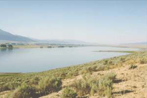
Chicken Creek starts in the San Pitch Mountains. It flows west, then turns southwest, and finally south. It empties into the northern part of the Chicken Creek Reservoir. This reservoir is on the western side of the valley.
After leaving the reservoir, Chicken Creek flows west out of the valley. Little Salt Creek also flows west from the San Pitch Mountains. It then goes northwest to join Chicken Creek Reservoir.
Northern Valley Streams
The northern part of Juab Valley has different streams. Currant Creek actually starts on the valley floor, not in the mountains. It flows north into the Mona Reservoir.
Before reaching Mona Reservoir, Currant Creek meets West Creek. West Creek flows north from the West Hills. After leaving the Mona Reservoir, Currant Creek flows northwest out of the valley. It passes through Goshen Canyon on its way to Utah Lake.
Communities in Juab Valley
Several communities are located within the Juab Valley. These include:
- Juab (an unincorporated community)
- Levan (a town)
- Mona (a city)
- Nephi (a city)
- Rocky Ridge (a town)
- Starr (an unincorporated community)
Getting Around Juab Valley
The valley has different ways to travel, including an airport, a railroad, and several roads.
Air Travel
The only airport in the valley is the Nephi Municipal Airport. It's about 2.5 miles (4 km) northwest of downtown Nephi. This airport is for general aviation, meaning it doesn't have commercial passenger flights.
Train Routes
The Union Pacific Railroad (UP) has train tracks that run through the entire valley. The tracks enter the valley from the southwest, near Chicken Creek Reservoir. They generally run parallel to Interstate 15 (I-15).
The tracks pass by the western edges of Nephi and Mona before leaving the valley to the north. There are no large train stations here, but there are places called sidings in Juab and Nephi. Sidings are short tracks where trains can wait or pass each other.
Roads and Highways

Juab Valley has one major interstate highway and four state highways.
Interstate 15 (I-15) enters the valley from the southwest. It runs north along the western side of the valley. South of Nephi, it crosses to the eastern side and continues north until it leaves the valley.
Utah State Route 132 comes into the valley from the West Hills. It goes east through Nephi and then leaves the valley to the east. Utah State Route 28 enters the southern part of the valley. It runs north along the eastern foothills and ends at an interchange with I-15, just north of Nephi.
Utah State Route 78 starts at an interchange with I-15 near Chicken Creek Reservoir. It runs north-northeast and then east, ending at a junction with SR-28 in Levan. Utah State Route 54 begins in Mona and runs east to an interchange with I-15.
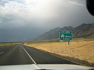
Besides these, an older road, U.S. Route 91 (now called Old Highway 91), also runs through the valley. It goes north from Nephi through Mona and exits the valley to the north. The Goshen Canyon Road runs west from Mona, past Mona Reservoir, and then north-northwest out of the valley.
 | James Van Der Zee |
 | Alma Thomas |
 | Ellis Wilson |
 | Margaret Taylor-Burroughs |


