Valley Mountains facts for kids
Quick facts for kids Valley Mountains |
|
|---|---|
| Highest point | |
| Peak | Bald Knoll |
| Elevation | 6,682 ft (2,037 m) |
| Dimensions | |
| Length | 28 mi (45 km) N-S |
| Geography | |
| Country | United States |
| Communities | Scipio, Mills, Gunnison and Redmond |
| Range coordinates | 39°12′57″N 112°00′05″W / 39.21583°N 112.00139°W |
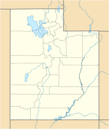
The Valley Mountains are a mountain range in Utah, USA. They stretch for about 28 miles (45 km) from north to south. These mountains are found where Sanpete County meets Millard County. Parts of the range also reach into Juab County in the north and Sevier County in the south.
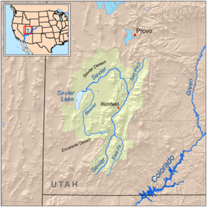
The Sevier River flows around the Valley Mountains. This river and its valleys are important features nearby. To the west, there are three other valleys. Juab Valley is located to the north and northeast. Even though the range runs north-south, it has a small valley inside called Japanese Valley. You can also find several small hills, or "knolls," to the southwest and south.
The Sevier River borders the mountains on the north, northeast, east, and southeast sides. Many towns are located on the east and southeast. The town of Scipio, Utah is at the northwest base of the mountains. The Sevier Bridge Reservoir is at the north end of the Valley Mountains, on the Sevier River. This reservoir is part of Yuba State Park. The park is 16 miles long and stretches along the foothills of the range.
About the Valley Mountains
The Valley Mountains run from north to south. They become narrower at both their northern and southern ends. At its widest point, the range is about 9 miles across. It has two main ridges, one on the east and one on the west, in the northern half. These ridges join together in the southern part of the mountains.
In the southwest, you'll find Dairy Knoll, which is about 6,000 feet (1,829 meters) high. There are also Three Knolls, reaching about 6,149 feet (1,874 meters). These knolls are on the east side of Round Valley, south of Scipio Lake. Scipio Lake is at the north end of Round Valley. Here, the Valley Mountains meet the Pavant Range.
The highest point in the Valley Mountains is Bald Knoll. It stands at 6,682 feet (2,037 meters) tall. Bald Knoll is located in Sevier County, at the southern end of the range. U.S. Highway 50 runs right next to Bald Knoll.
How to Visit the Mountains
You can reach the northwest part of the Valley Mountains from Interstate 15 and the town of Scipio. Old Yuba Dam Road goes to the very north of the range. This road leads to the Sevier Bridge Reservoir.
From Scipio, you can travel south on U.S. 50. This road runs along the western base of the mountains. It passes by the east side of Scipio Lake and through Round Valley. Then, it turns southeast and crosses the southern foothills to reach Salina on the Sevier River. Southwest of Salina is Aurora. You can get there by taking Utah State Route 260, which branches off from the foothills.
The entire eastern side of the range can be reached from towns along the Sevier River. In the northeast, Utah State Route 28 passes through Fayette, which is southeast of Yuba State Park. In the southeast, U.S. 89 goes through Axtell, Redmond, and Salina.
 | Emma Amos |
 | Edward Mitchell Bannister |
 | Larry D. Alexander |
 | Ernie Barnes |


