
Sevier County, Utah facts for kids
Quick facts for kids
Sevier County
|
|
|---|---|

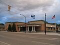
Sevier County Courthouse in Richfield
|
|

Location within the U.S. state of Utah
|
|
 Utah's location within the U.S. |
|
| Country | |
| State | |
| Founded | January 16, 1865 |
| Named for | Sevier River |
| Seat | Richfield |
| Largest city | Richfield |
| Area | |
| • Total | 1,918 sq mi (4,970 km2) |
| • Land | 1,911 sq mi (4,950 km2) |
| • Water | 7.8 sq mi (20 km2) 0.4% |
| Population
(2020)
|
|
| • Total | 21,522 |
| • Density | 11.3/sq mi (4.4/km2) |
| Time zone | UTC−7 (Mountain) |
| • Summer (DST) | UTC−6 (MDT) |
| Congressional district | 2nd |
Sevier County (pronounced sə-VEER) is a county in Utah, United States. In 2020, about 21,522 people lived there. Its main city and county seat is Richfield.
Did you know that Sevier County is home to Pando? This is a huge group of quaking aspen trees that are all connected by one root system. Some people say it's the oldest living thing on Earth, possibly 80,000 years old! It's also one of the largest, covering 106 acres and weighing millions of pounds.
Contents
History of Sevier County
People have lived in the area now known as Sevier County for a very long time. Scientists have found signs of early people living here up to 5,000 years ago. The Fremont culture, a group of Native Americans, lived in this area from about 2000 to 700 years ago. You can still see their ancient rock carvings, called petroglyphs, at the Clear Creek site.
Native American Tribes
In Utah, different groups of Native Americans spoke the Numic language. These groups included the Northern Shoshone, Goshute or Western Shoshone, Southern Paiute, and Ute peoples. The central and eastern parts of what is now Sevier County were mainly home to various groups of the Ute people.
Early Explorers and Settlers
The first Europeans to likely see the Sevier River were two Catholic priests, Silvestre Vélez de Escalante and Francisco Atanasio Domínguez. They explored the area in 1776 while on an expedition to California. They mapped a route that later became known as the Old Spanish Trail. For the next 100 years, this trail was used by fur trappers, hunters, traders, and settlers.
Modern settlement of Sevier County began when Richfield was founded. Mormon settlers from The Church of Jesus Christ of Latter-day Saints arrived on June 15, 1864. Many of these early settlers had come from countries in Scandinavia. Because the community grew quickly, the people asked the officials of Utah Territory to create a separate county.
Founding the County
On January 16, 1865, the Utah Territory government officially created Sevier County. The land for the new county came from Sanpete County. The county was named after the Sevier River. The main city, or county seat, was Big Spring, which was later renamed Richfield. The county's borders were changed a few times over the years, with the current borders set in 1931.
Even though the county was created in 1865, many settlers had to leave Sevier County during the Black Hawk War in 1867. It was hard to resettle the area, but by 1870, people started to return. By 1874, there were 753 residents living in the county.
Geography and Nature
Sevier County has a mix of landscapes. You'll find dry, rolling areas that are good for farming, along with mountain ridges that run from northeast to southwest. These mountains are usually covered in forests. The highest point in the county is Fish Lake Hightop, which is 11,633 feet (3,546 meters) above sea level.
The county covers a total area of 1,918 square miles (4,968 square kilometers). Most of this is land (1,911 sq mi or 4,949 km²), with a small amount of water (7.8 sq mi or 20 km²), which is about 0.4% of the total area.
Main Roads and Highways
Many important roads run through Sevier County, making it easy to travel.
- Interstate 70
 I-70 Bus. / SR-120
 US-50
US-50 US-89
US-89 SR-10
SR-10 SR-24
SR-24- SR-62
 SR-72
SR-72- SR-76
- SR-118
- SR-119
Neighboring Counties
Sevier County shares its borders with several other counties in Utah:
- Sanpete County – to the north
- Emery County – to the east
- Wayne County – to the southeast
- Piute County – to the south
- Beaver County – to the southwest
- Millard County – to the west
Protected Natural Areas
Sevier County is home to parts of several beautiful protected areas, perfect for outdoor adventures:
- Capitol Reef National Park (part)
- Fishlake National Forest (part)
- Fremont Indian State Park and Museum
- Koosharem Reservoir Recreation Site
- Manti-La Sal National Forest (part)
- Sand Ledges Recreation Area
- Willow Creek Wildlife Management Area
Lakes and Reservoirs
The county has many lakes and reservoirs, offering places for fishing and other water activities:
- Abes Reservoir
- Acord Lakes
- Annabella Reservoir
- Bear Valley Reservoir
- Big Lake
- Boobe Hole Reservoir
- Broadhead Lakes
- Cold Spring (near Twin Ponds)
- Coots Slough
- Crater Lakes
- Davis Hollow Reservoir
- Deep Lake
- Duck Lake
- Emerald Lakes
- Farnsworth Reservoir
- Farrell Pond
- Fish Lake
- Floating Island Lake
- Forsyth Reservoir
- Gardner Hollow Reservoirs
- Gates Lake
- Hamilton Reservoir
- Harves River Reservoir
- Hepplers Ponds
- Hunts Lakes
- Indian Springs
- Jeffery Reservoir
- Jensen Spring
- Johnson Valley Reservoir
- Killian Spring
- Koosharem Reservoir
- Lake Louise
- Lost Creek Reservoir
- Lower Hunts Lake
- Magelby Reservoir
- Meeks Lake
- Mill Meadow Reservoir (part)
- Morrell Pond
- Mud Lake
- Oles Pond
- Ox Spring
- Paradise Valley Lake
- Redmond Lake
- Rex Reservoir
- Rim Seep
- Rocky Ford Reservoir
- Saleratus Reservoir
- Salina Reservoir
- Sargent Lake
- Scrub Flat Reservoir
- Sheep Valley Reservoir
- Silas Spring
- Skutumpah Reservoir
- Slide Lake
- Snow Fence Pond
- Snow Lake
- Solomon Reservoir
- Spring Reservoir
- The Potholes
- Three Creeks Reservoir
- Three Lakes (two of the three)
- Tidwell Pond
- Twin Lake
- Twin Ponds
- Washburn Reservoir
- Willies Flat Reservoir
- Willow Creek Reservoir
- Willow Lake
- Wood Hollow Reservoir
People and Population
The population of Sevier County has grown a lot since it was first settled. In 1870, only 19 people lived there, but by 2020, the population had grown to 21,522!
What is the Population Like?
According to the 2020 census, there were 21,522 people in Sevier County. This means there were about 11.3 people for every square mile.
- About 90.1% of the people were White.
- About 4.9% of the people were of Hispanic or Latino background.
- The population was almost evenly split between males (50.51%) and females (49.49%).
- About 30% of the population was under 18 years old.
- The average age of people in Sevier County was 36.3 years.
There were 7,464 households in the county. A household is a group of people living together in one home.
- About 74.4% of these households were families.
- Most families (60.2%) were married couples.
- About 77.1% of homes were owned by the people living in them, while 22.9% were rented.
The average income for a household in Sevier County was about $55,361 per year. For families, the average income was $62,058. About 14.3% of the population lived below the poverty line.
Education in Sevier County
When it comes to education, most adults in Sevier County have completed high school.
- About 31.2% of adults (25 years or older) had a high school diploma.
- About 38.9% had some college education or an associate degree.
- About 14.3% had a bachelor's degree.
- About 6.6% had a graduate or professional degree.
Interesting Features and Attractions
Interstate 70 is a major highway that goes right through Sevier County. Because the city of Richfield is about halfway between big cities like Los Angeles, California and Denver, Colorado, it has become a popular stop for travelers. Many motels and restaurants are there to serve people driving through.
Another cool place to visit is Fremont Indian State Park. It's located in Clear Creek Canyon, right next to I-70. This park is special because it has many ancient remains from the Fremont culture. You can see artifacts found in the area displayed in the park's museum.
Cities and Towns

Sevier County has several cities, towns, and smaller communities.
Cities
Towns
Unincorporated Communities
These are smaller communities that are not officially part of a city or town.
Former Communities
Some communities that once existed in Sevier County are no longer there or have been absorbed into other places.
- Prattville
- Vermillion (This community became part of Sigurd)
Education
All the schools in Sevier County are part of the Sevier School District.
Images for kids
-
Sevier County Courthouse in Richfield
See also
 In Spanish: Condado de Sevier (Utah) para niños
