
Emery County, Utah facts for kids
Quick facts for kids
Emery County
|
||
|---|---|---|

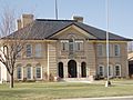
Museum of the San Rafael Swell, in Castle Dale
|
||
|
||

Location within the U.S. state of Utah
|
||
 Utah's location within the U.S. |
||
| Country | ||
| State | ||
| Founded | February 12, 1880 | |
| Named for | George W. Emery | |
| Seat | Castle Dale | |
| Largest city | Huntington | |
| Area | ||
| • Total | 4,472 sq mi (11,580 km2) | |
| • Land | 4,462 sq mi (11,560 km2) | |
| • Water | 9.5 sq mi (25 km2) 0.2% | |
| Population
(2020)
|
||
| • Total | 9,825 | |
| • Density | 2.1970/sq mi (0.84827/km2) | |
| Time zone | UTC−7 (Mountain) | |
| • Summer (DST) | UTC−6 (MDT) | |
| Congressional district | 3rd | |

Emery County is a county in east-central Utah, United States. In 2020, about 9,825 people lived there. Its main town, called the county seat, is Castle Dale. The biggest city in the county is Huntington.
Contents
History of Emery County
Ancient Times

People have lived in the San Rafael area for thousands of years! First, there were the Desert Archaic people. Later, the Fremont culture lived here from the 500s to the 1200s AD.
You can still see signs of these old groups today. There are many amazing rock paintings and carvings. Some famous spots include Temple Mountain Wash, Muddy Creek, and Buckhorn Wash. These places are so important they are listed on the National Register of Historic Places. Native Ute people also lived in the Castle Valley area.
The Old Spanish Trail
The first non-native people to see Castle Valley were Spanish traders and explorers. One of the first was Silvestre Vélez de Escalante in 1776. He traveled through northern Utah.
Later, Spanish traders found a path further south. This path became known as the Old Spanish Trail. It started in Santa Fe and went all the way to California.

The trail crossed the Colorado River near Moab and the Green River. It then went west through places like Buckhorn Flat and Huntington Creek. It also crossed Ferron Creek and Muddy Creek.
This trail was important for trade, especially for trading Native American women and children, which was against the law. It was also used to move animals like horses from California to Santa Fe. Travelers on this trail gave Castle Valley its name because they were amazed by the tall, castle-like rock formations.
Early American Explorers
The first Americans to visit Castle Valley were fur trappers. In 1809, James Workman and William Spencer traveled through the valley. Later, in 1830, William Wilfskill and his group also explored the area.
After the trappers, government explorers came to find good routes across the country. Kit Carson was one of these famous explorers. He was looking for a way to carry mail from St. Louis to California. In 1848, Carson brought news of gold found in California through Castle Valley.

In 1853, John W. Gunnison, an Army engineer, explored the valley. He was looking for a railroad route. He wrote detailed notes about his trip. He followed parts of the Spanish Trail but found new paths around tough areas.
Another explorer, John C. Fremont, came in the winter of 1853–54. His trip was very hard because of the cold weather and lack of food. They finally found relief when they reached the small Mormon town of Parowan.
Pioneers Arrive
In 1875, people from Sanpete County brought their cattle and sheep to graze in Castle Valley. Some of them saw that the area would be a good place to settle. There wasn't enough land or water in Sanpete County. Also, leaders of the Church of Jesus Christ of Latter-day Saints (LDS Church) wanted to settle the empty land.
So, in the fall of 1877, young families started moving to Castle Valley. They began to build homes in places that would become Huntington, Ferron, Castle Dale, and Orangeville.
In August 1877, Brigham Young, the leader of the LDS Church, asked for at least 50 families to move to Castle Valley. This was the last Mormon settlement started under Brigham Young's direction. He died just one week later. During his time as leader, Young helped start almost 400 towns and villages.
Soon after, settlers moved from Sanpete to Castle Valley. They settled along Huntington Creek, Cottonwood Creek, and Ferron Creek. More families arrived in the spring of 1878. Elias Cox and Charles Hollingshead built a sawmill in Huntington Canyon. Settlers also started building irrigation ditches to bring water to their farms. By 1879, most of the best land had been claimed.
The Utah government officially created Emery County on February 12, 1880. It was named after George W. Emery, who was the governor of Utah Territory. In 1880, 556 people lived in Emery County. By 1890, the population grew to 2,866.
Many important canals were built between 1880 and 1900, like the Huntington Canal and Emery Canal. Many of these old canals are still used today. In 1894, the northern part of Emery County became Carbon County.
In the early 1880s, the Denver and Rio Grande Western Railroad planned routes through the area. The railroad ended up bypassing most of Emery County's towns. This meant most towns missed out on the economic boost the railroad brought. However, Green River, on the eastern edge of the county, grew quickly when the trains arrived.
The 1900s
_School_House_1912.JPG)
By 1900, Emery County had over 4,600 people and many farms. Farmers expanded their irrigation systems. But this caused problems. The soil in Emery County has a lot of salt. Too much irrigation caused salt to build up on the surface, making land unusable for farming. By 1903, over 30% of farmland had been abandoned.
As irrigation grew, new towns were built. The coal industry also grew, with larger mines opening. During World War I, Emery County saw a small boom. Farm prices went up, and mine wages increased. But after the war, prices dropped, leading to tough times in the 1920s.
Things got even harder with the Great Depression in the early 1930s. A severe drought in 1931 and 1934 made the economic problems worse. The county's population dropped. Farm prices fell, and coal production was cut in half.

However, residents got help from programs like the Civilian Conservation Corps (CCC). The CCC built roads, bridges, and trails. They also built ranger stations on public lands. Many CCC workers stayed in Emery County after their service.
After World War II, veterans returned to a better economy. Farm income doubled, and coal mines were busy. The county modernized with new water systems, better roads, and telephones. But water supply for farming was still a problem. A new reservoir was built in Joes Valley in the mid-1950s.
In the 1970s, Emery County's population grew a lot. This was because large coal-fired power plants were built in Castle Dale and Huntington. More coal mines opened to fuel these plants.
Recent Times
On August 6, 2007, a mine called Crandall Canyon Mine collapsed. Six workers were trapped inside. The collapse was so strong that it caused seismic waves, like a small earthquake. Emery County is the second-biggest coal-producing county in Utah. It was also the site of a fire in the Wilberg Mine in 1984, which was a very sad event.
Geography of Emery County
The Green River flows south along the eastern side of Emery County. The Price River flows into the Green River in the northeast. The San Rafael River starts in the northwest and flows across the middle of the county, also joining the Green River.
The land in Emery County has flat areas, mountains, and ridges. Water has carved out many canyons. The highest point in the county is about 10,743 feet (3,274 meters) high. The county covers about 4,472 square miles (11,582 square kilometers). Most of this is land, with a small amount of water.

The Wasatch Plateau, a mountainous area, is on the western side. Most people in the county live at the base of these mountains. The San Rafael Swell is a large, rocky desert area that covers much of the eastern part of the county.
The western side of the county has more people and small towns. These towns are in a farming valley next to the Manti National Forest. Streams from the Wasatch Plateau feed reservoirs that provide water for farms. The eastern side of the county is dry and rugged.
Emery County has three main types of areas:
- The mountainous Wasatch Plateau in the west.
- Castle Valley, where most of the towns are located.
- The desert areas of the San Rafael Swell, San Rafael Reef, and Cedar Mountain in the east.
The San Rafael River is very important to the county. It starts in the Wasatch Plateau, where its water is stored in reservoirs. It flows into Castle Valley in three parts: Huntington Creek, Cottonwood Creek, and Ferron Creek. These join to form the San Rafael River, which then flows through the desert to the Green River.
Many places in Emery County have names from Native American, Spanish, and English languages. For example, Wasatch is a Ute Indian name for a gap in the mountains. San Rafael is a Spanish name meaning Saint Ralph.
Archaeology in Emery County
Range Creek is a special place in Emery County. It has very well-preserved remains from the Fremont culture. The State of Utah owns this site and is working to study and protect these ancient findings.
Main Roads
- United States Interstate I-70
- United States US-191
- Utah State Highway UT-10
- Utah State Highway UT-24
- Utah State Highway UT-29
- Utah State Highway UT-31
Neighboring Counties
- Carbon County - north
- Uintah County - northeast
- Grand County - east
- San Juan County - southeast
- Wayne County - south
- Sevier County - southwest
- Sanpete County - northwest
Protected Natural Areas
- Cedar Mountain Recreation Area
- Goblin Valley State Park
- Green River State Park
- Huntington State Park
- Manti-La Sal National Forest (part)
- Millsite State Park
Lakes and Reservoirs
Emery County has many lakes and reservoirs that are important for water storage and recreation. Some of these include Joes Valley Reservoir, Huntington Lake, and Millsite Reservoir.
Population of Emery County
| Historical population | |||
|---|---|---|---|
| Census | Pop. | %± | |
| 1880 | 556 | — | |
| 1890 | 5,076 | 812.9% | |
| 1900 | 4,657 | −8.3% | |
| 1910 | 6,750 | 44.9% | |
| 1920 | 7,411 | 9.8% | |
| 1930 | 7,042 | −5.0% | |
| 1940 | 7,072 | 0.4% | |
| 1950 | 6,304 | −10.9% | |
| 1960 | 5,546 | −12.0% | |
| 1970 | 5,137 | −7.4% | |
| 1980 | 11,451 | 122.9% | |
| 1990 | 10,332 | −9.8% | |
| 2000 | 10,860 | 5.1% | |
| 2010 | 10,976 | 1.1% | |
| 2020 | 9,825 | −10.5% | |
| US Decennial Census 1790–1960 1900–1990 1990–2000 2010 2020 |
|||
2020 Census Information
In 2020, Emery County had 9,825 people. This means there were about 2.2 people for every square mile. Most people (about 89.7%) were White. About 7.2% of the people were Hispanic or Latino.
There were slightly more males (50.53%) than females (49.47%). About 29.2% of the population was under 18 years old. The average age was 38.3 years.
There were 3,535 households in the county. Most of these (74.3%) were families. About 61.3% of families were married couples. Most households (80.1%) were owned by the people living in them.
The average income for a household in Emery County was about $57,772. For families, it was about $71,556. About 12.0% of the people and 7.8% of families lived below the poverty line.
When it comes to education, about 48.5% of adults (25 or older) had some college or an associate degree. About 10.8% had a bachelor's degree, and 5.0% had a graduate or professional degree.
Ancestry
Here are some of the largest ancestry groups reported in Emery County in 2015:
| Largest ancestries (2015) | Percent |
|---|---|
| English | 35.0% |
| German | 14.8% |
| Danish | 14.5% |
| Irish | 10.6% |
| Scottish | 6.6% |
| Swedish | 5.5% |
| Dutch | 5.0% |
| French (except Basque) | 4.3% |
| Italian | 3.9% |
| Welsh | 3.8% |
| Norwegian | 2.5% |
| Swiss | 1.6% |
Economy of Emery County

For a long time, farming and raising animals were the main ways people made a living in Emery County. But in the 1970s, things changed a lot. Large coal mines opened, and big power plants were built in Castle Dale and Huntington. This caused the population to grow quickly.
These new jobs paid well at first. However, the market for coal has slowed down. Also, new technology means fewer people are needed in mining. Because of this, unemployment in Emery County has been higher than in the rest of Utah since 1990.
Emery County still has a lot of natural resources. There's a plan for a new nuclear power plant, the Blue Castle Project, to start being built near Green River around 2023.
Education in Emery County
The Emery County School District runs the public schools here.
- Emery High School
- Green River High School
- Canyon View Middle School
- San Rafael Middle School
- Ferron Elementary
- Cleveland Elementary
- Huntington Elementary
- Cottonwood Elementary
- Book Cliff Elementary
- Castle Dale Elementary
Media
- The Castle Valley Review (Monthly newspaper)
- Emery County Progress (Weekly newspaper)
Transportation
Airports
- Green River Municipal Airport (U34) - in Green River
- Huntington Municipal Airport (69V) - in Huntington
Events
- Cleveland Days
- Elmo Horse and Buggy Days
- Emery (town) Days
- Emery County Fair
- Ferron Peach Days
- Green River Melon Days
- Huntington Heritage Days
- San Rafael Swell Mountain Bike Festival
- Joe's Valley Bouldering Festival
Attractions
- Joe's Valley Reservoir
- San Rafael Reef
- San Rafael Swell
- Buckhorn Draw Pictograph Panel
- The Wedge
- Huntington Reservoir
- Cottonwood Canyon
- Goblin Valley State Park
- Rochester Rock Art Panel
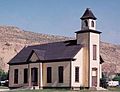
- The historic Emery LDS Church
Communities

Cities
- Castle Dale (the main county town)
- Ferron
- Green River
- Huntington
- Orangeville
Towns
Other Communities (Unincorporated)
Former Communities
- Connellsville
- Desert Lake
- Mohrland
- Victor
- Wilsonville
- Woodside
Images for kids
-
Castle Dale
-
Emery
-
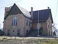
Ferron
-
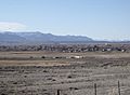
Cleveland


See also
 In Spanish: Condado de Emery para niños
