Huntington, Utah facts for kids
Quick facts for kids
Huntington, Utah
Area of Outstanding Natural Beauty
|
|
|---|---|

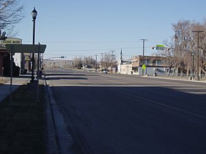
Looking northward along Huntington's Main Street, March 2008
|
|

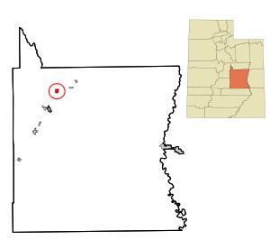
Location in Emery County and the State of Utah.
|
|

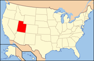
Location of Utah in the United States
|
|
| Country | United States |
| State | Utah |
| County | Emery |
| Founded | 1875 |
| Named for | William Huntington |
| Area | |
| • Total | 2.26 sq mi (5.85 km2) |
| • Land | 2.26 sq mi (5.85 km2) |
| • Water | 0.00 sq mi (0.00 km2) |
| Elevation | 5,787 ft (1,764 m) |
| Population
(2010)
|
|
| • Total | 2,129 |
| • Estimate
(2019)
|
1,934 |
| • Density | 855.75/sq mi (330.46/km2) |
| Time zone | UTC-7 (Mountain (MST)) |
| • Summer (DST) | UTC-6 (MDT) |
| ZIP code |
84528
|
| Area code(s) | 435 |
| FIPS code | 49-36950 |
| GNIS feature ID | 1428946 |
Huntington is a city in Emery County, Utah, in the United States. In 2010, about 2,129 people lived there. It is the biggest town in Emery County.
Contents
History of Huntington
Huntington got its name from Huntington Creek. This creek was likely named after the Huntington brothers (William, Oliver, and Dimick). They explored this area in the 1850s. The first European settlers arrived in 1875. They were four stockmen who brought their animals to Huntington Creek.
In 1877, a group from Fairview started a small settlement. They built simple homes called "dugouts" by the creek. They also began digging canals to bring water for farming. The settlement grew from 126 people in 1880 to 1,293 people by 1910. Many early settlers came from the Sanpete Valley.
In 1880, a town area was measured out. The first building was a large log meetinghouse, finished in 1880. Most of the town did not have water until the Huntington Canal was finished in 1882. People built homes in town as they claimed their land. Many homes were made of logs, planks, or adobe bricks. Around 1896, more brick homes, schools, and shops were built.
Early Economy and Growth
Huntington's first jobs were in farming and raising animals. Alfalfa seeds were an important crop around 1900. Local honey even won a prize at the St. Louis World's Fair in 1903. For most of its history, however, Huntington has earned money from coal mining.
Small coal mines in Huntington Canyon provided some jobs. The coal camp of Mohrland, about 8 miles north, was like an extension of Huntington. Many people worked there and also farmed. Later, better roads allowed miners to travel daily to other mines.
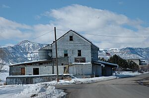
Huntington had a flour mill built in 1892. It made feed for local farmers and flour for people in Emery and Carbon counties. This mill worked until the 1980s. Huntington High School was a big part of the community until 1962.
Community Life and Changes
Huntington has always had a strong tradition of arts. A music band started in 1884. Community groups put on many plays between 1890 and 1910. A choir from Huntington and nearby Cleveland won a singing competition in 1895. A men's singing group started in the 1920s and still exists today.
In the 1950s, Huntington's population dropped as mining jobs became fewer. But things changed in 1972. A large power plant was built nearby. This brought new jobs in construction and coal mining. The town grew again, and new people moved in. This made the town more diverse.
Mine Accidents
Mining can be dangerous work. In August 2007, a mine near Huntington collapsed. Six workers were trapped inside. Rescue efforts were very difficult. Sadly, three rescue workers also died when a tunnel collapsed on them. The six trapped miners could not be saved. Later, in March 2013, another miner died in a different cave-in near Huntington.
Geography and Climate
Huntington is located in the northwest part of Emery County. It sits near the opening of a long canyon that goes into the Wasatch Plateau. The city covers about 2.26 square miles (5.85 square kilometers) of land.
Climate in Huntington
Huntington has a climate with big differences in temperature between seasons. Summers are warm to hot, and winters are cold. This type of weather is called a humid continental climate.
Population Information
| Historical population | |||
|---|---|---|---|
| Census | Pop. | %± | |
| 1890 | 513 | — | |
| 1900 | 653 | 27.3% | |
| 1910 | 800 | 22.5% | |
| 1920 | 1,285 | 60.6% | |
| 1930 | 877 | −31.8% | |
| 1940 | 997 | 13.7% | |
| 1950 | 1,029 | 3.2% | |
| 1960 | 787 | −23.5% | |
| 1970 | 857 | 8.9% | |
| 1980 | 2,316 | 170.2% | |
| 1990 | 1,875 | −19.0% | |
| 2000 | 2,131 | 13.7% | |
| 2010 | 2,129 | −0.1% | |
| 2019 (est.) | 1,934 | −9.2% | |
| U.S. Decennial Census | |||
In 2000, there were 2,131 people living in Huntington. There were 690 households, and 547 of them were families. About 46.5% of households had children under 18. Most people (92.40%) were White. About 12.39% of the population was Hispanic or Latino.
The population was spread out by age. About 36.2% of people were under 18. The average age was 26 years old.
Getting Around Huntington
Utah State Route 10 goes through the middle of Huntington. It is called Main Street. This road leads northeast to Price and southwest to Castle Dale. State Route 31 goes northwest from Huntington across the Wasatch Plateau to Fairview.
Huntington also has a small airport called the Huntington Municipal Airport. It is about 3 miles (6 kilometers) northeast of the city center.
Education
The Emery County School District is in charge of the public schools in the county, including those in Huntington.
See also
 In Spanish: Huntington (Utah) para niños
 | Leon Lynch |
 | Milton P. Webster |
 | Ferdinand Smith |


