Castle Dale, Utah facts for kids
Quick facts for kids
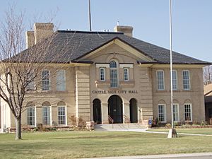
Castle Dale, Utah
|
|
|---|---|

Castle Dale's city hall
|
|

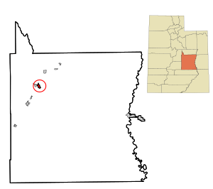
Location within Emery County and the State of Utah
|
|

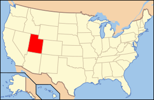
Location of Utah in the United States
|
|
| Country | United States |
| State | Utah |
| County | Emery |
| Settled | 1877 |
| Incorporated | 1920 |
| Area | |
| • Total | 2.23 sq mi (5.79 km2) |
| • Land | 2.23 sq mi (5.79 km2) |
| • Water | 0.00 sq mi (0.00 km2) |
| Elevation | 5,676 ft (1,730 m) |
| Population
(2020)
|
|
| • Total | 1,492 |
| • Density | 669.1/sq mi (257.69/km2) |
| Time zone | UTC-7 (Mountain (MST)) |
| • Summer (DST) | UTC-6 (MDT) |
| ZIP code |
84513
|
| Area code(s) | 435 |
| FIPS code | 49-10660 |
| GNIS feature ID | 1426380 |
Castle Dale is a small city located in Emery County, Utah, in the United States. In 2020, about 1,492 people lived there. It is the main city, or county seat, of Emery County.
History
Castle Dale was first settled in 1879. People came to live here and build a community.
Geography
Castle Dale is located in a beautiful area called Castle Valley. It sits on the north side of Cottonwood Creek, which flows into the San Rafael River.
The city covers an area of about 5.6 square kilometers (or 2.2 square miles). All of this area is land.
Utah State Route 10 is a main road that goes right through the middle of Castle Dale. This road can take you northeast about 31 miles to Price or southwest about 37 miles to Interstate 70.
Population Information
| Historical population | |||
|---|---|---|---|
| Census | Pop. | %± | |
| 1890 | 505 | — | |
| 1900 | 559 | 10.7% | |
| 1910 | 693 | 24.0% | |
| 1920 | 715 | 3.2% | |
| 1930 | 713 | −0.3% | |
| 1940 | 841 | 18.0% | |
| 1950 | 715 | −15.0% | |
| 1960 | 617 | −13.7% | |
| 1970 | 541 | −12.3% | |
| 1980 | 1,910 | 253.0% | |
| 1990 | 1,704 | −10.8% | |
| 2000 | 1,657 | −2.8% | |
| 2010 | 1,630 | −1.6% | |
| 2020 | 1,492 | −8.5% | |
| U.S. Decennial Census | |||
In 2000, there were 1,657 people living in Castle Dale. There were 508 households, and 420 of these were families.
Many families in Castle Dale have children under 18 living with them. The average household had about 3 people.
Castle Dale is also home to a notable Afghan community. In 2021, about 11.4% of the people living in Castle Dale were of Afghan background.
The median age of people in the city was 28 years old. This means half the population was younger than 28, and half was older.
Climate
Castle Dale has a cool semi-arid climate. This means it's usually dry. Summers are hot in the afternoons with lots of sunshine, but mornings are cool. Winters are very cold in the mornings, but most afternoons are above freezing.
It doesn't rain or snow much in Castle Dale because mountains block the storms. The wettest month on record was October 2006. The snowiest month was January 1980.
| Climate data for Castle Dale 1991-2020, extremes 1899- | |||||||||||||
|---|---|---|---|---|---|---|---|---|---|---|---|---|---|
| Month | Jan | Feb | Mar | Apr | May | Jun | Jul | Aug | Sep | Oct | Nov | Dec | Year |
| Record high °F (°C) | 67 (19) |
70 (21) |
83 (28) |
89 (32) |
97 (36) |
104 (40) |
107 (42) |
103 (39) |
102 (39) |
88 (31) |
81 (27) |
67 (19) |
107 (42) |
| Mean daily maximum °F (°C) | 40.4 (4.7) |
46.9 (8.3) |
58.4 (14.7) |
65.7 (18.7) |
74.6 (23.7) |
85.3 (29.6) |
91.4 (33.0) |
88.6 (31.4) |
81.1 (27.3) |
68.1 (20.1) |
53.0 (11.7) |
41.0 (5.0) |
66.2 (19.0) |
| Mean daily minimum °F (°C) | 9.7 (−12.4) |
16.1 (−8.8) |
24.7 (−4.1) |
30.8 (−0.7) |
39.5 (4.2) |
47.0 (8.3) |
54.1 (12.3) |
52.2 (11.2) |
42.8 (6.0) |
31.7 (−0.2) |
20.0 (−6.7) |
11.2 (−11.6) |
31.7 (−0.2) |
| Record low °F (°C) | −34 (−37) |
−35 (−37) |
−7 (−22) |
5 (−15) |
13 (−11) |
25 (−4) |
29 (−2) |
30 (−1) |
19 (−7) |
0 (−18) |
−10 (−23) |
−28 (−33) |
−35 (−37) |
| Average precipitation inches (mm) | 0.63 (16) |
0.64 (16) |
0.59 (15) |
0.54 (14) |
0.72 (18) |
0.45 (11) |
0.59 (15) |
0.92 (23) |
1.03 (26) |
0.97 (25) |
0.46 (12) |
0.47 (12) |
8.01 (203) |
| Average snowfall inches (cm) | 5.5 (14) |
3.3 (8.4) |
1.4 (3.6) |
0.2 (0.51) |
trace | 0 (0) |
0 (0) |
0 (0) |
0 (0) |
0.1 (0.25) |
1.2 (3.0) |
4.9 (12) |
16.6 (41.76) |
| Average precipitation days (≥ 0.01 in) | 4.8 | 4.7 | 3.8 | 4.4 | 5.0 | 3.3 | 5.2 | 7.3 | 5.6 | 5.0 | 3.3 | 4.6 | 57.0 |
| Average snowy days (≥ 0.1 in) | 2.4 | 2.0 | 0.6 | 0.2 | 0.0 | 0 | 0 | 0 | 0 | 0.1 | 0.6 | 2.2 | 8.1 |
| Source 1: NCEI | |||||||||||||
| Source 2: xmacis | |||||||||||||
Education
The Emery County School District is in charge of the public schools in Emery County, including those in Castle Dale.
See also
 In Spanish: Castle Dale (Utah) para niños
 | James Van Der Zee |
 | Alma Thomas |
 | Ellis Wilson |
 | Margaret Taylor-Burroughs |


