Price River facts for kids
Quick facts for kids Price River |
|
|---|---|

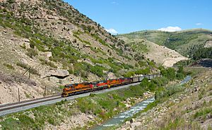
The Price River in Price Canyon, June 2010
|
|
|
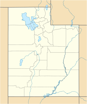
Location of the mouth of Price River in Utah
|
|
| Country | United States |
| State | Utah |
| Region | Carbon, Utah, and Emery Counties |
| Cities | Colton, Royal, Castle Gate, Helper, Spring Glen, Carbonville, Price, Wellington, Woodside |
| Physical characteristics | |
| Main source | Scofield Reservoir Northern edge of the Manti–La Sal National Forest and Wasatch Plateau 7,618 ft (2,322 m) 39°47′13″N 111°07′24″W / 39.78694°N 111.12333°W |
| River mouth | Confluence with the Green River 20 miles (32 km) north of Green River, Utah 4,140 ft (1,260 m) 39°10′46″N 110°06′23″W / 39.17944°N 110.10639°W |
| Basin features | |
| Basin size | 170 sq mi (440 km2) |
| Tributaries |
|
The Price River is a river in eastern Utah that is about 137 miles (220 km) long. It flows southeast through Carbon, Utah, and Emery counties. The river is a branch of the Green River, which then flows into the larger Colorado River.
Contents
History of the Price River's Name
The Price River got its name in the summer of 1869. A man named William Price, who was a leader in the LDS Church, explored the area. He decided to rename the river after himself. Before that, part of it was called the White River. Later, the town of Price was also named after this river.
Where the Price River Flows

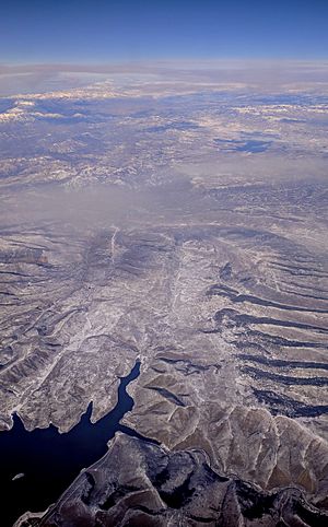
The Price River starts at the Scofield Reservoir in Carbon County, Utah. This reservoir is located in the Wasatch Plateau. From there, the river flows east and northeast into Utah County.
River's Journey Through Utah
At a place called Colton, the Price River meets the White River. Colton was once known as Pleasant Valley Junction. Some old stories say the Price River actually starts where the White River and Fish Creek meet. The White River gets its water from the Tavaputs Plateau.
After Colton, the Price River continues to flow southeast. It picks up water from Beaver Creek and Kyune Creek. Then, the river enters a deep cut in the land called Price Canyon. Here, it flows alongside U.S. Route 6. This canyon forms a natural boundary between the Wasatch Plateau and the Book Cliffs.
Meeting Other Creeks and Towns
Further along, the Price River is joined by Willow Creek at Castle Gate. Willow Creek is the biggest stream in the Book Cliffs area. After leaving Price Canyon, the river flows through the towns of Helper and Price.
From Price, the river keeps heading southeast. It passes by the edge of the San Rafael Swell and the old, empty town of Woodside. Finally, it turns east into more canyons and joins the Green River. This meeting point is in Gray Canyon, about 20 miles (32 km) north of Green River, Utah.
Dams and Water Management
The Scofield Reservoir was created in 1946 when the Scofield Dam was built. Water flows into this reservoir from Pondtown Creek, Mud Creek, and Fish Creek. There are plans to build another dam, called the Gooseberry Narrows Dam, upstream from Scofield Reservoir. This new dam would help store water for farms in the Sanpete Valley. However, some people are worried about how this dam might affect the fish in the Price River. Because of these concerns, the Price River was listed as one of the top ten endangered rivers in the United States in 2005.
Downstream from the town of Price, there's a project to make the Olsen Reservoir bigger. This project helps capture the large amounts of water that flow in the Price River during springtime. This stored water can then be used by farms and to keep the river flowing during dry seasons. Most of the streams that join the Price River downstream from Price only flow after it rains or snow melts. The largest of these is Grassy Trail Creek.
Animals Living in the Price River
The upper parts of the Price River are home to a special type of fish called the Colorado River cutthroat trout. These trout are now found in very few places, less than 1% of where they used to live. They are in danger because they can mix with other types of trout, like rainbow trout, or be pushed out by brown trout and brook trout.
The lower 89 miles (143 km) of the Price River are home to the Colorado pikeminnow, which is an endangered fish. Other important fish that live in the upper Colorado River basin, like the roundtail chub, flannelmouth sucker, and bluehead sucker, also used to live in the lower Price River. However, the roundtail chub might have disappeared from the Price River due to low water levels and pollution in the past.
Fun Activities on the Price River
The Price River is usually a small and shallow river, so it's not typically used for boating. However, when there's a lot of water flowing in the spring, the 23.5 miles (37.8 km) of the river below the Scofield Dam to Castle Gate can be exciting for canoeists and kayakers. This section has whitewater rapids that range from easy to very difficult.
The part of the river right below the Scofield Reservoir is sometimes called Lower Fish Creek. This area is known for excellent fly fishing, especially for large brown trout. This beautiful part of the river is next to railroad tracks and is stocked every year with young brown trout. Some of these trout have grown to be as big as 10 pounds (4.5 kg)!
 | Aurelia Browder |
 | Nannie Helen Burroughs |
 | Michelle Alexander |


