
Green River, Utah facts for kids
Quick facts for kids
City of Green River
|
||
|---|---|---|

Aerial of Green River, Utah
|
||
|
||

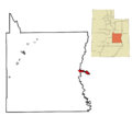
Location in Emery County and the state of Utah
|
||

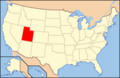
Location of Utah in the United States
|
||
| Country | United States | |
| State | Utah | |
| County | Emery | |
| Incorporated | 1906 | |
| Named for | The Green River | |
| Area | ||
| • Total | 27.26 sq mi (70.61 km2) | |
| • Land | 27.14 sq mi (70.29 km2) | |
| • Water | 0.12 sq mi (0.32 km2) | |
| Elevation | 4,078 ft (1,243 m) | |
| Population
(2020)
|
||
| • Total | 847 | |
| • Density | 34.45/sq mi (13.30/km2) | |
| Time zone | UTC−7 (Mountain (MST)) | |
| • Summer (DST) | UTC−6 (MDT) | |
| ZIP code |
84525
|
|
| Area code(s) | 435 | |
| FIPS code | 49-31670 | |
| GNIS feature ID | 1428398 | |

Green River is a city in Emery County, Utah, United States. In 2020, about 847 people lived there. The city is named after the Green River, which flows nearby.
Contents
History of Green River
Early Days and the Old Spanish Trail
The area where Green River is located was once the home of the Seuvarits/Sheberetch band of the Ute tribe. A long time ago, from 1829 to the 1850s, an important trade route called the Old Spanish Trail crossed the Green River right where the city is now.
John Wesley Powell's Explorations
In May 1869, a famous explorer named John Wesley Powell started a big adventure. He began his journey down the Green River from Green River, Wyoming, which is over 200 miles north of Green River, Utah. He explored the river all the way to where it joins the Colorado River and even further. Powell wrote detailed notes about the river and the land around it. He also created the first good maps of the river basin. During his two trips in 1869 and 1871, Powell and his team gave names to most of the canyons, land features, and fast-moving parts of the Green River. His work also helped future explorers and scientists who were interested in the unique geology of the Green River area.
A River Crossing and Ferry Service
The settlement of Green River began as a place where people could cross the river, especially for the U.S. mail. In 1876, a man named Mr. Blake set up a ferry and a rest stop on the east side of the river. This became a popular place for travelers to stop. The ferry helped people, supplies, and animals get across the river. Today, the river is mostly used for fun activities like rafting, canoeing, and kayaking. The "Gates of Lodore" part of the river is very popular for these trips, as it can be completed in about 3 to 6 days.
The Railroad Era
In 1883, the Denver and Rio Grande Western Railroad built a train line through the area, and a train station opened. The west side of the river became known as "Greenriver" (later changed to "Green River"), and the east side was called "Elgin". When the railroad arrived, Green River quickly grew from a small farming village into a busy town. Many workers came to build the bridge and the tracks for the railroad.
After the railroad was finished, Green River became a stop where trains could get fuel and water. It had switching yards and engine sheds. A hotel called the Palmer House was built and served as a meal stop for trains for many years. Green River was very busy because of the railroad until 1892. That's when the railroad moved most of its operations to Helper, and the town's population went down a lot.
Mining and Missile Research
During the 1940s, 1950s, and 1960s, uranium mining was a big part of Green River's economy. Several trucking companies transported uranium ore from mines in different areas, including the San Rafael Swell and the Henry Mountains.
In 1964, the U.S. Air Force built the Green River Launch Complex just outside Green River. This was a part of the U.S. Army's White Sands Missile Range. From 1964 to 1973, the Air Force launched 141 Athena missiles from this complex. This was part of their research to improve missiles.
Geography and Climate

Location and Surroundings
Green River is located right on the banks of the Green River. This river is a very important branch of the Colorado River. To the west of the city, you'll find the San Rafael Swell region, which is known for its unique rock formations. To the south is Canyonlands National Park, a beautiful national park.
The city is currently entirely within Emery County. However, until 2003, it was split between Emery and Grand counties. The county lines were changed to match the city's borders.
Green River has a total land area of about 27.14 square miles (70.29 square kilometers). It also has a small amount of water area, about 0.12 square miles (0.32 square kilometers).
Travel and Roads
Interstate 70 runs just south of Green River. You can get to the city from Exits 160 and 164. If you travel east on I-70, you'll reach Grand Junction, Colorado, about 102 miles away, and Denver, about 343 miles away. If you go west, Cove Fort is 162 miles away. From Cove Fort, you can take Interstate 15 to Las Vegas, which is 406 miles from Green River.
To the northwest, Price is 64 miles away on US Routes 6 and 191. Salt Lake City is 168 miles away if you take Interstate 15 from Spanish Fork.
Weather in Green River
Green River has a moderate desert climate. This means it's generally dry with warm summers and cool winters.
| Climate data for Green River Municipal Airport, UT | |||||||||||||
|---|---|---|---|---|---|---|---|---|---|---|---|---|---|
| Month | Jan | Feb | Mar | Apr | May | Jun | Jul | Aug | Sep | Oct | Nov | Dec | Year |
| Record high °F (°C) | 65 (18) |
71 (22) |
84 (29) |
93 (34) |
102 (39) |
108 (42) |
113 (45) |
110 (43) |
102 (39) |
92 (33) |
75 (24) |
68 (20) |
113 (45) |
| Mean daily maximum °F (°C) | 41.1 (5.1) |
50.5 (10.3) |
62.9 (17.2) |
72.0 (22.2) |
82.2 (27.9) |
93.0 (33.9) |
98.5 (36.9) |
94.9 (34.9) |
86.0 (30.0) |
71.3 (21.8) |
55.6 (13.1) |
43.5 (6.4) |
71.0 (21.7) |
| Daily mean °F (°C) | 27.4 (−2.6) |
35.9 (2.2) |
46.6 (8.1) |
55.1 (12.8) |
64.5 (18.1) |
74.1 (23.4) |
79.9 (26.6) |
77.5 (25.3) |
67.5 (19.7) |
54.1 (12.3) |
40.1 (4.5) |
30.0 (−1.1) |
54.4 (12.4) |
| Mean daily minimum °F (°C) | 13.7 (−10.2) |
21.3 (−5.9) |
30.3 (−0.9) |
38.2 (3.4) |
46.8 (8.2) |
55.1 (12.8) |
61.3 (16.3) |
60.0 (15.6) |
49.0 (9.4) |
36.9 (2.7) |
24.6 (−4.1) |
16.5 (−8.6) |
37.8 (3.2) |
| Record low °F (°C) | −27 (−33) |
−22 (−30) |
5 (−15) |
15 (−9) |
22 (−6) |
33 (1) |
24 (−4) |
37 (3) |
25 (−4) |
6 (−14) |
−6 (−21) |
−16 (−27) |
−25 (−32) |
| Average precipitation inches (mm) | 0.49 (12) |
0.59 (15) |
0.71 (18) |
0.59 (15) |
0.56 (14) |
0.38 (9.7) |
0.80 (20) |
0.78 (20) |
0.84 (21) |
0.98 (25) |
0.45 (11) |
0.43 (11) |
7.6 (191.7) |
| Average snowfall inches (cm) | 3.4 (8.6) |
0.6 (1.5) |
0.8 (2.0) |
0 (0) |
0 (0) |
0 (0) |
0 (0) |
0 (0) |
0 (0) |
0 (0) |
0.3 (0.76) |
2.5 (6.4) |
7.6 (19) |
People of Green River
| Historical population | |||
|---|---|---|---|
| Census | Pop. | %± | |
| 1890 | 375 | — | |
| 1900 | 222 | −40.8% | |
| 1910 | 628 | 182.9% | |
| 1920 | 645 | 2.7% | |
| 1930 | 474 | −26.5% | |
| 1940 | 470 | −0.8% | |
| 1950 | 583 | 24.0% | |
| 1960 | 1,075 | 84.4% | |
| 1970 | 1,033 | −3.9% | |
| 1980 | 1,048 | 1.5% | |
| 1990 | 866 | −17.4% | |
| 2000 | 973 | 12.4% | |
| 2010 | 952 | −2.2% | |
| 2020 | 847 | −11.0% | |
| U.S. Decennial Census | |||
In 2020, there were 847 people living in Green River, with 330 households. The city had about 34.45 people per square mile. There were 397 homes, with about 14.5 homes per square mile.
- About 60.9% of households were married couples living together.
- 16.1% had a female head of household without a spouse.
- 18.2% had a male head of household without a spouse.
The average household size was 2.77 people.
The population was spread out by age:
- 24.1% were under 18 years old.
- 9.8% were from 18 to 24 years old.
- 26.2% were from 25 to 44 years old.
- 17.2% were from 45 to 64 years old.
- 13.6% were 65 years or older.
The average age in the city was 32.8 years.
The typical income for a household in Green River was $42,361. About 21.1% of the people in the city lived below the poverty line.
Economy and Fun in Green River
Local Business
Green River is about 100 miles from both Richfield, Utah, and Grand Junction, Colorado. Because of this, the city's economy mainly serves people traveling on Interstate 70. There are no services on I-70 going west between Green River and Salina, which is 107 miles away. So, Green River has many hotels, fast food places, other restaurants, and gas stations for travelers.
A large natural gas field has been found about 3 miles south of the city. This field is managed by a company called Delta Petroleum.
Famous Melons and Outdoor Activities
Green River is very famous for its delicious melons! You can buy them during the growing season. The city also has an annual Melon Days Festival, which is a fun event celebrating the melons.
If you like outdoor adventures, Green River is a popular spot for freeride mountain biking.
There's also a plan for a new power plant, called the Blue Castle Project, about five miles west-northwest of the town.
Transportation in Green River

Train Service
Amtrak, which is the national passenger train system, has a stop at the Green River station. The California Zephyr train runs daily in both directions, connecting Chicago and Emeryville, California.
Highways
Interstate 70, along with U.S. Routes 6, 191, and 50, all pass through Green River. If you're driving east on I-70, Green River is the first place with services after Salina. If you're driving west, it's the last place with services. These two cities are about 110 miles apart, which is the longest stretch of interstate in the United States without any services.
The main local road in Green River is a short State road, SR 19, which also serves as Business I-70.
Notable people
- Bert Loper, a famous river-runner
Images for kids
-

Flag of Green River, Utah
-
Location in Emery County and the state of Utah
-
Location of Utah in the United States
See also
 In Spanish: Green River (Utah) para niños
