Helper, Utah facts for kids
Quick facts for kids
Helper, Utah
|
|
|---|---|
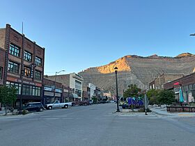
North along Main Street, September 2023
|
|
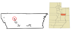
Location within Carbon County and the State of Utah
|
|
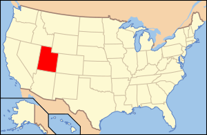
Location of Utah in the United States
|
|
| Country | United States |
| State | Utah |
| County | Carbon |
| Settled | c. 1881 |
| Incorporated | 1907 |
| Became a city | October 9, 1915 |
| Founded by | Teancum Pratt |
| Named for | Helper engines |
| Area | |
| • Total | 1.81 sq mi (4.68 km2) |
| • Land | 1.81 sq mi (4.68 km2) |
| • Water | 0.00 sq mi (0.00 km2) |
| Elevation | 5,909 ft (1,801 m) |
| Population
(2020)
|
|
| • Total | 2,112 |
| • Density | 1,164.91/sq mi (449.87/km2) |
| Time zone | UTC-7 (Mountain (MST)) |
| • Summer (DST) | UTC-6 (MDT) |
| ZIP code |
84526
|
| Area code(s) | 435 |
| FIPS code | 49-34530 |
| GNIS feature ID | 2410737 |
Helper is a city in Carbon County, Utah. It's about 110 miles (177 km) southeast of Salt Lake City. In 2020, about 2,112 people lived there.
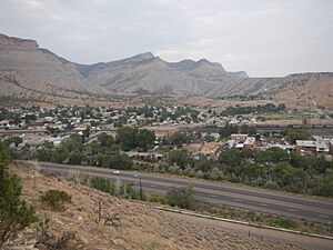
Helper sits by the Price River. It is also located along U.S. Route 6 and U.S. Route 191. These roads offer a quick way to travel between Provo and Interstate 70.
The city is home to the Western Mining and Railroad Museum. This museum is a fun place to visit. It shows what life was like in the late 1800s and early 1900s. Helper is also at the start of the Book Cliffs Escarpment. This is a very long cliff system, stretching 250 miles!
Contents
Helper's History
Helper started to grow when the Denver and Rio Grande Western Railroad (D&RGW) arrived. This was around 1881 and 1882. By 1887, the railroad had built many homes. They planned to make Helper a major freight stop. This happened after the train tracks were changed to a wider size.
The track changes began in 1889 and finished in 1891. In 1892, Helper became an important point for the D&RGW railroad. It was the middle point between Grand Junction, Colorado, and Ogden, Utah. A new train station and hotel were built.
In 1897, famous outlaws Butch Cassidy and Elzy Lay robbed a coal company nearby. They had stayed in Helper the day before. People say Butch Cassidy sometimes came back to visit Helper later on.
Early Settlers and Growth
Next to Helper is Spring Glen. It was settled in 1880 by people like Teancum Pratt. Helper grew slowly but steadily. At first, it had a few stores and saloons. A school was built in 1891. By 1895, the railroad buildings had electricity. They also had two water reservoirs.

Helper became known for its many different cultures. The railroad and coal mines needed many workers. So, people from different parts of Europe and Asia came to Helper. Chinese workers arrived early for the mines and railroads. By the late 1890s, people from Italy and Austria also came.
In 1900, Helper had 385 people. They came from sixteen different countries! Most of them worked as merchants or laborers.
After a coal miners' strike in 1903–04, many Italian workers moved to Helper. They started businesses and farms along the Price River. This helped Helper grow even more. The new farms provided fresh food for the town.
Becoming a City
In the early 1900s, Helper and Price became the main centers for the Carbon County coalfields. They provided services to the mining camps around them. By 1912–13, Helper had 29 businesses and about 850 people. Helper officially became a city in 1907.
By 1924–25, Helper had 157 businesses. Many of these businesses were started by different cultural groups. This showed that there were many chances for immigrants to succeed in Helper. Italian, Chinese, Slavic, Greek, and Japanese people opened shops, cafes, and theaters.
Helper was known as the "hub" of the area. It was a safe place where workers and soldiers could meet during tough times. People from different cultures shared their traditions. Over time, many of these traditions blended together in Helper.
Even during the Great Depression, Helper stayed strong because of its railroad connections. The city hall was built in 1927, and a civic auditorium in 1936.
Coal mining stayed strong through the 1960s. But some towns near Helper struggled. Many coal mining towns became ghost towns between the 1930s and 1970s. These include places like Castle Gate and Standardville.
In 2006, True West Magazine named Helper the top western town.
Power Plant Closure
A power plant in Helper, which had been running since 1954, closed on April 15, 2015. This happened because of new rules about mercury emissions.
How Helper Got Its Name
Helper is located at the entrance of Price Canyon. This area is on the eastern side of the Wasatch Plateau. Trains traveling west from Price to Salt Lake City needed extra "helper" engines. These engines helped them climb the steep 15-mile (24 km) hill up Price Canyon. The town was named after these special helper engines. The Denver and Rio Grande Western Railroad kept these engines in Helper.
Geography and Climate
Helper covers about 1.8 square miles (4.68 square kilometers) of land. It is located along the Price River.
Weather in Helper
Helper has a climate with hot summers.
| Climate data for Helper, Utah | |||||||||||||
|---|---|---|---|---|---|---|---|---|---|---|---|---|---|
| Month | Jan | Feb | Mar | Apr | May | Jun | Jul | Aug | Sep | Oct | Nov | Dec | Year |
| Record high °F (°C) | 57 (14) |
64 (18) |
80 (27) |
80 (27) |
93 (34) |
98 (37) |
105 (41) |
102 (39) |
90 (32) |
86 (30) |
78 (26) |
55 (13) |
105 (41) |
| Mean daily maximum °F (°C) | 36 (2) |
41 (5) |
50 (10) |
58 (14) |
69 (21) |
80 (27) |
87 (31) |
84 (29) |
74 (23) |
60 (16) |
46 (8) |
36 (2) |
60 (16) |
| Mean daily minimum °F (°C) | 18 (−8) |
21 (−6) |
29 (−2) |
34 (1) |
42 (6) |
52 (11) |
58 (14) |
57 (14) |
48 (9) |
37 (3) |
26 (−3) |
18 (−8) |
37 (3) |
| Record low °F (°C) | −9 (−23) |
−9 (−23) |
2 (−17) |
11 (−12) |
20 (−7) |
29 (−2) |
36 (2) |
35 (2) |
26 (−3) |
12 (−11) |
0 (−18) |
−14 (−26) |
−14 (−26) |
| Average rainfall inches (mm) | 1.03 (26) |
1.09 (28) |
0.96 (24) |
1.24 (31) |
1.25 (32) |
1.03 (26) |
1.22 (31) |
1.27 (32) |
1.89 (48) |
1.70 (43) |
0.67 (17) |
0.81 (21) |
14.16 (359) |
| Source: Weather.com | |||||||||||||
Population and People
| Historical population | |||
|---|---|---|---|
| Census | Pop. | %± | |
| 1900 | 402 | — | |
| 1910 | 905 | 125.1% | |
| 1920 | 1,606 | 77.5% | |
| 1930 | 2,707 | 68.6% | |
| 1940 | 2,843 | 5.0% | |
| 1950 | 2,850 | 0.2% | |
| 1960 | 2,459 | −13.7% | |
| 1970 | 1,964 | −20.1% | |
| 1980 | 2,724 | 38.7% | |
| 1990 | 2,148 | −21.1% | |
| 2000 | 2,025 | −5.7% | |
| 2010 | 2,201 | 8.7% | |
| 2020 | 2,112 | −4.0% | |
| U.S. Decennial Census | |||
In 2000, Helper had 2,025 people living in 814 households. About 559 of these were families. The city had about 1,132 people per square mile. Most people (92.59%) were White. Other groups included African American, Native American, Asian, and Pacific Islander. About 11.31% of the population was Hispanic or Latino.
About 31.8% of households had children under 18. Many households (51.8%) were married couples. The average household had 2.44 people. The average family had 2.97 people.
The population was spread out by age. About 25.5% were under 18. About 18.4% were 65 or older. The average age was 39 years.
In 2000, the average income for a household was $30,052. For families, it was $37,266. About 12.7% of the population lived below the poverty line. This included 13.3% of those under 18.
Schools in Helper
Helper has two schools. They are part of the Carbon School District. Sally Mauro Elementary is in western Helper. Helper Middle School is about half a mile east of the elementary school.
Getting Around Helper
Amtrak, the national passenger train service, stops at Helper station. Their California Zephyr train travels daily. It goes between Chicago and Emeryville, California. Helper is also on U.S. Route 6 and 191. These roads split just north of the city. U.S. 191 goes northeast to Duchesne. U.S. 6 goes northwest to Spanish Fork. Both roads continue southeast to I-70.
Famous People From Helper
- Tom M. Apostol, a mathematician born in Helper.
- Pat Boyack, a musician who grew up in Helper.
- Jay Lambert, an Olympic boxer born in Helper.
- Helen Z. Papanikolas, a historian and writer who grew up in Helper.
More to Explore
- Helper Historic District
- List of cities and towns in Utah
See also
 In Spanish: Helper para niños
 | Jackie Robinson |
 | Jack Johnson |
 | Althea Gibson |
 | Arthur Ashe |
 | Muhammad Ali |


