Carbon County, Utah facts for kids
Quick facts for kids
Carbon County
|
|
|---|---|

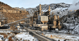
Carbon Power Plant at Castle Gate, Utah demolished in 2016
|
|

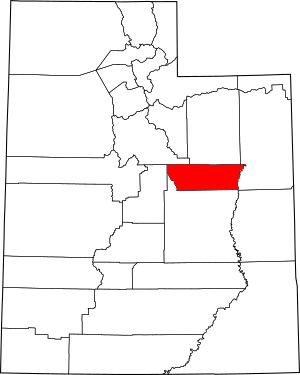
Location within the U.S. state of Utah
|
|
 Utah's location within the U.S. |
|
| Country | |
| State | |
| Founded | March 8, 1894 |
| Named for | Abundant coal deposits |
| Seat | Price |
| Largest city | Price |
| Area | |
| • Total | 1,485 sq mi (3,850 km2) |
| • Land | 1,478 sq mi (3,830 km2) |
| • Water | 6.1 sq mi (16 km2) 0.4% |
| Population
(2020)
|
|
| • Total | 20,412 |
| • Density | 13.745/sq mi (5.3071/km2) |
| Time zone | UTC−7 (Mountain) |
| • Summer (DST) | UTC−6 (MDT) |
| Congressional district | 3rd |
Carbon County is a place in Utah, a state in the United States. It's like a big district or area within the state. In 2020, about 20,412 people lived there. The main city and county seat is Price. The entire county is part of the Price, UT Micropolitan Statistical Area.
Contents
History of Carbon County
Carbon County was once part of Emery County. That was back in 1880. Things started to change when the Denver and Rio Grande Western Railroad was built in 1883. This led to many coal mines opening up. These mines helped power the new railroad.
Because of all the new people and mines, the northern part of Emery County grew a lot. People asked the Utah Territory Legislature to create a new county. So, on March 8, 1894, Carbon County was officially formed. It was named after the element Carbon. This name was chosen to show how important coal mining was to the area. Carbon County is also a big producer of natural gas in Utah.
Geography and Nature
The Green River flows along the eastern side of Carbon County. The county has mountains all around it. To the west are the Wasatch Range. To the north are the Book Cliffs.
The land generally slopes down to the south and east. The highest point is Monument Peak. It's about 10,452 feet (3,186 meters) above sea level. The county covers about 1,485 square miles. Most of this is land, with a small part being water.
Travel and Transportation
Airports in Carbon County
- Carbon County Regional Airport (PUC) in Price
Major Roads
These are the main roads that go through Carbon County:
- U.S. Routes 6/191
- Utah State Route 10
- Utah State Route 96
- Utah State Route 122
- Utah State Route 123
- Utah State Route 124
- Utah State Route 139
- Utah State Route 157
Neighboring Counties
Carbon County shares borders with these other counties:
- Utah County - northwest
- Duchesne County - north
- Uintah County - east
- Emery County - south
- Sanpete County - west
Parks and Lakes
Protected Natural Areas
- Gordon Creek Wildlife Management Area
- Manti National Forest (part of it)
- Price Canyon Recreation Area
- Scofield State Park
Lakes and Reservoirs
- Grassy Trail Reservoir
- Scofield Lake
People of Carbon County
| Historical population | |||
|---|---|---|---|
| Census | Pop. | %± | |
| 1900 | 5,004 | — | |
| 1910 | 8,624 | 72.3% | |
| 1920 | 15,489 | 79.6% | |
| 1930 | 17,798 | 14.9% | |
| 1940 | 18,459 | 3.7% | |
| 1950 | 24,901 | 34.9% | |
| 1960 | 21,135 | −15.1% | |
| 1970 | 15,647 | −26.0% | |
| 1980 | 22,179 | 41.7% | |
| 1990 | 20,228 | −8.8% | |
| 2000 | 20,422 | 1.0% | |
| 2010 | 21,403 | 4.8% | |
| 2020 | 20,412 | −4.6% | |
| US Decennial Census 1790–1960 1900–1990 1990–2000 2010 2020 |
|||
In 2020, Carbon County had a population of 20,412 people. This means there were about 13.8 people living in each square mile. Most people in the county are White. About 13% of the population is Hispanic or Latino.
The population is almost evenly split between males and females. About 25% of the people are under 18 years old. The average age in the county is about 38.6 years.
Most households in Carbon County are families. Many people own their homes. The average income for a household was about $50,328 per year. About 15.9% of the people live below the poverty line.
When it comes to education, many adults in Carbon County have a high school diploma. A large number also have some college education or an associate degree.
Towns and Communities
Cities in Carbon County
- East Carbon
- Helper
- Price (the county seat)
- Wellington
Town in Carbon County
Census-Designated Places
These are areas that are like towns but are not officially incorporated as cities:
Unincorporated Community
Ghost Towns
These are towns that were once active but are now mostly abandoned:
- Castle Gate
- Coal City
- Consumers
- Hale
- Heiner
- Kiz
- Latuda
- Mutual
- National
- Peerless
- Rains
- Royal
- Spring Canyon
- Standardville
- Sweets (or Sweet)
- Wattis
- Winter Quarters
Education in Carbon County
Carbon County has several public schools for students. There are five elementary schools: Bruin Point, Castle Heights, Creekview, Sally Mauro, and Wellington. There are two middle schools: Helper and Mont Harmon. The main high school is Carbon High School.
There is also a special school called Pinnacle Canyon Academy. It teaches students from kindergarten all the way through 12th grade. The Castle Valley Center helps children with disabilities.
For older students, Utah State University Eastern is located in Price. About 1,525 students attend this university.
See also
 In Spanish: Condado de Carbón para niños
 | Kyle Baker |
 | Joseph Yoakum |
 | Laura Wheeler Waring |
 | Henry Ossawa Tanner |


