Scofield Reservoir facts for kids
Quick facts for kids Scofield Reservoir |
|
|---|---|

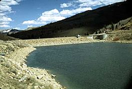
Scofield Reservoir and dam
|
|
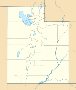
| Location | Carbon County, Utah, United States |
| Coordinates | 39°47′13″N 111°07′12″W / 39.78694°N 111.12000°W |
| Type | reservoir |
| Primary inflows | Price River |
| Primary outflows | Price River |
| Catchment area | 4,350,000 acres (17,600 km2) |
| Basin countries | United States |
| Max. length | 4.9 mi (7.9 km) |
| Max. width | 2.1 mi (3.3 km) |
| Surface area | 2,815 acres (11.39 km2) |
| Average depth | 26 ft (7.9 m) |
| Max. depth | 66 ft (20.1 m) |
| Water volume | 73,600 acre⋅ft (90,800,000 m3) |
| Shore length1 | 15.5 mi (24.9 km) |
| Surface elevation | 7,618 ft (2,321 m) |
| Islands | 1 |
| Settlements | Scofield, Utah |
| 1 Shore length is not a well-defined measure. | |
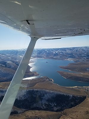
Scofield Reservoir is a large lake in Carbon County, Utah. It covers about 2,815 acres (11.39 km2) of land. This reservoir was created by the Scofield Dam. It sits on the Price River, which flows into the Green River.
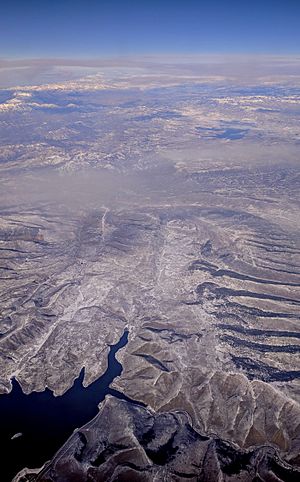
Scofield Reservoir is located right next to the northern part of the Manti–La Sal National Forest. It is high up, at an elevation of 7,618 feet (2,322 m), on the northern edge of the Wasatch Plateau. Utah State Route 96 runs along its western side.
The Scofield project was started by the US Bureau of Reclamation after earlier attempts to build a dam on the Price River. The current dam was finished in 1946. This reservoir helps prevent floods and provides important water for homes and businesses. It is also a very popular place for fishing and other outdoor activities.
Contents
Water Flow and Sources
Scofield Reservoir is mainly fed by the Price River. It also gets water from underground sources and many small mountain streams, especially when snow melts in the spring. The most important streams that feed it are Fish Creek (Utah) and Clear Creek Canyon (Utah). Each year, the reservoir receives about 52,000 acre-feet (64,000,000 m3) of water.
Building the Dam: A Look Back
People started developing irrigation systems in the Scofield area in 1883. Farmers created ditch companies to take water from the Price River. Over time, these systems grew, but soon there wasn't enough natural river water to meet all the farming needs.
Early Attempts to Store Water
In 1896, a company called Mammoth Reservoir Company was formed to store floodwaters from the Price River. Later, in 1900, farmers from Sanpete County bought the rights to this water. They planned to move the water over the mountains to their farms.
By 1902, the Sanpete group faced money problems. The project then went to the Irrigated Lands Co. This company changed the plan. Instead of watering Sanpete County, they aimed to irrigate 25,000 acres (100 km2) near Price, Utah. They began building Mammoth Dam with help from the State of Utah.
Mammoth Dam Failure
The Irrigated Lands Co. faced more financial difficulties. In 1911, it was reorganized into the Price River Irrigation Co. They continued building the project as they could. However, on June 25, 1917, the Mammoth Dam broke while it was still being built. It released 11,000 acre-feet (14,000,000 m3) of water. This caused about $1 million in flood damage to railroads and mining properties.
First Scofield Dam and Its Problems
After the Mammoth Dam failed, the Price River Water Conservation District was created in 1921. Their goal was to build new water storage facilities. Under their guidance, the first Scofield Dam 39°47′12″N 111°07′13″W / 39.78667°N 111.12028°W was built between 1925 and 1926. The lake behind this dam could hold 6,000 acre-feet (7,400,000 m3) of water.
In May 1928, the reservoir was almost full for the first time. But then, the dam partly broke. Quick repairs and letting water out through a tunnel helped stop a complete failure and a huge flood. However, many attempts to make the dam safe failed. Because the dam was weak, the amount of water allowed in Scofield Reservoir was strictly limited to 30,000 acre-feet (37,000,000 m3).
Building the New Dam
During World War II, it became very important to replace the old, unsafe dam. If it failed, it could damage important wartime transportation and coal mines. The US Bureau of Reclamation studied the project. They decided to build a completely new and larger dam about 800 feet (240 m) downstream from the old one.
The president approved the project on June 24, 1943. In 1943, the Carbon Water Conservancy District was formed. This group worked with the United States to build the new dam.
The W.W. Clyde Company started building the new dam during World War II. This was to protect the main railroad line, the State highway, phone and telegraph lines, and coal mines, all of which were vital for the war. The new dam was finished on June 15, 1946.
The Current Scofield Dam
The Scofield Dam we see today is made of earth and rock. It stands 125 feet (38 m) tall. The top of the dam is 575 feet (175 m) long and thirty feet wide. It contains a huge amount of material, about 204,000 cubic yards. The widest part of its base is 400 feet (120 m).
Scofield Reservoir can hold a total of 73,600 acre-feet (90,800,000 m3) of water. About 65,800 acre-feet (81,200,000 m3) of this water can be used. The dam has a special concrete overflow area called a spillway on its right side. This spillway helps control water levels during floods.
What Scofield Reservoir is Used For
Scofield Reservoir and the land around it are used for many things. These include coal mining, farming, and homes. It's also a popular spot for fishing, hunting, snowmobiling, camping, and many other fun activities in both summer and winter.
Water for Farms and Flood Control
When the dam was first built, the Federal government saw it as a way to control floods. This was important to protect industries and transportation vital for the war effort. For local people, Scofield Dam and Reservoir also provided water for nearby farms. In 1943, farms in the area grew crops like alfalfa, barley, corn, oats, wheat, potatoes, and sugar beets. Orchards near Helper grew peaches, pears, apricots, and apples.
The value of crops grown with Scofield water reached over one million dollars in the 1960s and early 1970s. In 1981, the total value of crops reached four million dollars.
A Place for Fun and Fishing
Today, the reservoir still helps prevent floods and provides a steady water supply. But it's also a very popular place for recreation. It is part of Scofield State Park, which is managed by the Utah State Parks system.
Scofield has always been one of Utah's best places for fishing. It's known for having many good-sized trout. It's also special because you can catch a lot of fish right from the shore. The reservoir is home to fish like rainbow trout, cutthroat trout, redside shiner, and mountain sucker. You can also find creatures like damselfly larvae, mayfly larvae, and crayfish. In winter, it's a favorite spot for ice fishing.
The reservoir also hosts the Scofield triathlon, a sports event held every year since 2006.
Nearby Communities
The town of Scofield, Utah is located directly south of the reservoir. About 45 miles (72 km) to the northwest, you'll find the larger metropolitan area of Provo and Orem.
 | William L. Dawson |
 | W. E. B. Du Bois |
 | Harry Belafonte |


