Orangeville, Utah facts for kids
Quick facts for kids
Orangeville, Utah
|
|
|---|---|

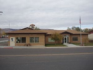
Orangeville City Office
|
|

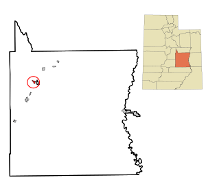
Location in Emery County and the state of Utah
|
|

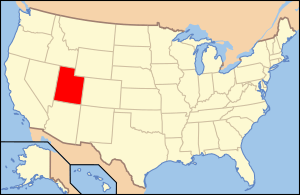
Location of Utah in the United States
|
|
| Country | United States |
| State | Utah |
| County | Emery |
| Founded | 1878 |
| Incorporated | June 6, 1901 |
| Became a city | March 1921 |
| Named for | Orange Seely |
| Area | |
| • Total | 1.43 sq mi (3.69 km2) |
| • Land | 1.43 sq mi (3.69 km2) |
| • Water | 0.00 sq mi (0.00 km2) |
| Elevation | 5,778 ft (1,761 m) |
| Population
(2010)
|
|
| • Total | 1,470 |
| • Estimate
(2019)
|
1,326 |
| • Density | 929.87/sq mi (359.05/km2) |
| Time zone | UTC-7 (Mountain (MST)) |
| • Summer (DST) | UTC-6 (MDT) |
| ZIP code |
84537
|
| Area code(s) | 435 |
| FIPS code | 49-56860 |
| GNIS feature ID | 1431021 |
Orangeville is a city in Emery County, Utah, United States. It is located near the Manti-La Sal National Forest. The city sits where State Routes 29 and 57 meet. It also stretches along the banks of Cottonwood Creek. In 2010, about 1,470 people lived there.
Contents
Exploring Orangeville's Location
Orangeville is about 2 miles (3.2 km) west of Castle Dale. Castle Dale is the main city of Emery County. The United States Census Bureau says Orangeville covers about 1.43 square miles (3.69 square kilometers). All of this area is land.
Orangeville's Population Over Time
The population of Orangeville has changed quite a bit over the years. Here's a look at how many people have lived in the city during different census counts:
| Historical population | |||
|---|---|---|---|
| Census | Pop. | %± | |
| 1890 | 353 | — | |
| 1900 | 623 | 76.5% | |
| 1910 | 643 | 3.2% | |
| 1920 | 553 | −14.0% | |
| 1930 | 532 | −3.8% | |
| 1940 | 652 | 22.6% | |
| 1950 | 589 | −9.7% | |
| 1960 | 571 | −3.1% | |
| 1970 | 511 | −10.5% | |
| 1980 | 1,309 | 156.2% | |
| 1990 | 1,459 | 11.5% | |
| 2000 | 1,398 | −4.2% | |
| 2010 | 1,470 | 5.2% | |
| 2019 (est.) | 1,326 | −9.8% | |
| U.S. Decennial Census | |||
In 2000, there were 1,398 people living in Orangeville. Most residents were White. About 1.22% of the population was of Hispanic or Latino background. The average age of people in Orangeville was 29 years old. Many households had children under 18 living with them.
The Story of Orangeville
Orangeville was started in 1878. It was first called Upper Castle Dale. In 1879, a post office was opened. The town was then named Orangeville. This name honored Orange Seely, who was the first person asked to settle in Castle Valley.
How Orangeville Got Its Name
Orange Seely wanted new settlers to stay on one side of the creek. But people did not follow his plan. Eventually, two towns grew about four miles apart. One was on the northwest side of the creek, and the other on the southeast. The settlers decided each town should have its own name.
A friendly disagreement started between the two towns. Some people thought the lower town, now Castle Dale, should have been Orangeville. This was because it was Orange Seely's home. The name Orangeville was suggested in his honor. People in Orangeville thought their town should have kept the original name of Castle Dale. This was because they settled there first. People from Orangeville were sometimes called 'Skillet Lickers'. This was because they made molasses there. People from Castle Dale were called 'Woodenshoes'. This hinted that Danish people had settled there.
The Wilberg Mine Event
The Wilberg Mine is located about 12 miles (19 km) northwest of Orangeville. On December 19, 1984, a serious mine fire happened there. This event sadly took the lives of 27 people. These included 18 miners and nine company officials. It was the worst coal mine fire in Utah's history. The fire quickly blocked the escape path for the 27 people. The fire started because of a faulty air compressor. This machine was left running without anyone watching it. The area where it was running was not protected against fire.
See also
 In Spanish: Orangeville (Utah) para niños
 | DeHart Hubbard |
 | Wilma Rudolph |
 | Jesse Owens |
 | Jackie Joyner-Kersee |
 | Major Taylor |

