Currant Creek (Juab and Utah counties, Utah) facts for kids
Quick facts for kids Currant Creek |
|
|---|---|
|
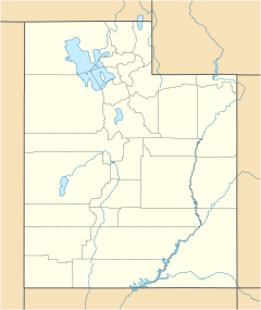
Location of the mouth of Currant Creek within the State of Utah
|
|
| Country | United States |
| State | Utah |
| Counties | Juab, Utah |
| City | Mona |
| Physical characteristics | |
| Main source | Unnamed spring Juab Valley 39°46′12.3″N 111°51′31.6″W / 39.770083°N 111.858778°W |
| River mouth | Utah Lake Goshen Valley 4,306 ft (1,312 m) 39°59′01″N 111°55′39″W / 39.98361°N 111.92750°W |
| Basin features | |
| River system | Great Salt Lake |
| Tributaries |
|
| GNIS feature ID | 1440201 |
Currant Creek is a cool stream located in Utah, a state in the western United States. It flows through parts of Juab County and Utah County. This creek is an important part of the local water system, helping to fill reservoirs and eventually reaching Utah Lake.
Contents
Currant Creek: A Journey Through Utah
Currant Creek starts its journey in a spring-fed marsh area. This marsh is found in the northern part of Juab Valley in eastern Juab County. Imagine a place where water bubbles up from the ground, creating a wet, grassy area. That's where our creek begins!
Where Currant Creek Starts and Flows
The creek starts at an elevation of about 4,930 feet (1,503 meters). From its source, it flows generally north-northwest. As it moves, it passes through several small ponds. It also joins up with other small streams. These streams add more water to Currant Creek.
A bit further along, the creek flows near the Burriston Ponds. These ponds also help feed the creek. Then, it meets another stream called West Creek. Currant Creek continues its path, passing west of the city of Mona.
Before it reaches the Mona Reservoir, also known as Mount Nebo Reservoir, the creek flows under Goshen Canyon Road. The Mona Reservoir is a large body of water that the creek helps to fill.
After leaving the Mona Reservoir, Currant Creek continues its journey. It flows through a narrow passage called the Goshen Canyon. As it travels through this canyon, the creek leaves Juab County and enters Utah County.
The creek then keeps flowing northwest through the Goshen Valley. Here, it meets another important stream, Kimball Creek. After this meeting, Currant Creek flows into the Goshen Reservoir.
Just north of this reservoir, the creek passes under U.S. Route 6. Finally, Currant Creek reaches its end point. It flows into a marshy area on the north side of Goshen Valley. This is where it joins the Goshen Bay of Utah Lake, which is a very large freshwater lake.
Friends of the Creek: Tributaries
Currant Creek gets water from many small, unnamed springs and streams. But it also has two main "friends" or branches that join it. These are called tributaries. They are West Creek and Kimball Creek.
West Creek: A Helper Stream
West Creek is the first named tributary that joins Currant Creek. It's also located in eastern Juab County. West Creek starts from a place called Orme Spring. This spring is high up in the West Hills range.
From Orme Spring, West Creek flows north-northeast. It travels down Spring Canyon. Then, it enters the Juab Valley. It continues flowing north along the west side of the valley. It even passes under State Route 132. Finally, West Creek flows into Currant Creek, just west of the Burriston Ponds.
Orme Spring: West Creek's Beginning
Orme Spring is a spring in eastern Juab County. It's a "seepage spring," which means water slowly seeps out of the ground. This spring is located in Spring Canyon in the West Hills. It's the starting point, or source, for West Creek.
Kimball Creek: Another Important Branch
Kimball Creek is the other important tributary of Currant Creek. This stream is found in southern Utah County. Kimball Creek is an "intermittent stream." This means it doesn't flow all the time; it might dry up during certain parts of the year.
Kimball Creek starts on the east side of Tintic Mountain. This mountain is part of the East Tintic Mountains range. From its source, the creek flows south through Big Dog Canyon. Then, it turns northeast. It flows into the southwest end of the Goshen Valley. After entering the valley, Kimball Creek continues northeast until it joins Currant Creek. This meeting point is about 3,250 feet (991 meters) south of the Goshen Reservoir.
 | Isaac Myers |
 | D. Hamilton Jackson |
 | A. Philip Randolph |


