Jericho, Utah facts for kids
Quick facts for kids
Jericho, Utah
|
|
|---|---|
| Country | United States |
| State | Utah |
| County | Juab |
| Elevation | 5,319 ft (1,621 m) |
| Time zone | UTC-7 (Mountain (MST)) |
| • Summer (DST) | UTC-6 (MDT) |
| ZIP codes |
84628
|
| Area code(s) | 435 |
| GNIS feature ID | 1437597 |
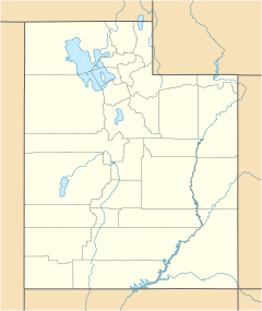
Jericho is a ghost town in eastern Juab County, Utah, United States. A ghost town is a place that used to have many people living there, but now it is mostly empty. Jericho is located in the southern part of the Tintic Valley. It is about 30 miles (48 km) west of Nephi. It is also about 103 miles (166 km) southwest of Salt Lake City.
Contents
Exploring Jericho
The area where Jericho used to be is right next to the Union Pacific Railroad's (UP) Lynndyl Subdivision tracks. You can get to Jericho by taking U.S. Route 6. This road is also known as the Grand Army of the Republic Highway. You can drive south from Eureka or northeast from Delta. Another way to reach the area is by heading west from Nephi on Utah State Route 132.
Why the Name Jericho?
Jericho was given its name because of its surroundings. The area is very empty, isolated, and sandy. It is close to the Little Sahara Recreation Area. This recreation area is famous for its large sand dunes.
Fun in the Sand Dunes
The Little Sahara Recreation Area is a very popular spot for outdoor activities. Many people enjoy riding off-road vehicles and motocross bikes there. It is also a great place for camping.
Jericho's Climate
The weather in Jericho is typical for the Great Basin Desert. Summers are very hot, often reaching between 90 and 100 degrees Fahrenheit (32-38 degrees Celsius). Winters are cold, with temperatures usually between 30 and 40 degrees Fahrenheit (-1 to 4 degrees Celsius).
Jericho Junction
The State Road Commission of Utah, which is now called the Utah Department of Transportation, named a nearby highway intersection after this former community. It is known as Jericho Junction.
Jericho's Past
Jericho started out as a place where sheep were sheared. This means their wool was cut off. It was located along the Los Angeles and Salt Lake Railroad line. This railroad line is now part of the Union Pacific's Lynndyl Subdivision. Later, Jericho became a camp for the Civilian Conservation Corps. This group was known as Camp Jericho. The Civilian Conservation Corps was a program during the Great Depression that put young men to work on conservation projects.
 | Emma Amos |
 | Edward Mitchell Bannister |
 | Larry D. Alexander |
 | Ernie Barnes |


