Birdseye, Utah facts for kids
Quick facts for kids
Birdseye, Utah
|
|
|---|---|
| Country | United States |
| State | Utah |
| County | Utah |
| Settled | 1885 |
| Named for | Birdseye marble |
| Elevation | 5,430 ft (1,660 m) |
| Time zone | UTC-5 (Mountain (MST)) |
| • Summer (DST) | UTC-4 (MDT) |
| ZIP code |
84629
|
| Area codes | 801 & 385 |
| GNIS feature ID | 1438817 |
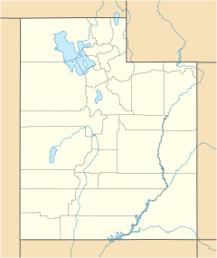
Birdseye is a small, unincorporated community. It is located in southeastern Utah County, Utah, in the United States. An unincorporated community means it's a settlement without its own local government.
| Historical population | |||
|---|---|---|---|
| Census | Pop. | %± | |
| 1900 | 150 | — | |
| 1910 | 134 | −10.7% | |
| 1920 | 50 | −62.7% | |
| 1930 | 116 | 132.0% | |
| 1940 | 90 | −22.4% | |
| 1950 | 77 | −14.4% | |
| Source: U.S. Census Bureau | |||
About Birdseye
Birdseye is found on the eastern side of the Wasatch Range mountains. It is southeast of Loafer Mountain. The community sits along U.S. Route 89. This is where two creeks, Bennie Creek and Thistle Creek, meet.
How Birdseye Got Its Name
The area where Birdseye is located was first settled in 1885. It was originally called Summit Basin. Later, its name was changed to Clinton.
The name "Birdseye" was chosen because of a special type of marble found nearby. This marble has patterns that look like the eyes of birds. These unique marble quarries are located close to Indianola.
 | Calvin Brent |
 | Walter T. Bailey |
 | Martha Cassell Thompson |
 | Alberta Jeannette Cassell |


