Riverton, Utah facts for kids
Quick facts for kids
Riverton, Utah
|
|||
|---|---|---|---|
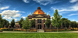
Old Dome Meeting Hall in Riverton
|
|||
|
|||
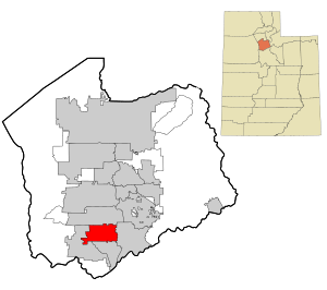
Location in Salt Lake County and the state of Utah.
|
|||
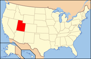
Location of Utah in the United States
|
|||
| Country | United States | ||
| State | Utah | ||
| County | Salt Lake | ||
| Settled | 1865 | ||
| Incorporated | 1947 | ||
| Named for | Jordan River | ||
| Area | |||
| • Total | 12.58 sq mi (32.59 km2) | ||
| • Land | 12.58 sq mi (32.59 km2) | ||
| • Water | 0.00 sq mi (0.00 km2) 0% | ||
| Elevation | 4,439 ft (1,353 m) | ||
| Population
(2020)
|
|||
| • Total | 45,285 | ||
| • Density | 3,599.8/sq mi (1,389.54/km2) | ||
| Time zone | UTC−7 (MST) | ||
| • Summer (DST) | UTC−6 (MDT) | ||
| ZIP Code |
84065, 84096, 84095
|
||
| Area code(s) | 385, 801 | ||
| FIPS code | 49-64340 | ||
| GNIS feature ID | 1431862 | ||
Riverton is a city located in Salt Lake County, Utah, in the United States. It's part of the bigger Salt Lake City metropolitan area. In 2020, about 45,285 people lived here. Riverton is in the fast-growing southwest part of the Salt Lake Valley.
Contents
Riverton's History
Riverton is in the southern part of the Salt Lake Valley. The first European settlers arrived here in the mid-1850s. These early families built simple homes, often dugouts, along the river. Some stories say Archibald Gardner was the first to settle in the area. The town was even called "Gardnerville" before it became Riverton.
At first, Riverton grew slowly because there wasn't enough water for farming. But as more water became available, the town started to expand. Three canals were built to bring water from the nearby Jordan River. This helped farmers grow crops on the higher lands.
By the time World War I started in 1914, Riverton was a busy farming community. It had more water and more people. The town's business area also started to thrive.
How Businesses Grew in Riverton
The Page-Pixon store was built around the early 1900s. It was a large department store that sold many different things. You could buy building materials, coal, clothes, groceries, and even grain there. The store had a special rail outside for tying up horses.
The Jordan Valley Bank opened in 1905. It was a local bank for the community. It moved a few times before settling into its own building in 1920. Many other businesses came to Riverton around World War I. These included Bill's Meat Market, Gilbert Lloyd's Blacksmith Shop, and Riverton Motors. There was also a canning factory, an alfalfa mill, and a poultry company. The town even had theaters and other stores.
Farming was a very important business in Riverton. Farmers slowly changed from growing everything they needed for themselves to growing crops to sell. Riverton farmers started to focus on specific crops like alfalfa, wheat, and sugar beets. They also raised chickens, sheep, or dairy cows.
In 1886, The Church of Jesus Christ of Latter-day Saints bought land to store farm products and animals given as tithes. This area became known as Tithing Yard Hill. Today, it's a neighborhood with homes.
Electricity first came to Riverton in 1912. In 1913, the Salt Lake and Utah Railroad (also called the Orem Line) was built. It ran through Riverton, west of Redwood Road. This train line carried people and goods from Salt Lake to Payson. Trains used this line from 1914 to 1945. Riverton had its own train station, which was also taken down when the line closed.
How Schools Developed in Riverton
Riverton's first school was just one room. It was in an old meetinghouse. In 1892, a new two-story brick schoolhouse was built. It had four rooms and taught students from first to eighth grade. John Hansen was the first principal.
As more families moved to Riverton, more classrooms were needed. Another building was added for elementary students. In 1925, the old south building was torn down. The north building was being updated when a fire destroyed the school in July 1926.
A junior high school was then built on the south lot. A new elementary school, matching the junior high, was built where the old school burned. These buildings became the Riverton Elementary School complex. In the 1970s and 1980s, Riverton's population grew even more. This led to two new elementary schools: Southland Elementary and Rosamond Elementary.
By 1948, Riverton had grown enough to become an official city. However, World War II slowed down its progress. In the 1960s and 1970s, Riverton changed from a farming town to a suburban area. Land prices went up, and new neighborhoods were built. Many farmers sold their land and moved to other states. Riverton's population more than tripled between 1970 (2,820 people) and the mid-1980s (around 10,000 people).
Community Growth and Changes
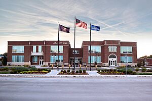
A new City Hall was built near the Riverton City Park. In 1996, the city bought the old Riverton Elementary School and its 9 acres of land. The city wanted to turn the old school into a Community Center. They also sold some land to the County Library System for a new library. By 2005–2006, the old elementary school was successfully renovated. It became the new Community Center and City Hall, holding all the city's main offices.
Riverton's city borders changed a lot until the year 2000. When it first became a city, its borders were from the Jordan River west to about 3600 West, and from 11800 South to 13800 South. In 1970, Bluffdale became a town, taking land south of 13800 South. In 1982, Draper became a city, taking land east of the Jordan River.
In 1996, Riverton's size almost doubled. It added land between Riverton and Herriman, extending its borders further west and south. The final borders of Riverton were set when Herriman became a city in 2000.
Riverton's Geography
Riverton shares its borders with several other cities. To the north is South Jordan, to the east is Draper, to the south is Bluffdale, and to the west is Herriman. The city covers about 12.6 square miles, and all of it is land.
Riverton is in the southwest part of the Salt Lake Valley. It's about 20 miles south and a little west of Salt Lake City. Riverton gets about 15.76 inches of rain and snow each year. It snows in the winter, and summer temperatures can sometimes reach over 100°F. Riverton has grown very quickly, changing from a quiet farming town into a busy suburban city.
How Riverton is Governed
Riverton City has a "six-member council" government. This means there are six elected officials who lead the city. These are the mayor and five city council members. Each council member represents a specific area of the city. The mayor represents the entire city.
The city council has hired a professional city manager. This person handles the daily operations of the city, its employees, and services. The city manager oversees all city departments and reports to the mayor and city council.
Education in Riverton
Public schools in Riverton are part of the Jordan School District. This is one of the biggest school districts in Utah.
Elementary Schools:
- Foothills Elementary
- Midas Creek Elementary
- Riverton Elementary
- Rosamond Elementary
- Rose Creek Elementary
- Southland Elementary
Middle Schools:
- Oquirrh Hills Middle School
- South Hills Middle School
High School:
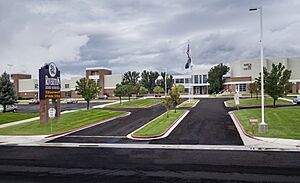
- Riverton High School
Other schools in the area include Kauri Sue Hamilton School for students with special needs. There's also the Jordan Academy for Technology and Careers (JATC) south campus. Saint Andrew Catholic School is also located in the community. Many students from Riverton also attend schools in nearby Bluffdale, Herriman, and South Jordan. This is because school boundaries don't always match city borders.
Riverton Hospital
The Intermountain Riverton Hospital opened in November 2009. It is run by Intermountain Healthcare. This hospital serves the fastest-growing part of the Salt Lake Valley. It helps people from Riverton, Herriman, Bluffdale, and South Jordan. It also provides services to cities in northern Utah County.
The hospital offers many services, including:
- Complete in-patient and out-patient care
- A 24-hour emergency department
- A modern women's center
- A surgical center
- Radiology and laboratory services
- Pharmacy and physical therapy
- 40 doctor's offices
- A helicopter pad
One special service is the children's out-patient center. It is run by Primary Children's Medical Center. The hospital is designed so it can grow as the southwest part of the valley continues to expand.
Transportation in Riverton
Riverton has easy access to major roads. Bangerter Highway, Mountain View Corridor, and Redwood Road all pass directly through the city. You can also easily reach Riverton from Interstate 15. You can take the 12300 S exit or the Bangerter Highway exit.
Riverton's Population
| Historical population | |||
|---|---|---|---|
| Census | Pop. | %± | |
| 1950 | 1,666 | — | |
| 1960 | 1,993 | 19.6% | |
| 1970 | 2,820 | 41.5% | |
| 1980 | 7,032 | 149.4% | |
| 1990 | 11,261 | 60.1% | |
| 2000 | 25,011 | 122.1% | |
| 2010 | 38,753 | 54.9% | |
| 2020 | 45,285 | 16.9% | |
| U.S. Decennial Census | |||
As of July 1, 2019, about 44,419 people lived in Riverton. Most of the people (90.3%) were non-Hispanic White. Other groups included 0.4% Black, 0.2% Native American, 1.0% Asian, and 0.8% Pacific Islander. About 1.3% of the population were from two or more races. Also, 6.5% of the people were Hispanic or Latino.
See also
 In Spanish: Riverton (Utah) para niños
 | Janet Taylor Pickett |
 | Synthia Saint James |
 | Howardena Pindell |
 | Faith Ringgold |


