
Berkeley, California facts for kids
Quick facts for kids
Berkeley
|
|||
|---|---|---|---|

Looking west over the city from the Berkeley Hills, with San Francisco in the background
|
|||
|
|||

Location of Berkeley in Alameda County, California
|
|||

Berkeley
Location in Oakland, California

Berkeley
Location in San Francisco Bay Area

Berkeley
Location in California

Berkeley
Location in the United States

Berkeley
Location in North America
|
|||
| Country | United States | ||
| State | California | ||
| County | Alameda | ||
| Incorporated | April 4, 1878 | ||
| Chartered | March 5, 1895 | ||
| Named for | George Berkeley | ||
| Government | |||
| • Type | Council-Manager | ||
| Area | |||
| • Total | 17.66 sq mi (45.73 km2) | ||
| • Land | 10.43 sq mi (27.02 km2) | ||
| • Water | 7.22 sq mi (18.71 km2) 40.83% | ||
| Elevation | 171 ft (52 m) | ||
| Population
(2020)
|
|||
| • Total | 124,321 | ||
| • Rank | |||
| • Density | 11,917.27/sq mi (4,601.36/km2) | ||
| Demonym(s) | Berkeleyan | ||
| Time zone | UTC−8 (Pacific) | ||
| • Summer (DST) | UTC−7 (PDT) | ||
| ZIP Codes |
94701–94710, 94712, 94720
|
||
| Area code | 510, 341 | ||
| FIPS code | 06-06000 | ||
| GNIS feature IDs | 1658037, 2409837 | ||

Berkeley (pronounced BURK-lee) is a city on the eastern side of San Francisco Bay in Alameda County, California, United States. It was named after George Berkeley, a famous thinker from the 1700s. The city is next to Oakland and Emeryville to the south. To the north are Albany and Kensington. Its eastern edge follows the Berkeley Hills. In 2020, about 124,321 people lived there.
Berkeley is home to the oldest campus of the University of California, called the University of California, Berkeley. It also has the Lawrence Berkeley National Laboratory, which the university manages. The city is known for being a very socially progressive place in the United States.
Contents
- Exploring Berkeley's Past
- Understanding Berkeley's Location
- People of Berkeley
- Getting Around Berkeley
- Berkeley's Economy and Jobs
- Places to See in Berkeley
- Parks and Fun Activities
- Arts and Culture in Berkeley
- Learning in Berkeley
- Berkeley in the News
- Famous People from Berkeley
- Berkeley's Sister Cities
- See also
Exploring Berkeley's Past
Early Beginnings
The land where Berkeley is today was once home to the Chochenyo/Huchiun group of the Ohlone people. They used pits in rocks to grind acorns. You can still see some of these pits at Indian Rock Park.

The first Europeans arrived in 1776 with the De Anza Expedition. This led to the Spanish setting up the Presidio of San Francisco across the bay. A soldier named Luis Peralta was given a large piece of land for his ranch, which included what is now Berkeley. He called it "Rancho San Antonio."
The ranch was mainly for raising cattle. Later, Peralta divided the land among his four sons. Most of what is now Berkeley went to his son Domingo. The names Domingo, Vicente, and Peralta are still used for streets in Berkeley today.
In 1853, Alameda County was created, and Berkeley became part of it. At this time, Berkeley was mostly open land, farms, and ranches. There was also a busy wharf by the bay.

How Berkeley Got Its Name
In 1866, a school called the College of California was looking for a new location. They chose a spot north of Oakland near Strawberry Creek, with great views of the Bay Area. One of the college's founders, Frederick Billings, thought of a quote by Bishop George Berkeley: "westward the course of empire takes its way." He suggested naming the town and college after him. Even though the philosopher's name is pronounced "bark-lee," the city's name is pronounced "burk-lee."
The college worked with the State of California to create the public University of California in 1868. As the university was built, more homes appeared nearby. A small town also grew around the wharf, called "Ocean View." The first post office opened in 1872.
By the 1870s, the Transcontinental Railroad reached Oakland. A branch line was built to what is now downtown Berkeley in 1876.
In 1878, the people of Ocean View and the university area officially formed the Town of Berkeley. The area near the university became known as "East Berkeley."
Modern changes came quickly. Electric lights were used by 1888, and telephones were already in town. Electric streetcars soon replaced horse-drawn ones.
Growing into a City
Berkeley's growth sped up after the Great San Francisco earthquake of 1906. Berkeley was not badly damaged, and many people from San Francisco moved across the bay. This led to a large group of artists moving to Berkeley.
In 1904, the first hospitals opened: Alta Bates Sanatorium and Herrick Hospital. In 1909, Berkeley officially became the City of Berkeley. The city continued to grow until the Crash of 1929. The Great Depression was tough, but the university helped Berkeley manage better than some other places.
On September 17, 1923, a big fire swept through the hills towards the university and downtown. About 640 buildings burned before the fire was stopped.
Growth picked up again during World War II, as many people moved to the Bay Area for war-related jobs. J. Robert Oppenheimer, a U.C. Professor, played a big role in the war's outcome. The element berkelium was even named after the university and city in 1949.
A Time of Change: The 1950s and 1960s
After the war, Berkeley continued to grow. The U.C. campus became a center for student activism. In the 1950s, some professors refused to sign a loyalty oath, standing up for freedom of thought. In 1960, students protested a government committee investigating communists. Many U.C. students also became active in the Civil Rights Movement.
In 1964, the university tried to ban political flyers on campus. This led to a huge student protest called the Free Speech Movement. As the Vietnam War grew, so did student protests at the university.
Berkeley is strongly linked to the social changes and protests of the late 1960s. During this time, Berkeley, especially Telegraph Avenue, became a key spot for the hippie movement. A famous event was the conflict over a piece of university land called "People's Park."

The struggle over People's Park led to the National Guard being sent to Berkeley for a month by Governor Ronald Reagan. In the end, the park remained undeveloped. Another park, Ohlone Park, was also created by activists.
Large protests in Berkeley became less common after the Vietnam War ended in 1975. Berkeley remains a very Democratic city.
From the 1970s to Today
Berkeley's population decreased in the 1970s as some people moved to the suburbs. Housing costs in Berkeley have risen a lot since the 1980s.
In 1983, Berkeley created a task force to support families, which led to new policies that became a model for other cities.
In 2006, the Berkeley Oak Grove Protest started. People protested building a new sports center that would remove oak trees on the UC campus. The protest ended in 2008 after a long court case.
In 2010, the Berkeley Student Food Collective opened. Students and community members worked together to create a grocery store near the UC Berkeley campus. It sells local, healthy, and organic foods.
In 2011, the Occupy Wall Street movement came to Berkeley, with protests on campus and in Civic Center Park.
In 2012, Berkeley became one of the first cities in the U.S. to officially recognize September 23 as Celebrate Bisexuality Day.
In 2014, Berkeley voters approved the Measure D soda tax, the first of its kind in the United States.
Berkeley has seen a decrease in its crime rate since 2000.
Understanding Berkeley's Location
Berkeley is located at 37.871775° N, −122.274603° W.

The city covers about 17.7 square miles. About 10.5 square miles are land, and 7.2 square miles (40.83%) are water, mostly part of San Francisco Bay.
Berkeley shares borders with Albany, Oakland, Emeryville, and Contra Costa County. It also borders San Francisco Bay.
Berkeley uses telephone area code 510. The postal ZIP codes are 94701 through 94710, 94712, and 94720 for the University of California campus.
Berkeley's Geology
Most of Berkeley is on a gently sloping plain that rises from the bay to the Berkeley Hills. East of the Hayward Fault, the land rises more steeply. The highest point in the hills above Berkeley is Grizzly Peak, which is about 1,754 feet high. Several small creeks flow from the hills to the Bay through Berkeley, like Cerrito, Codornices, Schoolhouse, and Strawberry Creeks.
The Berkeley Hills are part of the Pacific Coast Ranges. You can see different types of rocks in the hills, including volcanic rocks. Some of these rhyolite rock formations can be seen in city parks, like Indian Rock Park.
Earthquakes in Berkeley
Berkeley is located on the Hayward Fault Zone, a major branch of the San Andreas Fault. While no large earthquake has happened on the Hayward Fault near Berkeley recently, scientists warn that a big earthquake (magnitude 6.7 or higher) in the Bay Area is likely in the next 30 years. The Hayward Fault has the highest chance of being the center of such a quake. Also, some flat areas closer to the shore in Berkeley are at risk of soil liquefaction during an earthquake.
The 1868 Hayward earthquake happened on the southern part of the Hayward Fault. It caused damage in San Francisco and was felt strongly in Berkeley. This quake created a crack in the ground along the fault line in Berkeley. Today, you can see signs of the Hayward Fault's slow movement in Berkeley, like cracked roads and shifted streams. A well-known part of the Hayward Fault runs right through the middle of California Memorial Stadium on the University of California campus.
Berkeley's Weather
Berkeley has a cool summer Mediterranean climate. This means it has dry summers and wet winters. Because Berkeley is right across from the Golden Gate, fog often covers the city, especially in the mornings and evenings. Summers are cooler than in other Mediterranean climates due to ocean currents.
Winters have rainstorms but also sunny, clear days. It rarely snows, though the hilltops sometimes get a light dusting. Spring and fall are in-between seasons. Summer usually brings fog and low clouds in the mornings, followed by sunny, warm days. The warmest and driest months are usually June through September, with September being the hottest.
The average temperature in January is about 56°F (high) and 43°F (low). In September, the average is about 71°F (high) and 55°F (low). On average, there are only about 3 days a year when the temperature reaches 90°F or higher, and less than 1 day when it drops to 32°F or lower. The highest temperature ever recorded was 107°F. The lowest was 24°F.
January is usually the wettest month. Berkeley gets about 25 inches of rain each year. The most rain in one month was over 14 inches in February 1998. Heavy rainfall years are often linked to El Niño weather patterns. Dry years are often linked to La Niña patterns.
In late spring and early fall, strong, dry winds can blow from inland, making the area hot and dry. This creates a risk of wildfires, especially in the fall. In September 1923, a major fire swept through neighborhoods north of the university. In October 1991, strong winds caused a large fire along the Berkeley–Oakland border, destroying many homes and causing many injuries and deaths.
| Climate data for Berkeley, California (1981–2010) | |||||||||||||
|---|---|---|---|---|---|---|---|---|---|---|---|---|---|
| Month | Jan | Feb | Mar | Apr | May | Jun | Jul | Aug | Sep | Oct | Nov | Dec | Year |
| Record high °F (°C) | 77 (25) |
80 (27) |
87 (31) |
95 (35) |
101 (38) |
107 (42) |
107 (42) |
104 (40) |
106 (41) |
99 (37) |
86 (30) |
80 (27) |
107 (42) |
| Mean daily maximum °F (°C) | 58.4 (14.7) |
61.6 (16.4) |
64.2 (17.9) |
66.8 (19.3) |
69.7 (20.9) |
73.2 (22.9) |
73.9 (23.3) |
74.3 (23.5) |
74.8 (23.8) |
72.5 (22.5) |
64.8 (18.2) |
58.6 (14.8) |
67.8 (19.9) |
| Mean daily minimum °F (°C) | 42.0 (5.6) |
44.2 (6.8) |
45.7 (7.6) |
46.5 (8.1) |
49.4 (9.7) |
51.7 (10.9) |
53.0 (11.7) |
53.9 (12.2) |
53.4 (11.9) |
51.5 (10.8) |
46.6 (8.1) |
42.6 (5.9) |
48.4 (9.1) |
| Record low °F (°C) | 25 (−4) |
29 (−2) |
33 (1) |
36 (2) |
36 (2) |
40 (4) |
40 (4) |
42 (6) |
38 (3) |
38 (3) |
33 (1) |
25 (−4) |
25 (−4) |
| Average precipitation inches (mm) | 4.98 (126) |
5.21 (132) |
3.86 (98) |
1.66 (42) |
0.86 (22) |
0.15 (3.8) |
0.01 (0.25) |
0.06 (1.5) |
0.24 (6.1) |
1.37 (35) |
3.30 (84) |
5.04 (128) |
26.74 (679) |
| Source: Western Regional Climate Center | |||||||||||||
People of Berkeley
| Historical population | |||
|---|---|---|---|
| Census | Pop. | %± | |
| 1890 | 5,101 | — | |
| 1900 | 13,214 | 159.0% | |
| 1910 | 40,434 | 206.0% | |
| 1920 | 56,036 | 38.6% | |
| 1930 | 82,109 | 46.5% | |
| 1940 | 85,547 | 4.2% | |
| 1950 | 113,805 | 33.0% | |
| 1960 | 111,268 | −2.2% | |
| 1970 | 114,091 | 2.5% | |
| 1980 | 103,328 | −9.4% | |
| 1990 | 102,724 | −0.6% | |
| 2000 | 102,743 | 0.0% | |
| 2010 | 112,580 | 9.6% | |
| 2020 | 124,321 | 10.4% | |
| 2024 (est.) | 125,327 | 11.3% | |
| U.S. Decennial Census | |||
Who Lives in Berkeley?
| Race / Ethnicity (NH = Non-Hispanic) | Pop 2000 | Pop 2010 | Pop 2020 | % 2000 | % 2010 | % 2020 |
|---|---|---|---|---|---|---|
| White (NH) | 56,691 | 61,539 | 62,450 | 55.18% | 54.66% | 50.23% |
| Black or African American (NH) | 13,707 | 10,896 | 9,495 | 13.34% | 9.68% | 7.64% |
| Native American or Alaska Native (NH) | 293 | 228 | 226 | 0.29% | 0.20% | 0.18% |
| Asian (NH) | 16,740 | 21,499 | 24,701 | 16.29% | 19.10% | 19.87% |
| Pacific Islander (NH) | 121 | 170 | 253 | 0.12% | 0.15% | 0.20% |
| Some Other Race (NH) | 598 | 503 | 1,109 | 0.58% | 0.45% | 0.89% |
| Mixed race or Multiracial (NH) | 4,592 | 5,536 | 9,069 | 4.47% | 4.92% | 7.29% |
| Hispanic or Latino (any race) | 10,001 | 12,209 | 17,018 | 9.73% | 10.84% | 13.69% |
| Total | 102,743 | 112,580 | 124,321 | 100.00% | 100.00% | 100.00% |
In 2020, Berkeley had a population of 124,321 people. The population density was about 11,874 people per square mile. The city is made up of many different groups of people. About 50.2% were White, 7.6% Black or African American, and 19.9% Asian. About 13.7% of the people were of Hispanic or Latino background.
The average income for a household in Berkeley was about $104,716 in 2022. For families, it was about $177,068. About 17.7% of the population lived below the poverty line.

In 2010, about 88.6% of the population lived in homes, while 11.0% lived in places like college dorms. There were 46,029 households. About 18.4% of these had children under 18. About 40.9% of homes were owned by the people living in them, and 59.1% were rented.

Getting Around Berkeley
Berkeley has many ways to get around. You can use Amtrak trains, AC Transit buses, or BART trains. BART has three stations in Berkeley: Ashby, Downtown Berkeley Station, and North Berkeley. Many employers, like UC Berkeley, also have shuttle buses. The Eastshore Freeway (Interstate 80 and Interstate 580) runs along the bay.
Berkeley is known for having a lot of people who bike and walk to get around. It's one of the safest cities in California for pedestrians and cyclists, based on the number of injuries.

Berkeley has changed its street layout with barriers to keep most car traffic off smaller neighborhood streets and onto main roads. This can sometimes be confusing for visitors. The city also has special bike routes called Bicycle Boulevards with bike lanes and less car traffic.
Berkeley also has car sharing services like Zipcar. This allows members to share cars instead of owning their own. You can reserve cars online or by phone. These cars are parked in different spots around the city.
Berkeley has had issues with parking meter vandalism. To fix this, the city started replacing old mechanical meters with electronic ones in 2005.
A Look at Transportation History
The first train service to San Francisco from Berkeley started in 1876. It was called the Berkeley Branch Railroad. Later, in 1911, the Southern Pacific company made these lines electric. These large, heavy electric trains were known as the "Red Trains." The last Red Trains ran in 1941.
Electric streetcars began running in Berkeley in 1891. Most of these were later bought by the Key System. The Key System's streetcars ran on many main streets in Berkeley. The last streetcars stopped running in 1948 and were replaced by buses.
The Key System also started electric commuter trains to San Francisco in 1903. These trains went to a pier where passengers would take ferryboats to San Francisco. After the Bay Bridge was built, the Key trains used the lower deck of the bridge to go directly to San Francisco. These trains had letter names, like the F, E, G, and H trains. The Key System trains stopped running in 1958.
Berkeley's Economy and Jobs

Berkeley is home to many important businesses. Some well-known ones include Chez Panisse, which helped create California cuisine, and the original Peet's Coffee store. Other notable places are the Claremont Resort, the music venue 924 Gilman, and Saul Zaentz's Fantasy Studios.
Berkeley has fewer large chain stores compared to other cities its size. This is because the city has policies that support small businesses and limit the size of certain stores.
Major Employers in Berkeley
Here are the top employers in Berkeley, based on a 2023 report:
| # | Employer | Employees |
|---|---|---|
| 1 | University of California, Berkeley | 13,213 |
| 2 | Lawrence Berkeley National Laboratory | 3,470 |
| 3 | Alta Bates Summit Medical Center (part of Sutter Health) | 1,773 |
| 4 | Berkeley Unified School District | 1,710 |
| 5 | City of Berkeley | 1,602 |
| 6 | Bayer | 1,043 |
| 7 | Kaiser Permanente | 944 |
| 8 | Siemens | 679 |
| 9 | Lifelong Medical Care | 533 |
| 10 | Berkeley Bowl | 523 |
Places to See in Berkeley
Main Streets to Explore
- Shattuck Avenue: This street goes through several neighborhoods, including downtown, the city's main business area. It's named after Francis K. Shattuck, an important early citizen.
- University Avenue: This street runs from Berkeley's bay shore and marina to the University of California, Berkeley campus.
- Ashby Avenue (Highway 13): This street also goes from the bay to the hills and connects to other major highways.
- San Pablo Avenue (Highway 123): This street runs north-south through West Berkeley, connecting Oakland and Emeryville to the south and Albany to the north.
- Telegraph Avenue: This street runs north-south from the university campus to Oakland. It was a famous spot for the hippie culture in the 1960s.
- Martin Luther King Jr. Way: This street, formerly called Grove St, runs north-south a few blocks west of Shattuck Avenue.
- Solano Avenue: A popular street for shopping and restaurants, located near the north end of Berkeley and continuing into Albany.
Freeways Connecting Berkeley
- The Eastshore Freeway (I-80 and I-580) runs along Berkeley's bay shore. You can exit at Ashby Avenue, University Avenue, and Gilman Street.
Paths for Bikes and Walkers
- Ohlone Greenway
- San Francisco Bay Trail
- Berkeley I-80 bridge: Opened in 2002, this bridge is only for bikes and pedestrians. It crosses Interstate 80 and connects the city to the San Francisco Bay Trail and the Berkeley Marina.
- Berkeley's Network of Historic Pathways: Berkeley has many old pathways in the hills. They offer great views and are perfect for exploring. You can find a guide to these paths on the Berkeley Path Wanderers Association website.
Berkeley's Neighborhoods

Berkeley has many different neighborhoods. The areas around the University of California campus are the most crowded.
- Downtown Berkeley is west of the campus. It's the city's main business area, with the civic center, Berkeley High School, and the busiest BART station.
- The Southside neighborhood is south of the campus. It's mainly where many university students live. The busiest part of Telegraph Avenue is here.
- The Northside neighborhood is north of the campus and is quieter. It's home to the Graduate Theological Union.
Further from the university, most of Berkeley's neighborhoods have detached houses. Shops and restaurants are usually found along the main streets.
- In the southeast, you'll find the Claremont District, home to the Claremont Hotel.
- The Elmwood District has a small shopping area on College Avenue.
- West of Elmwood is South Berkeley, known for its weekend flea market at the Ashby Station.
- West Berkeley is west of San Pablo Avenue. It was the city's historic commercial center and used to be called Ocean View. This area used to have many factories, but now has more shops, offices, and homes.
- The Berkeley Marina is along the San Francisco Bay at the end of University Avenue. Nearby is Aquatic Park, which has a long lagoon.
- North of Downtown is the North Berkeley neighborhood, sometimes called the "Gourmet Ghetto" because of its many famous restaurants and food shops.
- Westbrae is a small neighborhood west of North Berkeley, with part of the Ohlone Greenway running through it.
- Further north are Northbrae and Thousand Oaks.
- Above these neighborhoods, on the hills, are Cragmont and La Loma Park. These areas have amazing views, winding streets, and many public stairways.
Interesting Places to Visit


- Berkeley Art Museum and Pacific Film Archive
- Berkeley Free Clinic, a clinic that has offered free services since 1969.
- Berkeley High School
- Berkeley Historical Society and Museum
- Berkeley Marina
- Berkeley Public Library
- Berkeley Repertory Theatre
- Berkeley Rose Garden
- Cloyne Court Hotel, part of the Berkeley Student Cooperative
- The Edible Schoolyard at Martin Luther King Middle School (Berkeley)
- Hearst Greek Theatre
- Indian Rock Park
- Judah L. Magnes Museum
- Lawrence Berkeley National Laboratory
- Lawrence Hall of Science
- Regional Parks Botanic Garden
- Telegraph Avenue and People's Park, famous for their role in the 1960s.
- Tilden Regional Park
- University of California, Berkeley
- The Campanile (Sather Tower) on the UC Berkeley campus.
- University of California Botanical Garden
- Urban Ore
Parks and Fun Activities

Berkeley has many parks and cares a lot about nature. The city has been planting trees for many years. It is also working to restore creeks and wetlands. Tilden Regional Park is east of the city. The Berkeley Marina and East Shore State Park are along the bay. César Chávez Park, near the Berkeley Marina, was built on the site of a former city dump.
Special Buildings and Areas

165 buildings in Berkeley are recognized as important local landmarks. 49 of these are listed on the National Register of Historic Places, including:
- Berkeley High School and the Berkeley Community Theatre.
- Berkeley Women's City Club, now Berkeley City Club.
- First Church of Christ, Scientist.
- St. John's Presbyterian Church, now the Berkeley Playhouse.
- Studio Building.
- Thorsen House.
Historic districts listed on the National Register of Historic Places:
- George C. Edwards Stadium on the University of California, Berkeley campus.
- Site of the Clark Kerr Campus, UC Berkeley. This location used to be a school for the deaf and blind.
Arts and Culture in Berkeley

Berkeley is home to the La Peña Cultural Center, which is the largest cultural center for the Chilean-American community in the United States. The Freight and Salvage is the oldest full-time folk and traditional music venue west of the Mississippi River.
Berkeley also has the Berkeley Repertory Theater, known as "Berkeley Rep." It has two stages and a school, and has won a Tony Award. The historic Berkeley Art Museum and Pacific Film Archive (BAMPFA) is run by UC Berkeley. It moved to downtown Berkeley in 2016 and shows many art exhibits and old films.
Yearly Events to Enjoy
- Jewish Music Festival – March
- Cal Day, University of California, Berkeley Open House – April
- Berkeley Arts Festival – April and May
- Himalayan Fair – May
- The Berkeley Juneteenth Festival – June
- Berkeley Kite Festival – July
- Berkeley Juggling and Unicycling Festival – July or August
- The Solano Avenue Stroll – September
- The Bay Area Book Festival – May
Learning in Berkeley
Colleges and Universities
The main campus of University of California, Berkeley is located in the city.
The Graduate Theological Union, a group of eight independent religious schools, is just north of the UC Berkeley campus. It has one of the largest religious studies programs in the U.S. Zaytuna College, a new Muslim liberal-arts college, is also in Berkeley. The Institute of Buddhist Studies has been in Berkeley since 1966. Wright Institute, a psychology graduate school, is also here. Berkeley City College is a community college.
Schools for Kids
.JPG)
The Berkeley Unified School District runs the public schools.
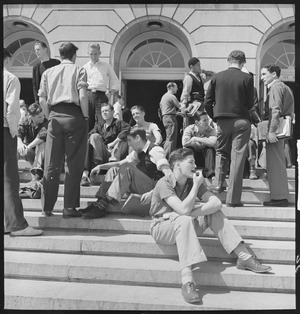
The first public school in Berkeley was the Ocean View School. Today, it's the site of the Berkeley Adult School. In the 1960s, Berkeley was one of the first U.S. cities to voluntarily desegregate its schools, using a busing system that is still in use. The district has eleven elementary schools and one public high school, Berkeley High School (BHS). BHS was established in 1880 and has over 3,000 students. The Berkeley High campus was named a historic district in 2008. Saint Mary's College High School, a Catholic school, is also in Berkeley, though most of its buildings are in nearby Albany. Berkeley has 11 public elementary schools and three middle schools.
.jpg)
The East Bay campus of the German International School of Silicon Valley (GISSV) used to be in Berkeley but closed in 2016.
Public Libraries
The Berkeley Public Library is the city's main library. The University of California, Berkeley Libraries manages the libraries for the university.
Berkeley in the News

Berkeley used to have a daily newspaper called the Berkeley Gazette, which closed in 1984. The Berkeley Barb published counter-culture news from 1965 to 1980. Today, local news comes from The Daily Californian (the UC Berkeley student newspaper), the Berkeley Times, and online publications like Berkeleyside, the Berkeley Daily Planet, and The Berkeley Scanner.
Famous People from Berkeley
Many well-known people were born or have lived in Berkeley. These include Kamala Harris, Steve Wozniak, scientists J. Robert Oppenheimer and Ernest Lawrence, actors Ben Affleck and Andy Samberg, baseball announcer Matt Vasgersian, model Rebecca Romijn, Billie Joe Armstrong (lead singer of Green Day), Adam Duritz of Counting Crows, rapper Lil B, authors Ursula K. Le Guin and Michael Chabon, and music producer KSHMR.
Berkeley's Sister Cities
Berkeley has 17 sister cities around the world:
| Sister City | Year Established |
|---|---|
| Sakai, Osaka, Japan | 1966 |
| Edda people, Imo State, Nigeria | 1982 |
| San Antonio Los Ranchos, El Salvador | 1983 |
| Haidian District, Beijing, China | 1985 |
| Gao, Mali | 1985 |
| Mathopestad, South Africa | 1986 |
| León, Nicaragua | 1986 |
| Brits, South Africa | 1986 |
| Jena, Thuringia, Germany | 1989 |
| Yondó, Colombia | 1990 |
| Dmitrov, Russia | 1991 |
| Uma Bawang, Borneo, Malaysia | 1991 |
| Ulan-Ude, Russia | 1992 (cancelled in 2022 due to the Russian invasion of Ukraine) |
| Yurok Tribe, California, United States | 1993 |
| Blackfeet Nation, Montana, United States | 2000 |
| Palma Soriano, Cuba | 2002 |
| Gongju, South Korea | 2018 |
See also
 In Spanish: Berkeley (California) para niños
