
Strawberry Creek facts for kids
Quick facts for kids Strawberry Creek |
|
|---|---|
 |
|
| Country | United States |
| State | California |
| Region | Alameda County |
| City | Berkeley |
| Physical characteristics | |
| Main source | Berkeley Hills Oakland 37°52′51″N 122°13′54″W / 37.88083°N 122.23167°W |
| River mouth | San Francisco Bay |

Strawberry Creek is a main stream that flows through the city of Berkeley, California. It starts with two branches, called "forks," high up in the Berkeley Hills. These hills are part of the California Coast Ranges.
The two forks meet together on the campus of the University of California, Berkeley. After they join, the creek flows west across the city. Finally, it empties into San Francisco Bay.
The northern branch of the creek is sometimes called "Blackberry Creek." This name is also used for another small creek in Berkeley. Part of that other creek has been "daylighted," meaning it was uncovered from underground pipes. The valley where the north fork of Strawberry Creek runs is known as "Blackberry Canyon."
Strawberry Creek is also important because it shows how the Hayward Fault moves. The creek shifts where it leaves Strawberry Canyon, right near California Memorial Stadium. Some parts of the creek on the UC campus were filled in long ago. These might be old paths of the southern branch that moved north because of the fault.
Contents
History of Strawberry Creek
Strawberry Creek was once the main source of water for the University of California, Berkeley, and parts of the city. In the late 1800s, a reservoir was built in Strawberry Canyon. This was above where California Memorial Stadium is now.
Water Supply Changes
In the early 1900s, the reservoir was replaced. The East Bay Municipal Utility District began supplying water from a larger reservoir. This new water source is located far away in the Sierra Nevada mountains. When the stadium was built, a waterfall on the creek was removed. The creek in that area was also put into underground pipes.
Changes in Downtown Berkeley
In the late 1800s, both a road bridge and a railroad bridge crossed Strawberry Creek. This was in the downtown area, where Shattuck Avenue and Allston Way meet today. These bridges were taken down in 1893. They were replaced with underground pipes, called culverts. At the same time, a group of old, large oak trees nearby were cut down.
Creek Sections Underground
Over the years, parts of the creek have been put into culverts. Many of these projects happened during the Great Depression in the 1930s. However, most of the creek still flows openly through the UC Berkeley campus. Only in the central part of campus were two smaller branches filled in long ago. The southern branch of Strawberry Creek has special areas with coast redwood trees on campus. These areas are also good homes for animals like the California slender salamander and arboreal salamander.
Bringing the Creek Back to Light
People are working to uncover or "daylight" more parts of Strawberry Creek. They want it to flow openly along its natural path through Berkeley.
Strawberry Creek Park
These efforts have led to the creation of "Strawberry Creek Park." This park is in West Berkeley. It was built on the site of an old freight yard that belonged to the Santa Fe Railway. The creek also flows openly through several private yards east of the park. This starts just west of Sacramento Street.
Future Plans
In 2010, there was a plan to bring water from Strawberry Creek to the surface along Center Street. This idea was supported by groups like Ecocity Builders. This plan would not bring back the creek's original path or natural plant life. The creek's original path is one block south, along Allston Way. Instead, this plan would show parts of the stream in a walking area.
Where the Creek Meets the Bay
At the mouth of Strawberry Creek, where it flows into San Francisco Bay, local native people once built a shellmound. Until the late 1700s, the Ohlone people ate shellfish from the creek. They piled the empty shells into a mound. This mound was a sacred burial site.
Early Settlements and Nature
There was also a small forest of native willow trees here. In the late 1800s, this area was used as a park. Jacobs' Landing was an important spot established during the California Gold Rush. It was the center of the Ocean View settlement, which existed before Berkeley was founded.
The Creek Today
Today, the creek enters San Francisco Bay from a concrete pipe. This pipe is south of University Avenue and west of the I-80/580 freeway. It is behind the Sea Breeze Market and Deli. This area is now part of Eastshore State Park. The park is managed by the East Bay Regional Park District. The muddy areas at the creek's mouth are important homes for shorebirds. Many people enjoy watching birds there. A volunteer group called Friends of Five Creeks has worked since 2000. They remove harmful plants and help native plants grow again in this area.
Images for kids
-
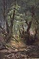
Strawberry Creek, Berkeley, by Edwin Deakin

