Schoolhouse Creek (Alameda County) facts for kids
Schoolhouse Creek is a small stream that flows through the city of Berkeley, California. Berkeley is located in the San Francisco Bay Area in California. This creek is an important part of the local environment and has an interesting history.
Contents
The Story of Schoolhouse Creek
Schoolhouse Creek got its name from a school that used to be right next to it. This school was called the Ocean View School. It was the very first school in what is now Berkeley, built way back in 1856! The land for the school was given by José Domingo Peralta.
Over the years, other schools were built on the same spot, like the San Pablo Avenue School and later, Franklin Elementary School. Franklin Elementary closed in 2003. In 2004, the Berkeley Adult School moved into the updated buildings. Today, at the corner of Curtis and Virginia Streets, there is a small park called Schoolhouse Creek Common. Volunteers helped create this park, and it opened on May 13, 2006.
Where the Creek Begins
Schoolhouse Creek starts in the Berkeley Hills. It gets its water from several small springs. These springs are just south of Codornices Creek and north of Cedar Street.
The main branch of Schoolhouse Creek is called Lincoln Creek. Lincoln Creek also starts in the hills, near the top of Virginia Street. Schoolhouse Creek and Lincoln Creek meet each other near McGee and Cedar Streets, on the flatter land below the hills. From there, the creek flows southwest, between Virginia and Cedar Streets.
For most of its journey, the creek flows underground in pipes. This is called being "culverted." You can see parts of it above ground between Sacramento and Acton Streets, and again at Curtis Street. Where the creek crosses the old Santa Fe railroad path (which is now a walking and biking trail), it's hidden by a large concrete pipe.
How the Creek Flows to the Bay
The Creek's Original Path
Long ago, Schoolhouse Creek flowed into a large marsh. This marsh also carried water from Codornices and Marin Creeks to San Francisco Bay. West of this marsh, there were low sand dunes and a curved sandy beach.
But over time, the marsh was filled in. The creek was put into a pipe, and for a while, this pipe also carried sewage to the Bay. The shoreline was even extended further west using Berkeley's garbage!
Cleaning Up the Creek
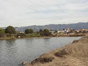
In the late 1940s, the East Bay Municipal District stopped the sewage from flowing into the creek's pipe. However, the creek still flows in that pipe today. It runs just north of and parallel to Virginia Street. The creek reaches San Francisco Bay in an area called the "North Basin." This area was originally planned to be filled with more garbage. But in the 1960s, people worked together to stop more of the Bay from being filled.
Today, this shoreline is part of Eastshore State Park. The park is managed by the East Bay Regional Park District. There's a long-term plan for the park to "daylight" the creek here. This means bringing the creek back to the surface to create a small salt marsh. This would also help reduce flood risks in West Berkeley. A group of volunteers called Friends of Five Creeks helps maintain and replant plants in this area.
 | Ernest Everett Just |
 | Mary Jackson |
 | Emmett Chappelle |
 | Marie Maynard Daly |


