Goodyear, Arizona facts for kids
Quick facts for kids
Goodyear, Arizona
|
|||
|---|---|---|---|
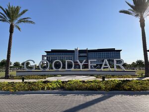
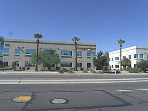
Goodyear City Hall building at 1900 N. Civic Square.
|
|||
|
|||
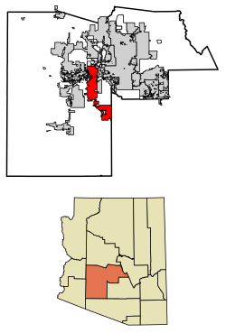
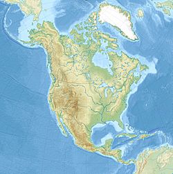
Location in Maricopa County, Arizona
|
|||
| Country | United States | ||
| State | Arizona | ||
| County | Maricopa | ||
| Area | |||
| • Total | 191.33 sq mi (495.54 km2) | ||
| • Land | 191.30 sq mi (495.46 km2) | ||
| • Water | 0.03 sq mi (0.08 km2) | ||
| Elevation | 968 ft (295 m) | ||
| Population
(2020)
|
|||
| • Total | 95,294 | ||
| • Density | 498.14/sq mi (192.33/km2) | ||
| Time zone | UTC-7 (MST (no DST)) | ||
| ZIP codes |
85338, 85395
|
||
| Area code(s) | 623 | ||
| FIPS code | 04-28380 | ||
| GNIS feature ID | 5172 | ||
Goodyear is a city in Maricopa County, Arizona, United States. It is a suburb of Phoenix. In 2020, the city had a population of 95,294 people. This was a big jump from 65,275 people in 2010 and 18,911 in 2000.
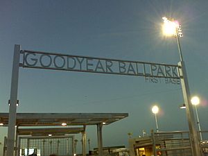
The city is home to the Goodyear Ballpark. Here, the Cleveland Guardians and Cincinnati Reds baseball teams hold their spring training.
In 2008, Goodyear won the All-America City Award. This award is given by the National Civic League. The city got its name from the Goodyear Tire and Rubber Company. This company bought land here to grow cotton for their tires.
Contents
History of Goodyear
Goodyear was started in 1917. The Goodyear Tire and Rubber Company bought 16,000 acres (65 km2) of land. They used this land to grow cotton for vehicle tire cords.
Goodyear During World War II
World War II was important for Goodyear in the 1940s. The Phoenix Goodyear Airport was built during this time. It was known as Luke Field Auxiliary #6 (Goodyear Field). The United States Army Air Forces built it in 1943. It was a smaller airfield used by Luke Army Air Field. This airfield had many buildings for crews, operations, and supplies. After the war, the local economy faced challenges.
Goodyear officially became a town on November 19, 1946. At that time, it had 151 homes and 250 apartments. There was also a grocery store, a barber shop, a beauty shop, and a gas station.
Modern Growth and Development
In January 1965, the Phoenix Trotting Park opened. This was a horse racing track. It closed just two years later because not enough people visited. The park was taken down in 2017.
Goodyear became a city in 1985. In the same decade, the remaining 10,000 acres (40 km2) of the original farmland were sold. This land was set aside for future building projects. The Phoenix Goodyear Airport got its current name in 1986.
Building Homes and Population Growth
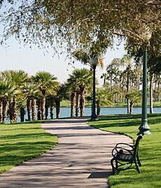
Even though Goodyear was founded in 1917, most of its growth happened after 1990. Many new communities have been built or are being built. These communities cover about 20,000 acres (81 km2). They are planned to have almost 200,000 homes. So far, about 25,000 homes have been built.
Goodyear was affected by the 2000s American housing bubble. This caused home values to drop. However, the housing market has since recovered well. Goodyear's ZIP code 85338 was one of the most popular places to buy a home in the Phoenix area in recent years. There are many types of homes for families, single people, and seniors. As more people move to Goodyear, builders are working fast to meet the demand.
Estrella is the biggest community in Goodyear. It covers 20,000 acres (81 km2) and has about 10,000 residents. Palm Valley is another large community, north of Interstate 10. It is 9,000 acres (36 km2) with various home sizes. PebbleCreek is a community for active adults. It has golf courses, fitness centers, and restaurants.
From the 1990s through the 2010s, new homes helped Goodyear grow as a suburb of Phoenix. Experts believe Goodyear's population could reach 358,000 by 2035.
Geography and Location
Goodyear is about 17 miles (27 km) west of downtown Phoenix. Nearby cities include Avondale, Litchfield Park, Tolleson, and Buckeye. The city limits stretch far, from Glendale in the north to Rainbow Valley in the south.
The city covers a total area of 191.3 square miles (495.5 km2). Only a tiny part, 0.03 square miles (0.08 km2), is water. The Gila River flows through the city. The largest planned community, Estrella, is south of the Gila River. It is near the Estrella Mountains.
The Estrella Mountain Regional Park is nearly 20,000 acres (81 km2). Most of it is still desert. It has eight trails that are over 30 miles (48 km) long combined. There are also two baseball fields and a 9.5-mile (15.3 km) track.
 |
Buckeye, White Tank Mountains | Glendale, Surprise | Litchfield Park, Glendale |  |
| Buckeye | Avondale | |||
| Buckeye | Estrella Mountains | Avondale |
Climate and Weather
Goodyear has a hot desert climate. This is because it is located in the Sonoran Desert. The city gets about ten inches (250 mm) of rain each year. Goodyear enjoys more than 300 sunny days every year.
Winters are sunny and mild. Night temperatures are usually between 40 and 50 °F (4 and 10 °C). Daytime temperatures range from 60 to 75 °F (16 to 24 °C). The coldest temperature ever recorded in Goodyear was 16 °F (−9 °C).
Summers are very hot. Daily high temperatures are often 100 °F (38 °C) or higher in June, July, and August. Many days in May and September are also very hot. Sometimes, a heat wave can push temperatures above 115 °F (46 °C). Night temperatures in summer are usually between 70 and 80 °F (21 and 27 °C). Sometimes, it stays above 80 °F (27 °C) overnight. The hottest temperature ever recorded in Goodyear was 125 °F (52 °C).
Snow is rare in Goodyear, happening only once every few years. Winter lows can sometimes drop below freezing. This can harm some desert plants like saguaros and other cacti. In the summer, especially July, August, and early September, the North American Monsoon brings thunderstorms. These storms can cause heavy rain, even after a sunny morning. Dust storms also happen sometimes, mainly in the summer.
| Climate data for Goodyear, Arizona | |||||||||||||
|---|---|---|---|---|---|---|---|---|---|---|---|---|---|
| Month | Jan | Feb | Mar | Apr | May | Jun | Jul | Aug | Sep | Oct | Nov | Dec | Year |
| Record high °F (°C) | 89 (32) |
93 (34) |
100 (38) |
105 (41) |
115 (46) |
125 (52) |
125 (52) |
120 (49) |
116 (47) |
109 (43) |
98 (37) |
89 (32) |
125 (52) |
| Mean daily maximum °F (°C) | 65 (18) |
70 (21) |
76 (24) |
85 (29) |
94 (34) |
103 (39) |
105 (41) |
103 (39) |
98 (37) |
87 (31) |
74 (23) |
64 (18) |
85 (30) |
| Mean daily minimum °F (°C) | 42 (6) |
45 (7) |
50 (10) |
56 (13) |
64 (18) |
72 (22) |
79 (26) |
79 (26) |
72 (22) |
59 (15) |
48 (9) |
41 (5) |
59 (15) |
| Record low °F (°C) | 16 (−9) |
22 (−6) |
22 (−6) |
27 (−3) |
36 (2) |
49 (9) |
57 (14) |
50 (10) |
44 (7) |
31 (−1) |
22 (−6) |
20 (−7) |
16 (−9) |
| Average precipitation inches (mm) | 0.99 (25) |
1.28 (33) |
0.97 (25) |
0.37 (9.4) |
0.11 (2.8) |
0.04 (1.0) |
0.83 (21) |
1.23 (31) |
0.95 (24) |
0.49 (12) |
0.68 (17) |
0.99 (25) |
8.93 (227) |
| Source: The Weather Channel | |||||||||||||
Population and People
| Historical population | |||
|---|---|---|---|
| Census | Pop. | %± | |
| 1930 | 1,135 | — | |
| 1950 | 1,254 | — | |
| 1960 | 1,654 | 31.9% | |
| 1970 | 2,140 | 29.4% | |
| 1980 | 2,747 | 28.4% | |
| 1990 | 6,258 | 127.8% | |
| 2000 | 18,911 | 202.2% | |
| 2010 | 65,275 | 245.2% | |
| 2020 | 95,294 | 46.0% | |
| 2022 (est.) | 105,406 | 61.5% | |
| U.S. Decennial Census | |||
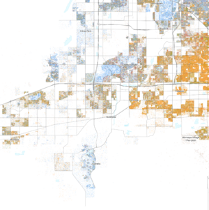
In 2020, Goodyear had a population of 95,294 people. The most common backgrounds reported were Mexican (25.3%), German (14.8%), English (13.6%), and Irish (11.6%).
Economy and Jobs
Goodyear has many large employers. These companies provide jobs for many people in the city.
Top Employers in Goodyear
Here are some of the biggest employers in Goodyear as of 2020:
| # | Employer | # of employees |
|---|---|---|
| 1 | Amazon | 4,166 |
| 2 | UPS | 1,852 |
| 3 | Macy's | 1,550 |
| 4 | Chewy | 1,500 |
| 5 | Abrazo | 1000 |
| 6 | Cancer Treatment Centers of America | 768 |
| 7 | Sub-Zero Inc./Wolf | 695 |
| 8 | Cavco Industries Inc. | 385 |
| 9 | McLane Southwest | 375 |
| 10 | Aersale | 360 |
City Government and Services
Goodyear has a council-manager type of government. The current mayor is Joe Pizzillo. He was a city councilman and took over as mayor after Georgia Lord passed away in December 2021. Lord was elected mayor in 2011, 2013, and 2017. There are six council members, and they can serve up to three terms.
Goodyear City Hall is at 1900 N. Civic Square. It opened in August 2022. The new city hall complex also has a new two-story library. This library is named the Georgia T. Lord Library, after the former mayor. The complex also includes a two-acre park and space for new shops and restaurants.
Education in Goodyear
Several school districts serve the city of Goodyear. These districts manage elementary, middle, and high schools.
Elementary and Middle Schools
- Incito Schools
- Mabel Padgett Elementary School
- Palm Valley Elementary School
- Desert Star Elementary School
- Centerra Mirage S.T.E.M Academy
- Copper Trails Elementary School
- Desert Thunder Elementary School
- Estrella Mountain Elementary School K–8
- Las Brisas Academy Elementary School
- Westar Elementary School
- Western Sky Middle School
- Wildflower Elementary School
- Odyssey Preparatory Academy
- St. John Vianney Catholic School
High Schools
- Desert Edge High School
- Millennium High School
- Estrella Foothills High School
- Goodyear High School (This school is being built and is expected to open for the 2025–2026 school year.)
Colleges and Universities
Franklin Pierce University has a campus in Goodyear. It opened in 2008. The university offers programs related to healthcare, like a Doctor of Physical Therapy program.
Sports and Recreation
Goodyear is well-known for its professional baseball spring training facilities. The Cleveland Guardians of Major League Baseball moved their spring training here in February 2009. They had been away from Arizona for 15 years. Before that, the Guardians (then called the Indians) trained in Tucson.
In 2008, Goodyear's city council approved plans for a new baseball complex. This $33 million complex is for the Cincinnati Reds and Cleveland Guardians. It includes Goodyear Ballpark, which opened in 2009 and has 10,000 seats. Both teams have their own offices, clubhouses, and practice fields.
The Goodyear Centennials baseball team used to play their home games at Goodyear Ballpark. Two other baseball teams, the Arizona Complex League Guardians and the Arizona Complex League Reds, also play at the stadium.
Transportation in Goodyear
Goodyear has different ways for people and goods to travel.
Air Travel
Phoenix Goodyear Airport is located in the city. It has a long runway, 8,500 feet (2,591 m), that can handle large airplanes. This airport is used by many international airlines for plane maintenance and storage. It does not have regular passenger flights.
Rail Transport
Union Pacific operates a railroad that runs through Goodyear. These rail lines connect Goodyear to 23 states in the western and central United States.
Roads and Highways
Interstate 10 goes through Goodyear. It heads west towards Buckeye and Los Angeles. To the east, I-10 goes to Phoenix, Tucson, and the Southern states.
The city also has bus routes operated by Valley Metro Bus.
Other important roads serve the area. Loop 303 starts as Cotton Lane and goes north to Surprise and then to Interstate 17. Van Buren Street, McDowell Road, Indian School Road, and Camelback Road are major roads. They connect the western Phoenix area to places like Scottsdale in the east. MC 85 (Maricopa County Highway 85) runs from Arizona State Route 85 in Buckeye to Loop 202 in Phoenix. This highway passes through the southern parts of Goodyear.
Public Transportation Services
Valley Metro provides public transportation in Goodyear. They have the Avondale ZOOM neighborhood circulator. The 562 Goodyear Express runs during weekday rush hours. It connects Goodyear Park and Ride to Downtown Phoenix. The 17 McDowell bus runs Monday through Saturday. Goodyear is also part of WeRIDE, which offers on-demand transportation in Goodyear and nearby cities.
Road Improvements
Interstate 10 was built through Goodyear in the late 1900s. Between 2008 and 2014, the road was greatly expanded. It went from two lanes in each direction to five or six lanes. This included a special lane for cars with multiple passengers. New exits were also added.
Loop 303 Upgrades
The Arizona Department of Transportation built a new interchange where Interstate 10 and Loop 303 meet. This interchange was made larger and more efficient. The new interchange was finished in 2014.
South of Interstate 10, Loop 303 is planned to extend further. It will connect to a future highway called State Route 30. Loop 303 will go south to Estrella Mountain Ranch and near Interstate 8.
State Route 30 (Future Highway)
Arizona State Route 30 is a planned highway south of Interstate 10. Its purpose is to help reduce traffic jams. It is planned to run between Arizona State Route 85 and Interstate 17.
Notable People from Goodyear
- Carrick Felix: A former basketball player for the Cleveland Cavaliers.
- Hersey Hawkins: A former NBA basketball player. He moved to Goodyear and coached at Estrella Foothills High School.
- Gilbert Levin: A scientist who worked on experiments to find life on Mars. He had a winter home in Goodyear.
- Rick Manning: A former MLB baseball player and current broadcaster.
- Tim Raines: A MLB Hall of Famer who lives in Goodyear.
- Josh Rojas: A professional baseball player who went to Millennium High School (Arizona).
- Mitchell Watt: A former college basketball player from Desert Edge High School.
See also
 In Spanish: Goodyear (Arizona) para niños
 | Victor J. Glover |
 | Yvonne Cagle |
 | Jeanette Epps |
 | Bernard A. Harris Jr. |


