Tolleson, Arizona facts for kids
Quick facts for kids
Tolleson, Arizona
|
||
|---|---|---|
|
||
| Motto(s):
"Honoring Our Past, Positioning Our Future"
|
||

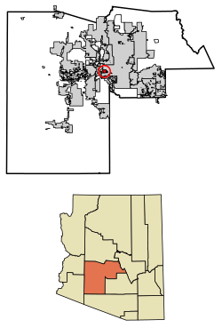
Location in Maricopa County, Arizona
|
||
| Country | United States | |
| State | Arizona | |
| County | Maricopa | |
| Government | ||
| • Type | City council | |
| Area | ||
| • Total | 5.73 sq mi (14.85 km2) | |
| • Land | 5.73 sq mi (14.85 km2) | |
| • Water | 0.00 sq mi (0.00 km2) | |
| Elevation | 1,014 ft (309 m) | |
| Population
(2020)
|
||
| • Total | 7,216 | |
| • Density | 1,258.68/sq mi (485.94/km2) | |
| Time zone | UTC-7 (MST (no DST)) | |
| ZIP Code |
85353
|
|
| Area code(s) | 623 | |
| FIPS code | 04-74190 | |
| GNIS feature ID | 2412078 | |
Tolleson is a city located in Maricopa County, Arizona, in the United States. In 2020, the city had a population of 7,216 people. This was an increase from 6,545 people in 2010.
Contents
History of Tolleson
Founding and Early Growth
Tolleson became an official city in 1929. It was named after its founders, Walter G. Tolleson and his wife, Alethea H. Tolleson. They moved to the area in 1910. They bought a large ranch at 91st Avenue and Van Buren Street.
Walter Tolleson reopened the Ten Mile Store. This store was the first stop for stagecoaches and a general store. It was on the route from Phoenix to Yuma. The store was located where 91st Drive and Monroe Street are today.
In 1912, the Tollesons divided their ranch into smaller pieces. This allowed more people to buy land. Mr. Tolleson wanted to attract farmers to his new community. He offered free train rides and lunches to people who came to see the land. He even gave away five dollars in gold! Eighty lots were sold for $50.00 each.
Walter's brother, Leon Tolleson, became the first postmaster in 1913. The mail service first ran from Walter's store. Later, a separate post office was built. It is still located at 91st Avenue and Van Buren Street.
From Farms to Factories
In the 1940s, farming in the area grew a lot. This helped the city's economy. By the 1950s, Tolleson was known as the "Vegetable Center of the World." But in the early 1960s, farming changed. New machines meant less need for farm workers. This caused a decline in agriculture.
In the 1970s, city leaders made a plan for Tolleson's future. They improved streets and encouraged new homes. They also built a large sewage treatment plant. This was important for new businesses and homes. The city hoped these changes would attract more people and businesses.
Tolleson also grew its land during the "range war" of the late 1970s. Nearby cities like Avondale, Goodyear, and Phoenix were taking over large areas of land. This was happening near where I-10 was being built. Tolleson grew from one square mile to six square miles during this time. However, larger cities often had more money. This meant Tolleson could not grow as much as others. For example, Phoenix bought small strips of land between Tolleson and Avondale. This was done to keep Tolleson from expanding further.
Modern Growth and Economy
The 1980s brought big companies to Tolleson. Fry's Food and Drug and Albertson's built distribution centers here. This led to more industrial growth. These companies showed that Tolleson was a great place for moving goods. It is close to Phoenix and California. This makes it easy to ship products from the west coast.
Tolleson is also located near major transportation routes. These include Interstate 10, the Union Pacific Railroad, and State Route 85. The new Loop 202 is also nearby. All these connections make shipping very efficient.
Today, Tolleson is a major job center for the West Valley. Over twenty large companies have operations here. The city provides jobs for more than 20,000 people. This is impressive, as the city's population is just over 7,000 residents. Tolleson has one of the best jobs-to-residents ratios in the country.
Geography of Tolleson
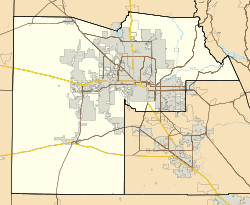
Tolleson is located on the western side of the Phoenix metropolitan area. The city is just south of I-10. The city of Avondale is about 6 miles (9.7 km) to the southwest. Fowler, which is now part of Phoenix, is 3 miles (4.8 km) to the east. The Agua Fria River is about 4 miles (6.4 km) to the west.
The United States Census Bureau states that Tolleson covers a total area of 5.7 square miles (14.8 km²). All of this area is land.
Population and People
| Historical population | |||
|---|---|---|---|
| Census | Pop. | %± | |
| 1930 | 910 | — | |
| 1940 | 1,731 | 90.2% | |
| 1950 | 3,042 | 75.7% | |
| 1960 | 3,886 | 27.7% | |
| 1970 | 3,881 | −0.1% | |
| 1980 | 4,433 | 14.2% | |
| 1990 | 4,434 | 0.0% | |
| 2000 | 4,974 | 12.2% | |
| 2010 | 6,545 | 31.6% | |
| 2020 | 7,216 | 10.3% | |
| U.S. Decennial Census | |||
In 2010, Tolleson had a population of 6,545 people. Most of the people living in Tolleson are of Hispanic background (80.1%). Many of these residents are of Mexican descent (72.7%). The population also includes non-Hispanic white people (11.0%) and non-Hispanic black people (5.8%).
In 2000, there were 4,974 people living in Tolleson. There were 1,432 households and 1,151 families. The average household had 3.47 people. The average family had 3.83 people.
About 32.4% of the population was under 18 years old. About 9.8% of the population was 65 years or older. The average age in the city was 29 years.
Economy and Jobs
Tolleson is a very important place for jobs. Many large companies have chosen to set up their businesses here.
Major Employers in Tolleson
Here are some of the biggest employers in Tolleson, based on a 2021 report:
| # | Employer | # of Employees |
|---|---|---|
| 1 | JBS Packerland | 1,150 |
| 2 | Papa Johns Salads Produce | 960 |
| 3 | Albertsons, Inc. | 810 |
| 4 | Atlas Retail Services | 650 |
| 5 | SK Food Group | 550 |
| 6 | PepsiCo | 440 |
| 7 | Carvana Co | 400 |
| 8 | Autozone | 380 |
| 9 | Salt River Project | 380 |
| 10 | Sysco Arizona | 370 |
SK Food Group expanded its operations in Tolleson in 2016. This food processing plant was expected to create 550 new jobs. It aimed to help young people aged 16–24 who were not in school. It also wanted to attract talented workers from across the area.
Notable People from Tolleson
- Merle Keagle, a baseball player
- Bob Stump, a congressman
- Anna Tovar, a state legislator and former mayor of Tolleson
Government and Representation
Tolleson is part of Arizona's 7th Congressional District. This district is represented by Representative Ruben Gallego.
The city is also in Arizona's 19th State Legislative District. This district is represented by Representatives Mark A. Cardenas and Diego Espinoza. It is also represented by Senator Lupe Contreras. All of these representatives are Democrats.
Education in Tolleson
Several school districts serve the city of Tolleson:
- Tolleson Union High School District
- Tolleson Elementary School District
- Littleton Elementary School District
- Union Elementary School District
- Fowler Elementary School District
See also
 In Spanish: Tolleson para niños
 | Precious Adams |
 | Lauren Anderson |
 | Janet Collins |


