San Mateo, California facts for kids
Quick facts for kids
San Mateo
|
||
|---|---|---|
|
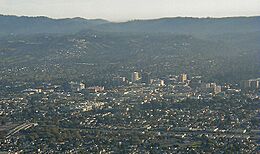
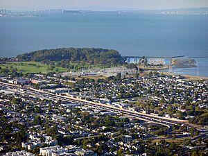
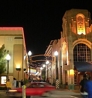
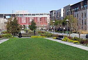
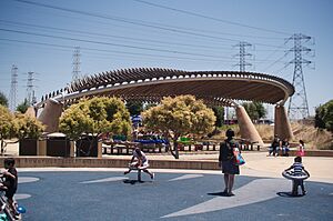
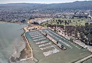
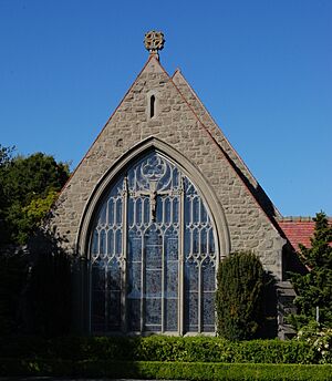
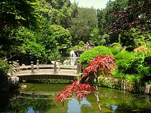
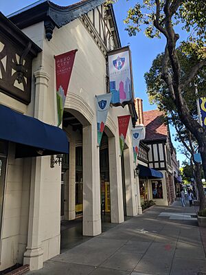
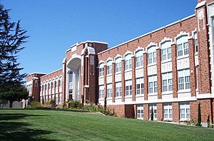
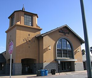
Top: aerial view of San Mateo; middle: downtown (left) and Draper University (right); bottom: downtown (left) and Bay Meadows (right)
|
||
|
||
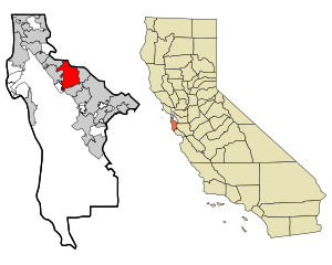
Location in San Mateo County and the state of California
|
||
| Country | United States | |
| State | California | |
| County | San Mateo | |
| Incorporated | September 4, 1894 | |
| Named for | St. Matthew | |
| Area | ||
| • Total | 15.85 sq mi (41.04 km2) | |
| • Land | 12.13 sq mi (31.42 km2) | |
| • Water | 3.71 sq mi (9.62 km2) 23.63% | |
| Elevation | 46 ft (14 m) | |
| Population
(2020)
|
||
| • Total | 105,661 | |
| • Rank | 73rd in California 317th in the United States |
|
| • Density | 8,711/sq mi (3,363/km2) | |
| Time zone | UTC−8 (Pacific) | |
| • Summer (DST) | UTC−7 (PDT) | |
| ZIP Codes |
94401–94404, 94497
|
|
| Area code | 650 | |
| FIPS code | 06-68252 | |
| GNIS feature IDs | 1659584, 2411800 | |
San Mateo (Spanish for 'Saint Matthew') (![]() i/ˌsæn məˈteɪoʊ/ san-_-mə-TAY-oh) is a lively city in San Mateo County, California. It's located on the San Francisco Peninsula, about 20 miles (32 km) south of San Francisco. The city is surrounded by other towns like Burlingame to the north and Belmont to the south. In 2020, about 105,661 people lived here. San Mateo is known for its strong economy, especially in technology, health care, and education.
i/ˌsæn məˈteɪoʊ/ san-_-mə-TAY-oh) is a lively city in San Mateo County, California. It's located on the San Francisco Peninsula, about 20 miles (32 km) south of San Francisco. The city is surrounded by other towns like Burlingame to the north and Belmont to the south. In 2020, about 105,661 people lived here. San Mateo is known for its strong economy, especially in technology, health care, and education.
Contents
History of San Mateo
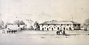
The San Francisco Bay Area was first settled by the Ramaytush people. They lived here as early as 10,000 BC.
Spanish and Mexican Eras
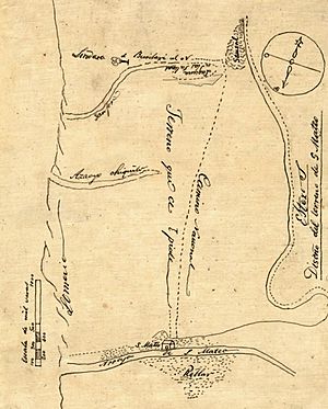
In 1789, Spanish missionaries named a Native American village near Laurel Creek Los Laureles. This means "The Laurels." It was part of Mission San Francisco de Asís. By the time Mexico became independent, about 30 native Californians lived in San Mateo.
In 1827, Captain Frederick William Beechey described San Mateo as a beautiful area. He said it looked like a nobleman's park, with oak trees and grazing animals. The Spanish colonists recorded San Mateo as part of large land grants called Rancho de las Pulgas and Rancho San Mateo. In 1846, Rancho San Mateo was given to Cayetano Arenas. Later that year, William Davis Merry Howard bought it.
Growth After 1850
After California became part of the United States in the 1850s, many people from San Francisco built summer homes here. They liked the milder weather. Large landowners, like William Howard, owned most of the land.
In 1858, a stagecoach stop called Sun Water Station was set up in San Mateo. It was part of the Butterfield Overland Mail route.
Many important buildings were built around this time. Amadeo Giannini, who started the Bank of America, lived in San Mateo. His home, Seven Oaks, is a historic site.
The city of San Mateo officially became a city on September 4, 1894. Its first mayor was Captain A.H. Payson. When the San Francisco and San Jose Railroad was being built in the 1860s, Charles Polhemus bought land in what is now downtown San Mateo. He helped plan the town. The land he settled on is now Central Park.
The Borel Estate was built in 1874 by Antoine Borel. Today, it has modern offices and shops. Hayward Park, a large estate with a mansion, was built in 1880. It later became The Peninsula Hotel but burned down in 1920.
San Mateo in the 20th Century
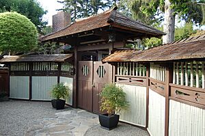
In the early 1900s, Japanese immigrants came to San Mateo. They worked in salt ponds and the flower industry. The Eugene J. De Sabla Japanese Teahouse and Garden was created in 1894. It was designed by Makoto Hagiwara, who also designed the Japanese garden in Golden Gate Park. This garden is now on the National Register of Historic Places.
During the Vietnam War, the city of San Mateo "adopted" Alpha Company of the 101st Airborne Division. Citizens sent letters and gifts to boost the soldiers' spirits. In 1972, San Mateo held a parade for Alpha Company. This was one of the only parades honoring the military during the Vietnam War.
The Bay Meadows horse-racing track was a famous place in San Mateo. It was taken down in 2008.
San Mateo in the 21st Century
In 2022, there was a unique situation with the city council. Two councilmembers did not follow the usual way of choosing a new mayor. After a few meetings, Amourence Lee was chosen as the mayor.
Geography and Natural Areas
San Mateo is located at 37°33′15″N 122°18′47″W / 37.55417°N 122.31306°W. The city covers about 15.9 square miles (41.04 km2). About 3.8 square miles (9.62 km2) of this is water.
The most famous natural spot is Coyote Point Park. It's a peninsula that reaches into the San Francisco Bay. Spanish explorers called it la punta de San Mateo. Today, Coyote Point is home to CuriOdyssey. This is a science museum and wildlife center. The Peninsula Humane Society also has an animal care facility here.

San Mateo has different natural areas. These include oak woodlands and marshlands. Some rare animals, like the California clapper rail and the salt marsh harvest mouse, live in the marsh areas.
Sugarloaf Mountain is another important natural landmark. It's a mountain with oak trees and chaparral. This area has been saved as a park and open space. It is home to the endangered mission blue butterfly.
Sawyer Camp Trail is a popular place for walking, jogging, and biking. It's about 6 miles (9.7 km) long. The trail runs along the Crystal Springs Reservoir on the western edge of San Mateo.
Neighborhoods of San Mateo
San Mateo has different types of neighborhoods. Areas east of El Camino Real are usually more crowded. Areas to the west have fewer people.
Downtown San Mateo
San Mateo has one of the largest downtown areas in the San Francisco Bay Area. It has over 800 shops and restaurants. Many of these are in historic buildings. The Downtown San Mateo Association helps promote businesses and improve the area.
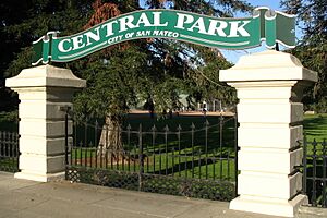
Central Park is San Mateo's main park. It has a baseball field, tennis courts, and picnic areas. There's also a Japanese tea garden, a rose garden, and a miniature train. The park is a historic spot for the Japanese-American community. Downtown also has many Japanese restaurants and shops. The San Mateo Caltrain station is located here.
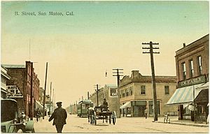
In 2020, parts of South B Street downtown were closed to cars. This allowed restaurants to have more outdoor dining. The city plans to make this a permanent pedestrian area.
Bay Meadows
The Bay Meadows neighborhood is a new area built where the Bay Meadows Racetrack used to be. It has homes, offices, shops, and parks. Construction started in 2012 and is still ongoing.
Hillsdale
Hillsdale Shopping Center is a large mall in San Mateo. It has over 120 stores, including Nordstrom and Macy's. The mall was expanded in 2019 with a new food court and outdoor plaza. It also has a movie theater and a bowling alley. The Hillsdale Caltrain station is nearby.
Climate and Weather
San Mateo has a Mediterranean climate. This means it has warm, dry summers and mild, wet winters. The city is mostly protected from the Pacific Ocean by mountains. However, gaps in the mountains can bring fog and windy afternoons in the summer.
The average temperature in January is about 50°F (10°C). In September, the warmest month, the average temperature is about 66°F (19°C). The highest temperature ever recorded was 109°F (43°C) in June 1961. The lowest was 23°F (-5°C) in January 1949 and December 1972. San Mateo gets about 18.77 inches (477 mm) of rain each year.
| Climate data for San Mateo, California | |||||||||||||
|---|---|---|---|---|---|---|---|---|---|---|---|---|---|
| Month | Jan | Feb | Mar | Apr | May | Jun | Jul | Aug | Sep | Oct | Nov | Dec | Year |
| Record high °F (°C) | 78 (26) |
80 (27) |
88 (31) |
89 (32) |
98 (37) |
109 (43) |
108 (42) |
103 (39) |
107 (42) |
96 (36) |
89 (32) |
78 (26) |
109 (43) |
| Mean daily maximum °F (°C) | 58.0 (14.4) |
61.5 (16.4) |
63.9 (17.7) |
67.0 (19.4) |
70.5 (21.4) |
74.4 (23.6) |
76.7 (24.8) |
76.6 (24.8) |
77.8 (25.4) |
73.0 (22.8) |
65.4 (18.6) |
59.0 (15.0) |
68.6 (20.4) |
| Daily mean °F (°C) | 49.7 (9.8) |
52.7 (11.5) |
54.5 (12.5) |
57.0 (13.9) |
60.2 (15.7) |
63.5 (17.5) |
65.2 (18.4) |
65.4 (18.6) |
65.8 (18.8) |
62.1 (16.7) |
55.7 (13.2) |
50.8 (10.4) |
58.5 (14.7) |
| Mean daily minimum °F (°C) | 41.5 (5.3) |
43.9 (6.6) |
45.3 (7.4) |
46.9 (8.3) |
49.9 (9.9) |
52.7 (11.5) |
53.8 (12.1) |
54.2 (12.3) |
53.8 (12.1) |
51.2 (10.7) |
46.2 (7.9) |
42.6 (5.9) |
48.5 (9.2) |
| Record low °F (°C) | 23 (−5) |
29 (−2) |
31 (−1) |
31 (−1) |
36 (2) |
40 (4) |
42 (6) |
46 (8) |
40 (4) |
36 (2) |
29 (−2) |
25 (−4) |
23 (−5) |
| Average precipitation inches (mm) | 4.64 (118) |
3.17 (81) |
2.75 (70) |
1.31 (33) |
0.46 (12) |
0.13 (3.3) |
0.04 (1.0) |
0.04 (1.0) |
0.16 (4.1) |
0.91 (23) |
2.11 (54) |
3.39 (86) |
19.11 (486.4) |
| Average precipitation days (≥ 0.01 in) | 11 | 10 | 9 | 5 | 3 | 1 | 0 | 0 | 1 | 3 | 7 | 10 | 60 |
| Source: Western Regional Climate Center | |||||||||||||
People and Population
| Historical population | |||
|---|---|---|---|
| Census | Pop. | %± | |
| 1880 | 932 | — | |
| 1900 | 1,832 | — | |
| 1910 | 4,384 | 139.3% | |
| 1920 | 5,979 | 36.4% | |
| 1930 | 13,444 | 124.9% | |
| 1940 | 19,403 | 44.3% | |
| 1950 | 41,782 | 115.3% | |
| 1960 | 69,870 | 67.2% | |
| 1970 | 78,991 | 13.1% | |
| 1980 | 77,640 | −1.7% | |
| 1990 | 85,486 | 10.1% | |
| 2000 | 92,482 | 8.2% | |
| 2010 | 97,207 | 5.1% | |
| 2020 | 105,661 | 8.7% | |
| U.S. Decennial Census | |||
In 2020, San Mateo had a population of 105,661 people. The city is very diverse. Many different ethnic groups live here. About 38% of the people are White, and about 26% are Asian. Around 25% of the population is Hispanic or Latino.
Most people in San Mateo live in families. The average household size is about 2.5 people. The median income for a family in 2011 was about $107,023. This means that half of the families earned more than this amount, and half earned less.
Economy and Jobs
San Mateo has a wide range of jobs. Many people work in technology, health care, and finance. Some big companies based here include Sony Interactive Entertainment, NetSuite, and GoPro.
Since 1990, new buildings in San Mateo have a height limit of 55 feet (17 m). San Mateo is a very expensive place to live. In 2018, the average home was valued at over $1.4 million. Rent was also very high.
The second floors of downtown buildings became a popular spot for startup companies in the mid-2000s. Companies like Roblox and YouTube started here.
Here are some of the top employers in San Mateo:
| # | Employer | # of employees |
|---|---|---|
| 1 | County of San Mateo Medical Center | 1,317 |
| 2 | Sony Interactive Entertainment | 1,248 |
| 3 | San Mateo Union High School District | 1,003 |
| 4 | San Mateo-Foster City Unified | 999 |
| 5 | San Mateo Community College District | 579 |
| 6 | Franklin Templeton Investments | 541 |
| 7 | San Mateo County Behavioral Health | 467 |
| 8 | City of San Mateo | 456 |
| 9 | Rakuten | 423 |
| 10 | Mills-Peninsula Health Services | 351 |
Education in San Mateo
Students in San Mateo attend schools in the San Mateo Foster City School District and San Mateo Union High School District. There are elementary schools, middle schools, and magnet schools.
There are also several private schools. These include Saint Matthew's Episcopal Day School and The Carey School. San Mateo has three public high schools: San Mateo, Aragon, and Hillsdale. Two private high schools are Junípero Serra (all-boys) and The Nueva Upper School.
The San Mateo Union High School District also has an adult school. The San Mateo Performing Arts Center is a large theater on the San Mateo High School campus.
The city is home to the College of San Mateo. This is a community college with over 10,000 students. Its campus offers great views of the San Francisco Bay. Other nearby universities include Notre Dame de Namur University and Stanford University.
Public Libraries
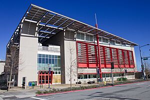
The City of San Mateo has three libraries. These are the Main Library, the Hillsdale Library, and the Marina Library. They are all part of the Peninsula Library System. The Main Library, located downtown near Central Park, opened in 2006. It's a large, modern building with lots of natural light.
Parks and Recreation
San Mateo has more than 15 parks. Central Park is the most important one. It has a Japanese tea garden, which celebrates San Mateo's sister city Toyonaka, Japan. The park also has a rose garden, a mini train, and the San Mateo Arboretum.
Beresford Park is another large park with bocce ball and a skate plaza. Martin Luther King Jr. Park and Joinville Park have swimming pools. Ryder Park has a fun water play structure. Parkside Aquatic Park, on Seal Slough, is great for swimming and volleyball. Many parks have picnic areas, playgrounds, and sports courts.
Coyote Point Park is a large county park. It's a great spot for windsurfing and sailing. It's also home to CuriOdyssey, a science museum with native animals.
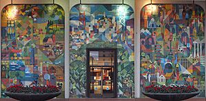
You can find public art all around the city. One famous piece is a colorful mosaic mural from 1963. It's located at 300 S. El Camino Real and tells the story of Amadeo Giannini, who founded the Bank of America.
Transportation
San Mateo is in the middle of the San Francisco Bay Area. It's about halfway between San Francisco and San Jose. Three major freeways serve the city: U.S. Route 101, Interstate 280, and State Route 92. State Route 92 crosses the San Francisco Bay over the San Mateo-Hayward Bridge to Hayward.
Bicycling
San Mateo has many bikeways. These connect different parts of the city. In 2011, the city made a plan to improve its bike paths.
Public Transportation
SamTrans provides bus service within San Mateo and the whole county. AC Transit buses go across the San Mateo Bridge to Alameda County. Caltrain offers commuter train service. It runs between San Francisco and San Jose. Caltrain has three stations in San Mateo: Hillsdale, Hayward Park, and San Mateo (downtown).
Media
- San Mateo Daily Journal – newspaper
- San Mateo County Times – newspaper
- KCSM (FM)
- KPJK
Sister Cities
San Mateo has two sister cities:
 Varde, Denmark (since 1969)
 Toyonaka, Osaka Prefecture, Japan (since 1963)
Famous People from San Mateo
- Barry Bostwick (born 1945), actor (The Rocky Horror Picture Show)
- Tom Brady (born 1977), famous NFL quarterback
- Emma Chamberlain, internet personality
- Merv Griffin (1925–2007), TV host and creator of Jeopardy! and Wheel of Fortune
- Dennis Haysbert, actor (24)
- Kris Kristofferson (1936-2024), singer-songwriter
- J. Kenji López-Alt, chef and food writer
- Daniel Naroditsky, chess grandmaster
- Sean Payton (born 1963), NFL coach
- Neal Schon (born 1954), musician
- Lynn Swann (born 1952), former NFL wide receiver
See also
 In Spanish: San Mateo (California) para niños
 | DeHart Hubbard |
 | Wilma Rudolph |
 | Jesse Owens |
 | Jackie Joyner-Kersee |
 | Major Taylor |


