Carlsbad, California facts for kids
Quick facts for kids
Carlsbad, California
|
|||
|---|---|---|---|
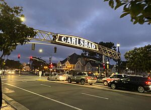
Downtown Carlsbad in 2020
|
|||
|
|||
| Nickname(s):
Village by the Sea
|
|||
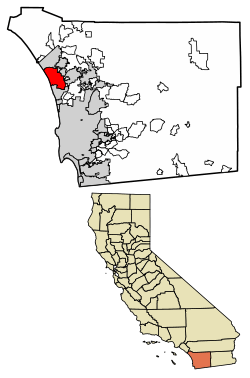
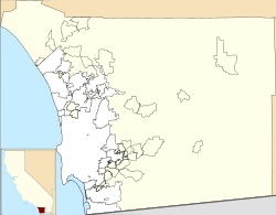
Location of Carlsbad in San Diego County, California.
|
|||
| Country | United States | ||
| State | California | ||
| County | San Diego | ||
| Incorporated | July 16, 1952 | ||
| Named for | Karlsbad, Kingdom of Bohemia | ||
| Government | |||
| • Type | Council–manager | ||
| • Body | Carlsbad City Council | ||
| Area | |||
| • Total | 39.08 sq mi (101.21 km2) | ||
| • Land | 37.77 sq mi (97.83 km2) | ||
| • Water | 1.30 sq mi (3.38 km2) 3.55% | ||
| Elevation | 52 ft (16 m) | ||
| Population
(2020)
|
|||
| • Total | 114,746 | ||
| • Rank | 5th in San Diego County 56th in California |
||
| • Density | 3,038.02/sq mi (1,172.91/km2) | ||
| Time zone | UTC−8 (Pacific) | ||
| • Summer (DST) | UTC−7 (PDT) | ||
| ZIP codes |
92008–92011, 92018
|
||
| Area codes | 442/760 | ||
| FIPS code | 06-11194 | ||
| GNIS feature IDs | 1660437, 2409984 | ||
| City flower | Bird-of-paradise | ||
Carlsbad is a sunny beach city in San Diego County, California. It's about 35 miles (56 km) north of downtown San Diego and 87 miles (140 km) south of downtown Los Angeles. In 2020, about 114,746 people lived here. Carlsbad is a fun place for tourists and home to many companies that make golf equipment.
Contents
History of Carlsbad
Carlsbad's story began with the Luiseño people, who lived near Mission San Luis Rey. Some Kumeyaay people also lived in the La Costa area. Many fresh water creeks had native villages, like Palamai near today's Buena Vista Lagoon.
In 1769, Spanish explorers arrived and met villagers near Buena Vista Creek. Another Luiseño village was 'Ajopunquile' at the mouth of San Marcos Creek. A Kumeyaay village called Hakutl was in the Rancho Ponderosa area.
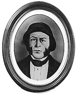
Later, in 1842, a large part of southern Carlsbad became Rancho Agua Hedionda. It was given to Juan María Marrón.
How Carlsbad Got Its Name
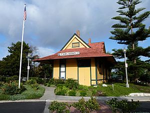
In the 1880s, a former sailor named John A. Frazier dug a well in the area. He started selling his water at the train station. Soon, the train stop was known as Frazier's Station.
Another well was dug, and tests showed its water was like the famous spa waters in Karlsbad, Bohemia (now Karlovy Vary, Czech Republic). Because of this, the town was named Carlsbad.
A group of businessmen, including Gerhard Schutte, formed the Carlsbad Land and Mineral Water Company. They promoted the town to attract visitors. Carlsbad grew quickly in the 1880s, with new homes and businesses. Farmers also started growing citrus fruits, avocados, and olives. Even when land prices dropped in 1887, the community survived thanks to its rich farmland.
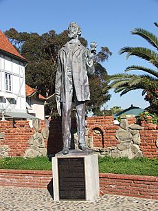
You can still see the spot of John Frazier's first well at Alt Karlsbad. It's a building that looks like an old German house on Carlsbad Boulevard.
Becoming a City and Modern Changes
In 1952, Carlsbad officially became a city. This was done to prevent its neighbor, Oceanside, from taking over the area.
The McClellan-Palomar Airport opened in 1959. It was later named after Gerald McClellan, a local leader.
Carlsbad was also home to the world's first modern skateboard park. It opened in March 1976 at Carlsbad Raceway. The skatepark closed in 1979, but now Carlsbad has two new skateparks.
In March 1999, Legoland California opened. It was the first Legoland park outside of Europe. It's a very popular theme park today.
Carlsbad also has the largest desalination plant in the United States. It turns ocean water into fresh drinking water. It was finished in 2015.
Carlsbad's Geography and Climate
Carlsbad covers about 39.1 square miles (101.2 km2). Most of this is land, but about 1.4 square miles (3.55%) is water. This water is found in three lagoons and one lake.
The city's northern part is next to southern Oceanside and western Vista.
Carlsbad has beautiful ocean cliffs and wide sandy beaches. Its mild weather makes it a great place for vacations all year.
Carlsbad's Weather
Carlsbad has a mild, semi-arid Mediterranean climate. This means it gets about 263 sunny days each year. Winters are mild with some rain. It rarely freezes near the coast.
Summers are mostly dry, but can be cool and foggy due to the Pacific Ocean. Sometimes, hot, dry Santa Ana winds bring high temperatures, usually in the fall.
| Climate data for Carlsbad, California (McClellan–Palomar Airport), 1991–2020 normals, extremes 1998–present | |||||||||||||
|---|---|---|---|---|---|---|---|---|---|---|---|---|---|
| Month | Jan | Feb | Mar | Apr | May | Jun | Jul | Aug | Sep | Oct | Nov | Dec | Year |
| Record high °F (°C) | 90 (32) |
90 (32) |
93 (34) |
92 (33) |
86 (30) |
89 (32) |
98 (37) |
95 (35) |
103 (39) |
104 (40) |
99 (37) |
86 (30) |
104 (40) |
| Mean maximum °F (°C) | 80.9 (27.2) |
78.9 (26.1) |
80.6 (27.0) |
81.2 (27.3) |
77.3 (25.2) |
79.3 (26.3) |
83.5 (28.6) |
85.3 (29.6) |
90.5 (32.5) |
91.7 (33.2) |
87.5 (30.8) |
78.5 (25.8) |
96.1 (35.6) |
| Mean daily maximum °F (°C) | 65.0 (18.3) |
64.0 (17.8) |
64.5 (18.1) |
66.3 (19.1) |
67.6 (19.8) |
69.9 (21.1) |
74.2 (23.4) |
75.8 (24.3) |
75.7 (24.3) |
73.3 (22.9) |
69.5 (20.8) |
64.6 (18.1) |
69.2 (20.7) |
| Daily mean °F (°C) | 56.4 (13.6) |
56.3 (13.5) |
57.6 (14.2) |
59.8 (15.4) |
62.5 (16.9) |
65.1 (18.4) |
69.2 (20.7) |
70.5 (21.4) |
69.6 (20.9) |
66.1 (18.9) |
60.8 (16.0) |
56.0 (13.3) |
62.5 (16.9) |
| Mean daily minimum °F (°C) | 47.8 (8.8) |
48.5 (9.2) |
50.8 (10.4) |
53.3 (11.8) |
57.4 (14.1) |
60.3 (15.7) |
64.1 (17.8) |
65.3 (18.5) |
63.6 (17.6) |
58.9 (14.9) |
52.1 (11.2) |
47.3 (8.5) |
55.8 (13.2) |
| Mean minimum °F (°C) | 39.9 (4.4) |
40.4 (4.7) |
44.5 (6.9) |
47.9 (8.8) |
53.2 (11.8) |
56.9 (13.8) |
61.8 (16.6) |
62.3 (16.8) |
58.5 (14.7) |
52.4 (11.3) |
45.5 (7.5) |
38.9 (3.8) |
37.3 (2.9) |
| Record low °F (°C) | 33 (1) |
36 (2) |
38 (3) |
39 (4) |
45 (7) |
50 (10) |
57 (14) |
57 (14) |
54 (12) |
46 (8) |
37 (3) |
32 (0) |
32 (0) |
| Average precipitation inches (mm) | 2.94 (75) |
2.64 (67) |
1.61 (41) |
0.88 (22) |
0.28 (7.1) |
0.06 (1.5) |
0.08 (2.0) |
0.03 (0.76) |
0.11 (2.8) |
0.50 (13) |
0.99 (25) |
1.72 (44) |
11.84 (301.16) |
| Average precipitation days (≥ 0.01 in) | 6.8 | 8.2 | 7.2 | 5.0 | 3.4 | 1.2 | 0.8 | 0.6 | 2.2 | 4.3 | 5.9 | 7.6 | 53.2 |
| Source 1: NOAA | |||||||||||||
| Source 2: National Weather Service (mean maxima/minima 2006–2020) | |||||||||||||
Carlsbad's Neighborhoods
Carlsbad is divided into four main areas for city planning.
Northwest Carlsbad
This area includes the downtown "Village," "The Barrio," and "Olde Carlsbad." It was the first part of the city to be settled. Homes here range from older cottages to large mansions with ocean views. It also has Hosp Grove Park and the Buena Vista and Agua Hedionda Lagoons.
"The Barrio" is a historic area near downtown. It was settled by Latino families in the early 1900s.
Northeast Carlsbad
This part of Carlsbad has mostly single-family homes. You'll find older areas like Chestnut Hills and newer ones around Calavera Hills.
The Northeast quadrant also has the Lake Calavera Nature Preserve. This 110-acre (45 ha) area includes a 513-foot (156 m) extinct volcano called Mount Calavera. The preserve has a small lake and hiking trails with ocean views.
Southeast Carlsbad
This area has many newer, planned communities with hillsides and golf courses. It includes Bressi Ranch and the La Costa neighborhoods. The famous Omni La Costa Resort & Spa is located here.
Southwest Carlsbad
This quadrant runs along the Pacific Ocean south of central Carlsbad. It includes the Aviara neighborhood, home to the Park Hyatt Aviara Resort.
Carlsbad's Population
| Historical population | |||
|---|---|---|---|
| Census | Pop. | %± | |
| 1960 | 9,253 | — | |
| 1970 | 14,944 | 61.5% | |
| 1980 | 35,490 | 137.5% | |
| 1990 | 63,126 | 77.9% | |
| 2000 | 78,247 | 24.0% | |
| 2010 | 105,328 | 34.6% | |
| 2020 | 114,746 | 8.9% | |
| 2023 (est.) | 114,549 | 8.8% | |
| U.S. Decennial Census | |||
Carlsbad is part of the larger San Diego metropolitan area.
In 2020, Carlsbad had a population of 114,746 people. Most residents were White (69.02%), followed by Hispanic or Latino (15.08%), Asian (7.85%), and people of two or more races (6.04%).
The city has a mix of families. Many households are married couples, and about 30.9% of households have children under 18. The average household size is 2.55 people.
Carlsbad is a well-educated city. About 95.7% of adults have graduated from high school, and 51.3% have a bachelor's degree or higher.
Carlsbad's Economy
Carlsbad is a hub for many different industries. These include technology, video games, manufacturing, robotics, and medical devices. It's also known for clean energy, action sports, and tourism. In 2013, Google even called Carlsbad the "digital capital of California" for its strong online business community.
Carlsbad is sometimes called "Titanium Valley" because of its golf industry. Big golf companies like Callaway Golf Company, TaylorMade, Cobra Golf, and Titleist are all located here.
Top Employers in Carlsbad
Here are some of the largest employers in Carlsbad:
| # | Employer | # of Employees |
|---|---|---|
| 1 | Viasat, Inc. | 2,481 |
| 2 | Legoland California | 2,300 |
| 3 | Life Technologies Corporation | 1,982 |
| 4 | Omni La Costa Resort & Spa | 1,300 |
| 5 | Carlsbad Unified School District | 1,092 |
| 6 | TaylorMade Golf Company | 960 |
| 7 | City of Carlsbad | 748 |
| 8 | Nortek Security Control | 637 |
| 9 | HM Electronics | 571 |
| 10 | Gemological Institute of America | 555 |
Schools in Carlsbad
Carlsbad has several school districts and many schools for students of all ages.
- School Districts
- Carlsbad Unified School District
- Encinitas Union School District (for elementary schools in South Carlsbad)
- San Dieguito Union High School District (for junior high and high schools in South Carlsbad)
- San Marcos Unified School District (for schools in southeast Carlsbad)
- Public High Schools
- Carlsbad High School
- La Costa Canyon High School
- Sage Creek High School
- Public Middle Schools
- Aviara Oaks Middle School
- Calavera Hills Middle School
- Valley Middle School
- Public Elementary Schools
- Aviara Oaks Elementary School
- Buena Vista Elementary School
- Calavera Hills Elementary School
- Carlsbad Seaside Academy (K-6 Alternative Education)
- El Camino Creek Elementary School
- Hope Elementary School
- Jefferson Elementary School
- Kelly Elementary School
- La Costa Heights Elementary School
- La Costa Meadows Elementary School
- Magnolia Elementary School
- Pacific Rim Elementary School
- Poinsettia Elementary School
- Mission Estancia Elementary School
- Olivenhain Pioneer Elementary School
- Rancho Carillo Elementary School
- Private Schools
- Army and Navy Academy
- Carlsbad Christian Academy
- Pacific Ridge School
- St. Patrick School
Public Libraries
- Carlsbad City Library (with three different branches)
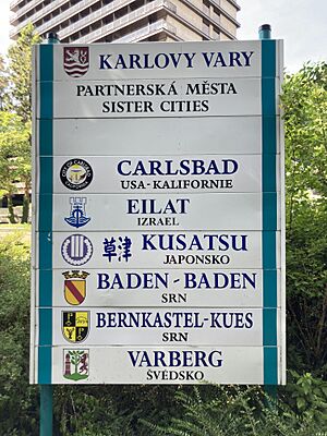
Sister Cities
Carlsbad has two sister cities, which are cities that form a special bond to promote cultural exchange:
 Futtsu, Japan
 Karlovy Vary, Czech Republic (the city Carlsbad was named after!)
Fun Things to Do in Carlsbad
Carlsbad offers many attractions for visitors and residents.
- Amusement Parks
- Aquariums
- Sea Life Aquarium at Legoland California
- Beaches
- Carlsbad State Beach
- South Carlsbad State Beach
- Campgrounds
- South Carlsbad State Beach
- Golf
- Aviara Golf Club
- Omni La Costa Resort & Spa
- The Crossings at Carlsbad
- Rancho Carlsbad Golf Club
- Nature and Open Spaces
- Agua Hedionda Lagoon
- Batiquitos Lagoon
- Buena Vista Lagoon
- Lake Calavera Nature Preserve
- Rancho La Costa Preserve
- Museums
- Carlsbad Historical Society Museum
- Museum of Making Music
- Miniature Engineering Craftsmanship Museum
- Gardens
- The Flower Fields
Getting Around Carlsbad (Transportation)
The North County Transit District (NCTD) helps people get around Carlsbad. They offer:
- The Coaster commuter train (with stops at Carlsbad Village station and Carlsbad Poinsettia station)
- Breeze bus service
- The Carlsbad Connector (a special ride-sharing service)
- Lift (a service for people who need extra help)
Interstate 5 runs through the western part of Carlsbad. California State Route 78 is also nearby.
McClellan–Palomar Airport is about 7 miles (11 km) southeast of downtown Carlsbad. It's used for general aviation and some commercial flights.
Famous People from Carlsbad
Many interesting people have lived in or are from Carlsbad:
- Adam Brody, actor (from The O.C.)
- Ron Capps, champion race car driver
- Leo Carrillo, actor and conservationist
- Aaron Chang, famous surf photographer
- Brandon Chillar, former NFL football player
- Jon Foreman, lead singer of the band Switchfoot
- Tim Foreman, bassist for Switchfoot
- Troy Glaus, former baseball player
- Tony Hawk, legendary skateboarder (lived nearby)
- Michellie Jones, Olympic silver medalist and Ironman world champion triathlete
- Rod Laver, former world #1 tennis player
- Fred Lynn, former baseball player
- Sal Masekela, TV host for Winter X Games
- Martin Milner, television actor (from Route 66 and Adam-12)
- Emily O'Brien, actress (from The Young and the Restless)
- Kevin Pearce, snowboarder and advocate
- Jean Peters, actress and wife of Howard Hughes
- Bridget Regan, actress (from Legend of the Seeker)
- Gene Roddenberry, creator of Star Trek
- Steve Scott, champion runner
- Pancho Segura, former professional tennis player
- Staciana Stitts, Olympic gold medalist swimmer
- Victor Villaseñor, author
See also
 In Spanish: Carlsbad (California) para niños
 | Charles R. Drew |
 | Benjamin Banneker |
 | Jane C. Wright |
 | Roger Arliner Young |


