Kansas City, Kansas facts for kids
Quick facts for kids
Kansas City, Kansas
|
|||
|---|---|---|---|
|
Consolidated city-county
|
|||
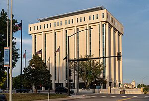
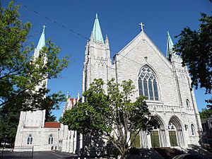
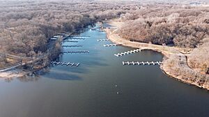
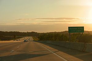
Cityscape of Kansas City, Kansas
|
|||
|
|||
| Nickname(s):
"KCK"
|
|||
Location within Wyandotte County and Kansas
|
|||
Kansas City map
|
|||
| Country | United States | ||
| State | Kansas | ||
| County | Wyandotte | ||
| Incorporated | 1872, 1886 | ||
| Named for | Kansas City, Missouri | ||
| Area | |||
| • Total | 128.30 sq mi (332.31 km2) | ||
| • Land | 124.74 sq mi (323.07 km2) | ||
| • Water | 3.57 sq mi (9.24 km2) | ||
| Elevation | 869 ft (265 m) | ||
| Population
(2020)
|
|||
| • Total | 156,607 | ||
| • Density | 1,220.63/sq mi (471.268/km2) | ||
| Time zone | UTC-6 (CST) | ||
| • Summer (DST) | UTC-5 (CDT) | ||
| ZIP codes |
66101–66113, 66115, 66117–66119, 66160
|
||
| Area code | 913 | ||
| FIPS code | 20-36000 | ||
| GNIS ID | 478635 | ||
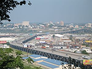
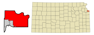
Kansas City (often called KCK) is a major city in the state of Kansas. It is the third-largest city in Kansas and the main city of Wyandotte County. KCK is located very close to Kansas City, Missouri, and is named after it.
In 2020, about 156,607 people lived here. This makes it one of the main cities in the larger Kansas City metropolitan area. The city is special because it sits where two big rivers meet: the Missouri and the Kansas rivers. Kansas City, Kansas, has a special government that combines the city and county, called the "Unified Government." It is also home to important places like the University of Kansas Medical Center and Kansas City Kansas Community College.
Contents
History of Kansas City, Kansas
The original "Kansas City, Kansas" was officially started in October 1872. The first mayor, James Boyle, was elected that same month. In 1880, the Governor of Kansas, John St. John, declared it a "city of the second class."
A "new" Kansas City, Kansas, was formed in March 1886. This happened when five smaller towns joined together. These towns were the old Kansas City, Armstrong, Armourdale, Riverview, and Wyandotte. The oldest of these was Wyandotte, which was founded in 1857 by Wyandot Native Americans and Methodist missionaries.
In the 1890s, the city grew very fast. Many people moved there because it was easy to get to from Kansas City, Missouri, by streetcar. This growth continued until the 1930s. Kansas City, Kansas, was one of the 100 largest cities in the U.S. for many years, from 1890 to 1960. In 1920, its population went over 100,000 for the first time.
Over the years, the mix of people living in the city changed. In 1997, people voted to combine the city and county governments. This created the "Unified Government of Wyandotte County."
Geography of Kansas City, Kansas
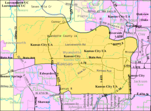
Kansas City, Kansas, covers about 128.38 square miles (332.31 square kilometers). Most of this area is land, with about 3.57 square miles (9.24 square kilometers) being water.
Neighborhoods in KCK
Kansas City, Kansas, has many different neighborhoods, including:
- Downtown
- Argentine – named after a silver factory that used to be there. It joined Kansas City in 1910.
- Armourdale – was once its own city before joining Kansas City in 1886.
- Armstrong – a small town on the north side of the Kansas River, which became part of Kansas City.
- Arrickary Subdivision
- Bethel – a neighborhood along Leavenworth Road. It was never its own town.
- Fairfax District – an area with many factories along the Missouri River.
- Hanover Heights
- Historic Westheight
- Muncie
- Maywood – this area used to be quiet and mostly homes. Now, it's part of the "Village West" project. This project includes shopping, entertainment, sports stadiums like Children's Mercy Park, and the Kansas Speedway racetrack.
- McGrew Grove
- Nearman
- Northeast Neighborhoods
- Parkwood
- Piper
- Polish Hill
- Pomeroy – an old train stop and trading post from the late 1800s.
- Quindaro Bluffs
- Riverview – another small town that joined Kansas City.
- Rosedale – became part of Kansas City in 1922.
- Stony Point
- Strawberry Hill
- Turner – a community near the border of Wyandotte and Johnson counties.
- Vinewood
- Wolcott
- Welborn
Parks and Green Spaces
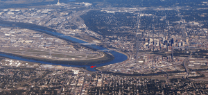
Kansas City, Kansas, has several parks and green areas for people to enjoy:
- City Park
- Wyandotte County Lake Park
- Big Eleven Park
- Boston Daniels' Park (named after the first Black Chief of Police in the United States)
- Kaw Point Park
Understanding the Climate
Kansas City is in the middle of the United States, where the Missouri River and Kansas River meet. The city has a humid continental climate, which means it has four clear seasons. Summers are hot and can be humid, while winters are cold.
Temperatures can change a lot throughout the year. In July, the average temperature is about 81°F (27°C). In January, the average is about 31°F (-0.5°C). It can get very hot in summer, sometimes over 100°F (38°C). Winters can be very cold, with temperatures sometimes dropping below 0°F (-18°C). The area usually gets about 13.4 inches (34 cm) of snow each winter.
Kansas City is also located near "Tornado Alley." This is a region where cold air from the Rocky Mountains meets warm air from the Gulf of Mexico. This can create strong storms, especially in the spring, and sometimes leads to tornadoes. The area can also experience ice storms in winter, which can cause power outages. Flooding can also happen, as seen in the Great Flood of 1951 and Great Flood of 1993.
| Climate data for Kansas City, Missouri (Downtown Airport), 1981–2010 normals, extremes 1934–present) | |||||||||||||
|---|---|---|---|---|---|---|---|---|---|---|---|---|---|
| Month | Jan | Feb | Mar | Apr | May | Jun | Jul | Aug | Sep | Oct | Nov | Dec | Year |
| Record high °F (°C) | 76 (24) |
83 (28) |
89 (32) |
94 (34) |
103 (39) |
108 (42) |
112 (44) |
113 (45) |
109 (43) |
98 (37) |
83 (28) |
74 (23) |
113 (45) |
| Mean maximum °F (°C) | 61.5 (16.4) |
68.1 (20.1) |
78.1 (25.6) |
84.4 (29.1) |
89.3 (31.8) |
94.8 (34.9) |
100.1 (37.8) |
100.3 (37.9) |
93.3 (34.1) |
84.8 (29.3) |
73.5 (23.1) |
62.8 (17.1) |
102.1 (38.9) |
| Mean daily maximum °F (°C) | 39.5 (4.2) |
44.6 (7.0) |
56.2 (13.4) |
66.7 (19.3) |
75.9 (24.4) |
85.0 (29.4) |
90.1 (32.3) |
88.6 (31.4) |
80.0 (26.7) |
67.8 (19.9) |
54.2 (12.3) |
41.8 (5.4) |
65.9 (18.8) |
| Mean daily minimum °F (°C) | 22.4 (−5.3) |
26.3 (−3.2) |
35.8 (2.1) |
46.6 (8.1) |
57.1 (13.9) |
66.7 (19.3) |
72.0 (22.2) |
70.2 (21.2) |
60.5 (15.8) |
48.9 (9.4) |
36.6 (2.6) |
25.6 (−3.6) |
47.4 (8.6) |
| Mean minimum °F (°C) | 3.7 (−15.7) |
6.5 (−14.2) |
16.9 (−8.4) |
30.6 (−0.8) |
43.2 (6.2) |
54.6 (12.6) |
62.0 (16.7) |
59.4 (15.2) |
44.3 (6.8) |
32.8 (0.4) |
20.0 (−6.7) |
5.3 (−14.8) |
−2.7 (−19.3) |
| Record low °F (°C) | −14 (−26) |
−13 (−25) |
−3 (−19) |
16 (−9) |
32 (0) |
44 (7) |
52 (11) |
48 (9) |
34 (1) |
21 (−6) |
5 (−15) |
−19 (−28) |
−19 (−28) |
| Average precipitation inches (mm) | 1.14 (29) |
1.48 (38) |
2.15 (55) |
3.71 (94) |
5.13 (130) |
5.52 (140) |
3.97 (101) |
4.39 (112) |
4.16 (106) |
3.52 (89) |
2.14 (54) |
1.75 (44) |
39.06 (992) |
| Average snowfall inches (cm) | 4.1 (10) |
3.2 (8.1) |
0.9 (2.3) |
0.2 (0.51) |
0 (0) |
0 (0) |
0 (0) |
0 (0) |
0 (0) |
0.3 (0.76) |
0.3 (0.76) |
4.4 (11) |
13.4 (34) |
| Average precipitation days (≥ 0.01 in) | 4.8 | 5.3 | 7.6 | 9.4 | 11.0 | 10.2 | 7.9 | 7.5 | 8.1 | 7.5 | 6.1 | 5.4 | 90.8 |
| Average snowy days (≥ 0.1 in) | 2.5 | 2.1 | 0.6 | 0.1 | 0 | 0 | 0 | 0 | 0 | 0.1 | 0.4 | 2.5 | 8.3 |
| Source: NOAA | |||||||||||||
| Climate data for Kansas City Int'l, Missouri (1981–2010 normals, extremes 1888–present) | |||||||||||||
|---|---|---|---|---|---|---|---|---|---|---|---|---|---|
| Month | Jan | Feb | Mar | Apr | May | Jun | Jul | Aug | Sep | Oct | Nov | Dec | Year |
| Record high °F (°C) | 75 (24) |
83 (28) |
91 (33) |
95 (35) |
103 (39) |
108 (42) |
112 (44) |
113 (45) |
109 (43) |
98 (37) |
83 (28) |
74 (23) |
113 (45) |
| Mean maximum °F (°C) | 60.6 (15.9) |
67.4 (19.7) |
78.4 (25.8) |
84.5 (29.2) |
88.2 (31.2) |
92.9 (33.8) |
98.1 (36.7) |
99.0 (37.2) |
92.6 (33.7) |
84.9 (29.4) |
72.5 (22.5) |
61.9 (16.6) |
100.5 (38.1) |
| Mean daily maximum °F (°C) | 38.0 (3.3) |
43.3 (6.3) |
55.1 (12.8) |
65.7 (18.7) |
74.8 (23.8) |
83.5 (28.6) |
88.3 (31.3) |
87.4 (30.8) |
79.0 (26.1) |
66.9 (19.4) |
53.2 (11.8) |
40.3 (4.6) |
64.6 (18.1) |
| Mean daily minimum °F (°C) | 19.6 (−6.9) |
23.8 (−4.6) |
33.4 (0.8) |
44.0 (6.7) |
54.2 (12.3) |
63.6 (17.6) |
68.4 (20.2) |
66.8 (19.3) |
57.3 (14.1) |
45.9 (7.7) |
34.1 (1.2) |
22.6 (−5.2) |
44.5 (6.9) |
| Mean minimum °F (°C) | −0.1 (−17.8) |
2.6 (−16.3) |
13.8 (−10.1) |
27.0 (−2.8) |
40.0 (4.4) |
50.3 (10.2) |
57.9 (14.4) |
55.1 (12.8) |
40.3 (4.6) |
28.6 (−1.9) |
16.7 (−8.5) |
1.7 (−16.8) |
−7 (−22) |
| Record low °F (°C) | −20 (−29) |
−22 (−30) |
−10 (−23) |
12 (−11) |
27 (−3) |
42 (6) |
51 (11) |
43 (6) |
31 (−1) |
17 (−8) |
1 (−17) |
−23 (−31) |
−23 (−31) |
| Average precipitation inches (mm) | 1.07 (27) |
1.46 (37) |
2.37 (60) |
3.70 (94) |
5.23 (133) |
5.23 (133) |
4.45 (113) |
3.89 (99) |
4.62 (117) |
3.16 (80) |
2.15 (55) |
1.53 (39) |
38.86 (987) |
| Average snowfall inches (cm) | 4.6 (12) |
5.4 (14) |
2.0 (5.1) |
0.6 (1.5) |
0 (0) |
0 (0) |
0 (0) |
0 (0) |
0 (0) |
0.2 (0.51) |
1.2 (3.0) |
4.8 (12) |
18.8 (48) |
| Average precipitation days (≥ 0.01 in) | 6.3 | 7.1 | 9.5 | 11.0 | 11.5 | 10.8 | 9.0 | 8.3 | 8.6 | 8.2 | 7.3 | 7.2 | 104.8 |
| Average snowy days (≥ 0.1 in) | 4.0 | 3.5 | 1.6 | 0.5 | 0 | 0 | 0 | 0 | 0 | 0.1 | 1.2 | 3.7 | 14.6 |
| Average relative humidity (%) | 68.8 | 69.6 | 66.7 | 62.9 | 68.0 | 69.2 | 67.4 | 70.0 | 70.4 | 67.1 | 69.7 | 71.0 | 68.4 |
| Mean monthly sunshine hours | 183.7 | 174.3 | 223.9 | 257.8 | 285.0 | 305.5 | 329.3 | 293.9 | 240.5 | 213.6 | 155.3 | 147.1 | 2,809.9 |
| Percent possible sunshine | 61 | 58 | 60 | 65 | 64 | 68 | 73 | 69 | 64 | 62 | 52 | 50 | 63 |
| Source: NOAA (relative humidity and sun 1961–1990) | |||||||||||||
Population and People
| Historical population | |||
|---|---|---|---|
| Census | Pop. | %± | |
| 1880 | 3,200 | — | |
| 1890 | 38,316 | 1,097.4% | |
| 1900 | 51,418 | 34.2% | |
| 1910 | 82,331 | 60.1% | |
| 1920 | 101,177 | 22.9% | |
| 1930 | 121,857 | 20.4% | |
| 1940 | 121,458 | −0.3% | |
| 1950 | 129,553 | 6.7% | |
| 1960 | 121,901 | −5.9% | |
| 1970 | 168,213 | 38.0% | |
| 1980 | 161,087 | −4.2% | |
| 1990 | 149,767 | −7.0% | |
| 2000 | 146,866 | −1.9% | |
| 2010 | 145,786 | −0.7% | |
| 2020 | 156,607 | 7.4% | |
| U.S. Decennial Census 2010–2020 |
|||
The 2020 United States census counted 156,607 people living in Kansas City. There were 57,079 households, which are groups of people living together. The city had about 1,255.5 people per square mile.
Kansas City, Kansas, is a very diverse city. In 2020, about 41% of the people were white, and about 21.5% were Black or African American. A large part of the population, about 34.6%, was Hispanic or Latino. People of Asian descent made up about 4.85% of the population. There were also smaller groups of Native Americans and Pacific Islanders.
About 27.1% of the people in the city were under 18 years old. The average age was 34.3 years. The average household had 2.7 people.
Economy and Jobs
Kansas City, Kansas, has a growing job market. From March 2011 to March 2012, the number of jobs in Wyandotte County increased by 4%. This made it one of the top places for job growth in the Kansas City area.
The city is home to the General Motors Fairfax Assembly Plant, which makes cars like the Chevrolet Malibu. The Federal Bureau of Prisons also has an office here. Other big companies include Associated Wholesale Grocers and Kansas City Steak Company. The largest employer in the city is the University of Kansas Hospital. The University of Kansas Medical Center, which includes schools for medicine and nursing, is also a major employer.
Village West: A Fun Place to Visit
Village West is a large area with businesses and entertainment. It's located where two major highways, Interstate 70 and Interstate 435, meet. It's a popular spot for fun and shopping.
Some of the exciting places at Village West include:
- The Kansas Speedway, a famous racetrack.
- Hollywood Casino.
- The Legends At Village West, a big outdoor shopping center.
- AMC Theatres with IMAX movies.
- Stores like Cabela's and Nebraska Furniture Mart.
- Great Wolf Lodge, a popular indoor water park resort.
- Monarchs Stadium, where the Kansas City Monarchs baseball team plays.
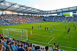
- Children's Mercy Park, the home stadium for the Sporting Kansas City soccer team.
In 2011, Google chose Kansas City to build an experimental fiber-optic internet network. This network brought very fast internet speeds to the city, starting in 2012. Piper, Kansas, a community within Kansas City, was one of the first places in the country to get these super-fast internet speeds.
Top Employers in Kansas City, Kansas
Here are some of the biggest employers in the city:
- University of Kansas Hospital
- University of Kansas Medical Center
- General Motors Corporation
- Kansas City, KS School District #500
- Burlington Northern/Santa Fe Railroad
- Unified Government of Wyandotte Co/KCK / Kansas City, Kansas
- Associated Grocers
- Providence Medical Center
- Nebraska Furniture Mart
Education in KCK
Kansas City, Kansas, has many schools and colleges.
Colleges and Universities
- Public
- Kansas City Kansas Community College
- University of Kansas Medical Center (where you can study medicine, nursing, and other health professions)
- Private
- Donnelly College
School Districts
- Public
- Kansas City USD 500
- Bonner Springs–Edwardsville USD 204
- Piper USD 203
- Turner USD 202
- Private
- Catholic Archdiocese of Kansas City
High Schools
- Bishop Ward High School
- Fairfax Learning Center
- J. C. Harmon High School
- Kansas City Kansas Community College: Technical Education Center
- Piper High School, in Piper
- F.L. Schlagle High School
- Kansas State School for the Blind (KSSB)
- Sumner Academy of Arts & Science
- Turner High School
- Washington High School
- Wyandotte High School
Public Libraries
The Kansas City, Kansas Public Library system has five libraries. These include the Main Library and branches like South Branch, Turner Community Library, West Wyandotte Library, and the F.L. Schlagle Environmental Library. The library system started in 1895.
Transportation in KCK
In the past, river transportation was very important for Kansas City, Kansas. Its location at the meeting point of the Missouri and Kansas Rivers made it easy for trade. Today, the Kansas City Area Transportation Authority helps many people get around daily. A part of Interstate 70 in Kansas was one of the first highway projects completed under a new federal law in 1956.
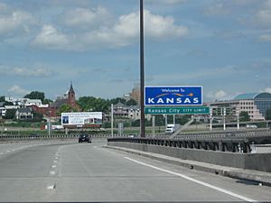
Major Highways
- Interstate 35 – This highway goes north to Des Moines, Iowa, and south to Wichita, Kansas.
- Interstate 70 – This highway goes east to St. Louis, Missouri, and west to Topeka, Kansas, and Denver, Colorado.
Other Important Roads
- Interstate 435 – A loop highway that goes through the suburbs of both Kansas and Missouri. It also provides access to Kansas City International Airport.
- Interstate 635 – Connects the Kansas suburbs with Kansas City, Kansas, and Riverside, Missouri.
- Interstate 670 – A shortcut that bypasses part of I-70 downtown.
- US-24-40 – A combination of US-24 and US-40 highways.
- K-5 – A smaller highway that goes north of Kansas City, Kansas.
- K-7 – A highway connecting Leavenworth, Wyandotte, and Johnson counties.
- K-32 – A highway linking Leavenworth, Wyandotte, and Douglas counties.
Local Roads
- US-169, also known as 7th Street Trafficway
- South 18th Street Expressway
- State Avenue and Parallel Parkway
- Kansas Avenue and the Turner Diagonal
Airports
The closest airport for air travel is Kansas City International Airport.
Culture and Landmarks
Kansas City, Kansas, has many interesting buildings and places listed on the National Register of Historic Places. It is also the home of the Roman Catholic Archdiocese of Kansas City in Kansas, which serves a large area in eastern Kansas.
Memorial Hall is a large building downtown with 3,500 seats. It's used for concerts, sports, and other events. The John and Margaret Scroggs house, built in 1887, is a beautiful example of Queen Anne style homes in the Strawberry Hill area.
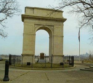
The Rosedale Arch is a smaller copy of France's famous Arc de Triomphe. It honors the men from Kansas City, Kansas, who served in World War I. You can find it on Mount Marty in Rosedale, looking over Rainbow and Southwest Boulevards.
Wyandotte High School is a historic public school building built in 1936. It was later named a Historical Landmark. The Wyandotte County Museum and Historical Society was started in 1889 to keep the county's history safe. The Argentine Carnegie Library, built in 1917, is the only Carnegie library left in the Kansas City area.
Other interesting places in Kansas City, Kansas, include:
- Fire Station No. 9
- Granada Theater
- Hanover Heights Neighborhood Historic District
- Huron Cemetery
- Judge Louis Gates House
- Great Wolf Lodge
- Schlitterbahn Vacation Village
- Quindaro Townsite
- Sauer Castle
- Scottish Rite Temple
- Shawnee Street Overpass
- Soldiers and Sailors Memorial Building
- St. Augustine Hall
- Theodore Shafer House
- Trowbridge Archeological Site
- Westheight Manor and Westheight Manor District
- White Church Christian Church
- Wyandotte County Courthouse
- The Muncie area
Media and News
Kansas City, Kansas, is part of a larger media market that covers parts of Kansas and Missouri. This means people in KCK can get news and entertainment from many TV and radio stations.
Newspapers
The Kansan used to be a daily newspaper for Kansas City, Kansas. Now, it's an online-only newspaper. Other local newspapers include The Record, Piper Press, and The Wyandotte West. There are also weekly newspapers like The Pitch, The Kansas City Metro Voice, The Wyandotte Echo, The Call, Kansas City Business Journal, and the Spanish-English paper Dos Mundos.
TV Stations
Major TV networks have stations in the Kansas City area. These include:
- WDAF-TV (Fox)
- KCTV (CBS)
- KMBC-TV (ABC)
- KCPT (PBS)
- KCWE (The CW)
- KSHB-TV (NBC)
- KSMO-TV (MyNetworkTV)
Sports in Kansas City, Kansas
Kansas City, Kansas, is home to several professional sports teams and exciting venues.
Sporting Kansas City (Soccer)
The Major League Soccer team Sporting Kansas City plays its home games at Children's Mercy Park in the Village West area. The team was first known as the Kansas City Wiz and then the Kansas City Wizards before changing its name in 2011.
Kansas City Current (Women's Soccer)
The Kansas City Current is a professional women's soccer team in the National Women's Soccer League. They played their first season in 2021 at Legends Field and then moved to Children's Mercy Park for the 2022 season. The team plans to build a new stadium in Kansas City, Missouri, which is expected to open in 2024.
Kansas City Monarchs (Baseball)
The Kansas City Monarchs are an independent baseball team. They play in the American Association of Professional Baseball. The team moved to Kansas City, Kansas, in 2003 and played at Legends Field. The Monarchs won the Northern League Championship in 2008 and the American Association Championship in 2018.
Auto Racing at Kansas Speedway
The Kansas Speedway is a large auto racetrack next to the Village West area. It hosts exciting races that are part of the NASCAR Cup Series and other racing events. The track is a 1.5-mile (2.4 km) oval. The first race was held there on June 2, 2001. The top NASCAR series holds the annual Hollywood Casino 400 race at the track.
Notable people
See also
 In Spanish: Kansas City (Kansas) para niños
 | Chris Smalls |
 | Fred Hampton |
 | Ralph Abernathy |


