
Interstate 35 facts for kids
Quick facts for kids
|
|
|---|---|
| Lua error in Module:Infobox_road/map at line 15: attempt to index field 'wikibase' (a nil value). | |
| Route information | |
| Length | 1,569.06 mi (2,525.16 km) |
| Existed | 1956 (completed 1982)–present |
| Major junctions | |
| South end | |
|
|
| North end | |
| Location | |
| States: | Texas, Oklahoma, Kansas, Missouri, Iowa, Minnesota |
| Highway system | |
| Main route of the Interstate Highway System Main • Auxiliary • Business |
|

Interstate 35 (I-35) is a very long highway in the United States. It is part of the Interstate Highway System, a network of important roads that connect different states. I-35 starts in Laredo, Texas, right near the border with Mexico. From there, it goes all the way north to Duluth, Minnesota.
This major road is about 1,568 miles (2,524 kilometers) long. It helps millions of people travel across six different states.
In June 2015, a part of I-35 had to close. This happened because of a lot of rain and a rock slide caused by Tropical Storm Bill. The storm made the water levels very high. The lanes going south opened first, but it took longer for the northbound lanes to be safe for drivers again.
Exploring Interstate 35
Interstate 35 travels through many different landscapes and cities. It connects important places across the central United States.
I-35 in Kansas

When I-35 enters Kansas, it becomes part of the Kansas Turnpike. This section of the highway is a toll road, meaning drivers pay a fee to use it. As it goes through Kansas, I-35 passes by the city of Wichita. It also goes through the beautiful Flint Hills area, which is known for its rolling grasslands.
After leaving Emporia, I-35 becomes a regular, free highway again. This part of the road goes through Ottawa. Then, it enters the Kansas City Metropolitan Area. Here, I-35 travels through Johnson County and Kansas City, Kansas.
Images for kids
-

I-35 starts at this traffic signal in Laredo, Texas
-

I-35 in Goldsby, Oklahoma, at milemarker 102
-
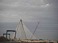
Bond Bridge carries I-35 in Kansas City
-
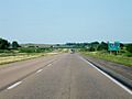
I-35 in Iowa, near exit 182. The town of Swaledale is about one mile (1.6 km) to the east.


See also
 In Spanish: Interestatal 35 para niños
