
Santa Ana, California facts for kids
Quick facts for kids
Santa Ana, California
|
|||||
|---|---|---|---|---|---|
.jpg) .jpg) .jpg) .JPG) _(cropped).jpg) _(cropped).jpg) .jpg) Top: Santora Building (left) and Santa Ana Regional Transportation Center (right); middle: Santa Ana City Hall (left), West Coast Theatre (center), and high rises (right); bottom: Bowers Museum (left) and Old Santa Ana Courthouse
|
|||||
|
|||||
| Motto(s):
Education First
|
|||||

Location of Santa Ana within Orange County, California
|
|||||

Santa Ana, California
Location in the Los Angeles metropolitan area

Santa Ana, California
Location in California

Santa Ana, California
Location in the United States

Santa Ana, California
Location in North America
|
|||||
| Country | United States | ||||
| State | California | ||||
| County | Orange | ||||
| Founded | 1869 | ||||
| Incorporated | June 1, 1886 | ||||
| Named for | Saint Anne | ||||
| Area | |||||
| • Total | 27.37 sq mi (70.89 km2) | ||||
| • Land | 27.34 sq mi (70.81 km2) | ||||
| • Water | 0.03 sq mi (0.08 km2) 0.90% | ||||
| Elevation | 115 ft (35 m) | ||||
| Population
(2020)
|
|||||
| • Total | 310,227 | ||||
| • Rank | (2023) 3rd in Orange County 14th in California 65th in the United States |
||||
| • Density | 11,334.6/sq mi (4,376.17/km2) | ||||
| Demonyms |
|
||||
| Time zone | UTC−8 (Pacific) | ||||
| • Summer (DST) | UTC−7 (PDT) | ||||
| ZIP Codes |
92701–92708, 92711, 92712, 92728, 92735, 92799
|
||||
| Area code | 657/714, 949 | ||||
| FIPS code | 06-69000 | ||||
| GNIS feature IDs | 1652790,2411814 | ||||


Santa Ana is a big city in Southern California. It is the main city of Orange County, California. The city's name comes from the Spanish for "Saint Anne."
In 2020, about 310,227 people lived here. Santa Ana is the third largest city in Orange County. It is also the 14th largest city in California. The city is an important center for business and culture in the Orange Coast area.
In 1810, a Spanish governor gave land to José Antonio Yorba. This land was called Rancho Santiago de Santa Ana. After Mexico became independent, the rancho grew very large. Many different people lived there. In 1869, William H. Spurgeon bought the land. He then officially started the city of Santa Ana.
Most people in Santa Ana are of Hispanic or Latino background. The New York Times newspaper has called Santa Ana "the face of a new California." This means that Latino people have a big influence in the state.
Contents
- Santa Ana's History: A Journey Through Time
- Geography and Climate of Santa Ana
- People of Santa Ana: Demographics
- Economy: Businesses and Jobs
- Arts and Culture: Fun Things to Do
- Sports: High School and College Teams
- Education: Schools and Colleges
- Infrastructure: Getting Around and Services
- Images for kids
- See also
Santa Ana's History: A Journey Through Time

Santa Ana has a long and interesting history. It started with native people. Then, Spanish and Mexican settlers arrived. Later, American settlers built the modern city.
Early Days: Native People and Spanish Explorers
The Tongva and Juaneño/Luiseño tribes lived here first. The Tongva called this area "Hotuuk." A village named Pajbenga was located along the Santa Ana River.
In 1769, Spanish explorers came from Mexico City. A friar named Junípero Serra called the area "Vallejo de Santa Ana." This means "Valley of Saint Anne." In 1776, Mission San Juan Capistrano was built nearby.
In 1810, a Spanish army sergeant, Jose Antonio Yorba, received a large land grant. He named it Rancho Santiago de Santa Ana. This rancho included land where many cities are today. These cities include Orange, Irvine, and Santa Ana. This was the only Spanish land grant in Orange County.
After the Mexican-American War in 1848, California became part of the United States. More American settlers began to move to the area.
Building the City: From Rancho to City
In 1869, William H. Spurgeon bought land from the Yorba family. He officially founded the city of Santa Ana. In 1886, Santa Ana became an official city. About 2,000 people lived there then.
In 1889, Santa Ana became the main city for the new Orange County. Railroads came to Santa Ana in 1877 and 1887. This made it easier for people to travel and for businesses to grow.
By 1890, most people in Santa Ana were white. Many came from southern states after the American Civil War. They were looking for new homes and jobs.
Growth in the 20th Century
.jpg)
,_circa_1932_(51898275593).jpg)
In 1905, a railway connected Santa Ana to Los Angeles. This made travel easier. The Santa Ana Freeway opened in 1953. It was the first direct car route between Los Angeles and Santa Ana.
The Glenn L. Martin Company, an aviation company, started in Santa Ana in 1912. This company later became part of Lockheed Martin, a very large defense company.
During World War II, the Santa Ana Army Air Base was built. It was a training center for the U.S. Army Air Forces. Many veterans moved to Santa Ana after the war. This helped the city's population grow.
In the 1950s, Santa Ana's economy grew fast. But this growth mostly helped white residents. Latino residents did not benefit as much.
Santa Ana Becomes a Latino City
.jpg)
By the 1970s, more and more Latino people lived in Santa Ana. Many white families moved to other towns. The downtown area became a center for Latino businesses. This changed how people saw the city. Property values went down in Santa Ana. But they went up in nearby cities.
In the 1980s, Santa Ana had about equal numbers of white and Latino residents. Fourth Street, once a white business area, became a street of Latino businesses. Latino families moved into all parts of the city. People started calling Santa Ana "Santana." Fourth Street became "La Cuatro."
In 1988, citizens voted to directly elect their mayor. Miguel A. Pulido was the first mayor of Latino background. He was also the first mayor chosen by the voters.
Since the 1980s, there have been efforts to improve downtown Santa Ana. The Santa Ana Artist's Village was created. It brought artists and new businesses. The historic Yost Theater reopened in 2009.
_(cropped).jpg)
In the 2010s, some residents worried about "gentrification." This means that new, wealthier people move in. They can cause prices to go up. This can make it hard for long-time residents to stay. Some Spanish-speaking businesses were replaced by art projects. This brought in new people. But it also caused some displacement of immigrant families.
Residents also worked to fix lead pollution in poorer areas. A study in 2020 found higher lead levels in low-income areas. This is a big concern for children's health. People continue to work for environmental fairness in the city.
Geography and Climate of Santa Ana

Santa Ana is located at 33°44′27″N 117°52′53″W / 33.74083°N 117.88139°W. The city covers about 27.5 square miles (70.89 square kilometers). Most of this area is land. Only a small part is water. Santa Ana is one of the most densely populated cities in the U.S. for its size.
The city is on flat, low land. The Santa Ana River runs through the western part of the city. This river is mostly controlled by dams. It can be dry for parts of the year. But it has caused serious floods in the past.
Cityscape: Exploring Santa Ana's Districts
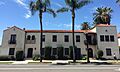
Santa Ana has different areas, or districts. The downtown area is the heart of the city. It has shops, homes, and government buildings. The Santa Ana Civic Center is here. It has offices for the city and Orange County. Historic homes from the late 1800s are also in downtown. People are working to protect these old homes.
North of downtown is the "Midtown" area. Here you can find the Bowers Museum, MainPlace Mall, and the Discovery Science Center.
_(cropped).jpg)
The "Metro East" area is a newer district. The city wants it to have offices, shops, and homes. The Santa Ana Zoo is on the east side of the city. It is known for its collection of monkeys.
The southeast part of the city is called South Coast Metro. It is shared with the city of Costa Mesa. South Coast Plaza, a big shopping center, is in this area. It also has tall office and apartment buildings.
Climate: Sunny Days and Mild Winters

Santa Ana has a warm, dry climate. Summers are hot and dry. Winters are mild with some rain. On average, Santa Ana gets about 12.54 inches (318.5 mm) of rain each year. Most of the rain falls from November to April.
The highest temperature ever recorded in Santa Ana was 112°F (44°C) in 1917. The lowest was 16°F (-9°C) in 1989. On average, there are about 30 days a year when the temperature reaches 90°F (32°C) or higher.
People of Santa Ana: Demographics
Santa Ana is a very diverse city. Most people in Santa Ana have Mexican, Salvadorian, or Guatemalan roots. Common European backgrounds include German, Irish, English, and Italian.
| Historical population | |||
|---|---|---|---|
| Census | Pop. | %± | |
| 1880 | 711 | — | |
| 1890 | 3,628 | 410.3% | |
| 1900 | 4,933 | 36.0% | |
| 1910 | 8,429 | 70.9% | |
| 1920 | 15,485 | 83.7% | |
| 1930 | 30,322 | 95.8% | |
| 1940 | 31,921 | 5.3% | |
| 1950 | 45,533 | 42.6% | |
| 1960 | 100,350 | 120.4% | |
| 1970 | 155,710 | 55.2% | |
| 1980 | 204,023 | 31.0% | |
| 1990 | 293,742 | 44.0% | |
| 2000 | 337,977 | 15.1% | |
| 2010 | 324,528 | −4.0% | |
| 2020 | 310,227 | −4.4% | |
| 2023 (est.) | 299,630 | −7.7% | |
| U.S. Decennial Census 2010 2020 |
|||
Population in 2020
.jpg)
_(cropped).JPG)
In 2020, Santa Ana had a population of 310,227 people. About 76.7% of the people were Hispanic or Latino. Other groups included Asian (12.3%), White (8.5%), and African American (1.1%).
There were 73,174 households in 2010. About 56.3% of these households had children under 18. The average household had about 4.37 people.
In 2009-2013, the average household income was $53,335. About 21.5% of the people lived below the poverty line.
Economy: Businesses and Jobs

.jpg)
Santa Ana is home to the main offices of several companies. These include Behr Paint, First American Corporation, and Ingram Micro. It also has big offices for companies like Xerox and T-Mobile.
One famous business in Santa Ana is Rickenbacker. This company makes electric guitars and bass guitars. Many famous rock and roll musicians have used their instruments.
The Glenn L. Martin Company, which later became part of Lockheed Martin, started in Santa Ana in 1912.
The nearby city of Irvine has grown a lot in business. To compete, Santa Ana has approved new business projects. These are in the South Coast Metro area and the "Metro East" area.
The Historic South Main Business District has many older shops. It goes from downtown Santa Ana south to the South Coast Metro area.
Major Employers in Santa Ana
.jpg)
Many people work for large organizations in Santa Ana. Here are some of the top employers:
- County of Orange
- Santa Ana Unified School District
- Santa Ana College
- KPC Healthcare
- City of Santa Ana
- United States Postal Service
- Allied Universal
- First American
- Superior Court of CA-County of Orange
- Johnson & Johnson
Arts and Culture: Fun Things to Do
.jpg)
_(cropped).jpg)
The Bowers Museum is a popular art and history museum. It opened in the 1930s. It has many artworks and historical items from around the world. It also hosts special exhibits.
Santa Ana has many colorful wall paintings and murals. These show local history and different cultures in Orange County.
The Chiarini Fountain is a beautiful fountain in downtown Santa Ana. It was given to the city to honor artists.
Santa Ana has many parks. Famous amusement parks like Disneyland and Knott's Berry Farm are not far away. Beaches are about 20 minutes south. You can go shopping, eat, boat, swim, and surf at beaches like Huntington Beach and Newport Beach.
Places to Visit in Santa Ana
- CSUF Grand Central Art Center - a creative hub in the Artist Village.
- Discovery Science Center - a fun place to learn about science.
- Main Place Mall - a large shopping center.
- Old Orange County Courthouse - a historic building.
- Santa Ana Civic Center - where city and county government offices are.
- Santa Ana College - a local community college.
- Santa Ana Zoo - home to many animals, especially monkeys.
- Bowers Museum - an art and history museum.
- Yost Theater - a historic theater.
- Lyon Air Museum - a museum with old airplanes.
- Heritage Museum of Orange County - learn about local history.
Sports: High School and College Teams
.JPG)
Santa Ana has strong sports teams at its high schools and colleges. They play at Santa Ana Stadium and the Santa Ana Unified School District Sports Complex Stadium.
The Dons of Santa Ana College have one of the best soccer teams in California. They often win their conference title. The college is also known for its successful baseball teams.
Mater Dei High School has one of the most famous football programs in the country.
Education: Schools and Colleges

.jpg)
Most students in Santa Ana go to schools in the Santa Ana Unified School District. This district has many elementary, intermediate, and high schools. Some elementary schools are John Adams, Manuel Esqueda, and Diamond.
The public high schools include Valley High School (Santa Ana), Middle College High School, Santa Ana High School, Saddleback High School, Century High School, Segerstrom Fundamental High School, and Godinez Fundamental High School. The Orange County School of the Arts is also in Santa Ana.
The Roman Catholic Diocese runs Mater Dei High School. They also run several K-8 schools.
Santa Ana is also home to Santa Ana College. This is a two-year public college. Other colleges include California Coast University and the Orange County branch of the Art Institute of California.
Infrastructure: Getting Around and Services
Transportation: Roads, Trains, and Airports
_(cropped).jpg)
Several major freeways run through Santa Ana. These roads connect the city to other parts of Orange County and beyond.
- The Santa Ana Freeway (Interstate 5) goes north to Los Angeles and south to San Diego.
- The Garden Grove Freeway (State Route 22) runs near Santa Ana's northern edge.
- The Costa Mesa Freeway (State Route 55) goes south to Costa Mesa.
- The Orange Freeway (State Route 57) connects to Pomona.
Amtrak provides train service to Santa Ana. The Pacific Surfliner train runs between San Diego and Los Angeles. The Santa Ana Regional Transportation Center is a major train station. Metrolink commuter trains also stop here.
Greyhound Lines offers bus service across the U.S. and Canada. Other bus lines go to Mexico.
_(cropped).jpg)
The Orange County Transportation Authority (OCTA) provides local bus service. A new light rail line, the OC Streetcar, is being built. It will connect Santa Ana and Garden Grove.
John Wayne Airport is located in Santa Ana. Its airport code is SNA.
City Services: Utilities and Safety
Southern California Edison provides electricity to Santa Ana. The Southern California Gas Company provides natural gas. AT&T offers phone and cable TV services.
The Santa Ana Police Department provides law enforcement. They have different units, including K9 dogs and a SWAT team. The city also shares a helicopter with nearby cities.
In 2012, the city's fire department joined the Orange County Fire Authority. This group now provides fire protection for Santa Ana.
Images for kids
-
The historic Casa del Rey.
-

The Ebell Society of Santa Ana.
_(cropped).jpg)
See also
 In Spanish: Santa Ana (California) para niños
