Newport Beach, California facts for kids
Quick facts for kids
Newport Beach, California
|
|||||||||||
|---|---|---|---|---|---|---|---|---|---|---|---|
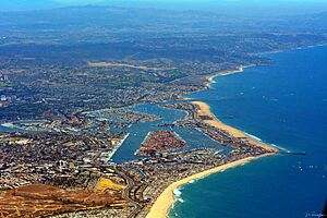
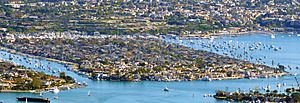
Aerial view of Newport Beach in July 2014
|
|||||||||||
|
|||||||||||
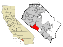
Location within California and Orange County
|
|||||||||||
| Country | United States | ||||||||||
| State | California | ||||||||||
| County | Orange | ||||||||||
| Incorporated | September 1, 1906 | ||||||||||
| Government | |||||||||||
| • Type | Council-Manager | ||||||||||
| • Body | Newport Beach City Council | ||||||||||
| Area | |||||||||||
| • Total | 52.92 sq mi (137.07 km2) | ||||||||||
| • Land | 23.79 sq mi (61.62 km2) | ||||||||||
| • Water | 29.13 sq mi (75.45 km2) 55.07% | ||||||||||
| Elevation | 10 ft (3 m) | ||||||||||
| Population
(2020)
|
|||||||||||
| • Total | 85,239 | ||||||||||
| • Rank | 103rd in California | ||||||||||
| • Density | 1,610.71/sq mi (621.865/km2) | ||||||||||
| Time zone | UTC−8 (Pacific) | ||||||||||
| • Summer (DST) | UTC−7 (PDT) | ||||||||||
| ZIP Codes |
92657–92663
|
||||||||||
| Area code | 949 | ||||||||||
| FIPS code | 06-51182 | ||||||||||
| GNIS feature IDs | 1661104, 2411250 | ||||||||||
|
|||||||||||
Newport Beach is a city on the coast in southern Orange County, California. About 85,000 people live there. It is known for its beautiful sandy beaches. The city's harbor was once used for shipping and fishing. Today, it is mostly for fun activities. Balboa Island is a popular spot. It has a path along the water and shops and restaurants. You can easily get there by ferry.
Contents
History of Newport Beach
The Upper Bay of Newport was formed long ago. It was a canyon carved by a stream. The Lower Bay of Newport was made much later. Ocean currents brought sand that created the Balboa Peninsula.
For thousands of years, the Tongva people lived on this land. They had large, thriving communities. The Tongva villages of Genga and Moyongna were in the Newport Beach area. Later, the Spanish Empire took over the land. Then came Mexicans and Americans. All of these groups displaced the Tongva people.
In the 1870s, more Anglo-Americans moved to the area. This happened after a ship called The Vaquero sailed safely into Newport Bay. Captain Samuel S. Dunnells steered the 105-ton steamer. James Irvine heard this amazing news. He traveled from San Francisco to his ranch. There, he met with his brother Robert Irvine and friend James McFadden. They decided to name the new port "Newport." This is where Newport Beach gets its name. James McFadden built a long pier, McFadden Wharf, in 1888.
In 1905, the city grew faster. The Pacific Electric Railway built a train line to Newport. This connected the beach to downtown Los Angeles. In 1906, Newport Beach became an official city. It had 206 citizens then.
More areas were added to the city over time. These included the Peninsula, West Newport, Newport Island, Balboa Island, and Lido Isle. In 1923, Corona del Mar joined Newport Beach. In 2002, Newport Coast, East Santa Ana Heights, and San Joaquin Hills were added. In 2008, West Santa Ana Heights also became part of Newport Beach.
Geography of Newport Beach
Newport Beach goes from sea level up to Signal Peak. This peak is 1,161 feet high in the San Joaquin Hills. The city's official elevation is 10 feet above sea level.
The city is next to Huntington Beach on the west. This is near the Santa Ana River. To the north are Costa Mesa, John Wayne Airport, Irvine, and UC Irvine. On the east side is Crystal Cove State Park.
Newport Beach covers about 53 square miles. About 23.8 square miles is land. The rest, about 29.2 square miles (55.07%), is water.
Some areas within Newport Beach are Corona del Mar, Balboa Island, Balboa Peninsula, Lido Peninsula, Newport Coast, San Joaquin Hills, Santa Ana Heights, and West Newport.
Newport Harbor and Newport Bay
Newport Harbor is a harbor that was partly made by people. It was created by digging out the Newport Bay estuary in the early 1900s. Several islands were also built. These islands now have private homes on them. They include Newport Island, Balboa Island, Little Balboa Island, Collins Island, Bay Island, Harbor Island, Lido Isle, and Linda Isle.
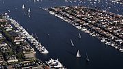
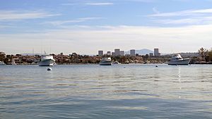
Newport Harbor used to have industries like boatbuilding and commercial fishing. But today, it is mostly used for fun. Most of its shores have private homes and docks. Newport Harbor has about 9,000 boats. It is one of the largest harbors for recreational boats on the U.S. west coast. It is a popular place for all kinds of boating. This includes sailing, fishing, rowing, canoeing, kayaking, and paddleboarding.
Today, some commercial boats still operate. These include the Catalina Flyer ferry to Catalina Island. There are also harbor tours, sport fishing trips, and whale watching tours. A few small commercial fishing boats also use the harbor.
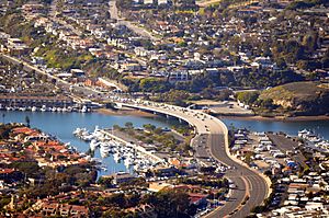
The Pacific Coast Highway bridge divides Newport Bay. Most sailboats and very large boats cannot pass under it. The area north of the bridge is called Upper Newport Bay, or the Back Bay. The area south of the bridge is called Lower Newport Bay, or Newport Harbor. The Back Bay also has boat facilities, like the marina at Newport Dunes.
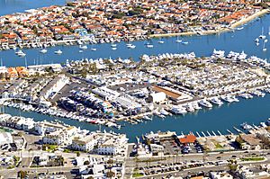
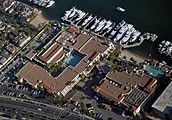
The north end of Newport Harbor, near Lido Isle, has business centers. It used to be a home for fishing boats. Now, the Lido Marina Village is a local port. Many "Newport Party Boats" can be rented there. It also has small shops and restaurants. The village hosts a boat show each year. It also has an organic "Farmers Market" on Sundays. The local Gondola Company also operates from here. The Lido Village was renovated and reopened in 2017.
In 1927, a unique home was built at the entrance of Newport Harbor. It was known as the China House of China Cove. The home was built in a traditional Chinese style. It was a famous landmark until it was torn down in the 1980s. Some of its original roof can still be seen on a home in China Cove.
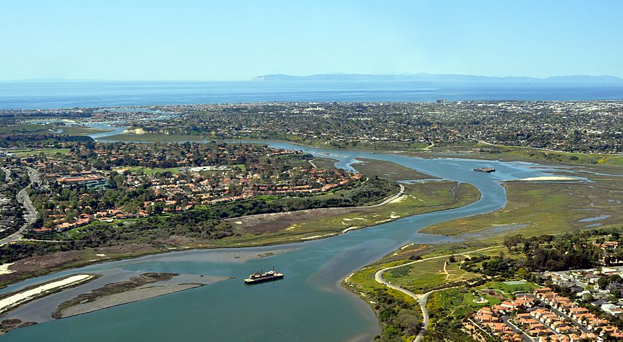
Upper Newport Bay is an estuary. It was formed by an ancient flow of the Santa Ana River. Today, a small stream from San Diego Creek feeds it. Much of Upper Newport Bay is a protected natural area. It is called the Upper Newport Bay Ecological Reserve. It was created in 1975.
Newport Beach Climate
Newport Beach has a mild climate. It is like a warm-summer Mediterranean climate. The Pacific Ocean helps keep temperatures steady. Winters are warmer, and summers are cooler than in inland cities. Newport Beach does not get enough rain to be a true Mediterranean climate.
| Climate data for Newport Beach Harbor, California (1991–2020 normals, extremes 1921–present) | |||||||||||||
|---|---|---|---|---|---|---|---|---|---|---|---|---|---|
| Month | Jan | Feb | Mar | Apr | May | Jun | Jul | Aug | Sep | Oct | Nov | Dec | Year |
| Record high °F (°C) | 87 (31) |
91 (33) |
91 (33) |
101 (38) |
95 (35) |
102 (39) |
88 (31) |
94 (34) |
107 (42) |
96 (36) |
94 (34) |
86 (30) |
107 (42) |
| Mean maximum °F (°C) | 76.4 (24.7) |
73.8 (23.2) |
74.1 (23.4) |
76.1 (24.5) |
74.4 (23.6) |
74.4 (23.6) |
77.1 (25.1) |
79.2 (26.2) |
82.0 (27.8) |
83.0 (28.3) |
80.4 (26.9) |
74.5 (23.6) |
88.2 (31.2) |
| Mean daily maximum °F (°C) | 64.5 (18.1) |
63.3 (17.4) |
64.7 (18.2) |
65.9 (18.8) |
66.7 (19.3) |
68.4 (20.2) |
71.8 (22.1) |
73.3 (22.9) |
74.1 (23.4) |
72.7 (22.6) |
68.4 (20.2) |
64.1 (17.8) |
68.2 (20.1) |
| Daily mean °F (°C) | 57.4 (14.1) |
57.2 (14.0) |
58.9 (14.9) |
60.5 (15.8) |
62.5 (16.9) |
64.9 (18.3) |
68.2 (20.1) |
69.4 (20.8) |
69.1 (20.6) |
66.5 (19.2) |
61.4 (16.3) |
57.0 (13.9) |
62.8 (17.1) |
| Mean daily minimum °F (°C) | 50.4 (10.2) |
51.0 (10.6) |
53.1 (11.7) |
55.1 (12.8) |
58.3 (14.6) |
61.5 (16.4) |
64.6 (18.1) |
65.5 (18.6) |
64.1 (17.8) |
60.2 (15.7) |
54.5 (12.5) |
49.8 (9.9) |
57.3 (14.1) |
| Mean minimum °F (°C) | 42.3 (5.7) |
43.3 (6.3) |
46.0 (7.8) |
49.1 (9.5) |
53.1 (11.7) |
57.3 (14.1) |
60.6 (15.9) |
61.1 (16.2) |
59.4 (15.2) |
54.4 (12.4) |
46.4 (8.0) |
41.8 (5.4) |
39.7 (4.3) |
| Record low °F (°C) | 29 (−2) |
31 (−1) |
33 (1) |
37 (3) |
39 (4) |
42 (6) |
45 (7) |
51 (11) |
45 (7) |
32 (0) |
34 (1) |
32 (0) |
29 (−2) |
| Average precipitation inches (mm) | 2.20 (56) |
2.38 (60) |
1.34 (34) |
0.55 (14) |
0.18 (4.6) |
0.07 (1.8) |
0.02 (0.51) |
0.00 (0.00) |
0.10 (2.5) |
0.33 (8.4) |
0.64 (16) |
1.62 (41) |
9.43 (240) |
| Average precipitation days | 6.4 | 6.6 | 4.8 | 2.7 | 1.5 | 0.6 | 0.6 | 0.2 | 0.5 | 2.0 | 3.2 | 5.7 | 34.8 |
| Mean monthly sunshine hours | 217 | 226 | 279 | 300 | 279 | 270 | 341 | 341 | 270 | 248 | 210 | 217 | 3,198 |
| Mean daily sunshine hours | 7 | 8 | 9 | 10 | 9 | 9 | 11 | 11 | 9 | 8 | 7 | 7 | 8.75 |
| Percent possible sunshine | 69 | 73 | 75 | 76 | 65 | 63 | 78 | 82 | 73 | 71 | 67 | 70 | 72 |
| Average ultraviolet index | 3 | 4 | 6 | 8 | 9 | 10 | 10 | 10 | 8 | 6 | 4 | 3 | 7 |
| Source 1: National Oceanic and Atmospheric Administration | |||||||||||||
| Source 2: En.tutiempo, Weather Atlas (sun and uv) | |||||||||||||
People of Newport Beach
| Historical population | |||
|---|---|---|---|
| Census | Pop. | %± | |
| 1910 | 445 | — | |
| 1920 | 894 | 100.9% | |
| 1930 | 2,203 | 146.4% | |
| 1940 | 4,438 | 101.5% | |
| 1950 | 12,120 | 173.1% | |
| 1960 | 26,564 | 119.2% | |
| 1970 | 49,582 | 86.7% | |
| 1980 | 62,556 | 26.2% | |
| 1990 | 66,643 | 6.5% | |
| 2000 | 70,032 | 5.1% | |
| 2010 | 85,186 | 21.6% | |
| 2020 | 85,239 | 0.1% | |
| 2023 (est.) | 82,637 | −3.0% | |
| U.S. Decennial Census | |||
Population in 2020
In 2020, Newport Beach had a population of 85,239 people. Most residents were White (75.50%). About 8.73% were Asian, and 9.61% were Hispanic or Latino.
Population in 2010
In 2010, Newport Beach had 85,186 people. About 87.3% of the people were White. About 7.0% were Asian, and 7.2% were Hispanic or Latino.
Most people (99.5%) lived in homes. The average home had 2.19 people. The average family had 2.81 people. About 17.3% of the people were under 18 years old. About 19.0% were 65 or older. The average age was 44.0 years.
More than half of the homes (54.8%) were owned by the people living in them. The rest were rented.
Population in 2000
In 2000, the city had 70,032 people. There were 33,071 households. The average home had 2.09 people. The average family had 2.71 people.
About 15.7% of the population was under 18. About 17.6% were 65 or older. The average age was 42 years.
Economy of Newport Beach
Newport Beach is known for its high housing prices. In 2009, it was the eighth most expensive place to live in the United States.
Many companies have their main offices in Newport Beach. These include Pacific Life, an insurance company. Other companies are Chipotle Mexican Grill and The Irvine Company. PIMCO and Urban Decay are also based here. Fletcher Jones Motor Cars is the biggest Mercedes-Benz dealership in the world.
Top Employers in Newport Beach
Here are some of the biggest employers in Newport Beach:
| # | Employer | # of employees |
|---|---|---|
| 1 | Hoag Memorial Hospital Presbyterian | 5,292 |
| 2 | PIMCO | 1,258 |
| 3 | Pacific Life Insurance | 1,250 |
| 4 | Glidewell Dental | 1,008 |
| 5 | Irvine Management Company | 895 |
| 6 | Tower Semiconductor | 868 |
| 7 | Resort at Pelican Hill | 798 |
| 8 | Newport-Mesa Unified School District | 780 |
| 9 | City of Newport Beach | 728 |
| 10 | Fletcher Jones Motor Cars | 465 |
| 11 | Balboa Bay Club | 427 |
| 12 | Newport Beach Marriott Hotel & Tennis Club | 371 |
Arts and Culture in Newport Beach
Fun Places to Visit
- Newport Back Bay or Upper Newport Bay
- Newport Pier
- Balboa Pier
- Balboa Fun Zone
- Balboa Island Ferry
- Balboa Island
- Mariners Medical Arts complex by Richard Neutra
- Bunnyhenge
- Sherman Library and Gardens
- Newport Sports Museum
- Pacific Coast Highway
- Orange County Council BSA Sea Base
- The Crab Cooker
- Corona del Mar State Beach
- Crystal Cove State Park
- The Wedge (surfing)
- Lovell Beach House
- Wooden Boat Festival
Past Landmarks
- The China House of China Cove
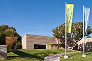
- Orange County Museum of Art
- The Reuben E. Lee
- Rendezvous Ballroom
- The Banana Stand
- Balboa Inn
- Hall House
Attractions in Newport Beach
Beaches and Surfing
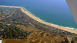
People have loved visiting Newport Beach's beaches since 1905. That's when the Pacific Electric Railway started bringing them here. The city has beaches from the Santa Ana River to the end of the Balboa Peninsula. There are also Corona del Mar State Beach and the beaches at Crystal Cove State Park.
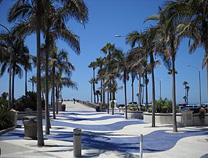
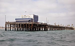
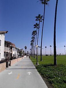
Newport Beach is great for surfing. Especially between Newport Pier and the Santa Ana River. At the tip of the Balboa Peninsula, The Wedge is famous. It offers amazing bodyboarding and bodysurfing. Both Newport Pier and Balboa Pier are popular for fishing and sightseeing. A boardwalk runs for 2.9 miles. It goes from 36th Street in West Newport, past both piers, to the Balboa Peninsula. It's perfect for walking and biking.
Harbor and Boating Fun
Newport Harbor is the biggest harbor for fun boats on the U.S. west coast. It's a popular place for all kinds of boating. You can go sailing, fishing, rowing, kayaking, and paddleboarding.
The yearly Christmas Boat Parade started in 1908. It's a very old tradition.
Many competitive events happen here. These include sailing, rowing, and paddling races. The yearly Newport to Ensenada International Yacht Race is the biggest sailboat race in the world.
Five private yacht clubs organize boating activities. Also, Orange Coast College, UC Irvine, and the Sea Scouts have bases here. They offer sailing, rowing, and water activities. The Newport Aquatic Center lets the public join in competitive rowing, canoeing, and kayaking. The Orange Coast College School of Sailing offers courses for fun and for jobs. These include United States Coast Guard licenses. Weekly races, like the Beer Can Races, happen during the summer.
Nautical Clubs
- Newport Harbor Yacht Club
- Balboa Yacht Club
- Bahia Corinthian Yacht Club
- Lido Isle Yacht Club
Balboa Island Fun
The historic Balboa Pavilion and Balboa Island Ferry are famous landmarks. They are on the Balboa Peninsula. The Catalina Flyer ferry is next to the Pavilion. It takes 500 passengers to and from Avalon on Santa Catalina Island every day. The Balboa Fun Zone is also home to the Newport Harbor Nautical Museum.
The village on Balboa Island attracts many visitors. A path along the water goes around the island. It's great for walkers and joggers. It also makes it easy to get from the ferry to the shops and restaurants.
Media in Newport Beach
- Newport Beach Independent (a newspaper)
- Newport Beach (a magazine)
Culture and Nightlife
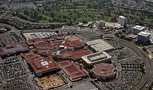
Fashion Island at Newport Center is a big place for shopping and entertainment.
Restaurants in Newport Beach often focus on seafood.
Parks and Recreation
Upper Newport Bay, also called the Back Bay, has Back Bay Drive. It also has many trails and paths. These are popular with bicyclists, rollerbladers, joggers, and walkers. Bird watchers and nature lovers enjoy the Upper Newport Bay Ecological Reserve. They also visit the Peter and Mary Muth Interpretive Center. Crystal Cove State Park has tide pools at its beach. It also has hiking and mountain biking trails in the backcountry. You can go Camping at Crystal Cove State Park. Camping is also available at the Newport Dunes Waterfront Resort and Marina.
Whale watching is also popular. Boats leave from Newport Harbor for tours. You can often see whales and dolphins from the Balboa and Newport Piers. This is especially true during migration season.
Fishing is very popular in Newport Bay and off the coast. There are about 80 types of fish you can catch. Some common ones include sharks, stingrays, and various types of bass. Commercial fishing also happens offshore. Lobsters are often caught in the reefs. However, the bright orange Garibaldi fish is protected.
On dark nights, you might see amazing bioluminescence. This happens when waves splash on the shore. Or when marine animals leave glowing trails in the water.
Golf Courses
The Pelican Hill area has two golf courses. They are ranked among America's 100 Greatest Public Golf Courses.
Education in Newport Beach
- Newport Elementary School
- Corona del Mar High School
- Newport Harbor High School
- Sage Hill School
- Pacifica Christian High School
- Carden Hall
- Eastbluff Elementary School
- Ensign Intermediate School
- Harbor Day School
- Harbor View Elementary School
- Lincoln Elementary School
- Mariners Elementary School
- Newport Heights Elementary School
- Newport Coast Elementary School
- Our Lady Queen of Angels School
- Roy O. Andersen Elementary School
City Services
Fire Department
The Newport Beach Fire Department helps keep people safe. They provide fire protection, lifeguard services, and emergency medical services.
Newport Beach has 8 fire stations. They also have a Lifeguard Headquarters at Newport Pier.
Marine Operations
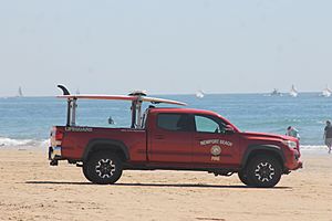
The marine division of the Fire Department has an important job. They are responsible for lifeguarding the beaches. About 10 million people visit Newport Beach's 6.2 miles of ocean and 2.5 miles of bay beaches each year. In 2013, the marine division saved 3,811 people from the water. Newport Beach lifeguards are known as a top agency in the country.
Newport Beach lifeguards also run a summer Junior Lifeguard program. It is one of the largest and oldest in the nation. This program works with the John Wayne Cancer Foundation. They help teach kids about skin cancer safety.
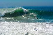
The lifeguards also watch over The Wedge. This spot is at the very end of the Balboa Peninsula. It's famous for its huge, wedge-shaped waves. It's a popular place for skimboarding, surfing, bodyboarding, and bodysurfing. When the waves are just right, The Wedge can have waves up to 30 feet high! Newport Beach has a very diverse coastline. Because of this, the lifeguards need to be in great shape. They also need years of experience with the local ocean.
Notable People from Newport Beach
Sister Cities
Newport Beach has sister cities around the world:
Images for kids
See also
 In Spanish: Newport Beach para niños
 | Shirley Ann Jackson |
 | Garett Morgan |
 | J. Ernest Wilkins Jr. |
 | Elijah McCoy |


