
Rancho Cucamonga, California facts for kids
Quick facts for kids
Rancho Cucamonga
|
|||
|---|---|---|---|
   Cucamonga Peak (top), Virginia Dare Winery (left), and shops in Rancho Cucamonga (right)
|
|||
|
|||
| Motto(s):
A World Class Community
|
|||

Location of Rancho Cucamonga in San Bernardino County
|
|||

Rancho Cucamonga
Location in the United States
|
|||
| Country | United States | ||
| State | California | ||
| County | San Bernardino | ||
| Incorporated (city) | November 30, 1977 | ||
| Government | |||
| • Type | Council-Manager | ||
| Area | |||
| • Total | 40.12 sq mi (103.91 km2) | ||
| • Land | 40.11 sq mi (103.89 km2) | ||
| • Water | 0.01 sq mi (0.02 km2) 0.05% | ||
| Elevation | 1,207 ft (368 m) | ||
| Population
(2020)
|
|||
| • Total | 174,625 | ||
| • Estimate
(2023)
|
174,405 | ||
| • Rank | 4th in San Bernardino County 26th in California 152nd in the United States |
||
| • Density | 4,349.36/sq mi (1,679.21/km2) | ||
| Time zone | UTC−8 (PST) | ||
| • Summer (DST) | UTC−7 (PDT) | ||
| ZIP Code |
91701, 91729, 91730, 91737, 91739
|
||
| Area code(s) | 909, 840 | ||
| FIPS code | 06-59451 | ||
| GNIS feature ID | 1667908 | ||


Rancho Cucamonga (/ˌræntʃoʊ kuːkəˈmʌŋɡə/ ran-CHOH-_-KOO-kə-MUNG-ɡə) is a city in San Bernardino County, California, United States. It is located south of the San Gabriel Mountains and Angeles National Forest. The city is about 37 miles (60 km) east of Downtown Los Angeles.
Rancho Cucamonga is one of California's largest cities by population. In 2020, about 174,453 people lived there. The city's seal shows a cluster of grapes, which reminds everyone of its history in farming and wine-making. Many big companies like Coca-Cola and Frito-Lay have chosen Rancho Cucamonga because it's close to major roads, airports, and transportation centers. The city's name became famous thanks to The Jack Benny Program.
Contents
Discovering Rancho Cucamonga's Past

The area where Rancho Cucamonga is today has a long history. Around 1200 AD, Native Americans called Kukamongan lived here. Their village was near what is now Red Hill. The name "Kukamonga" comes from a Tongva word meaning "sandy place." These early settlers were likely part of the Tongva people.
Early Spanish and Mexican Influence
In the 1700s, after an expedition led by Gaspar de Portolá, the land became part of the Mission System. This system was set up by Father Junipero Serra and his group. Later, in 1839, the land came under the control of Juan Bautista Alvarado, who was the governor of Mexico.
Alvarado gave about 13,000 acres (5,300 ha) of land, known as "Cucamonga," to Tiburcio Tapia. Tapia was a successful merchant from Los Angeles. He started California's first winery on this land.

In 1858, John Rains and his wife bought Rancho Cucamonga. Their home, Casa de Rancho Cucamonga, was finished in 1860. Today, it is a National Historic Landmark.
Growth and Development
The town grew and became successful over the years. In 1887, Chinese laborers dug irrigation tunnels in Cucamonga Canyon. The Santa Fe Railroad also extended its tracks through the area.
Farming was very important to the town's economy. They grew olives, peaches, citrus fruits, and especially grapes for vineyards. In 1913, the Pacific Electric Railway was built through Rancho Cucamonga. This helped transport crops more easily.
Today, some landmarks remind us of the city's diverse beginnings. Our Lady of Mt. Carmel church honors the Mexican farm workers. The Chinatown House remembers the Chinese immigrants who helped build the area's roads and railways.
Becoming a City
In 1977, three communities – Alta Loma, Cucamonga, and Etiwanda – decided to join together. They officially became the city of Rancho Cucamonga.
The Story of Grapeland
There was once a community called Grapeland, first settled in 1869. It was located where Victoria Groves Park and Central Park are today. Grapeland had a schoolhouse that also served as a church. In 1890, people tried to set up an irrigation system, but the plan didn't work out. Without enough water, the farms struggled, and many residents moved away. The post office closed in 1905. By 1957, Grapeland was almost empty.
Rancho Cucamonga's Location and Climate
Rancho Cucamonga is part of the Inland Empire region in San Bernardino County. This area is east of Los Angeles County and away from the coast. The city is bordered by Upland to the west, Ontario to the south, and Fontana to the east. The beautiful San Gabriel Mountains are to its north.
The city is built on a flat area called an alluvial plain. Sometimes, bears from the mountains might wander into the city. You can often see Cucamonga Peak, one of the tallest mountains in the San Gabriel range. Rancho Cucamonga covers about 39.9 square miles (103.3 km2) of land.
Weather in Rancho Cucamonga
The city has a hot-summer Mediterranean climate. This means summers are long and hot, while winters are generally mild and comfortable. Rancho Cucamonga gets about 17.68 inches (449 mm) of rain each year. The city enjoys about 287 sunny days per year, which is much more than the national average.
| Climate data for Rancho Cucamonga, California (1987–2016; extremes since 1909) | |||||||||||||
|---|---|---|---|---|---|---|---|---|---|---|---|---|---|
| Month | Jan | Feb | Mar | Apr | May | Jun | Jul | Aug | Sep | Oct | Nov | Dec | Year |
| Record high °F (°C) | 90 (32) |
90 (32) |
97 (36) |
110 (43) |
107 (42) |
115 (46) |
112 (44) |
111 (44) |
112 (44) |
110 (43) |
98 (37) |
93 (34) |
115 (46) |
| Mean daily maximum °F (°C) | 66.2 (19.0) |
68.5 (20.3) |
69.3 (20.7) |
74.3 (23.5) |
79.0 (26.1) |
86.0 (30.0) |
93.9 (34.4) |
93.7 (34.3) |
89.4 (31.9) |
82.2 (27.9) |
72.3 (22.4) |
66.9 (19.4) |
78.4 (25.8) |
| Mean daily minimum °F (°C) | 41.4 (5.2) |
43.0 (6.1) |
44.1 (6.7) |
46.9 (8.3) |
51.4 (10.8) |
55.9 (13.3) |
61.2 (16.2) |
62.1 (16.7) |
59.0 (15.0) |
53.2 (11.8) |
45.7 (7.6) |
41.4 (5.2) |
52.5 (11.4) |
| Record low °F (°C) | 25 (−4) |
29 (−2) |
30 (−1) |
33 (1) |
38 (3) |
43 (6) |
52 (11) |
51 (11) |
47 (8) |
40 (4) |
26 (−3) |
24 (−4) |
24 (−4) |
| Average rainfall inches (mm) | 4.16 (106) |
5.14 (131) |
2.70 (69) |
1.10 (28) |
0.44 (11) |
0.21 (5.3) |
0.07 (1.8) |
0.04 (1.0) |
0.25 (6.4) |
0.93 (24) |
1.22 (31) |
1.42 (36) |
17.68 (450.5) |
| Average rainy days (≥ 0.01 inch) | 7.2 | 6.7 | 7.7 | 4.1 | 2.8 | 1.6 | 0.5 | 0.7 | 1.7 | 2.6 | 3.4 | 4.8 | 43.8 |
People and Demographics
| Historical population | |||
|---|---|---|---|
| Census | Pop. | %± | |
| 1980 | 55,250 | — | |
| 1990 | 101,409 | 83.5% | |
| 2000 | 127,743 | 26.0% | |
| 2010 | 165,269 | 29.4% | |
| 2020 | 174,453 | 5.6% | |
Rancho Cucamonga is a diverse city. The population has grown a lot over the years. In 2020, the city had 174,453 residents.
Who Lives in Rancho Cucamonga?
The city is home to people from many different backgrounds.
| Race / Ethnicity (NH = Non-Hispanic) | Pop 2000 | Pop 2010 | Pop 2020 | % 2000 | % 2010 | % 2020 |
|---|---|---|---|---|---|---|
| White alone (NH) | 70,028 | 70,572 | 59,931 | 54.82% | 42.70% | 34.35% |
| Black or African American alone (NH) | 9,789 | 14,486 | 15,237 | 7.66% | 8.77% | 8.73% |
| Native American or Alaska Native alone (NH) | 405 | 409 | 357 | 0.32% | 0.25% | 0.20% |
| Asian alone (NH) | 7,469 | 16,741 | 25,186 | 5.85% | 10.13% | 14.44% |
| Pacific Islander alone (NH) | 292 | 383 | 387 | 0.23% | 0.23% | 0.22% |
| Other Race alone (NH) | 294 | 400 | 987 | 0.23% | 0.24% | 0.57% |
| Mixed race or Multiracial (NH) | 3,975 | 4,590 | 7,107 | 3.11% | 2.78% | 4.07% |
| Hispanic or Latino (any race) | 35,491 | 57,688 | 65,261 | 27.78% | 34.91% | 37.41% |
| Total | 127,743 | 165,269 | 174,453 | 100.00% | 100.00% | 100.00% |
In 2010, about 62% of the population was White, 9.2% African American, and 10.4% Asian. About 34.9% of residents were of Hispanic or Latino background. The average household size was about 2.98 people. Many households (42.4%) had children under 18. The median age in the city was 34.5 years.
Rancho Cucamonga's Economy

Rancho Cucamonga is a big center for the logistics industry in Southern California. Logistics means managing how goods are moved and stored. This is because the city is close to two major interstate highways and Ontario International Airport. There's also a lot of open land that used to be farms, which is perfect for large distribution centers.
You'll find many huge distribution centers and smaller manufacturing companies in the city. There are also office parks and shopping areas. These include the Terra Vista Town Center and large malls like Victoria Gardens and Ontario Mills.
The city is also home to CMC Steel, which is the only company in California that makes rebar (steel bars used in concrete). This company recycles old metal like junked cars to make new steel.
Rancho Cucamonga has a minor-league baseball stadium called LoanMart Field. It's home to the Rancho Cucamonga Quakes baseball team. Their mascot is a "Rallysaurus" named Tremor.
Shopping and Culture at Victoria Gardens

Victoria Gardens is a large shopping and lifestyle center. It was designed to feel like a traditional downtown area, even though Rancho Cucamonga never had one. It has big department stores, a food court, and lots of parking. But the smaller shops are set up like city blocks with streets and sidewalks.

At Victoria Gardens, you'll find the Victoria Gardens Cultural Center. This center includes the Lewis Playhouse, a theater with 570 seats, and a branch of the city library. There are also many restaurants and a 12-screen movie theater.
Top Employers in the City
Many companies and organizations provide jobs in Rancho Cucamonga. Here are some of the biggest employers:
| Rank | Employer | # of employees | % of total employment |
|---|---|---|---|
| 1 | Inland Empire Health Plan | 3,511 | 3.70% |
| 2 | Etiwanda School District | 1,854 | 1.95% |
| 3 | Chaffey Community College | 1,619 | 1.70% |
| 4 | Frito Lay | 950 | 1.00% |
| 5 | Majestic Terminal Services, Inc | 684 | 0.72% |
| 6 | City of Rancho Cucamonga | 662 | 0.70% |
| 7 | Amphastar Pharmaceuticals | 641 | 0.67% |
| 8 | Central School District | 591 | 0.62% |
| 9 | National Community Renaissance of California | 550 | 0.58% |
| 10 | Reyes Coca Cola Bottling | 453 | 0.48% |
Education and Libraries

Rancho Cucamonga has many schools for students from kindergarten through 12th grade. These schools are part of different school districts, including Alta Loma, Central, Cucamonga, and Etiwanda School Districts. The city is also home to Chaffey College, a community college. Several universities have satellite campuses here, such as the University of La Verne and University of Phoenix.
High Schools in Rancho Cucamonga:
- Alta Loma High School
- Etiwanda High School
- Los Osos High School
- Rancho Cucamonga High School
Public Libraries

The city has two public libraries with over 200,000 books combined. The library on Archibald Avenue opened in 1994. The Paul A. Biane library, located at the Victoria Gardens Cultural Center, opened in 2006. In 2013, the Rancho Cucamonga Public Library received the National Medal for Museum and Library Services. This is the highest honor a library or museum can get in the United States.
City Infrastructure and Transportation

Rancho Cucamonga has good transportation options. The city is served by Omnitrans bus service and Metrolink train service from the Rancho Cucamonga station. The nearby Ontario International Airport is a major airport for both passengers and shipping companies like UPS and FedEx.
Rancho Cucamonga is planned to be the starting point for the Brightline West High Speed Rail project. This project will connect Southern California with Las Vegas. In 2023, the project received a large grant to help it move forward.
Major highways run through Rancho Cucamonga, including Interstate 15 (I-15) and State Route 210 (SR-210). The historic U.S. Route 66 also passes through the city as Foothill Boulevard. I-15 connects the city to the High Desert, Nevada, and areas to the north.
Utilities and Services
The city gets natural gas from the Southern California Gas Company. The Cucamonga Valley Water District manages the city's water supply and sewage. Burrtec Disposal handles garbage collection. Phone service is provided by Frontier Communications, and cable TV by Charter Communications.
Electric power in Rancho Cucamonga comes from Southern California Edison and the Rancho Cucamonga Municipal Utility.
Famous People from Rancho Cucamonga
- The Young Bucks (Matt and Nick Jackson), professional wrestlers.
- Ejiro Evero, a professional American football coach.
- C. J. Stroud, a professional American football quarterback for the Houston Texans. He was named the 2023 Offensive Rookie of the Year.
- Nichkhun, a singer, songwriter, actor, and model. He is a member of the boy band 2PM.
- Frank Zappa, a famous musician who lived and worked in Cucamonga in the early 1960s. He had a recording studio there called "Studio Z."
Images for kids
-

Orchards and farms, like this Cucamonga ranch photographed in 1884, were common until the city grew in the late 20th century.
-
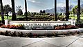
Central Park in Rancho Cucamonga.


See also
 In Spanish: Rancho Cucamonga para niños
