Salem, Oregon facts for kids
Quick facts for kids
Salem
|
|||
|---|---|---|---|
|
|
|||
|
|||
| Nickname(s):
Cherry City
|
|||
|
|||
| Country | United States | ||
| State | Oregon | ||
| Counties | Marion and Polk | ||
| Founded | 1842 | ||
| Government | |||
| • Type | City Council – City Manager | ||
| Area | |||
| • City | 49.45 sq mi (128.08 km2) | ||
| • Land | 48.91 sq mi (126.67 km2) | ||
| • Water | 0.55 sq mi (1.41 km2) | ||
| Elevation | 177 ft (54 m) | ||
| Population
(2020)
|
|||
| • City | 175,535 | ||
| • Rank | US: 147th | ||
| • Density | 3,589.09/sq mi (1,385.74/km2) | ||
| • Urban | 268,331 (US: 152nd) | ||
| • Urban density | 3,691.8/sq mi (1,425.4/km2) | ||
| • Metro | 433,353 (US: 125th) | ||
| Demonym(s) | Salemite | ||
| Time zone | UTC−8 (PST) | ||
| • Summer (DST) | UTC−7 (PDT) | ||
| ZIP Codes |
97301–97306 and 97308–97314
|
||
| Area codes | 503 and 971 | ||
| FIPS code | 41-64900 | ||
| GNIS feature ID | 2411764 | ||
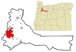
Salem is the capital city of Oregon, a state in the United States. It is also the main city of Marion County. Salem is located in the middle of the Willamette Valley, right next to the Willamette River. This river flows north through the city and separates Marion and Polk counties. The area called West Salem is actually in Polk County.
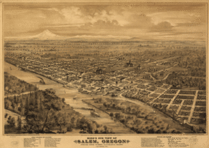
Salem was started in 1842. It became the capital of the Oregon Territory in 1851 and an official city in 1857.
In 2020, Salem had about 175,535 people. This makes it the third-largest city in Oregon, after Portland and Eugene. Salem is the main city of a larger area called the Salem Metropolitan Statistical Area. This area includes Marion and Polk counties and had about 433,353 people in 2020.
The city is home to several colleges, including Willamette University, Corban University, and Chemeketa Community College. The State of Oregon is the biggest public employer in Salem. Salem Health is the largest private employer. You can get around Salem using public buses called Cherriots. There is also Amtrak train service and a small airport called McNary Field. Major roads like Interstate 5 also pass through Salem.
Contents
History of Salem
How Salem Got Its Name
The first people living in this area were Native Americans called the Kalapuya. They called the place Chim-i-ki-ti, which means "meeting or resting place."
When missionaries moved here, they first called their new settlement Chemeketa. It was also known as "the Mill" because it was on Mill Creek. Later, when the Oregon Institute was built, the community was called "the institute."
After the institute closed, people decided to plan a town. One idea for the name "Salem" came from William H. Willson. In the 1850s, he suggested using an English version of the Biblical Hebrew word "Shalom," which means "peace."
Another idea came from Reverend David Leslie. He was the head of the town's leaders and wanted a Biblical name. He suggested using the last five letters of "Jerusalem." It's also possible the town was named after Salem, Massachusetts, where Leslie went to school.
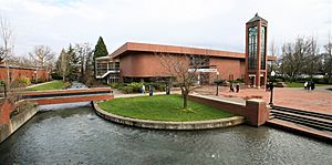
Even after the name changed to Salem, some people wanted to go back to Chemeketa. Today, the city offices and library are in the Vern Miller Civic Center. It has a public area called the Peace Plaza to remember the different names the city has had.
Early European Settlers
The first Europeans came to this area around 1812. They were trappers and gathered food for fur trading companies.
The first lasting American settlement was the Jason Lee Methodist mission, started in 1840. It was located north of Salem in an area called Wheatland. In 1842, the missionaries built the Oregon Institute in the spot where Salem is now. This institute later became Willamette University. In 1844, the mission closed, and the town was officially started.
In 1851, Salem became the capital of the Oregon Territory. Before that, the capital was in Oregon City. For a short time in 1855, the capital moved to Corvallis, but it moved back to Salem permanently that same year. Salem became an official city in 1857. When Oregon became a state in 1859, Salem became its state capital.
Oregon's Capitol Buildings
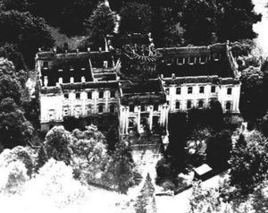
Salem has had three capitol buildings. The first one, a two-story building, burned down in December 1855 after only two months of use.
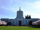
Oregon's second capitol building was finished in 1876 on the same spot. It was built in the Greek Revival style, similar to the U.S. Capitol building. In 1893, it got its special copper dome. But on April 25, 1935, this building also burned down.
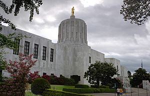
The third and current Oregon State Capitol was completed in 1938 on the same site. It faces north instead of west like the old one. You can easily recognize it by the unique pioneer statue on top of its dome. This statue is covered in gold leaf and is officially called the Oregon Pioneer.
State Fair and Cherry Festival
Farming has always been very important to Salem. The city has celebrated this in many ways. In 1861, Salem was chosen as the permanent home for the Oregon State Fair.
Salem is known as the "Cherry City." This is because growing cherries was a big industry here in the past. The first cherry festival in Salem was in 1903. It was an annual event with parades and a cherry queen, lasting until after World War I. The festival was brought back for a few years in the late 1940s as the Salem Cherryland Festival.
Geography and Climate
Salem is located in the north-central part of the Willamette Valley. It is in both Marion and Polk counties. The 45th Parallel, which is about halfway between the North Pole and the Equator, runs through Salem.
The city covers about 48.45 square miles (125.5 square kilometers). Most of this area is land, with a small part being water.
Even though the Willamette River flows through Salem, the North Santiam River is the main source of Salem's drinking water. Other important streams in the city include Mill Creek, Pringle Creek, and Shelton Ditch.
The elevation in Salem ranges from about 120 to 800 feet (37 to 244 meters). Salem has the volcanic Salem Hills in the south. It is also surrounded by the Eola Hills to the west and the Waldo Hills to the east. The northern and eastern parts of Salem are less hilly. From the city, you can see the Coast Range and the Cascades mountains. On clear days, you might even see Mount Hood, Mount Jefferson, and even Mount St. Helens and Mount Adams in Washington.
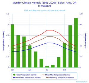
Salem has a Mediterranean climate. This means it has wet winters and dry summers. Most of the rain falls between October and April. From May to September, it is usually dry. Light snow can fall in winter, but heavy snow is rare. During the rainy season, the skies are often cloudy.
Salem's average yearly temperature is 54.1°F (12.3°C). It gets about 40.08 inches (101.8 cm) of rain each year, including about 3.5 inches (8.9 cm) of snow. However, some years have no snowfall at all. Salem is about 47 miles (76 km) south of Portland.
The highest temperature ever recorded in Salem was 117°F (47°C). The lowest was -12°F (-24°C).
| Climate data for Salem, Oregon (McNary Field), 1991–2020 normals, extremes 1893–present | |||||||||||||
|---|---|---|---|---|---|---|---|---|---|---|---|---|---|
| Month | Jan | Feb | Mar | Apr | May | Jun | Jul | Aug | Sep | Oct | Nov | Dec | Year |
| Record high °F (°C) | 68 (20) |
72 (22) |
80 (27) |
93 (34) |
100 (38) |
117 (47) |
108 (42) |
108 (42) |
104 (40) |
93 (34) |
74 (23) |
72 (22) |
117 (47) |
| Mean maximum °F (°C) | 59.4 (15.2) |
61.9 (16.6) |
70.3 (21.3) |
77.6 (25.3) |
87.3 (30.7) |
93.8 (34.3) |
100.1 (37.8) |
100.4 (38.0) |
92.6 (33.7) |
77.8 (25.4) |
64.1 (17.8) |
59.0 (15.0) |
103.2 (39.6) |
| Mean daily maximum °F (°C) | 48.4 (9.1) |
52.1 (11.2) |
56.8 (13.8) |
61.6 (16.4) |
69.0 (20.6) |
74.6 (23.7) |
83.5 (28.6) |
83.6 (28.7) |
77.5 (25.3) |
64.8 (18.2) |
53.6 (12.0) |
47.4 (8.6) |
64.4 (18.0) |
| Daily mean °F (°C) | 42.1 (5.6) |
44.0 (6.7) |
47.5 (8.6) |
51.3 (10.7) |
57.7 (14.3) |
62.7 (17.1) |
69.3 (20.7) |
69.2 (20.7) |
64.0 (17.8) |
54.3 (12.4) |
46.3 (7.9) |
41.3 (5.2) |
54.1 (12.3) |
| Mean daily minimum °F (°C) | 35.8 (2.1) |
35.9 (2.2) |
38.3 (3.5) |
41.0 (5.0) |
46.3 (7.9) |
50.8 (10.4) |
55.1 (12.8) |
54.8 (12.7) |
50.6 (10.3) |
43.9 (6.6) |
39.0 (3.9) |
35.1 (1.7) |
43.9 (6.6) |
| Mean minimum °F (°C) | 23.9 (−4.5) |
24.1 (−4.4) |
27.7 (−2.4) |
31.1 (−0.5) |
35.2 (1.8) |
41.5 (5.3) |
47.0 (8.3) |
46.7 (8.2) |
41.0 (5.0) |
32.1 (0.1) |
26.3 (−3.2) |
21.8 (−5.7) |
17.7 (−7.9) |
| Record low °F (°C) | −10 (−23) |
−4 (−20) |
12 (−11) |
23 (−5) |
25 (−4) |
32 (0) |
35 (2) |
30 (−1) |
26 (−3) |
19 (−7) |
9 (−13) |
−12 (−24) |
−12 (−24) |
| Average precipitation inches (mm) | 6.08 (154) |
4.54 (115) |
4.35 (110) |
3.12 (79) |
2.25 (57) |
1.25 (32) |
0.25 (6.4) |
0.39 (9.9) |
1.46 (37) |
3.47 (88) |
5.95 (151) |
6.97 (177) |
40.08 (1,018) |
| Average precipitation days (≥ 0.01 in) | 18.2 | 15.9 | 17.5 | 15.7 | 11.6 | 8.0 | 2.3 | 3.2 | 6.4 | 12.5 | 17.7 | 18.9 | 147.9 |
| Average relative humidity (%) | 82.9 | 81.5 | 77.3 | 73.6 | 71.1 | 67.8 | 63.0 | 64.3 | 69.4 | 79.5 | 84.8 | 84.9 | 75.0 |
| Average dew point °F (°C) | 34.3 (1.3) |
36.9 (2.7) |
38.1 (3.4) |
40.3 (4.6) |
44.8 (7.1) |
49.3 (9.6) |
51.4 (10.8) |
52.0 (11.1) |
48.9 (9.4) |
45.0 (7.2) |
40.5 (4.7) |
35.6 (2.0) |
43.1 (6.2) |
| Mean monthly sunshine hours | 77.6 | 117.9 | 200.3 | 238.1 | 281.7 | 295.2 | 350.3 | 318.8 | 253.1 | 171.0 | 86.2 | 73.5 | 2,463.7 |
| Source: NOAA (sun, dew points and relative humidity 1961–1990) | |||||||||||||
Salem's Population
| Historical population | |||
|---|---|---|---|
| Census | Pop. | %± | |
| 1860 | 902 | — | |
| 1870 | 2,139 | 137.1% | |
| 1880 | 2,538 | 18.7% | |
| 1890 | 3,422 | 34.8% | |
| 1900 | 4,258 | 24.4% | |
| 1910 | 14,094 | 231.0% | |
| 1920 | 17,679 | 25.4% | |
| 1930 | 26,266 | 48.6% | |
| 1940 | 30,908 | 17.7% | |
| 1950 | 43,140 | 39.6% | |
| 1960 | 49,142 | 13.9% | |
| 1970 | 68,296 | 39.0% | |
| 1980 | 89,233 | 30.7% | |
| 1990 | 107,786 | 20.8% | |
| 2000 | 136,924 | 27.0% | |
| 2010 | 154,637 | 12.9% | |
| 2020 | 175,535 | 13.5% | |
| 2022 (est.) | 180,013 | 16.4% | |
| Sources: | |||
In 2020, Salem had 175,535 people living in 64,426 homes. The city's population density was about 3,596 people per square mile.
Most of the people in Salem are White (75.3%). Other groups include African American (1.4%), Native American (1.0%), Asian (3.3%), and Pacific Islander (1.8%). About 10.2% of people reported two or more races. People of Hispanic or Latino background made up 22.4% of the population.
About 24.2% of the people were under 18 years old. People over 65 made up 14.6% of the population. The city's population was almost evenly split between females (49%) and males (51%).
The average household income was $62,185. About 14.7% of the population lived below the poverty line.
Salem's Economy
The state government is the biggest employer in Salem. But the city is also important for local farms and is a major center for processing food from agriculture. Salem is located along the I-5 highway. It is less than an hour's drive from Portland, Oregon's largest city.
Salem is home to Kettle Foods, which makes potato chips. They employ 700 people in Salem. NORPAC Foods, Inc., is another large food processor in Salem. They make frozen fruits and vegetables. Oregon Fruit Products, Inc., has been canning fruits like blackberries and marionberries in Salem since 1935.
In the 1990s, Salem tried to bring in more computer manufacturing companies. However, some of these plants later closed.
Salem is also the main office for the Oregon Department of Corrections. It has four state prisons, including the Oregon State Penitentiary, which is Oregon's only maximum-security prison.
Many projects are happening to build more homes and offices in downtown Salem. These projects include new apartments and office spaces.
Top Employers in Salem
Here are the top employers in the Salem area, based on a 2022 report:
| Rank | Employer | Number of Employees |
|---|---|---|
| 1 | State of Oregon | 21,000 |
| 2 | Salem-Keizer School District | 5,137 |
| 3 | Salem Health | 5,058 |
| 4 | Marion County | 1,742 |
| 5 | Federal Government | 1,500 |
| 6 | Amazon Fulfillment Center | 1,400 |
| 7 | City of Salem | 1,291 |
| 8 | Chemeketa Community College | 1,080 |
| 9 | Wal-Mart | 980 |
| 10 | State Accident Insurance Fund | 923 |
People and Culture
Neighborhood Groups
Salem has 17 recognized neighborhood associations. These are independent groups that get help from the city. They help neighbors work together and improve their areas.
- Central Area (CAN-DO)
- East Lancaster (ELNA)
- Faye Wright
- Grant
- Highland
- Morningside
- Northeast Salem (NESCA)
- North Lancaster (NOLA)
- Northeast Neighbors (NEN)
- Northgate
- South Central (SCAN)
- South Gateway
- Southeast Mill Creek (SEMCA)
- Southeast Salem (SESNA)
- Southwest Salem (SWAN)
- Sunnyslope
- West Salem
Cultural Events and Activities
The group Salem Community Markets (SCM) runs several farmers' markets in Salem. The biggest is the Salem Saturday Market, held north of the Capitol from May to October. It sells local art, baked goods, fresh produce, plants, and more. Other markets include a Monday Market, a Wednesday Farmers' Market at Chemeketa Community College, a Thursday Market in West Salem, and a Holiday Gift Market in December. There is also an indoor Saturday Public Market open all year.
The annual World Beat Festival happens in June at Riverfront Park. This two-day event celebrates cultures from around the world with crafts, music, dance, food, and stories. It even has a Dragon Boat race!
The Salem Art Association hosts the yearly Salem Art Fair and Festival at Bush's Pasture Park in the summer. It features art, hands-on activities, food, and performances, attracting many visitors.
The Bite of Salem, held in July at Riverfront Park, is a food festival. Local restaurants offer samples of their food, and there's live entertainment. It also helps local charities. Other food events include Chef's Nite Out and the Oregon Wine & Food Festival.
The biggest event in Salem is the Oregon State Fair, held from late August through Labor Day. It takes place at the Oregon State Fairgrounds and offers exhibits, competitions, and carnival rides. Other events like concerts and rodeos happen at the Fairgrounds throughout the year.
Salem has theaters like the Reed Opera House and the Pentacle Theatre, which show plays and musicals. The historic Elsinore Theatre hosts concerts, films, and plays. It has the largest working pipe organ on the West Coast! The Grand Theater is home to Enlightened Theatrics, a professional theater company.
Salem Capital Pride, Salem's yearly Gay Pride Event, is held in early August.
The beautiful house and garden of landscape architects Elizabeth Lord and Edith Schryver, called Gaiety Hollow, is a historic site.
Museums and Other Fun Places
Downtown Salem has many interesting places. You can visit the Oregon State Capitol and nearby Willson Park. There's also the Willamette Heritage Center, the Hallie Ford Museum of Art, the Elsinore Theatre, and Riverfront Park. You can also find some of Oregon's oldest buildings, shops, and restaurants. The A.C. Gilbert's Discovery Village is a children's museum with interactive exhibits. The Prewitt-Allen Archaeological Museum is also in Salem.
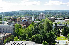
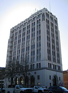
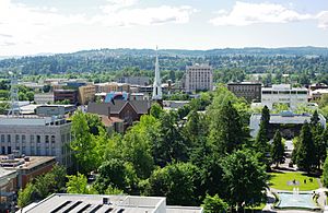
The two tallest buildings in Salem are the Salem First United Methodist Church and the Capitol Center. The church's tall white spire is a famous landmark. The Capitol Center was built in 1927 and was once the tallest commercial building in the state.
In 1988, the former home of Mayor Thomas A. Livesley was bought and given to the state. It is now called Mahonia Hall and is the official home of the Governor of Oregon.
The Oregon Symphony performs about ten concerts each year in Salem. The Salem Chamber Orchestra includes professional musicians and students. The Salem Armory Auditorium hosts concerts by touring bands. The Salem Concert Band also performs several concerts each year.
Because Salem is the state capital, it has many government buildings with interesting designs.
The historic Reed Opera House in downtown Salem has local shops, restaurants, and an art gallery.
Salem has been named a "Tree City USA" for 30 years in a row because it takes good care of its city trees. Many streets and the Capitol Mall have beautiful flowering cherry trees, fitting Salem's "Cherry City" nickname.
The Salem Public Library's main branch is south of downtown. There's also a branch in West Salem. Your Salem library card works at other libraries in the area too. The Mark O. Hatfield Library at Willamette University is also open to the public.
The movie One Flew Over the Cuckoo's Nest was filmed at the Oregon State Hospital in Salem.
Salem and the areas around it have many wineries and vineyards that you can visit.
Media
Salem has one daily newspaper called the Statesman Journal. The Capital Press, a weekly newspaper about farming, is also published here. The Salem Business Journal is a monthly magazine about local business and government. Salem Magazine is published four times a year and focuses on the people and culture of Salem.
Several TV and radio stations broadcast from Salem. You can also pick up many radio stations from Portland, Corvallis, and Albany. NPR programs are available through Oregon Public Broadcasting.
Parks and Recreation
City Parks in Salem
Salem's Parks Operations Division takes care of a large park system. It includes 2,338 acres (946 hectares) of land, with 29.53 miles (47.52 km) of trails, 46 parks, and 55 undeveloped areas.
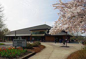
Minto-Brown Island Park is the biggest park, covering 1,200 acres (486 hectares). In 2018, the Peter Courtney pedestrian and bicycle bridge was built. This bridge connects Minto-Brown Park to the 23-acre (9.3-hectare) Riverfront Park, which is next to downtown. Riverfront Park is also home to the Salem Carousel.
Bush's Pasture Park is a 90.5-acre (36.6-hectare) park a few blocks south of downtown. It has native Oregon White Oak trees, the historic Bush House, and a rose garden. The Deepwood Estates are also nearby.
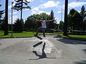
Other city parks include the 101-acre (41-hectare) Cascade Gateway Park and Marion Square Park. Marion Square Park is downtown and has a skatepark and basketball court. It was planned by city founder William H. Willson.
Across the Willamette River in West Salem is the 114-acre (46-hectare) Wallace Marine Park. It has a boat ramp and dock for water sports. The historic Union Street Railroad Bridge was turned into a bridge for bikes and walkers. It connects Wallace Marine Park to Riverfront Park and downtown Salem.
Salem is also home to one of the smallest city parks in the world, Waldo Park. It consists of just one Sequoia tree!
The capitol grounds are maintained by the Oregon Parks and Recreation Department. They cover three city blocks and include Willson and Capitol parks.
Fun Activities in Salem
Salem's central location means you can enjoy many outdoor activities all year round. To the west are the Coast Range mountains and the Pacific Ocean. To the east are the Santiam Canyon area and the Cascades mountains. Portland is to the north, and Eugene is to the south.
Salem also has two disc golf courses. One is a nine-hole course in Woodmansee Park. The other is an 18-hole course in Cascade Gateway Park. Both are free to use.
Sports in Salem
| Sport | League | Team |
|---|---|---|
| Baseball | Mavericks Independent Baseball League | Salem-Keizer Volcanoes |
| Roller Derby | WFTDA | Cherry City Roller Derby |
| Soccer | USL2 | Capital FC |
| College Athletics | NCAA Division III | Willamette Bearcats |
| College Athletics | Cascade Collegiate Conference | Corban University |
| College Athletics | Northwest Athletic Conference | Chemeketa Community College |
| Basketball | The Basketball League | Salem Capitals |
| Arena Football | Arena Football League | Oregon Black Bears |
Education in Salem
Schools for Kids
Most public elementary and secondary schools in Salem are part of the Salem-Keizer School District. This district has about 39,000 students and is the second largest public school district in Oregon. A small part of Salem is in the Cascade School District 5.
Salem also has many private schools, like Blanchet Catholic School and Salem Academy Christian. Willamette Academy is a special program by Willamette University. It helps students from 7th to 12th grade learn about college life.
Salem is also home to some public boarding schools. These include the Chemawa Indian School, a high school for Native American students, and the Oregon School for the Deaf.
Colleges and Universities
Higher education schools in Salem include Chemeketa Community College, Corban University, Tokyo International University of America, and Willamette University. Willamette University is the oldest university in the western United States.
Other universities like Portland State University, Eastern Oregon University, Western Oregon University, and Oregon State University offer classes and degrees at Chemeketa Community College.
The Chemeketa community college district covers all of Marion County and Polk County.
City Services and Transportation
Transportation in Salem
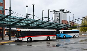
Cherriots is the public bus service in Salem. It provides bus routes, helps people find carpools, and offers special services for people with disabilities. Cherriots Regional buses connect Salem to other towns like Wilsonville, Dallas, Silverton, and Mill City. You can even take a bus from Salem to Wilsonville and then connect to the WES Commuter Rail and MAX Light Rail to Portland.
Greyhound Lines offers bus service from the Salem Amtrak station to places north and south, and to Bend, Oregon.
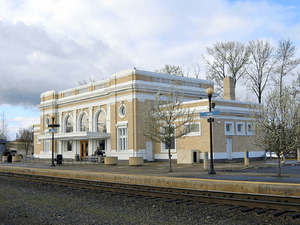
Amtrak, the national passenger train system, uses the Salem Depot. The Coast Starlight train travels daily between Los Angeles and Seattle, stopping in Salem. The Amtrak Cascades trains also serve Salem several times a day, going as far north as Vancouver, British Columbia, and as far south as Eugene.
HUT Airport Shuttle provides rides to Portland International Airport. Mountain Express offers transportation between Salem and Bend.
McNary Field (Salem-Willamette Valley Airport) is owned by the City of Salem. It is mainly used for private planes and the Oregon National Guard. Avelo Airlines started offering commercial flights to Burbank, CA, and Las Vegas, NV, in October 2023.
Major highways serving Salem include:
- Interstate 5
- Oregon Route 99E
- Oregon Route 22
- Oregon Route 221
- Oregon Route 51
- Oregon Route 213
Healthcare in Salem
Salem Hospital Regional Health Services is one of Oregon's largest hospitals. It has 454 beds and provides acute care. It is a non-profit organization and is the biggest private employer in Salem.
Notable People from Salem
Many interesting people have connections to Salem, including:
- Ryan Allen, a football player
- Debbie Armstrong, an Olympic gold medalist in skiing
- Alfred Carlton Gilbert, who invented the Erector Set and won an Olympic gold medal
- Jon Heder, an actor
- Frank Herbert, author of the Dune series
- Herbert Hoover, the 31st President of the United States, who worked in Salem
- Jed Lowrie, a Major League Baseball player
- Donald G. Malarkey, a World War II hero
- Douglas McKay, a former mayor, state senator, governor, and U.S. Secretary of the Interior
- Dolora Zajick, an opera singer
Fun Facts about Salem, Oregon
- The name "Salem" comes from the Hebrew word "shalom," which means "peace."
- Salem earned the nickname "Cherry City" because it used to be a major center for growing and processing cherries.
- It is the second-largest city in the Willamette Valley.
- The city experiences all four seasons, with warm summers and mild, rainy winters.
- It's a great place for outdoor activities like hiking, biking, and kayaking.
- The Oregon Garden, a beautiful botanical garden, is located just a short drive from Salem.
Sister Cities
Salem has three sister cities around the world:
 Salem, Tamil Nadu, India
 Kawagoe, Saitama, Japan
 Gimhae, South Gyeongsang, South Korea
There are plans to restart the Sister City project with Salem, India, which began in 1964.
See also
 In Spanish: Salem (Oregón) para niños
 | Selma Burke |
 | Pauline Powell Burns |
 | Frederick J. Brown |
 | Robert Blackburn |


