Oregon Coast Range facts for kids
Quick facts for kids Oregon Coast Range |
|
|---|---|
| Coast Range | |
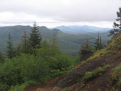
The Northern Coast Range, seen from Saddle Mountain in Clatsop County
|
|
| Highest point | |
| Peak | Marys Peak |
| Elevation | 4,101 ft (1,250 m) |
| Dimensions | |
| Length | 200 mi (320 km) North–South |
| Geography | |
| Country | United States |
| Parent range | Pacific Coast Ranges |
| Geology | |
| Age of rock | Paleocene and Eocene |
| Type of rock | volcanic and forearc basin |
The Oregon Coast Range is a mountain range in Oregon, United States. It runs along the Pacific Ocean. People often call it simply the Coast Range. It is part of a bigger group of mountains called the Pacific Coast Ranges. These ranges stretch along the western edge of North America.
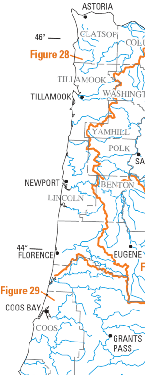
This mountain range goes from north to south. It is about 200 miles (320 km) long. In the north, it starts near the Columbia River. This river forms the border between Oregon and Washington. The range ends in the south near the middle fork of the Coquille River. It is usually 30 to 60 miles (48 to 97 km) wide. The mountains are about 1,500 feet (460 m) high on average. The Coast Range has three main parts: a Northern, Central, and Southern section.
The oldest parts of the range are over 60 million years old. They formed from volcanoes and a special type of ocean basin. The Coast Range creates a "rain shadow" effect. This means it blocks rain from reaching the Willamette Valley to the east. This makes the valley's weather more stable and drier. On the west side, facing the Oregon Coast, the mountains cause more rain to fall. This helps create many rivers that flow into the Pacific Ocean.
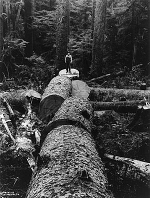
Marys Peak is in the Central Coast Range. It is the highest point at 4,090 feet (1,248 m). Logging is an important industry here. Forests are managed by both the state and federal governments. Many animals live in these mountains. These include black bears, elk, deer, and beavers. You can also find many types of birds and bats. The rivers and streams are home to fish like salmon and trout.
Contents
How the Mountains Formed: Geology
The Oregon Coast Range began forming about 66 million years ago. This was during the Cretaceous Period. First, volcanoes erupted offshore, creating islands in the southern part of what is now the range. These were called the Roseburg volcanics. Later, the Siletz River Volcanics formed in the northern parts. Some basalt flows from the Columbia River Basalt Group also added to these formations.
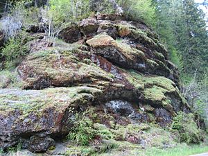
Many of these rocks are "pillow basalt." This forms when hot lava quickly cools in ocean water. These rock layers were then pushed into the North American Plate. This slow movement over millions of years caused the basalt and other rocks to be lifted up. This is how the Coast Range was created.
More basalt flows came from Eastern Oregon. These added to the layers that were pushed up. At that time, the Cascade Mountains had not yet formed. By about 30 million years ago, the coastline looked much like it does today. Rivers have continued to carve deep valleys through the volcanic and sedimentary rocks.
The Coast Range stretches from southwest Washington state in the north. It goes south to the Coquille River. Here, the older and taller Klamath Mountains begin. To the east, the mountains become foothills. They form the western edge of the Willamette Valley. To the west, they continue out into the ocean. The rock formations slowly disappear into the continental shelf.
Weather and Climate
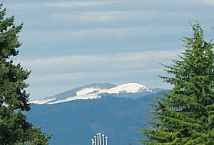
The Oregon Coast Range has a mild maritime climate. This means it's influenced by the ocean. Temperatures and rainfall change depending on how high up you are and how close you are to the coast. Summers are usually cool and dry. Winters are mild and wet. Most of the rain falls as rain. Snow falls in the winter at higher elevations, but it doesn't stay all year.
The amount of rain each year can be from 60 inches (1,500 mm) to 120 inches (3,000 mm). Higher elevations get more rain. In January, the average high temperature is 36.3 °F (2.4 °C). In July, the average high is 61.9 °F (16.6 °C). Temperatures also change with elevation. Areas further inland and to the south have a climate more like the Willamette Valley. This means hotter summers and less rain.
The Coast Range creates a rain shadow effect. As moist clouds from the ocean hit the mountains, they are forced to rise. This makes them drop their moisture as rain or snow on the western side. This shields the Willamette Valley, giving it a drier climate with hotter summers.
Sections of the Range
The Oregon Coast Range is split into three parts: North, Central, and South. The southern part is the oldest. It started forming in the Paleocene era from volcanic activity. The northern part is the newest. It formed from the Siletz River Volcanics. The Central and Northern sections have more sedimentary rocks. These rocks are made of mud, silt, sand, and volcanic bits.
The Oregon Coast Range is home to many animals. There are over 50 types of mammals. More than 100 kinds of birds live here. Nearly 30 types of reptiles or amphibians spend much of their lives in these mountains.
Northern Oregon Coast Range
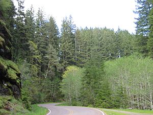
This section is in northwest Oregon. Some peaks here are as high as 3,706 feet (1,130 m), like Rogers Peak. The forests here are known for growing a lot of timber. Important trees include Sitka spruce, western redcedar, Douglas fir, and Western hemlock. Other plants like huckleberry, salmonberry, and Oregon grape also grow here.
The northern border of this section is the Columbia River. It extends south for about 100 miles (160 km) to the Salmon River. Here, Oregon Route 18 crosses the mountains from the Willamette Valley to the Oregon Coast. This section is about 35 miles (60 km) wide.
Central Oregon Coast Range
The Central Coast Range is between the Salmon River (north) and the Umpqua River (south). The Willamette Valley is to its east, and the Pacific Ocean is to its west. This part of the range is about 90-mile (140 km) long. It includes Marys Peak, the highest point in the entire range, at 4,097 feet (1,248 m).
Some parts of this section are within the Siuslaw National Forest. There are also three special wilderness areas: Drift Creek Wilderness, Cummins Creek Wilderness, and Rock Creek Wilderness. Larger animals here include deer, elk, bobcats, and bears. The bears are black bears. Deer include mule deer and black-tailed deer. Other mammals are mountain beavers, coyotes, mink, river otters, and mountain lions.
Southern Oregon Coast Range
This is the southernmost part of the Coast Range. It is in southwest Oregon. It stretches from the middle fork of the Coquille River in the south to the Umpqua River in the north. Oregon Route 38 generally separates the Central and Southern parts. This section is about 55 miles (90 km) long. Mountains here can be as high as 3,547 feet (1,081 m) for Bone Mountain. To the south, the Coquille River's middle fork generally divides it from the Klamath Mountains.
Many birds live in the Southern Coast Range. These include peregrine falcons, pileated woodpeckers, and western bluebirds. The threatened northern spotted owl also lives in these forests. The rivers, streams, and lakes are home to fish like lamprey, cutthroat trout, and coho salmon. You can also find frogs, salamanders, and turtles.
Tallest Peaks
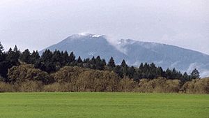
Here are the five tallest peaks in the Oregon Coast Range:
- Marys Peak, 4,101 feet
- Rogers Peak, 3,706 feet
- Grass Mountain, 3,615 feet, 44°25′25.99″N 123°40′25.46″W / 44.4238861°N 123.6737389°W
- Laurel Mountain, 3,592 feet, 44°55′23.85″N 123°34′23.51″W / 44.9232917°N 123.5731972°W
- Bone Mountain, 3,547 feet
Rivers of the Range
Many rivers start in the Oregon Coast Range. They flow in different directions:
- Drains to the Pacific Ocean:
- Alsea River
- Coos River
- Coquille River
- D River
- Kilchis River
- Little Nestucca River
- Miami River
- Necanicum River
- Nehalem River
- Nestucca River
- Salmonberry River
- Salmon River
- Siletz River
- Siltcoos River
- Siuslaw River
- Smith River
- Tillamook River
- Trask River
- Umpqua River
- Wilson River
- Yachats River
- Yaquina River
- Drains to the Columbia River:
- Drains to the Willamette River:
See also
 In Spanish: Cordillera costera de Oregón para niños
 | Stephanie Wilson |
 | Charles Bolden |
 | Ronald McNair |
 | Frederick D. Gregory |


