Tualatin River facts for kids
Quick facts for kids Tualatin River |
|
|---|---|

Mouth of the Tualatin River
|
|
|
Location of the mouth of the Tualatin River in Oregon
|
|
| Country | United States |
| State | Oregon |
| County | Washington, Clackamas |
| Physical characteristics | |
| Main source | Northern Oregon Coast Range near Windy Point, Tillamook State Forest, Washington County, Oregon 1,978 ft (603 m) 45°28′55″N 123°24′21″W / 45.48194°N 123.40583°W |
| River mouth | Willamette River near West Linn, Clackamas County, Oregon 59 ft (18 m) 45°20′17″N 122°39′05″W / 45.33806°N 122.65139°W |
| Length | 83 mi (134 km) |
| Basin features | |
| Basin size | 712 sq mi (1,840 km2) |
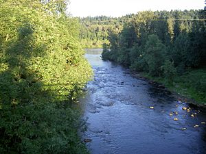
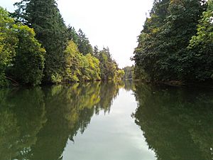
The Tualatin River is a river in Oregon, United States. It flows into the Willamette River. The Tualatin River is about 83 miles (134 km) long. It helps drain a rich farming area called the Tualatin Valley. This valley is located southwest and west of Portland.
About 500,000 people live in the area that the river drains. This area is known as the river's watershed.
Contents
Where Does the Tualatin River Start and End?
The Tualatin River begins in the Northern Oregon Coast Range. It starts near Windy Point in the Tillamook State Forest. This forest is in Washington County.
The river flows for about 83 miles (134 km). It ends when it joins the Willamette River near West Linn. This area is in Clackamas County.
The River's Journey and Water Flow
When the river starts, it is about 2,000 feet (610 m) above sea level. By the time it reaches the Willamette River, it is only about 60 feet (18 m) high. Most of this drop happens in the first 15 miles (24 km) of the river.
After the community of Cherry Grove, the river flows much more slowly. It drops only about 220 feet (67 m) over many bends. It generally flows east across the flat Tualatin Valley.
The river flows south for about 1 mile (1.6 km) at first. Then it turns east. It passes over the 40-foot (12 m) Ki-a-Kuts Falls. Many smaller streams join the Tualatin River along its path.
The river flows past several towns and natural areas. These include Gaston, Forest Grove, and Hillsboro. It also goes through the Jackson Bottom Wetlands Preserve. This preserve is an important natural area.
Further downstream, the river enters the Tualatin River National Wildlife Refuge. This refuge protects many plants and animals. The river then flows past King City and Tigard.
Near Tigard, a stream called Fanno Creek joins the Tualatin River. The river then passes under several bridges, including Interstate 5. Finally, it enters Clackamas County.
The Tualatin River then flows past Browns Ferry Park and Canal Acres Park. It also passes the Oswego Canal. This canal carries water from the Tualatin River to Oswego Lake in Lake Oswego. The river continues past other parks and towns. It flows under Interstate 205. The Tualatin River then joins the Willamette River at West Linn.
How Much Water Flows in the Tualatin River?
The amount of water in the Tualatin River changes a lot. The highest flow ever recorded was 26,400 cubic feet per second (750 m3/s). This happened on February 10, 1996. The lowest flow was 0.20 cubic feet per second (0.0057 m3/s). This was recorded between July 30 and August 2, 1966. This low flow does not include water that goes into the Lake Oswego Canal.
History of the Tualatin River
The Tualatin River got its name from the Native American group called the Atfalati. They lived in the Tualatin Valley. Their name for the river meant "sluggish" or "lazy." Early settlers sometimes called it the "Quality River."
The Tualatin Valley was a very important farming area for early settlers in Oregon. In 1856, a special road made of wood planks was built from Portland to the Tualatin Valley. Historians believe this road was a big reason why Portland grew to be such an important city in the region.
The valley has many natural wetlands. Wetlands are areas where the land is covered by water, either all the time or for parts of the year. Some of these wetlands are now protected. They include the Tualatin River National Wildlife Refuge and the Jackson Bottom Wetlands Preserve. These places help protect the environment and the animals that live there.
 | James Van Der Zee |
 | Alma Thomas |
 | Ellis Wilson |
 | Margaret Taylor-Burroughs |


