Northern Oregon Coast Range facts for kids
Quick facts for kids Northern Oregon Coast Range |
|
|---|---|
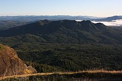
The Northern Coast Range, seen from Saddle Mountain in Clatsop County
|
|
| Highest point | |
| Peak | Rogers Peak |
| Elevation | 3,706 ft (1,130 m) |
| Dimensions | |
| Length | 100 mi (160 km) north–south |
| Geography | |
| Country | United States |
| Parent range | Oregon Coast Range, Pacific Coast Ranges |
| Geology | |
| Orogeny | Geologic fault, basalt flows |
| Age of rock | Paleocene and Eocene |
| Type of rock | volcanic and forearc basin |
The Northern Oregon Coast Range is a group of mountains in the northwest part of Oregon, United States. It's the northern part of the larger Oregon Coast Range. These mountains are part of the Pacific Coast Ranges, which stretch along the western coast of North America.
The tallest peak here is Rogers Peak, reaching about 3,710 feet (1,131 meters) high. The forests in these mountains are known for growing a lot of timber. This makes them very important for wood production. To the south, you'll find the Central Oregon Coast Range.
Contents
How the Mountains Formed (Geology)
The Northern Oregon Coast Range started forming about 40 million years ago. This was during a time called the Eocene age. During this period, soft rocks like sandstone and siltstone began to take shape.
Harder rocks, like igneous rocks and basalt flows, also formed. These combined with basaltic sandstone to create the mountain shapes we see today. Some parts of these mountains might have even been islands during the Eocene era.
The entire Coast Range sits on a "convergent tectonic margin." This means two huge pieces of Earth's crust, called tectonic plates, are pushing into each other. The Juan de Fuca Plate is sliding underneath the North American plate.
Over time, heavy rainfall and landslides have also changed the mountains. This process is called weathering and erosion.
Plants and Animals (Flora and Fauna)
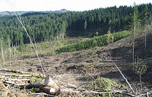
Some parts of these mountains are protected areas. These include the Siuslaw National Forest and Tillamook State Forest. Large sections of the range were burned in big forest fires during the 1930s and 1940s. These fires are known as the Tillamook Burn.
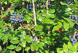
In the forests, you can find many types of trees. These include Sitka spruce, western redcedar, Douglas fir, and Western hemlock. Other plants that grow here are huckleberry, salmonberry, thimbleberry, salal, vine maple, and different kinds of ferns like sword and bracken ferns. You might also spot Oregon grape.
Many small creatures live here, such as spiders, beetles, slugs, and millipedes. Larger animals include weevils, chipmunks, bears, rabbits, and Columbian black tail deer.
The mountains are also home to many birds. Some examples are chickadees, red-breasted nuthatches, kinglets, Western pileated woodpeckers, and Oregon Canada jays.
Where the Mountains Are and What the Weather is Like (Location and Climate)
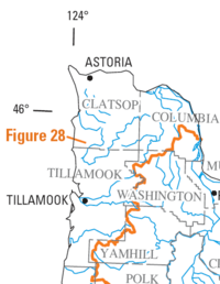
The Northern Oregon Coast Range starts near the Columbia River. It then stretches south for about 100 miles (160 km) to the Salmon River. Here, Oregon Route 18 crosses the mountains, connecting the Willamette Valley to the Oregon Coast. The mountains are usually about 35 miles (56 km) wide.
The weather in these mountains is mild. This is because of the ocean's influence. It also rains a lot here, with annual rainfall ranging from 60 to 180 inches (1,500 to 4,600 mm).
Tallest Mountains (Peaks)
Here are the mountains in the Northern Coast Range that are over 3,000 feet (914 meters) high:
| Mountain Name | Elevation | County | |
|---|---|---|---|
| feet | metres | ||
| Rogers Peak | 3,706 | 1,130 | Tillamook |
| South Saddle Mountain | 3,465 | 1,056 | Washington |
| Larch Mountain | 3,452 | 1,052 | Washington |
| Trask Mountain | 3,426 | 1,044 | Yamhill |
| Saddle Mountain | 3,288 | 1,002 | Clatsop |
| Triangulation Point | 3,235 | 986 | Tillamook |
| Kings Mountain | 3,226 | 983 | Tillamook |
| Mount Hebo | 3,154 | 961 | Yamhill |
| Edwards Butte | 3,136 | 956 | Tillamook |
| Buck Mountain | 3,097 | 944 | Tillamook |
| Sheridan Peak | 3,091 | 942 | Yamhill |
| Woods Point | 3,084 | 940 | Tillamook |
| Gobblers Knob | 3,058 | 932 | Tillamook |
| Onion Peak | 3,057 | 932 | Clatsop |
Rivers
Many rivers start in the Northern Oregon Coast Range. They flow in different directions:
- Rivers that flow into the Columbia River:
- Rivers that flow into the Willamette River:
- Rivers that flow into the Pacific Ocean:
 | Sharif Bey |
 | Hale Woodruff |
 | Richmond Barthé |
 | Purvis Young |


