Mount Hebo facts for kids
Quick facts for kids Mount Hebo |
|
|---|---|

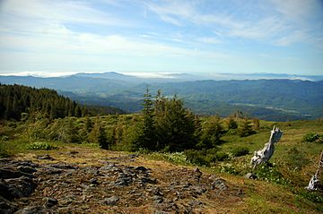
View from Mount Hebo.
|
|
| Highest point | |
| Elevation | 3,157 ft (962 m) NAVD 88 |
| Geography | |
| Parent range | Northern Oregon Coast Range, Oregon Coast Range |
| Topo map | USGS Hebo |
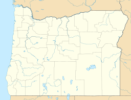
Mount Hebo is a mountain in Oregon, USA. It sits on the border of Tillamook County and Yamhill County. People love Mount Hebo because it offers amazing 360-degree views from its top. It is one of the best places to see the northern Oregon Coast.
Contents
Where is Mount Hebo Located?
Mount Hebo is part of the Northern Oregon Coast Range. It is found within the Siuslaw National Forest. From the mountain, you can look out over the vast Pacific Ocean.
How to Reach the Summit
You can get to the top of Mount Hebo by driving an eight-mile forest service road. This road starts near the town of Hebo. It's close to where U.S. Route 101 and Oregon Route 22 meet.
The Story Behind the Name
Mount Hebo got its name in a fun way! Long ago, a group of people were looking for a new path to the Willamette Valley. They climbed this mountain to get a better view of the land. One person in the group thought the mountain looked like it had been "heaved up" from the ground around it. So, they said it should be called "Heave Ho." Over many years, the name changed a bit and became "Mount Hebo."
Mount Hebo Air Force Station
From 1956 to 1980, Mount Hebo was home to the Mount Hebo Air Force Station. This was a special place with long-range radar equipment. It helped keep an eye on the skies.
 | Shirley Ann Jackson |
 | Garett Morgan |
 | J. Ernest Wilkins Jr. |
 | Elijah McCoy |


