Tillamook County, Oregon facts for kids
Quick facts for kids
Tillamook County
|
|
|---|---|
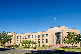
Tillamook County Courthouse in Tillamook
|
|
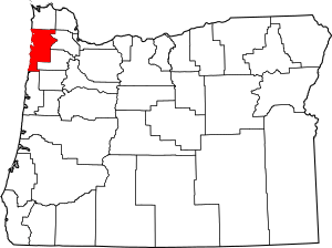
Location within the U.S. state of Oregon
|
|
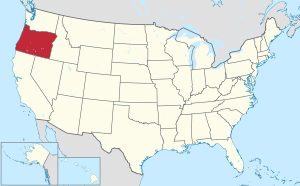 Oregon's location within the U.S. |
|
| Country | |
| State | |
| Founded | December 15, 1853 |
| Named for | Tillamook people |
| Seat | Tillamook |
| Largest city | Tillamook |
| Area | |
| • Total | 1,333 sq mi (3,450 km2) |
| • Land | 1,103 sq mi (2,860 km2) |
| • Water | 230 sq mi (600 km2) 17% |
| Population
(2020)
|
|
| • Total | 27,390 |
| • Estimate
(2023)
|
27,417 |
| • Density | 23/sq mi (9/km2) |
| Congressional district | 1st |
Tillamook County is one of the 36 counties in the U.S. state of Oregon. In 2020, about 27,390 people lived there. The main city and county seat is Tillamook. The county is named after the Tillamook (or Killamook) people. They were a Native American tribe living in the area when European Americans first arrived in the early 1800s. Tillamook County is located in the northwest part of Oregon.
Contents
History of Tillamook County
The Tillamook people were part of the Coast Salish group. They lived south of other related tribes. The name "Tillamook" comes from a trade language called Chinook. It means "people of Nekelim." Nekelim means "the place of Elim."
Tillamook County was officially created on December 15, 1853. It was the 12th county formed in Oregon. It was made from parts of Clatsop, Yamhill, and Polk counties. Its borders changed a few times over the years.
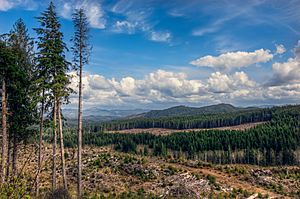
The Coast Range mountains behind Tillamook had a series of huge forest fires. These fires, known as the Tillamook Burn, happened between 1933 and 1951. In 1948, Oregon voters approved a plan to buy the burned land. The state then worked to replant the forests. This area was renamed the Tillamook State Forest in 1973. By the end of the 1900s, the new trees were big enough to be harvested for wood.
A special airbase for large airships called blimps opened on December 1, 1942. It was named U.S. Naval Air Station Tillamook. It had two huge wooden hangars to hold the blimps. After World War II, the base closed. The hangars were given to Tillamook County. One of them, Hangar B, is now a national historic landmark. It is home to the Tillamook Air Museum. Sadly, the other hangar, Hangar A, burned down in 1992.
The U.S. Mount Hebo Air Force Station was an important air defense site during the Cold War. It operated from 1956 to 1980. This station was located south of Tillamook, on top of Mount Hebo, which is 3,154 feet (961 m) high. It used large radar systems to watch for aircraft. The big dome-shaped covers protecting the radars could be seen from most of Tillamook County.
Over the years, building along U.S. Route 101 north of Tillamook changed the land. This has sometimes caused the Wilson River to flood the city during winter.
Geography of Tillamook County
Tillamook County covers about 1,333 square miles (3,452 sq km). Most of this is land (1,103 sq mi or 2,857 sq km), but 230 square miles (596 sq km) is water. The highest point in the county is Rogers Peak, which is 3,706 feet (1,129 m) high. It's also the highest point in the Northern Oregon Coast Range.
Sunset Magazine once called the county "a natural cow pasture." This is because it has a lot of good land for raising cows.
Neighboring Counties
- Clatsop County (north)
- Washington County (east)
- Yamhill County (east)
- Polk County (southeast)
- Lincoln County (south)
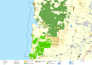
National Protected Areas
- Cape Meares National Wildlife Refuge
- Nestucca Bay National Wildlife Refuge
- Oregon Islands National Wildlife Refuge (part)
- Siuslaw National Forest (part)
- Three Arch Rocks National Wildlife Refuge
Population of Tillamook County
| Historical population | |||
|---|---|---|---|
| Census | Pop. | %± | |
| 1860 | 95 | — | |
| 1870 | 408 | 329.5% | |
| 1880 | 970 | 137.7% | |
| 1890 | 2,932 | 202.3% | |
| 1900 | 4,471 | 52.5% | |
| 1910 | 6,266 | 40.1% | |
| 1920 | 8,810 | 40.6% | |
| 1930 | 11,824 | 34.2% | |
| 1940 | 12,263 | 3.7% | |
| 1950 | 18,606 | 51.7% | |
| 1960 | 18,955 | 1.9% | |
| 1970 | 17,930 | −5.4% | |
| 1980 | 21,164 | 18.0% | |
| 1990 | 21,570 | 1.9% | |
| 2000 | 24,262 | 12.5% | |
| 2010 | 25,250 | 4.1% | |
| 2020 | 27,390 | 8.5% | |
| 2023 (est.) | 27,417 | 8.6% | |
| U.S. Decennial Census 1790–1960 1900–1990 1990–2000 2010–2020 |
|||
2020 Census Data
In 2020, the county had 27,390 people living there.
2010 Census Data
In 2010, there were 25,250 people in Tillamook County. About 91.5% of the people were white. About 9.0% of the population were of Hispanic or Latino background. The average age of people in the county was 47.5 years old.
Economy of Tillamook County
Agriculture
Dairy farming is a very important type of farming in the county. The Tillamook Cheese Factory is the biggest business and employer in the county. You can find Tillamook dairy products, like cheese and ice cream, all over the Western United States.
Timber
The state of Oregon owns 44% of the land in Tillamook County. Most of this land is part of the Tillamook State Forest. This forest grew back after the huge Tillamook Burn fires, which covered 355,000 acres (144,000 ha). As the forest grows, people hope it will help the local timber industry get stronger. There are currently three lumber mills in the county.
Tourism
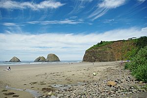
Tillamook County has a beautiful coastline with four bays, nine rivers, and the Pacific Ocean. This draws many visitors who enjoy outdoor activities, farm visits, and cultural events. U.S. Route 101 runs along the Oregon Coast. It brings many travelers through the county by car, RV, and bike. Many people from nearby Portland and the Willamette Valley also have vacation homes here. In 2015, visitors spent about $229.4 million in Tillamook County.
Fishing
Fishing is also a very important part of the economy. Oysters are farmed in the bay, which helps keep the bay clean. Sport fishing is also popular. With nine rivers, salmon fishing is a big draw.
Tillamook County was the first place in the continental United States to be declared ready for a tsunami. This means they have plans and systems in place to warn people. They installed 27 warning sirens and an emergency radio system. In 2012, county leaders decided to turn off most of the sirens. However, the communities of Garibaldi and Rockaway Beach kept their sirens.
Transportation
- Tillamook County Transportation District
Communities
Cities
Census-designated places
Other Unincorporated Communities
Notable People
- Dennis Awtrey, a former professional basketball player.
- Nellie Owens, who was the real-life person that inspired the character Nellie Oleson in the Little House on the Prairie books. She lived and got married here.
See also
 In Spanish: Condado de Tillamook para niños
 | Anna J. Cooper |
 | Mary McLeod Bethune |
 | Lillie Mae Bradford |


