Yamhill County, Oregon facts for kids
Quick facts for kids
Yamhill County
|
|
|---|---|
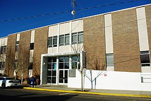
Yamhill County Courthouse in McMinnville
|
|
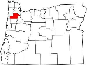
Location within the U.S. state of Oregon
|
|
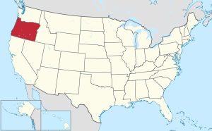 Oregon's location within the U.S. |
|
| Country | |
| State | |
| Founded | July 5, 1843 |
| Named for | Yamhela people of the Kalapuya |
| Seat | McMinnville |
| Largest city | McMinnville |
| Area | |
| • Total | 718 sq mi (1,860 km2) |
| • Land | 716 sq mi (1,850 km2) |
| • Water | 2.5 sq mi (6 km2) 0.3%% |
| Population
(2020)
|
|
| • Total | 107,722 |
| • Estimate
()
|
108,644 |
| • Density | 139/sq mi (54/km2) |
| Time zone | UTC−8 (Pacific) |
| • Summer (DST) | UTC−7 (PDT) |
| Congressional district | 6th |
Yamhill County is one of 36 counties in the U.S. state of Oregon. In 2020, about 107,722 people lived here. Its main city, or county seat, is McMinnville. Yamhill County was named after the Yamhelas, a group from the Kalapuya Tribe.
Yamhill County is part of the larger Portland metropolitan area. It sits in the beautiful Willamette Valley.
Contents
History of Yamhill County
The first people known to live in this area were the Yamhelas. They are a part of the Kalapuya Tribe and have lived here for over 8,000 years. Today, they are part of the Confederated Tribes of the Grand Ronde Community of Oregon. In 1857, they had to move to the Grand Ronde Indian Reservation. This reservation was created two years earlier in Oregon's Coastal Range.
The first non-native settlers were people who worked for fur companies. They started settling here around 1814. But the Oregon Trail brought many more people to the area.
How Yamhill County Was Formed
The area known as Yamhill District was created on July 5, 1843. This was five years before Oregon became a territory. It was one of the first four districts made by Oregon's first government. The other districts were Twality (now Washington), Clackamas, and Champooick (now Marion).
The original district was very large, covering about 12,000 square miles (31,000 km2). This huge area later became twelve different counties we know today.
Lafayette was an important trading center in the early days of Oregon. It became the county seat in 1847. Later, in 1889, the county government moved to McMinnville. It has been there ever since.
Mount Hebo Air Force Station
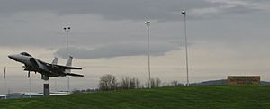
From 1956 to 1980, the Mount Hebo Air Force Station was a Cold War air defense base. It was located near Tillamook County, on top of Mount Hebo, which is 3,154 feet (961 m) high. Air Force radars helped protect the nation's skies.
Large dome-shaped covers, called radomes, protected the radars from bad weather. You could see these domes against the sky from many parts of Yamhill County.
Yamhill River Lock and Dam
In 1900, a lock and dam were finished on the Yamhill River. It was about 1.5 miles (2.4 km) downstream from Lafayette. The lock was stopped from being used in 1954. The dam was taken down in 1963. This helped salmon swim more easily up the river. The place where the lock and dam once stood is now a county park.
Geography of Yamhill County
Yamhill County covers a total area of 718 square miles (1,860 km2). Most of this, 716 square miles (1,850 km2), is land. Only 2.5 square miles (6.5 km2), or 0.3%, is water. It is the fifth-smallest county in Oregon by size.
The tallest mountain in the county is Trask Mountain. It is located in the northwest part of the county.
Neighboring Counties
Yamhill County shares borders with these other counties:
- Washington County (to the north)
- Clackamas County (to the east)
- Marion County (to the southeast)
- Polk County (to the south)
- Tillamook County (to the west)
Protected Natural Areas
Parts of these national protected areas are found in Yamhill County:
- Siuslaw National Forest
- Tualatin River National Wildlife Refuge
Population and People
| Historical population | |||
|---|---|---|---|
| Census | Pop. | %± | |
| 1860 | 3,245 | — | |
| 1870 | 5,012 | 54.5% | |
| 1880 | 7,945 | 58.5% | |
| 1890 | 10,692 | 34.6% | |
| 1900 | 13,420 | 25.5% | |
| 1910 | 18,285 | 36.3% | |
| 1920 | 20,529 | 12.3% | |
| 1930 | 22,036 | 7.3% | |
| 1940 | 26,336 | 19.5% | |
| 1950 | 33,484 | 27.1% | |
| 1960 | 32,478 | −3.0% | |
| 1970 | 40,213 | 23.8% | |
| 1980 | 55,332 | 37.6% | |
| 1990 | 65,551 | 18.5% | |
| 2000 | 84,992 | 29.7% | |
| 2010 | 99,193 | 16.7% | |
| 2020 | 107,722 | 8.6% | |
| 2023 (est.) | 108,644 | 9.5% | |
| U.S. Decennial Census 1790–1960 1900–1990 1990–2000 2010–2020 |
|||
In 2010, about 99,193 people lived in Yamhill County. There were 34,726 households, which are groups of people living together. The population density was about 138 people per square mile (53 per km2).
Most people in the county were white (85.4%). Other groups included Asian (1.5%), American Indian (1.5%), and Black or African American (0.9%). About 14.7% of the population was of Hispanic or Latino background.
The average age of people in Yamhill County was 36.8 years old.
Economy and Industries
Yamhill County has a strong economy based on several key industries. These include farming, forest products, manufacturing, and education.
Oregon International Air Show
In 2019, the Oregon International Air Show moved to the McMinnville Municipal Airport. This show celebrates aviation and honors military members and veterans. It brings a lot of business to the area. The Air Show also helps the community by giving grants to McMinnville and other parts of Oregon. Since 1988, over $3 million has been donated back to the community.
Major Industries
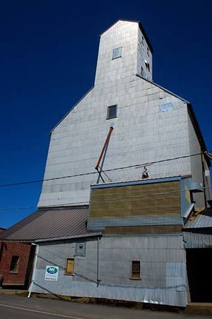
Yamhill County is known for its many unionized facilities. These include Cascade Steel in McMinnville and WestRock in Newberg. The county also has a very successful wine industry. It was once home to Evergreen Aviation, a large aviation company.
Yamhill County is ranked seventh in Oregon for the value of its farm products. These products include wheat, barley, and items from horticulture (growing fruits, vegetables, and flowers). Dairy farming is also important. In 1997, over 13,201 acres (53.42 km2) were used for orchards.
About one-third of the county is covered with commercial timber. In the western part of the county, logging and wood products are a main part of the economy.
Oregon's Wine Industry
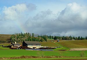
Yamhill County is a very important part of Oregon's wine industry. It has the largest area of any Oregon county planted with vineyards. Six of Oregon's special wine regions, called American Viticultural Areas, are partly or fully in the county. These include:
- Chehalem Mountains AVA
- Dundee Hills AVA
- Eola-Amity Hills AVA
- McMinnville AVA
- Ribbon Ridge AVA
- Yamhill-Carlton District AVA
There are over 80 wineries and 200 vineyards here. This is the biggest group of wine growers and makers in any county in Oregon. Vineyards often grow Pinot noir grapes. But they also grow other types like Pinot gris, Pinot blanc, Chardonnay, Riesling, and Gewürztraminer.
Education in Yamhill County
Yamhill County has several colleges and universities. These include:
- Linfield University
- Chemeketa Community College (McMinnville Campus)
- George Fox University
- Portland Community College (in Newberg)
For private high school education, students can attend The Delphian School in Sheridan.
Communities in Yamhill County
Cities
Census-Designated Places
These are areas that are like towns but are not officially incorporated as cities:
Unincorporated Communities
These are smaller communities that are not part of any city or census-designated place:
- Bellevue
- Cove Orchard
- Eola Crest
- Eola Village
- Gopher
- Grand Ronde Agency
- Hopewell
- Lunnville
- Midway
- Riverside
- Saint Joseph
- Shipley
- Springbrook
- Sunnycrest
- Unionvale
- Wheatland
- Whiteson
See also
 In Spanish: Condado de Yamhill para niños
 | Janet Taylor Pickett |
 | Synthia Saint James |
 | Howardena Pindell |
 | Faith Ringgold |


