Tualatin River National Wildlife Refuge facts for kids
Quick facts for kids Tualatin River National Wildlife Refuge |
|
|---|---|
|
IUCN Category IV (Habitat/Species Management Area)
|
|
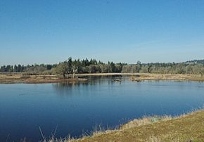
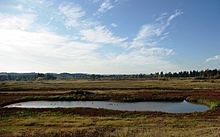
Pond at the park with woodlands in background
|
|
| Location | Washington and Yamhill counties Oregon, United States |
| Nearest city | Sherwood, Oregon |
| Area | 1,856 acres (751 ha) |
| Established | 1992 Opened in 2006 |
| Visitors | 40,000 (in 2007) |
| Governing body | U.S. Fish and Wildlife Service |
The Tualatin River National Wildlife Refuge is a special natural area in Oregon, USA. It covers about 1,856 acres of wetlands and lowlands. This refuge was created in 1992 to protect nature. It opened to visitors in 2006. The United States Fish and Wildlife Service takes care of it.
The refuge is located in southeastern Washington County. It's about 15 miles southwest of Portland. Cities like Sherwood, Tualatin, and Tigard are nearby. There's also a newer part of the refuge in northern Yamhill County. This area is close to Gaston and the old Wapato Lake.
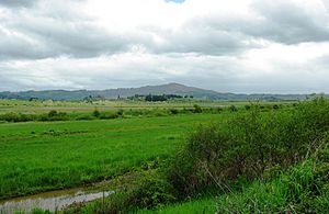
This refuge is one of only ten "urban refuges" in the United States. This means it's a wild space close to cities. It has many different natural areas. You can find forests, wetlands, grassy areas with oak and pine trees, and meadows. These habitats are perfect for many animals. The refuge helps protect migratory birds, endangered species, fish, and other wildlife. Nearly 200 types of birds and over 70 other animal species live here.
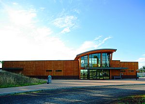
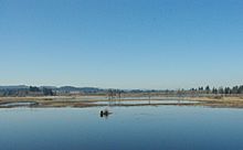
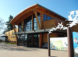
A visitor center opened in 2008. It has exhibits and information about the refuge. You can find it off Oregon Route 99W near Sherwood. The refuge headquarters and an observation deck are next to the center. From the deck, you can look out over seasonal ponds. The refuge has almost five miles of trails for exploring. In winter, officials flood parts of the refuge. This attracts up to 50,000 waterfowl.
History of the Refuge
The idea for a wildlife refuge here started in the early 1990s. People living in Sherwood suggested it. In 1991, the United States Fish and Wildlife Service began looking into creating a refuge. It would be along the Tualatin River. Citizens worked hard to get money from Congress. They even made a video with actor Robert Wagner!
In late 1992, Tom Stibolt and Lisa Brenner donated 12 acres of land. This donation officially created the refuge. The city of Sherwood also donated 1 acre in 1993. Congress then approved money to buy more land. They gave $2 million in 1993 and another $2.5 million in 1995.
At first, the refuge was only open a few times a year. This was for special events like a songbird festival. In 1997, work began to restore the land. They added systems to flood parts of the refuge. The refuge grew from 400 acres to over 800 acres by 1998. By 1999, it had grown to 1,066 acres. The number of bird species seen there jumped from 18 to 146!
The refuge kept growing. By 2003, it was 1,268 acres. Congress gave money to design a visitor center in 2004. Construction on public trails and observation decks began in 2005. The federal government gave $3.9 million to finish the visitor center and headquarters.
The refuge officially opened to the public on June 3, 2006. About 450 acres were opened permanently. In March 2007, a new part called the Wapato Lake Unit was added. The refuge also won an environmental award from Sunset Magazine. In 2007, 40,000 people visited the refuge.
The Wildlife Center finally opened in January 2008. A special ceremony was held in March 2008. Many people attended, including Congressman David Wu. In 2008, 50,000 birds visited the refuge in one day! The refuge had grown to 1,358 acres. In 2013, the Wapato Lake area became its own separate refuge.
Natural Environment and Wildlife
Before it became a protected area, much of this land was used for farming. There were hog and dairy farms. Farmers grew crops like corn and onions. Today, the refuge stretches over ten miles along the Tualatin River. It also follows Rock Creek and Chicken Creek. The refuge is managed in five main sections.
The refuge also includes areas shaped by ancient floods. These floods left a marshy valley. The Wapato Lake Unit is about 15 miles to the west. This refuge is on the Pacific Flyway. This is a major route for migratory birds. The habitat here includes wetlands that change with the seasons. There are also streams, forests, and parts of the Tualatin River.
The refuge is home to almost 200 types of birds. More than 50 kinds of mammals live here. You can also find 25 types of reptiles and amphibians. Common trees include red alder, maple, oak, and Douglas fir. Some plants you might see are bulrushes, wapato, and wild roses. Wildflowers like blue chicory also grow here.
Many kinds of waterfowl visit the refuge. These include Canada Geese, Wood Ducks, and swans. You might also spot Great Blue Herons and Sandhill Cranes. Other birds include Red-tailed Hawks, American Goldfinches, and Bald Eagles. When the refuge was created, only 24 bird species were counted. By 2008, there were 185!
Land animals include river otters, beavers, deer, and coyotes. You might also see raccoons and rabbits. Other wildlife includes painted turtles, frogs, and salamanders. This refuge is special because it's an important natural space in an urban area.
Visitor Amenities
Only about 450 acres of the refuge are open to the public. This area includes the visitor center. Inside, you'll find the Wildlife Center and the refuge headquarters. The Wildlife Center has classrooms, a student lab, and a gift shop. It also has displays with information. Next to the center are very old oak trees, about 350 years old!
Inside the Wildlife Center, you can see murals and exhibits. There are also hands-on displays. The classroom has animal skins and skulls. You can use a viewing scope to look out over the pond. The Wildlife Center is designed to teach you about nature. It encourages you to explore the refuge outside.
The Wildlife Center building is designed to be good for the environment. It has a flat roof with gravel. This provides a place for birds to nest. The building also has a large skylight. This lets in a lot of natural light. Local wood was used to build the center. The center and headquarters are on a small hill near Oregon Route 99W.
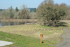
Outside, there are many things for visitors to enjoy. There's an outdoor deck that hangs over a pond. This concrete deck is 50 feet long. It extends 30 feet over the bank. You can also find footbridges and walking trails. There are almost five miles of trails. However, they are closed in the fall and winter. There are special viewing areas along the trails. Photographers can use special hiding spots called blinds. These help them take pictures without disturbing the animals.
Wapato Lake Unit
The Wapato Lake Unit is another part of the refuge. It's about 15 miles west of the main refuge. It's near Gaston along Oregon Route 47. This area was once a large lake called Wapato Lake. The soil here was rich in peat. This supported a special swamp ecosystem. The wapato plant grew here. Native Americans used to harvest this plant.
In the late 1800s, people started trying to drain the 800-acre lake. They wanted to create more farmland. This was finished in the 1930s. Today, the area has forests, prairies, and wetlands. It also has two small streams.
The government wanted to add this land to the refuge. At first, some local people didn't like the idea. But later, some residents asked the government to buy their land. By 2002, the United States Fish and Wildlife Service owned 108 acres here. They planned to restore the lake if the unit was created. In March 2007, the Wapato Lake Unit was officially approved.
In June 2008, the unit bought its first properties. They bought 180 acres for $631,000. This money came from a grant. More land was added later. The plan is to turn the farmland back into its natural state.
 | Jessica Watkins |
 | Robert Henry Lawrence Jr. |
 | Mae Jemison |
 | Sian Proctor |
 | Guion Bluford |


