Sherwood, Oregon facts for kids
Quick facts for kids
Sherwood, Oregon
|
|
|---|---|
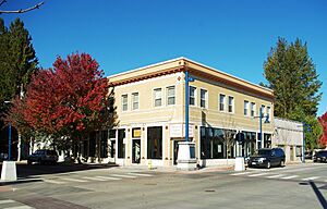
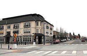
Building in downtown Sherwood
|
|
| Nickname(s):
Smockville
|
|
| Motto(s):
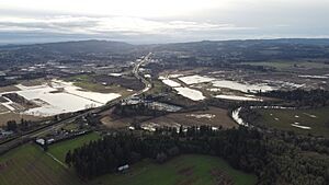
Home of the Tualatin River National Wildlife Refuge
|
|
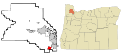
Location in Oregon
|
|
| Country | United States |
| State | Oregon |
| County | Washington |
| Incorporated | 1893 |
| Government | |
| • Type | Council-manager |
| Area | |
| • Total | 4.89 sq mi (12.67 km2) |
| • Land | 4.89 sq mi (12.67 km2) |
| • Water | 0.00 sq mi (0.00 km2) |
| Elevation | 207 ft (63 m) |
| Population
(2020)
|
|
| • Total | 20,450 |
| • Estimate
(2022)
|
20,030 |
| • Density | 4,178.59/sq mi (1,613.51/km2) |
| Time zone | UTC–8 (Pacific (PST)) |
| • Summer (DST) | UTC–7 (PDT) |
| ZIP code |
97140
|
| Area code(s) | 503, 971 |
| FIPS code | 41-67100 |
| GNIS feature ID | 2411889 |
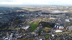
Sherwood is a city in Washington County, Oregon, United States. It's located in the southeast part of the county. Sherwood is a community in the Tualatin Valley, southwest of Portland. In 2020, about 20,450 people lived there.
Sherwood became an official town in 1893. It was first called Smockville, named after its founder, James Christopher Smock. But in 1891, a local businessman named Robert Alexander gave it the name Sherwood. This name might have come from Sherwood, Michigan or the famous Sherwood Forest in England.
Contents
Discover Sherwood's Past
The name "Sherwood" has an interesting story. It either came from Sherwood Forest in England or a town called Sherwood, Michigan. In 1885, the Smock family allowed the Portland and Willamette Valley Railway to build tracks on their land.
The Smocks officially planned out the town in 1889. This was the same year train service started. People say that no one, not even the Smock family, liked the name "Smock Ville." So, they held a public meeting to choose a new name.
Robert Alexander, a local resident and important businessman, suggested "Sherwood." He was from Sherwood, Michigan. He also said the forests around the city reminded him of Sherwood Forest in England. The U.S. Postal Department started sending mail to Sherwood, Oregon, on July 5, 1891. Smock was the first postmaster. Sherwood officially became a city in 1893.
In the 1890s, a brick factory was the main business. It closed in 1896 because of a money problem called the financial recession of 1893. But the Klondike Gold Rush in 1897 helped Sherwood's economy get better. In 2014, Money magazine said Sherwood was one of the top 50 best places to live in the United States.
In 1911, the city had 350 people and was about 1 square mile (2.6 km2) in size. Since then, Sherwood has grown to nearly 4.5 square miles (11.7 km2).
Sherwood's Location and Land
According to the United States Census Bureau, Sherwood covers about 4.31 square miles (11.16 square kilometers). All of this area is land.
Sherwood's Growing Population
| Historical population | |||
|---|---|---|---|
| Census | Pop. | %± | |
| 1900 | 111 | — | |
| 1910 | 115 | 3.6% | |
| 1920 | 320 | 178.3% | |
| 1930 | 382 | 19.4% | |
| 1940 | 447 | 17.0% | |
| 1950 | 575 | 28.6% | |
| 1960 | 680 | 18.3% | |
| 1970 | 1,396 | 105.3% | |
| 1980 | 2,386 | 70.9% | |
| 1990 | 3,093 | 29.6% | |
| 2000 | 11,791 | 281.2% | |
| 2010 | 18,194 | 54.3% | |
| 2020 | 20,450 | 12.4% | |
| 2022 (est.) | 20,030 | 10.1% | |
| U.S. Decennial Census 2020 Census |
|||
Sherwood has grown a lot over the years. In 1900, only 111 people lived here. By 2020, the population had grown to 20,450 people.
What the 2020 Census Shows
In 2020, there were 20,450 people living in Sherwood. There were 6,829 households, which are groups of people living together in one home.
What the 2010 Census Showed
In 2010, there were 18,194 people living in Sherwood. There were 6,316 households. Many households (49.6%) had children under 18 living with them. The average household had about 2.88 people. The average age in the city was 34.3 years old.
Getting Around and City Services
Sherwood is part of the Tri-County Metropolitan Transportation District of Oregon. This is the main public transportation system for the Portland area. You can take TriMet bus lines 94 and 97 in Sherwood. Line 94 goes all the way to downtown Portland.
Other bus routes from the Yamhill County Transit Area also connect Sherwood to nearby towns like Newberg and McMinnville.
Fire protection and emergency medical help are provided by Tualatin Valley Fire and Rescue.
Schools in Sherwood
The Sherwood School District has several schools. There are four elementary schools: Hawks View, Middleton, Archer Glen, and Ridges. There is one middle school, Sherwood Middle School. And there is one high school, Sherwood High School.
For the 2023–2024 school year, a total of 4,659 students were enrolled in Sherwood schools.
Famous People from Sherwood
Many interesting people have connections to Sherwood:
- Del Baker (1892–1973) — A baseball player, coach, and manager for the Detroit Tigers.
- Jim Benning (born 1963) — A former Canadian ice hockey executive and player.
- Dave Edstrom (1938–2019) — An athlete who won a gold medal in the decathlete event at the 1959 Pan American Games.
- Rich Fellers (born 1959) — An Olympic equestrian (horse rider).
- A.C. Gibbs (1825–1886) — An American politician who was the second Governor of Oregon.
- Iain Harrison — A competitive shooter and former British Army captain.
- Glenn Olds (1921–2006) — An academic leader, government official, and politician.
- Jiggs Parrott (1871–1898) — A professional baseball player.
- Thomas H. Parrott (1836–1899) — A musician.
- Tom Parrott (1868–1932) — A professional baseball player.
- Ilsa Paulson (born 1988) — A former long-distance runner who won the 2009 USA Marathon Championships.
- Bud Podbielan (1924–1982) — A baseball player for the Cincinnati Reds.
- Adley Rutschman (born 1998) — A baseball catcher for the Baltimore Orioles.
- Mark Smith — An author known for fantasy gamebooks.
- Daniela Solís (born 1993) — A Mexican-American football (soccer) player.
- Chuck Sun (born 1956) — A former motocross racer.
Images for kids
See also
 In Spanish: Sherwood (Oregón) para niños
 | Tommie Smith |
 | Simone Manuel |
 | Shani Davis |
 | Simone Biles |
 | Alice Coachman |


