Marion County, Oregon facts for kids
Quick facts for kids
Marion County
|
|
|---|---|

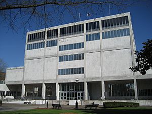
Marion County Courthouse in Salem
|
|

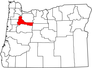
Location within the U.S. state of Oregon
|
|
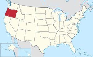
 Oregon's location within the U.S. |
|
| Country | |
| State | |
| Founded | July 5, 1843 |
| Named for | Francis Marion |
| Seat | Salem |
| Largest city | Salem |
| Area | |
| • Total | 1,194 sq mi (3,090 km2) |
| • Land | 1,184 sq mi (3,070 km2) |
| • Water | 10 sq mi (30 km2) 0.85% |
| Population
(2020)
|
|
| • Total | 345,920 |
| • Estimate
(2023)
|
346,741 |
| • Density | 289.72/sq mi (111.86/km2) |
| Time zone | UTC−8 (Pacific) |
| • Summer (DST) | UTC−7 (PDT) |
| Congressional districts | 5th, 6th |
Marion County is one of the 36 counties in the U.S. state of Oregon. It is located in the Willamette Valley, a fertile area in western Oregon. In 2020, about 345,920 people lived here, making it the 5th most populated county in Oregon.
The main city and county seat of Marion County is Salem. Salem is also the capital city of Oregon. The county was first called the Champooick District. This name came from Champoeg, a place where people often met by the Willamette River. Later, on September 3, 1849, the government of the Oregon Territory changed the name. They renamed it to honor Francis Marion, a general who fought in the American Revolutionary War. He was known as the "Swamp Fox."
Contents
History of Marion County
Marion County was officially created on July 5, 1843. It was one of the first four areas, or "districts," in the Oregon Country. The other original districts were Twality (now Washington), Clackamas, and Yamhill. In 1845, these districts were changed into counties.
When it was first formed, Marion County was much larger. It stretched all the way south to the California border and east to the Rocky Mountains. Over time, new counties like Wasco, Linn, and Polk were created. This made Marion County smaller. Its current borders were set in 1856.
In 1849, Salem became the county seat. The capital of the Oregon Territory moved to Salem in 1852 from Oregon City. There was some disagreement about where the capital should be. But in 1864, Salem was confirmed as the permanent state capital.
Geography and Nature
Marion County covers about 1,193 square miles. Most of this area, about 1,182 square miles, is land. The rest, about 10 square miles, is water.
Neighboring Counties
Marion County shares its borders with several other counties:
- Yamhill County (to the northwest)
- Clackamas County (to the north)
- Wasco County (to the northeast)
- Jefferson County (to the east)
- Linn County (to the south)
- Polk County (to the west)
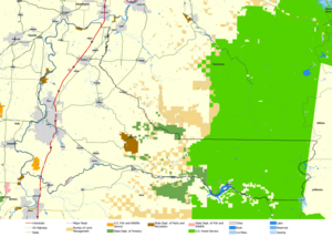
Protected Natural Areas
Marion County is home to parts of important natural areas:
- Ankeny National Wildlife Refuge
- Mount Hood National Forest (part of it)
- Willamette National Forest (part of it)
People of Marion County
The number of people living in Marion County has grown a lot over the years. In 1850, there were only 2,749 people. By 2020, the population had reached 345,920.
Population in 2020
In 2020, the people living in Marion County came from many different backgrounds. About 61.8% were non-Hispanic white. Other groups included African American (1.1%), Native American (0.9%), and Asian (2.1%). About 4.9% of people were of two or more races. Also, 27.7% of the population was Hispanic or Latino.
Economy and Jobs
The economy of Marion County is strong in several areas. Farming and food processing are very important. The county is a top leader in agricultural production in Oregon. For example, over 10,640 acres are used for orchards. The famous marionberry was even named after Marion County!
Other important industries include lumber and manufacturing. Education also plays a big role. However, the main employer and economic base in Marion County is the government. This is because Salem, the state capital, is located here.
Education in Marion County
Marion County offers many educational opportunities, from colleges to K-12 schools.
Colleges and Universities
You can find several colleges and universities in Marion County:
- Willamette University
- Corban University
- Chemeketa Community College
All of Marion County is part of the Chemeketa community college district.
K-12 Public Schools
Many public school districts serve students from kindergarten through 12th grade:
- Cascade School District 5
- Central School District 13J
- Gervais School District 1
- Jefferson School District 14J
- Mount Angel School District 91
- North Marion School District 15
- North Santiam School District 29J
- Salem-Keizer School District 24J
- Santiam Canyon School District 129J
- Silver Falls School District 4J
- St. Paul School District 45
- Woodburn School District
There are also state-operated schools:
- Oregon School for the Deaf
And a tribal school linked with the Bureau of Indian Education:
Cities and Towns
Marion County has many different communities, from large cities to smaller towns and villages.
Cities
Census-Designated Places
These are areas that are like towns but are not officially incorporated as cities:
Other Communities
Unincorporated Communities
These are smaller communities that are not part of any city or census-designated place:
Images for kids
See also
 In Spanish: Condado de Marion (Oregón) para niños
 | Kyle Baker |
 | Joseph Yoakum |
 | Laura Wheeler Waring |
 | Henry Ossawa Tanner |


