Linn County, Oregon facts for kids
Quick facts for kids
Linn County
|
|||
|---|---|---|---|
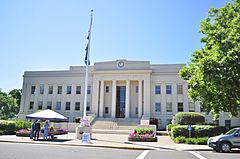
Linn County Courthouse in Albany
|
|||
|
|||
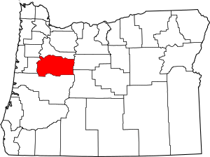
Location within the U.S. state of Oregon
|
|||
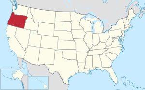 Oregon's location within the U.S. |
|||
| Country | |||
| State | |||
| Founded | December 28, 1847 | ||
| Named for | Lewis F. Linn | ||
| Seat | Albany | ||
| Largest city | Albany | ||
| Area | |||
| • Total | 2,309 sq mi (5,980 km2) | ||
| • Land | 2,290 sq mi (5,900 km2) | ||
| • Water | 19 sq mi (50 km2) 0.8% | ||
| Population
(2020)
|
|||
| • Total | 128,610 | ||
| • Estimate
(2023)
|
131,496 |
||
| • Density | 55.699/sq mi (21.506/km2) | ||
| Time zone | UTC−8 (Pacific) | ||
| • Summer (DST) | UTC−7 (PDT) | ||
| Congressional districts | 4th, 5th | ||
Linn County is one of the 36 counties in the U.S. state of Oregon. It is located in the beautiful Willamette Valley.
As of 2023, about 131,496 people live here. The main city and county seat is Albany.
The county is named after Lewis F. Linn. He was a U.S. Senator from Missouri. Senator Linn helped encourage American settlers to move to the Oregon Country.
Contents
History of Linn County
Linn County was created on December 28, 1847. It was formed from the southern part of what was then called Champoeg County. This area later became Marion County.
The county's borders changed a few times. This happened in 1851 and 1854 when Lane and Wasco Counties were formed.
The first county seat was in a place called Calapooia, which is now Brownsville. But in 1851, the government decided to make Albany the new county seat. People voted in 1856 to confirm that Albany would stay the county seat.
Geography and Nature
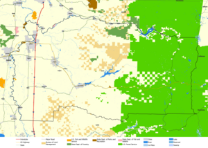
Linn County covers a total area of about 2,309 square miles. Most of this is land, with only a small part (about 19 square miles) being water.
Neighboring Counties
Linn County shares its borders with several other counties:
- Polk County (to the northwest)
- Marion County (to the north)
- Jefferson County (to the east)
- Deschutes County (to the southeast)
- Lane County (to the south)
- Benton County (to the west)
Protected Natural Areas
Part of the Willamette National Forest is located in Linn County. This is a large area of protected forests and natural beauty.
Plants and Animals
Linn County is home to many different kinds of plants and animals. You can find various mammals, birds, amphibians, and reptiles here.
Trees like different types of oaks and conifers grow in the area. One interesting amphibian found in the oak woodlands is the Rough-skinned Newt.
Carpenter Mountain is one of the highest points in the western Cascade Mountains. It's located in Linn County, but you usually access it through Lane County.
People of Linn County
| Historical population | |||
|---|---|---|---|
| Census | Pop. | %± | |
| 1850 | 994 | — | |
| 1860 | 6,772 | 581.3% | |
| 1870 | 8,717 | 28.7% | |
| 1880 | 12,676 | 45.4% | |
| 1890 | 16,265 | 28.3% | |
| 1900 | 18,603 | 14.4% | |
| 1910 | 22,662 | 21.8% | |
| 1920 | 24,550 | 8.3% | |
| 1930 | 24,700 | 0.6% | |
| 1940 | 30,485 | 23.4% | |
| 1950 | 54,317 | 78.2% | |
| 1960 | 58,867 | 8.4% | |
| 1970 | 71,914 | 22.2% | |
| 1980 | 89,465 | 24.4% | |
| 1990 | 91,227 | 2.0% | |
| 2000 | 103,069 | 13.0% | |
| 2010 | 116,672 | 13.2% | |
| 2020 | 128,610 | 10.2% | |
| 2023 (est.) | 131,496 | 12.7% | |
| U.S. Decennial Census 1790–1960 1900–1990 1990–2000 2010–2020 |
|||
The population of Linn County has grown a lot over the years. In 1850, there were less than 1,000 people. By 2020, the population was over 128,000!
2020 Census Information
According to the 2020 census, there were 128,610 people living in Linn County. Most people (81%) were non-Hispanic white. About 9.8% of the population was Hispanic.
2010 Census Information
In 2010, there were 116,672 people. The average household had about 2.55 people. The average family had about 3.01 people.
The median age of people in the county was 39.2 years old. This means half the people were younger than 39.2, and half were older.
Economy and Jobs
Linn County's economy relies on several important industries. These include wood products, farming (agriculture), mining, and manufacturing.
The lumber and wood products industry is very important. In 1990, it provided 40% of the manufacturing jobs in the county.
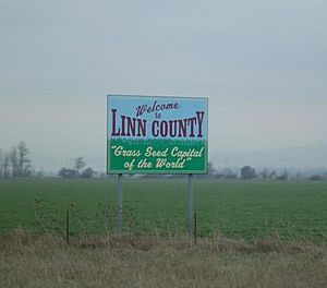
The climate and soil in Linn County are great for farming. This allows farmers to grow many different kinds of special crops. For example, they grow common and perennial ryegrass.
Linn County is also unique because it has the only emery mine in the United States. Emery is a very hard mineral used for grinding and polishing. The county also produces manufactured and motor homes.
Cities and Towns
Linn County has many communities, from small towns to larger cities.
Cities
- Albany (county seat) (part)
- Brownsville
- Gates (part)
- Halsey
- Harrisburg
- Idanha (part)
- Lebanon
- Lyons
- Mill City (part)
- Millersburg
- Scio
- Sodaville
- Sweet Home
- Tangent
- Waterloo
Census-Designated Places
These are areas that are like towns but are not officially incorporated as cities.
Unincorporated Communities
These are smaller communities that are not part of a city or a census-designated place.
- Berlin
- Calapooia
- Cascadia
- Crabtree
- Crawfordsville
- Foster
- Fox Valley
- Holley
- Jordan
- Kingston
- Lacomb
- Marion Forks
- Peoria
- Riverside
- Santiam Junction
- Shedd
- Shelburn
- West Scio
Former Communities
These are places that used to be communities in Linn County but no longer exist.
- Burlington
- Orleans
- Rowland
- Syracuse
- Tallman
- Thomas
See also
 In Spanish: Condado de Linn (Oregón) para niños
 | Bessie Coleman |
 | Spann Watson |
 | Jill E. Brown |
 | Sherman W. White |


