Benton County, Oregon facts for kids
Quick facts for kids
Benton County
|
|
|---|---|
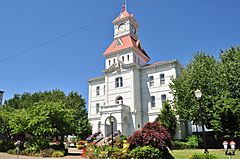
Benton County Courthouse in Corvallis
|
|
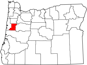
Location within the U.S. state of Oregon
|
|
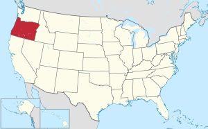 Oregon's location within the U.S. |
|
| Country | |
| State | |
| Founded | December 23, 1847 |
| Named for | Thomas H. Benton |
| Seat | Corvallis |
| Largest city | Corvallis |
| Area | |
| • Total | 679 sq mi (1,760 km2) |
| • Land | 676 sq mi (1,750 km2) |
| • Water | 2.7 sq mi (7 km2) 0.4%% |
| Population
(2020)
|
|
| • Total | 95,184 |
| • Estimate
(2023)
|
99,355 |
| • Density | 127/sq mi (49/km2) |
| Time zone | UTC−8 (Pacific) |
| • Summer (DST) | UTC−7 (PDT) |
| Congressional district | 4th |
Benton County is one of the 36 counties in the U.S. state of Oregon. As of 2023, about 99,355 people live there. Its main city and government center is Corvallis. The county is named after Thomas Hart Benton. He was a U.S. Senator who believed America should control the Oregon Country. Benton County is part of a larger group of cities around Portland. It is located in the beautiful Willamette Valley.
Contents
History of Benton County
Benton County was created on December 23, 1847. This happened by a decision of the Provisional Government of Oregon. The county got its name from Senator Thomas Hart Benton of Missouri. He strongly supported the idea of Manifest Destiny. This was a belief that the United States should expand its control across North America. Senator Benton thought the American government should control all of the Oregon Country.
When it was first formed, Benton County was much larger. It included all the land west of the Willamette River. It stretched south from Polk County all the way to the California border. It also went west to the Pacific Ocean.
The land in Benton County was originally home to Native American tribes. The Kalapuyas lived there, and the Klickitat tribe rented land for hunting. In 1855, the Native American claims to the land were given up in the Treaty of Dayton. Over time, parts of Benton County were used to create other counties. These included Coos, Curry, Douglas, Jackson, Josephine, Lane, and Lincoln Counties. This is how Benton County got its current shape.
The city of Marysville became the county seat in 1851. It was later renamed Corvallis. For a short time, Corvallis was even the capital of Oregon! In 1862, Corvallis became home to the Oregon State Agricultural College. Today, this school is known as Oregon State University.
Geography of Benton County
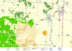
Benton County covers about 679 square miles. Most of this area, 676 square miles, is land. Only a small part, about 2.7 square miles, is water. This makes Benton County the fourth-smallest county in Oregon by land area. It is the third-smallest by total area.
Neighboring Counties
- Polk County (to the north)
- Lincoln County (to the west)
- Linn County (to the east)
- Lane County (to the south)
Protected Natural Areas
- Siuslaw National Forest (a part of it is in Benton County)
- William L. Finley National Wildlife Refuge
People of Benton County (Demographics)
| Historical population | |||
|---|---|---|---|
| Census | Pop. | %± | |
| 1850 | 814 | — | |
| 1860 | 3,074 | 277.6% | |
| 1870 | 4,584 | 49.1% | |
| 1880 | 6,403 | 39.7% | |
| 1890 | 8,650 | 35.1% | |
| 1900 | 6,706 | −22.5% | |
| 1910 | 10,663 | 59.0% | |
| 1920 | 13,744 | 28.9% | |
| 1930 | 16,555 | 20.5% | |
| 1940 | 18,629 | 12.5% | |
| 1950 | 31,570 | 69.5% | |
| 1960 | 39,165 | 24.1% | |
| 1970 | 53,776 | 37.3% | |
| 1980 | 68,211 | 26.8% | |
| 1990 | 70,811 | 3.8% | |
| 2000 | 78,153 | 10.4% | |
| 2010 | 85,579 | 9.5% | |
| 2020 | 95,184 | 11.2% | |
| 2023 (est.) | 97,713 | 14.2% | |
| U.S. Decennial Census 1790–1960 1900–1990 1990–2000 2010–2020 |
|||
2020 Census Information
In 2020, about 95,184 people lived in Benton County. Most people, about 75.9%, were non-Hispanic white. Other groups included 1% African American, 0.6% Native American, and 6.7% Asian. About 6.1% of people were of two or more races. People of Hispanic or Latino background made up 9% of the population.
2010 Census Information
In 2010, there were 85,579 people living in the county. The population density was about 127 people per square mile. The average age of people in Benton County was 32.1 years old.
Communities in Benton County
Benton County has several cities and smaller communities.
Cities
- Adair Village
- Albany (a small part of Albany is in Benton County)
- Corvallis (This is the county seat, where the main government offices are)
- Monroe
- Philomath
Census-designated places
These are areas that are like towns but are not officially incorporated as cities.
Unincorporated communities
These are smaller settlements that are not part of any city or census-designated place.
- Alder
- Caldwell Hill
- Cascade View
- Chinook
- Country Estates
- Crescent Valley
- Dawson
- Dry Creek
- Flynn
- Glenbrook
- Green Acres
- Greenberry
- Hidden Valley
- Hope
- Hoskins
- Harris
- Lewisburg
- Lobster Valley
- Mary’s River Estates
- Nash
- Nashville
- Noon
- Oakwood Heights
- Palestine
- Raguse
- Ridgewood
- Rosewood Estates
- Wren
- Vineyard Mountain
Economy of Benton County
The economy of Benton County is built on a few key areas. Oregon State University is a very important part of the economy. It brings many jobs and research projects. Other important parts of the economy include agriculture (farming), lumber and wood products. There is also some research and development in printing technology. Oregon State University does a lot of important research. This includes studies in forestry, farming, engineering, education, and various sciences.
See also
 In Spanish: Condado de Benton (Oregón) para niños
 | James Van Der Zee |
 | Alma Thomas |
 | Ellis Wilson |
 | Margaret Taylor-Burroughs |


