Josephine County, Oregon facts for kids
Quick facts for kids
Josephine County
|
|
|---|---|
|
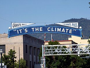
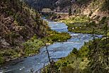
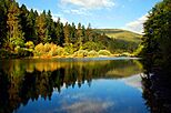
From clockwise: Josephine County Courthouse, the "It's the Climate" banner in downtown Grants Pass, Miller's Chapel in the Oregon Caves National Monument, the Rogue River from Hellgate Canyon, Illinois River Forks State Park
|
|
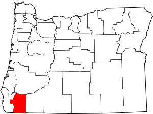
Location within the U.S. state of Oregon
|
|
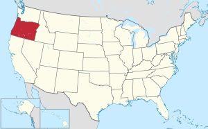 Oregon's location within the U.S. |
|
| Country | |
| State | |
| Founded | January 22, 1856 |
| Named for | Virginia “Josephine” Rollins |
| Seat | Grants Pass |
| Largest city | Grants Pass |
| Area | |
| • Total | 1,642 sq mi (4,250 km2) |
| • Land | 1,640 sq mi (4,200 km2) |
| • Water | 2.2 sq mi (6 km2) 0.1%% |
| Population
(2020)
|
|
| • Total | 88,090 |
| • Estimate
(2023)
|
87,821 |
| • Density | 50/sq mi (20/km2) |
| Time zone | UTC−8 (Pacific) |
| • Summer (DST) | UTC−7 (PDT) |
| Congressional district | 2nd |
Josephine County is one of the 36 counties in the state of Oregon. It is located in the southwestern part of Oregon. As of the 2020 census, about 88,090 people lived there. The main city and county seat is Grants Pass.
The county is named after Virginia Josephine Rollins. She was a settler who was the first white woman to live within the county's borders. Josephine County is part of the Grants Pass, Oregon, area. This area is also connected to Medford.
Contents
History of Josephine County
The first settlers came to this area because of gold. In 1852, rich gold deposits were found at Sailor Diggings. This led to a gold rush. The U.S. Army had several forts in the county. Many battles during the Rogue River Indian War (1855–1858) happened here.
How Josephine County Was Formed
In 1851, a group of gold prospectors went to the Illinois Valley. They found the first gold in Southern Oregon. Josephine Rollins Ort was part of this group. The county is named after her.
On January 22, 1856, a law was passed. It separated what is now Josephine County from Jackson County. Sailor Diggings became the first county seat. Josephine County was the nineteenth and last county created before Oregon became a state.
Changes to the County Seat
In 1885, the county seat moved to Kerby. The county's first jail was built there. Later in 1885, the border between Jackson and Josephine County changed. This made Grants Pass part of Josephine County. This change helped the county have a railroad connection.
In June 1886, voters chose a new county seat. They picked between Kerby, Wilderville, and Grants Pass. Grants Pass won with 116 votes out of 716.
Fun Facts from the 1920s
In the 1920s, Josephine County worked to attract tourists. In 1922, the Grants Pass Cavemen club was formed. Members dressed in furs and carried clubs. They did funny things like blocking traffic. They even tried to bid on building the San Francisco–Oakland Bay Bridge with deer hides! They also welcomed politicians like Mark Hatfield into their club.
In the 1920s, bridges were built over the Rogue River. But ferries were still used to cross the river. The first bridge in Grants Pass was destroyed by a flood in 1890.
The first newspaper in Josephine County was the Argus. It started on March 13, 1885. It only lasted a few months. The Grants Pass Courier began soon after. The Illinois Valley News started in Cave Junction in 1937 and is still published today.
Native American History
Many Native American tribes lived in the area. After the Rogue River Indian War, most were moved to reservations. These included the Grand Ronde and Siletz reservations.
Geography of Josephine County
Josephine County covers about 1,642 square miles. Most of this area, about 1,640 square miles, is land. Only a small part, about 2.2 square miles, is water.
Neighboring Counties
- Douglas County (north)
- Jackson County (east)
- Siskiyou County, California (south)
- Del Norte County, California (southwest)
- Curry County (west)
Protected Natural Areas
- Oregon Caves National Monument
- Rogue River-Siskiyou National Forest (part)
Population Information
| Historical population | |||
|---|---|---|---|
| Census | Pop. | %± | |
| 1860 | 1,623 | — | |
| 1870 | 1,204 | −25.8% | |
| 1880 | 2,485 | 106.4% | |
| 1890 | 4,878 | 96.3% | |
| 1900 | 7,517 | 54.1% | |
| 1910 | 9,567 | 27.3% | |
| 1920 | 7,655 | −20.0% | |
| 1930 | 11,498 | 50.2% | |
| 1940 | 16,301 | 41.8% | |
| 1950 | 26,542 | 62.8% | |
| 1960 | 29,917 | 12.7% | |
| 1970 | 35,746 | 19.5% | |
| 1980 | 58,855 | 64.6% | |
| 1990 | 62,649 | 6.4% | |
| 2000 | 75,726 | 20.9% | |
| 2010 | 82,713 | 9.2% | |
| 2020 | 88,090 | 6.5% | |
| 2023 (est.) | 87,821 | 6.2% | |
| U.S. Decennial Census 1790–1960 1900–1990 1990–2000 2010–2020 |
|||
Population in 2010
In 2010, there were 82,713 people living in Josephine County. There were 34,646 households. The average age of people living there was 47.3 years old.
Communities in Josephine County
Cities
- Cave Junction
- Grants Pass (county seat)
Census-Designated Places (CDPs)
Unincorporated Communities
- Bridgeview
- Dryden
- Galice
- Holland
- Hugo
- Leland
- Murphy
- Placer
- Pleasant Valley
- Rand
- Sunny Valley
- Three Pines
- Wilderville
- Wolf Creek
- Wonder
Former Communities
Economy and Resources
In the early days, the economy was mostly about gold mining. People also supplied goods to the miners. By the late 1850s, gold mining started to slow down. Many people left to find gold elsewhere.
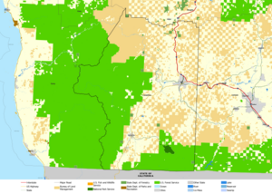
Today, Josephine County is known for its wine. It shares the Rogue Valley and Applegate Valley wine regions with Jackson County. The U.S. government owns a lot of land in the county. The Bureau of Land Management owns 28% and the Forest Service owns 39%.
Grants Pass is a starting point for trips on the Rogue River. People go fishing and take boat tours. One popular spot is Hellgate Canyon. The Illinois River, which flows into the Rogue, is also a scenic waterway.
Transportation in Josephine County
At first, goods were brought into Josephine County by pack trains. These were animals carrying supplies. As roads got better, freight wagons were used. Stage coaches were the main way to travel until 1914. Then, auto stages (early buses) cut travel time in half.
In 1883, the Oregon and California Railroad reached Grants Pass. The first train from Portland, Oregon arrived on Christmas Eve, 1883. Trains from California started arriving in 1887. In 1923, commercial flights began in Josephine County. Airplanes took off from the American Legion Air Field.
Libraries in Josephine County
In May 2007, all libraries in Josephine County closed. This happened because the county government did not have enough money to fund them.
But the community stepped up! In September 2007, people formed a group called Josephine Community Libraries, Inc. This was a non-profit organization. They worked hard to reopen the libraries.
- On December 20, 2008, the Grants Pass library reopened.
- On September 5, 2009, the Illinois Valley library reopened.
- On November 7, 2009, the Williams library reopened.
- With the Wolf Creek branch reopening on December 19, 2009, all four libraries were back!
For 10 years, volunteers and donations kept the libraries going. In May 2017, citizens voted to permanently fund the libraries. This vote passed, showing how much the community values its libraries.
See also
 In Spanish: Condado de Josephine para niños
 | Chris Smalls |
 | Fred Hampton |
 | Ralph Abernathy |


