Rogue River (Oregon) facts for kids
Quick facts for kids Rogue River |
|
|---|---|
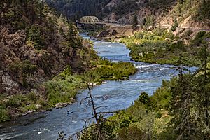
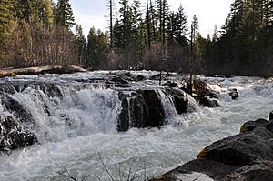
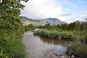
Rogue River from Hellgate Canyon
|
|
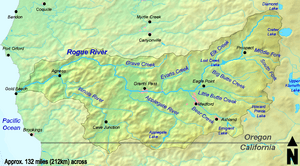
Map of the Rogue River watershed
|
|
|
Location of the mouth of the Rogue River in Oregon
|
|
| Country | United States |
| State | Oregon |
| County | Klamath, Douglas, Jackson, Josephine, and Curry |
| City | Grants Pass |
| Physical characteristics | |
| Main source | Boundary Springs in Crater Lake National Park Cascade Range, Klamath County, Oregon 5,320 ft (1,620 m) 43°3′57″N 122°13′56″W / 43.06583°N 122.23222°W |
| River mouth | Pacific Ocean Gold Beach, Curry County, Oregon 0 ft (0 m) 42°25′21″N 124°25′45″W / 42.42250°N 124.42917°W |
| Length | 215 mi (346 km) |
| Basin features | |
| Basin size | 5,156 sq mi (13,350 km2) |
| Type: | Wild, Scenic, Recreational |
| Designated: | October 2, 1968 |
The Rogue River is a famous river in southwestern Oregon, United States. It flows about 215 miles (346 km) from the Cascade Range to the Pacific Ocean. The river is well-known for its salmon runs, exciting whitewater rafting, and beautiful, wild scenery.
In 1968, the Rogue River was one of the first eight rivers included in the National Wild and Scenic Rivers System. This means parts of it are protected for their natural beauty and importance. The river starts near Crater Lake, which is a lake inside a huge caldera (a collapsed volcano). It flows through different types of volcanic mountains and then through older Klamath Mountains. Near the ocean, scientists even found the only dinosaur fragments ever discovered in Oregon!
People have lived along the Rogue River for at least 8,500 years. European explorers first met Native Americans here in the late 1700s. Later, fur trappers and settlers arrived. Sometimes, there were conflicts between the Native Americans and the newcomers. These conflicts led to the Rogue River Wars in 1855–56. After the wars, most Native Americans were moved to reservations outside the area.
For over 100 years, there has been debate about building and removing dams on the Rogue River. Some early dams blocked fish, and angry fishermen even blew one up! By 2009, most of the big dams on the main river had been removed to help the salmon. The Rogue River is generally clean, which is good for its amazing wildlife.
Even though the Rogue Valley near Medford has cities, most of the Rogue River area is wild and forested. Many public parks, hiking trails, and campgrounds are found along the river. The area is home to many different kinds of plants and animals. The forests here are among the most diverse in the world!
Contents
The River's Journey
The Rogue River starts at Boundary Springs, close to Crater Lake National Park. It flows generally west for 215 miles (346 km) through forests and mountains until it reaches the Pacific Ocean at Gold Beach.
Towns along the river include Union Creek, Prospect, Shady Cove, Grants Pass, and Agness. Important smaller rivers that join the Rogue include the Applegate River and the Illinois River. The river begins high up at 5,320 feet (1,622 m) above sea level and drops all the way to the ocean.
A large part of the Rogue River, about 124 miles (200 km), is protected as a Wild and Scenic River. This means it's kept in its natural state. The Rogue is one of only three rivers in Oregon that start in the Cascade Mountains and flow all the way to the Pacific Ocean.
River Flow and Water Levels
The United States Geological Survey (USGS) measures the river's flow at different points. Near Agness, the river's average flow between 1960 and 2007 was 6,622 cubic feet per second (188 m3/s). The highest flow ever recorded was on December 23, 1964, during a huge flood. The lowest flow was in July 1968.
The Rogue River Area
The Rogue River watershed (the area of land that drains into the river) covers 5,156 square miles (13,350 km2). It includes parts of Oregon and even a small part of northern California. The land is very steep and rugged, with elevations from 9,485 feet (2,891 m) at Mount McLoughlin down to sea level at the ocean.
In 2000, many people lived in cities in the Rogue River Valley, like Medford (63,200 people) and Grants Pass (23,000 people). However, the average population density for the whole watershed is only about 32 people per square mile (12.4/km2). This means much of the area is still wild.
About 60 percent of the land in the watershed is owned by the public. It is managed by groups like the United States Forest Service. Forests cover about 83 percent of the area. Only about 6 percent of the land is used for farming.
The weather in the Rogue basin changes a lot. Gold Beach on the coast gets about 80 inches (2,000 mm) of rain a year, while Ashland, inland, gets only about 20 inches (510 mm). Most rain falls in winter and spring, and summers are dry. High up in the mountains, snow melts slowly, helping to keep the river flowing in dry months.
How the Land Was Formed
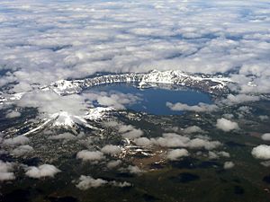
The Rogue River flows through different types of land that formed over millions of years. It starts in the younger Cascade Mountains, which were created by volcanoes. About 7.6 million years ago, and even more recently, volcanoes erupted here. The biggest eruption was Mount Mazama about 7,700 years ago. This volcano exploded, throwing huge amounts of ash into the air. When it collapsed, it formed the deep bowl that is now Crater Lake.
West of the Cascades are the older Klamath Mountains. These mountains are made of many different pieces of land called "terrane" that came together over a very long time. Imagine pieces of old volcanic islands, coral reefs, and parts of the Earth's deep mantle that slowly crashed into North America. This happened about 150 to 130 million years ago.
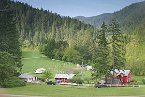
Some of the oldest rocks in Oregon are found here, dating back almost 250 million years. These rocks contain valuable metals like gold, silver, and copper. Gold mining was very popular here in the mid-1800s. The Greenback Mine, along a Rogue tributary, was one of Oregon's most productive gold mines.
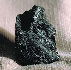
In the Kalmiopsis Wilderness, you can find special rocks called peridotite. These rocks are usually found deep inside the Earth's mantle. When exposed to air, they turn reddish-brown, but inside they are very dark green. Another rock, serpentine, is also found here. These rocks make the soil difficult for many plants to grow.
Near the mouth of the Rogue River, scientists found the only dinosaur fragments in Oregon. These were from a hadrosaur, or duck-billed dinosaur. This shows that dinosaurs once roamed this area!
History of the Rogue River
Early People and Explorers
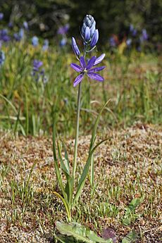
Scientists believe the first people in the Rogue River area were hunters and gatherers. They arrived at least 8,500 years ago. Over time, they built permanent villages along the streams. Different groups, like the Tututni and Takelma people, lived here. They shared many customs, like food, clothing, and shelter. They often married between groups and understood different languages.
Their homes were often made of wood planks. For about half the year, people left their villages to gather food like camas bulbs, acorns, and berries. They also hunted deer and elk. Their main food was salmon. Before Europeans arrived, the Native American population in southern Oregon was much larger than the estimated 3,800 people in the early 1850s.
Clashes and Changes
The first recorded meeting between white people and coastal Native Americans happened in 1792. In 1826, Alexander Roderick McLeod of the Hudson's Bay Company explored the area. The next year, Peter Skene Ogden met the inland Rogue River natives while looking for beaver.
At first, there wasn't much conflict. But in 1834, some trappers killed Native Americans. The name Rogue River came from French fur trappers who called the natives coquins, meaning "rogues" or "rascals." In 1835, Native Americans killed four white travelers.
More white settlers came after 1846, using the Applegate Trail to reach the Willamette Valley. This trail went through the Rogue Valley. Even though both sides were nervous, there wasn't much violence in the 1830s and 1840s.
The situation changed with the California Gold Rush in 1848. Many miners passed through the Rogue Valley. After Native Americans attacked miners in 1850, a peace treaty was signed. It promised to protect Native American rights and allow safe passage for miners.
But the peace didn't last. Gold was found in the watershed, and a mining camp started where Jacksonville is now. Conflicts grew, leading to the Rogue River Wars of 1855–56. After a volunteer militia attacked a group of Native Americans, killing many, the fighting spread. The war ended with a big battle on the lower river.
In 1856, most Rogue River Native Americans were moved to reservations further north. About 1,400 were sent to the Siletz Reservation. Another 400 were forced to march for 33 days to the Grande Ronde Reservation.
Mail Boats on the River
After the war, a few settlers moved into the Rogue River Canyon. They were quite isolated until the 1890s. In 1883, a settler named Elijah H. Price suggested a mail route by boat up the river. The Post Office Department agreed to try it in 1895. Price became the first postmaster at the new Illahe post office. The name Illahe means "land" or "earth" in the Chinook Jargon language.
The first mail boat was an 18-foot (5.5 m) cedar boat. It was rowed, poled, or even sailed. By 1930, there were three 26-foot (7.9 m) boats with engines. By the 1960s, faster jetboats took over. These boats could carry many passengers. As of 2010, jet boats still deliver mail between Gold Beach and Agness. The Rogue River is one of only two places in the U.S. where mail is still delivered by boat!
Fishing for Salmon
For thousands of years, salmon were a very important food for Native Americans along the Rogue. Early settlers said they could hear the fish moving upstream because there were so many! Even with gold mining hurting fish spawning areas and large-scale fishing starting, the salmon runs stayed strong into the 1900s.
In the 1880s, Robert Deniston Hume became known as the "Salmon King of Oregon." His company caught and shipped hundreds of tons of salmon from the lower Rogue. Upriver, fishermen also caught huge amounts. In 1913, crews in Grants Pass caught 5,000 pounds (2,300 kg) of salmon in one day!
Hume also built hatcheries to release young fish into the river. He believed this helped the fish population. However, as salmon numbers still went down, people who fished for fun started to oppose the big commercial fishing operations. In 1935, the state finally stopped commercial fishing on the Rogue.
Today, the Oregon Department of Fish and Wildlife (ODFW) runs the Cole M. Rivers Hatchery. It raises different types of salmon and trout. This hatchery was built in 1973 to help make up for fish habitat lost due to new dams. It's the third-largest salmon and steelhead hatchery in the U.S.
Famous Visitors
Many famous people have visited the Rogue River. In 1926, author Zane Grey bought a cabin here and wrote books about the West. Other famous visitors in the 1930s and 40s included actors Clark Gable and Ginger Rogers, singer Bing Crosby, and author William Faulkner. They loved the beautiful scenery, fishing, and boat trips.
Dams on the River
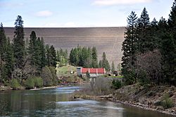
The William L. Jess Dam is a very large dam on the Rogue River, 157 miles (253 km) from its mouth. Built between 1972 and 1976, it helps control floods and makes electricity. It also stops salmon from swimming further upstream.
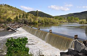
Other dams used to block fish between the William L. Jess Dam and Grants Pass. After many arguments about water rights and fish, most of these dams were removed or changed starting in 2008. This was done to help salmon reach their spawning grounds.
The Gold Ray Dam was built in 1904 to make electricity. It had a fish ladder to help fish pass. The dam was removed in 2010 to help the salmon even more. The Gold Hill Dam, another smaller dam, was also removed in 2008.
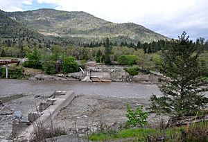
The Savage Rapids Dam was built in 1921 to send river water to farms. It was removed in 2009. Now, pumps provide water to the farms instead. Even a partly built dam on Elk Creek, a major tributary, was removed in 2008.
Historically, other dams were removed or destroyed. The Ament Dam, built in 1902, was partly destroyed by angry fishermen in 1912 because it killed too many fish. It was fully removed later.
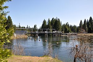
Today, the only artificial barrier on the main Rogue River upstream of Lost Creek Lake is a diversion dam at Prospect. It sends water to power plants, which then return the water to the river. Many smaller dams are still on the river's tributaries, mostly for irrigation.
Bridges Crossing the Rogue
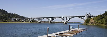
Many bridges cross the Rogue River. One of the most famous is the Isaac Lee Patterson Bridge at Gold Beach. It carries U.S. Route 101 over the river. Built in 1931, it's known for its beautiful design with many arches. It was the first bridge in the U.S. to use a special method for concrete bridges.
Other historic bridges are found between Gold Hill and Grants Pass. The Gold Hill Bridge, built in 1927, is the only one of its kind in Oregon. The Rock Point Bridge, built in 1920, also carries a highway over the river.
The Caveman Bridge in Grants Pass is a 550-foot (170 m) concrete bridge with three arches. Built in 1931, it's called "Caveman" because the highway it carries goes near Oregon Caves National Monument. Slightly downstream, the Robertson Bridge, built around 1909, was moved in 1929 to make way for the Caveman Bridge.
River Health and Pollution
To keep the river healthy, the Environmental Protection Agency (EPA) and Oregon agencies work to control water pollution. They set limits for pollutants like high temperatures, bacteria, and too much sediment.
The Oregon Water Quality Index (OWQI) measures water quality for general recreation. Scores range from 10 (worst) to 100 (ideal). Between 1997 and 2006, most parts of the Rogue River scored well, from 85 to 97. However, some areas, like Bear Creek, which is in a more populated part of the basin, scored poorly. This shows that while the main river is quite clean, some smaller streams need improvement.
Plants and Animals
Most of the Rogue River area is covered by coniferous forests. The upper part of the basin has many different kinds of plants and animals. Common trees include incense cedar, white fir, and Shasta red fir.
Further downstream, you'll find a mix of evergreen and deciduous trees and shrubs. In areas with more people, farms and towns have replaced much of the original plants. However, some natural areas still exist, like the oak savanna and prairies at Table Rocks.
The Klamath-Siskiyou region, which includes parts of the Rogue basin, is one of the most diverse temperate coniferous forests in the world. It has about 3,500 different plant species! This area is considered very important for biodiversity (the variety of life).
The lower Rogue River flows through the Southern Oregon Coast Range. Here, forests include Douglas-fir, western hemlock, and Sitka spruce. These coastal forests are some of the most productive in the world. They are full of ferns, mosses, and many types of trees.
The Rogue River is known for its excellent salmonid (salmon and trout) habitat. However, there are fewer fish now than there used to be. Fish found in the Rogue include Coho salmon, Chinook salmon, and steelhead. Other native fish include Pacific lamprey and green sturgeon. Some non-native fish like largemouth bass and carp are also present. Coho salmon in the Rogue are listed as a threatened species.
Along the river banks, you can see trees and shrubs like willows, red alder, and black cottonwood. Many animals and birds live here, including American black bears, North American river otters, bald eagles, ospreys, and great blue herons.
Fun on the Rogue River
Boating Adventures
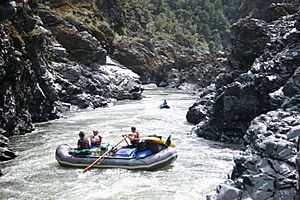
The Rogue River is famous for whitewater rafting and kayaking. One of the most popular runs is a 35-mile (56 km) section downstream of Grants Pass. It has exciting rapids (called Class 3+) mixed with calmer parts. This entire section is protected as Wild and Scenic.
To protect the river, only a certain number of people are allowed to raft this wild section each day. You need a special permit to enter. Other parts of the river are open to jetboats. You can take commercial jetboat trips from Gold Beach or enjoy excursions on the Hellgate section near Grants Pass.
Hiking Trails
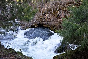
The Upper Rogue River Trail is a National Recreation Trail. It follows the river for about 40 miles (64 km) from Crater Lake National Park. Along the trail, you can see a canyon cut through volcanic rock, the Rogue Gorge with its black lava walls, and Natural Bridge, where the river flows through a 250-foot (76 m) lava tube.
The Lower Rogue River Trail is another National Recreation Trail, also 40 miles (64 km) long. It runs through the Wild Rogue Wilderness, a roadless area. Backpackers enjoy multi-day trips here, while day hikers take shorter walks. You can see rapids, wildlife, and historic lodges. Some lodges can even be reached by jet boat from Gold Beach!
Fishing Fun
Fishing on the Rogue River is fantastic! You can fish from the river banks or from boats. Upstream of Lost Creek Lake, you can catch different types of trout. Between Lost Creek Lake and Grants Pass, there are great places to fish for spring and fall Chinook salmon, Coho salmon, and steelhead.
Near Agness, you can catch "half-pounders," which are young steelhead returning from the ocean in large groups. The lower river also has spring and fall Chinook, as well as perch and crab near the ocean.
Parks Along the River
Many parks are located along the Rogue River. Crater Lake National Park is where the river begins. Other parks include:
- Prospect State Scenic Viewpoint: A forested area with hiking trails and waterfalls.
- Joseph H. Stewart State Recreation Area: Has campsites overlooking Lost Creek Lake.
- Casey State Recreation Site: Offers boating, fishing, and picnic areas.
- TouVelle State Recreation Site: A day-use park near the base of Table Rocks.
- Valley of the Rogue State Park: Built around 3 miles (4.8 km) of river shoreline.
Josephine County manages several parks between Grants Pass and the Hellgate Recreation Area, including Tom Pearce and Schroeder parks. Indian Mary Park has campsites and yurts along the river. These parks offer great places for camping, picnicking, and enjoying the river.
See also
 In Spanish: Río Rogue para niños
 | Toni Morrison |
 | Barack Obama |
 | Martin Luther King Jr. |
 | Ralph Bunche |


