Klamath County, Oregon facts for kids
Quick facts for kids
Klamath County
|
|
|---|---|
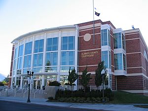
Klamath County Courthouse in Klamath Falls
|
|
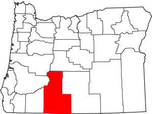
Location within the U.S. state of Oregon
|
|
 Oregon's location within the U.S. |
|
| Country | |
| State | |
| Founded | October 17, 1882 |
| Named for | Klamath Indians |
| Seat | Klamath Falls |
| Largest city | Klamath Falls |
| Area | |
| • Total | 6,136 sq mi (15,890 km2) |
| • Land | 5,941 sq mi (15,390 km2) |
| • Water | 194 sq mi (500 km2) 3.2%% |
| Population
(2020)
|
|
| • Total | 69,413 |
| • Estimate
(2023)
|
70,003 |
| • Density | 11/sq mi (4/km2) |
| Time zone | UTC−8 (Pacific) |
| • Summer (DST) | UTC−7 (PDT) |
| Congressional district | 2nd |
Klamath County is one of the 36 counties in the U.S. state of Oregon. In 2020, about 69,413 people lived there. The main city and county seat is Klamath Falls.
The county got its name from the Klamath people, a group of Native Americans. They lived in this area when the first European explorers arrived. Klamath County is also home to the Klamath Falls, OR Micropolitan Statistical Area.
Contents
History of Klamath County
The Klamath people, also called Clamitte, are the original inhabitants of this land. Their ancestors have lived here for over 10,000 years. They are the reason Klamath County has its name.
Early Encounters and Conflicts
In 1846, European-American travelers started using the Applegate Trail through the area. They began to compete with the Klamath people for hunting grounds and water. This led to disagreements and clashes between the groups.
As more settlers arrived, they cleared land for farming. This took away more hunting areas from the Klamath people. Eventually, the settlers pushed for Native Americans to be moved to special areas called reservations.
The Modoc War
The Modoc people, another Native American tribe, were moved to share a reservation with the Klamath. These two tribes had been rivals for a long time. The Modoc wanted their own reservation near the Lost River.
A Modoc leader named Captain Jack led his group back to the Lost River. The U.S. Army and local citizens tried to convince him to return. An argument started, shots were fired, and the Modoc War began. The Modoc then fled to a strong natural fort in northern California.
Klamath Reservation and Its End
A special agreement, called a treaty, was signed with the Klamath people on October 14, 1864. This led to the creation of the Klamath Reservation. Over the next 40 years, some Modoc people also settled on this reservation.
The Klamath people were very successful because of the large forests on their reservation. However, in 1954, the U.S. government ended the reservation. This act, called "termination," divided the shared tribal land into individual pieces. Many tribe members found it hard to manage these small pieces and were forced to sell them.
Edison Chiloquin's Stand
One Klamath man, Edison Chiloquin, refused to take money for his land. Instead, he insisted on getting the official ownership of his family's ancestral land. This land was along the Sprague River, where he lived.
On December 5, 1980, a law called the Chiloquin Act was signed. This law gave him the ownership of the land he wanted.
Geography of Klamath County
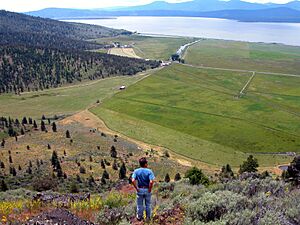
Klamath County is a large area, covering about 6,136 square miles. Most of this area, about 5,941 square miles, is land. The rest, about 194 square miles, is water. It is the fourth-largest county in all of Oregon.
Neighboring Counties
Klamath County shares its borders with several other counties:
- Douglas County (to the northwest)
- Lane County (to the northwest)
- Deschutes County (to the north)
- Lake County (to the east)
- Siskiyou County, California (to the south)
- Modoc County, California (to the south)
- Jackson County (to the west)
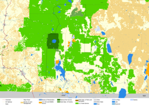
Protected Natural Areas
Klamath County is home to parts of several important natural areas. These places help protect wildlife and nature:
- Bear Valley National Wildlife Refuge
- Crater Lake National Park (part of it)
- Deschutes National Forest (part of it)
- Fremont National Forest (part of it)
- Klamath Marsh National Wildlife Refuge
- Lower Klamath National Wildlife Refuge (part of it)
- Rogue River – Siskiyou National Forest (part of it)
- Upper Klamath National Wildlife Refuge
- Winema National Forest (part of it)
Population and People
| Historical population | |||
|---|---|---|---|
| Census | Pop. | %± | |
| 1890 | 2,444 | — | |
| 1900 | 3,970 | 62.4% | |
| 1910 | 8,554 | 115.5% | |
| 1920 | 11,413 | 33.4% | |
| 1930 | 32,407 | 183.9% | |
| 1940 | 40,497 | 25.0% | |
| 1950 | 42,150 | 4.1% | |
| 1960 | 47,475 | 12.6% | |
| 1970 | 50,021 | 5.4% | |
| 1980 | 59,117 | 18.2% | |
| 1990 | 57,702 | −2.4% | |
| 2000 | 63,775 | 10.5% | |
| 2010 | 66,380 | 4.1% | |
| 2020 | 69,413 | 4.6% | |
| 2023 (est.) | 70,003 | 5.5% | |
| U.S. Decennial Census 1790–1960 1900–1990 1990–2000 2010–2020 |
|||
In 2010, there were 66,380 people living in Klamath County. The population density was about 11 people per square mile. Most people (85.9%) were white. About 4.1% were American Indian, and 10.4% were of Hispanic or Latino background.
The average age of people in the county was about 41.7 years old.
Communities in Klamath County
Klamath County has several cities and many smaller communities.
Cities
- Bonanza
- Chiloquin
- Klamath Falls (the county seat)
- Malin
- Merrill
Census-Designated Places
These are areas that are like towns but are not officially incorporated as cities:
- Altamont
- Beatty
- Beaver Marsh
- Bly
- Chemult
- Crescent
- Crescent Lake
- Falcon Heights
- Fort Klamath
- Gilchrist
- Keno
- Oregon Shores
- Rocky Point
- Running Y Ranch
- Sprague River
Other Unincorporated Communities
These are smaller communities that are not part of a city or a census-designated place:
- Ady
- Algoma
- Cascade Summit
- Dairy
- Fairhaven
- Hager
- Hatfield (part)
- Haynesville
- Henley
- Hildebrand
- Hot Springs
- Kirk
- Klamath Agency
- Lake of the Woods
- Langell Valley
- Lenz
- Lorella
- Malone
- Midland
- Modoc Point
- Odell Lake
- Odessa
- Olene
- Pelican City
- Pine Grove
- Pine Ridge
- Shevlin
- Worden
- Yonna
Economy of Klamath County
In the past, Klamath County's economy mainly relied on timber (wood from trees) and agriculture (farming). While these industries are still important, they make up a smaller part of the economy today.
Past Economic Activities
The arrival of the railroad in the early 1900s helped the area grow. Also, a big government project called the Klamath Reclamation Project changed the landscape. It built dams and drained large parts of lakes and wetlands. This turned about 188,000 acres of land into farms that could be irrigated.
Current Economic Activities
Today, the largest employer in Klamath County is Sky Lakes Medical Center. Other big employers include the Klamath County School District and Jeld-Wen, which makes doors and windows.
Many people are moving to Klamath County, especially retirees from California. This has led to a lot of new housing being built.
Outdoor activities are also a big part of the economy. People enjoy hiking, hunting, and fishing for trout. Crater Lake National Park, Oregon's only National Park, brings many visitors. The Klamath Basin National Wildlife Refuges Complex attracts huge numbers of waterfowl, making it a famous spot for birdwatchers.
Klamath County also has natural geothermal hot wells. These provide heat for many homes, businesses, and the Oregon Institute of Technology campus. Scientists are still studying how to use this energy even more.
Education in Klamath County
Klamath County has several places for higher education.
Colleges and Universities
- Klamath Community College
- Oregon Institute of Technology
See also
 In Spanish: Condado de Klamath para niños
 | Bayard Rustin |
 | Jeannette Carter |
 | Jeremiah A. Brown |


