
Lake County, Oregon facts for kids
Quick facts for kids
Lake County
|
|
|---|---|

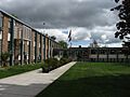
Lake County Courthouse in Lakeview
|
|

Location within the U.S. state of Oregon
|
|
 Oregon's location within the U.S. |
|
| Country | |
| State | |
| Founded | October 24, 1874 |
| Named for | Multiple lakes |
| Seat | Lakeview |
| Largest city | Lakeview |
| Area | |
| • Total | 8,358 sq mi (21,650 km2) |
| • Land | 8,139 sq mi (21,080 km2) |
| • Water | 219 sq mi (570 km2) 2.6%% |
| Population
(2020)
|
|
| • Total | 8,160 |
| • Estimate
(2023)
|
8,293 |
| • Density | 1.0/sq mi (0.4/km2) |
| Time zone | UTC−8 (Pacific) |
| • Summer (DST) | UTC−7 (PDT) |
| Congressional district | 2nd |
Lake County is one of the 36 counties in the U.S. state of Oregon. As of 2020, about 8,160 people lived there. Its main town and county seat is Lakeview. The county gets its name from the many lakes found within its borders. These include Lake Abert, Summer Lake, Hart Lake, and Goose Lake.
Lake County is located in the high desert area, also known as the Oregon Outback. This region is on the edge of the Great Basin. The county is generally split into two main areas. The southern part includes the towns of Lakeview and Paisley. The northern part has communities like Christmas Valley, Fort Rock, and Silver Lake.
The economy of Lake County mainly relies on farming and managing natural resources. You'll find many large cattle ranches and hay farms here. There are also big areas of public and private forests. While lumber was once a huge part of the economy, today only one sawmill is left in Lakeview.
Contents
History of Lake County
Ancient Times
Scientists have found very old human remains in the Paisley Caves in northern Lake County. These remains are about 14,300 years old. DNA from these findings shows links to Native American groups. In 1938, other ancient items were found in the Fort Rock Caves. These included baskets, stone tools, and sandals made from sagebrush bark. These sandals are more than 10,000 years old.
Modern History
European traders and explorers first came to this area in the early 1800s. Peter Skene Ogden led fur trappers to Goose Lake in 1827. Later, in 1832, trappers led by John Work explored the Goose Lake Valley. They wrote about Hunter's Hot Springs and even ate wild plums that still grow there today. In 1843, John C. Fremont led a group that named Christmas (Hart) Lake.
Lake County was once home to many Basque and Irish sheepherders. They often had disagreements with cattle ranchers over grazing rights. These conflicts sometimes led to "range wars." In one event in April 1904, about 2,300 sheep were killed in Lake County.
The county grew as homesteaders arrived, but the dry climate made farming difficult.
Lake County was officially created on October 24, 1874. It was formed from parts of Jackson and Wasco Counties. At first, it included what is now Klamath County. In 1875, Lakeview became the county seat. Because it was hard to travel to other parts of Oregon, Lake County often looked to California for trade. Newspapers from San Francisco would arrive daily, sometimes even before Oregon's own newspapers.
In the 1890s, a railroad line connected Lakeview to Reno, Nevada. This showed how separate the county was from the rest of Oregon. A big fire in 1900 destroyed much of Lakeview, including 75 businesses.
In 2012, two large wildfires burned big areas of Lake County. Both fires were started by lightning. The Lava Fire burned over 21,500 acres of land north of Fort Rock. The Barry Point Fire burned over 92,977 acres near the California border.
Geography of Lake County

Lake County covers about 8,358 square miles. Of this, 8,139 square miles are land and 219 square miles are water. It is the third-largest county in Oregon.
The elevation in Lake County ranges from about 4,130 feet to 8,446 feet. The highest point is Crane Mountain, located about 6 miles north of the California border. Lake County has six other peaks over 8,000 feet tall, all in the southern part of the county. Hager Mountain is the tallest peak in the northern area.
The landscape includes alkali lakes, high desert plants, and forests of Western Juniper, Ponderosa Pine, and Lodgepole Pine. There are also many interesting rock formations, making it a great place for rockhounding and geological tours.
The Lost Forest Research Natural Area is a special protected forest near the Christmas Valley Sand Dunes. Fossil Lake is a nearby area where many fossils of ancient animals have been found. Glass Buttes is a mountain area known for its large deposits of obsidian. Crack in the Ground, northeast of Christmas Valley, is a long crack in the earth that has ice on its floor all year. Big Hole, Hole-in-the-Ground, and Fort Rock are old maar craters in the northwestern part of the county.
In 2024, the southern part of the county was named a dark-sky preserve. This means it's a great place to see stars because there's very little light pollution.
Watersheds
Several important water systems, called watersheds, are found in Lake County:
- Beaver-South Fork watershed
- Goose Lake watershed
- Guano watershed
- Lake Abert watershed
- Little Deschutes
- Lost River watershed
- Crooked River, South Fork
- Silver watershed
- Sprague
- Summer Lake watershed
- Warner Lakes watershed
- Williamson
Lakes

Many named lakes are found partly or entirely in Lake County. Some of these include:
- Abert Lake
- Alkali Lake
- Duncan Reservoir
- Thompson Reservoir
- Ana Reservoir
- Campbell Lake
- Crump Lake
- Deadhorse Lake
- Dog Lake
- Drews Reservoir
- Goose Lake
- Hart Lake
- Heart Lake
- Silver Lake
- Summer Lake
- Warner Lakes (Pelican, Crump, Hart, Anderson, Swamp, Mugwump, Flagstaff, Upper Campbell, Lower Campbell, Stone Corral, Turpin, and Bluejoint).
Neighboring Counties
Lake County shares its borders with these other counties:
- Deschutes County (north)
- Harney County (east)
- Washoe County, Nevada (south)
- Modoc County, California (south)
- Klamath County (west)
Protected Natural Areas
Parts of these national protected areas are located in Lake County:
- Deschutes National Forest
- Fremont National Forest
- Hart Mountain National Antelope Refuge
- Sheldon National Wildlife Refuge
People of Lake County
| Historical population | |||
|---|---|---|---|
| Census | Pop. | %± | |
| 1880 | 2,804 | — | |
| 1890 | 2,604 | −7.1% | |
| 1900 | 2,847 | 9.3% | |
| 1910 | 4,658 | 63.6% | |
| 1920 | 3,991 | −14.3% | |
| 1930 | 4,833 | 21.1% | |
| 1940 | 6,293 | 30.2% | |
| 1950 | 6,649 | 5.7% | |
| 1960 | 7,158 | 7.7% | |
| 1970 | 6,343 | −11.4% | |
| 1980 | 7,532 | 18.7% | |
| 1990 | 7,186 | −4.6% | |
| 2000 | 7,422 | 3.3% | |
| 2010 | 7,895 | 6.4% | |
| 2020 | 8,160 | 3.4% | |
| 2023 (est.) | 8,293 | 5.0% | |
| U.S. Decennial Census 1790–1960 1900–1990 1990–2000 2010–2020 |
|||
In 2010, there were 7,895 people living in Lake County. Most people (90.3%) were white. About 2.1% were Native American, and other groups made up smaller percentages. About 6.9% of the population was of Hispanic or Latino origin. Many people had German, Irish, or English backgrounds.
The average age of people in Lake County was 47.4 years old. The average income for a family was about $47,188 per year. About 17.5% of the population lived below the poverty line.
Communities in Lake County
City
Census-designated places
- New Pine Creek
- Plush
- Silver Lake
Incorporated Community
- Lakeview (county seat)
Unincorporated communities
Economy of Lake County
Lake County's economy depends on lumber, farming, natural resources, healthcare, and government jobs. The area is also working to attract more visitors because of its many outdoor activities and beautiful sights.
Many cattle ranches are found in Lake County. Even with low rainfall, irrigation helps with raising livestock and growing hay and grain.
Wood products come from the Fremont National Forest, government-owned lands, and private forests. The Collins Companies runs the last sawmill in Lakeview. Over 78% of the land in Lake County is owned and managed by the federal and state governments.
The Lakeview area also has a perlite mine. A railroad line ships timber products and perlite to Alturas, California. This railway was once the only county-owned and operated rail line in the country.
Government jobs, like those at the national forest and the regional Bureau of Land Management office, provide many higher-paying jobs. The Bureau of Land Management owns 49% of the land in the county.
Tourism is growing due to the county's many attractions. These include Hart Mountain National Antelope Refuge, Hunter's Hot Springs, Goose Lake, Warner Canyon ski area, and places for rock hunting.
Lake County has the Lakeview Hospital and other healthcare facilities. It is also home to the Warner Creek Correctional Facility, a state prison that opened in 2005. This prison uses natural geothermal heat from deep inside the Earth to warm its buildings.
Arts and Culture in Lake County
Museums and Points of Interest
North Lake County has many interesting geological sites. One is Fort Rock, a crater shaped by water from an ancient ice age lake. The Fort Rock Homestead Village Museum is also there. This site is famous because the "world's oldest shoes" were found here in 1938. This discovery changed what scientists thought about when humans first lived in the American West. Other sights in North Lake include the Lost Forest, Crack-in-the-Ground, and Hole-in-the-Ground.
Oregon sunstones are found north of Plush. The Oregon sunstone is Oregon's state gemstone. Glass Buttes are mountains in northeastern Lake County named for the large amounts of obsidian found there. This is a favorite spot for rockhounds.
Other interesting places include Abert Lake and Abert Rim, Goose Lake, Hunter's Hot Springs with its Old Perpetual Geyser, and the Schminck Memorial Museum. You can also visit the Lake County Museum, the Lake County Round-Up Museum, Warner Canyon ski area, Gearhart Mountain Wilderness, Sheldon National Wildlife Refuge, Summer Lake Hot Springs, and the Warner Wetlands. The Hart Mountain National Antelope Refuge is home to big-horn sheep, pronghorn, and many birds.
Media in Lake County
Newspapers
- Desert Whispers
- Lake County Examiner
- The Community Breeze
Infrastructure in Lake County
Major Highways
- Oregon Route 31
- Oregon Route 140
- U.S. Route 395
Railways
- Lake County Railroad
Education in Lake County
School districts in Lake County include:
- Adel School District 21
- Lakeview School District 7
- North Lake School District 14
- Paisley School District 11
- Plush School District 18
Some districts, like Adel and Plush, share students. Younger students might go to Plush, while older students go to Adel. For high school, students from these areas often attend Paisley or Lakeview High School.
The northern part of the county is part of the Central Oregon Community College district. Other parts of the county have an agreement with Klamath Community College for higher education.
Images for kids
-
Lake County Courthouse in Lakeview
See also
 In Spanish: Condado de Lake (Oregón) para niños
