Adel, Oregon facts for kids
Quick facts for kids
Adel, Oregon
|
|
|---|---|

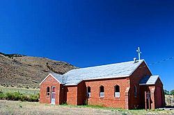
Saint Richard Catholic Church in Adel
|
|
| Country | United States |
| State | Oregon |
| County | Lake |
| Elevation | 4,547 ft (1,386 m) |
| Time zone | UTC-8 (Pacific) |
| • Summer (DST) | UTC-7 (Pacific) |
| Zip Code |
97620
|
| Elevation from the Geographic Names Information System | |
Adel is a small, unincorporated community in southeastern Lake County, Oregon. This means it's a settlement without its own local government. It's located in a dry area with few people.
Adel is found along Oregon Route 140, about 30 miles (48 km) east of Lakeview. The area around Adel, called the Warner Valley, has many wet marshlands and shallow lakes. Most of these lakes dry up at different times of the year.
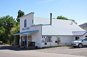
For thousands of years, Native Americans visited this valley. Later, in the late 1800s, it became a place for raising sheep and cattle. Today, Adel has a store that also serves as a restaurant and bar. It also has a post office (with Zip Code 97620), an elementary school, and a church.
Nearby, some ranches have hot springs and other interesting geological features. These areas might be used to create geothermal power stations in the future. This type of power uses heat from inside the Earth to make electricity.
Contents
History of Adel
People have lived in the Warner Valley for over 10,000 years. We know this from things left behind by Native Americans. These include petroglyphs (rock carvings), hunting blinds (hiding spots for hunting), and tools made from obsidian (a type of volcanic glass).
By the time European settlers arrived, the Kidütökadö band of Northern Paiute people often used the valley. They also used the uplands of Hart Mountain, a large ridge to the east.
Early Settlers and Ranching
The community of Adel began in the late 1800s. It grew around sheep farming and small cattle ranches. Many Catholics from Ireland came here to work as shepherds. Their family names and churches are still an important part of the area's history.
A stagecoach line once connected early Adel to Fort Bidwell in northern California. This stagecoach offered rides three times a week. J. J. Monroe owned the first store in Adel.
Adel Post Office
The Adel post office opened in 1896. There are two stories about how it got its name. One story says it was named after a former girlfriend of the person who owned the land. Another story says it was named after a local cow named Leda, but with the letters spelled backward. Back then, mail service was only available three days a week.
Crump Lake and Geothermal Energy
Crump Lake is just north of Adel. It is named after Thomas Crump (1854–1939), who settled here in the 1890s. This lake is part of a chain of marshes and lakes that mostly dry up at times. Crump Lake covers about 8,500 acres (3,400 ha) and has a shoreline of about 70 miles (110 km).
In 1959, something amazing happened on the Crump family property. A company drilled a well, and two days later, a constant geyser of steam and hot water shot 150 feet (46 m) into the air! This was called the Crump Geyser. By the 1960s, rocks plugged the geyser, but it still let out steam.
Today, the Crump Geyser site is being looked at for its potential to create geothermal electricity. This means using the Earth's heat to make power. Oregon's first geothermal power plant opened in Klamath Falls in 2010. Others have opened near Vale in 2012 and Paisley in 2014.
Geography of Adel
Adel is located along Oregon Route 140 in south-central Oregon. It's about 30 miles (48 km) east of Lakeview. From Adel, the Plush–Adel Road goes north along the western side of Crump and Hart lakes in the Warner Valley. Twentymile Road goes south from Adel into northern California.
Deep Creek flows east from the Warner Mountains through Adel. It then goes into marshlands and Pelican Lake before reaching Crump Lake.
Adel is 4,547 feet (1,386 m) above sea level. To the northeast, the Hart Mountain ridge rises to 8,017 feet (2,444 m).
Hot Springs and Geothermal Activity
The area around Adel has some geological activity, including hot springs. There was also the Crump Geyser, which is now retired. In 2010, scientists explored the 7,200-acre (2,900 ha) Crump Geyser site. They found hot springs with temperatures up to 172 °F (78 °C). They also found shallow wells with temperatures up to 248 °F (120 °C). The main heat source deep underground was even hotter, reaching up to 302 °F (150 °C).
Climate in Adel
Adel has a steppe climate. This type of climate has big differences in temperature between seasons. Summers are warm to hot, and winters are cold, sometimes very cold.
On average, Adel gets about 9 inches (230 mm) of rain and snow each year. July is the warmest month, with an average high temperature of 88 °F (31 °C). December and January are the coldest months, with average low temperatures around 22 °F (−6 °C).
| Climate data for Adel, Oregon, 1981–2010 normals, extremes 1956–present | |||||||||||||
|---|---|---|---|---|---|---|---|---|---|---|---|---|---|
| Month | Jan | Feb | Mar | Apr | May | Jun | Jul | Aug | Sep | Oct | Nov | Dec | Year |
| Record high °F (°C) | 64 (18) |
71 (22) |
77 (25) |
89 (32) |
98 (37) |
108 (42) |
107 (42) |
104 (40) |
101 (38) |
93 (34) |
77 (25) |
67 (19) |
108 (42) |
| Mean maximum °F (°C) | 55.2 (12.9) |
58.7 (14.8) |
66.9 (19.4) |
74.7 (23.7) |
83.6 (28.7) |
90.2 (32.3) |
96.9 (36.1) |
97.6 (36.4) |
90.9 (32.7) |
80.6 (27.0) |
66.1 (18.9) |
53.6 (12.0) |
99.0 (37.2) |
| Mean daily maximum °F (°C) | 42.4 (5.8) |
45.8 (7.7) |
53.3 (11.8) |
60.7 (15.9) |
69.6 (20.9) |
77.5 (25.3) |
88.5 (31.4) |
88.5 (31.4) |
79.3 (26.3) |
66.3 (19.1) |
49.6 (9.8) |
41.2 (5.1) |
63.6 (17.5) |
| Daily mean °F (°C) | 32.1 (0.1) |
34.3 (1.3) |
40.7 (4.8) |
46.7 (8.2) |
54.4 (12.4) |
61.2 (16.2) |
70.5 (21.4) |
69.7 (20.9) |
60.8 (16.0) |
50.6 (10.3) |
37.8 (3.2) |
31.1 (−0.5) |
49.2 (9.5) |
| Mean daily minimum °F (°C) | 21.8 (−5.7) |
22.7 (−5.2) |
28.1 (−2.2) |
32.7 (0.4) |
39.1 (3.9) |
44.8 (7.1) |
52.4 (11.3) |
50.8 (10.4) |
42.2 (5.7) |
34.9 (1.6) |
26.0 (−3.3) |
21.0 (−6.1) |
34.7 (1.5) |
| Mean minimum °F (°C) | 6.4 (−14.2) |
8.9 (−12.8) |
15.8 (−9.0) |
23.0 (−5.0) |
29.4 (−1.4) |
36.1 (2.3) |
44.6 (7.0) |
43.8 (6.6) |
33.4 (0.8) |
21.6 (−5.8) |
12.1 (−11.1) |
5.4 (−14.8) |
0.1 (−17.7) |
| Record low °F (°C) | −12 (−24) |
−24 (−31) |
−4 (−20) |
13 (−11) |
18 (−8) |
29 (−2) |
34 (1) |
31 (−1) |
20 (−7) |
6 (−14) |
−7 (−22) |
−24 (−31) |
−24 (−31) |
| Average precipitation inches (mm) | 0.70 (18) |
0.95 (24) |
0.80 (20) |
0.97 (25) |
1.05 (27) |
0.65 (17) |
0.71 (18) |
0.27 (6.9) |
0.47 (12) |
0.80 (20) |
1.20 (30) |
1.25 (32) |
9.82 (249.9) |
| Average precipitation days (≥ 0.01 in) | 5.8 | 6.3 | 6.5 | 6.1 | 6.0 | 4.0 | 1.6 | 1.2 | 2.2 | 4.3 | 7.0 | 6.8 | 57.8 |
| Source 1: NOAA | |||||||||||||
| Source 2: National Weather Service (mean maxima/minima 1991–2020) | |||||||||||||
Education in Adel
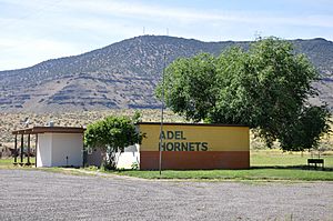
Adel School District 21 is one of five school districts in the Lake County Education Service District. Adel School teaches students in grades 4 through 8. It shares students with Plush School District 18, which teaches grades K through 3. Together, these two schools have about a dozen students.
For high school (grades 9-12), students from Adel usually attend Lakeview High School or Paisley School.
The community of Adel is not part of any community college district. However, Lake County has an agreement with Klamath Community College. This means students from Adel can attend Klamath Community College even though they are not in its direct district.
 | May Edward Chinn |
 | Rebecca Cole |
 | Alexa Canady |
 | Dorothy Lavinia Brown |


