Abert Rim facts for kids
Quick facts for kids Abert Rim |
|
|---|---|

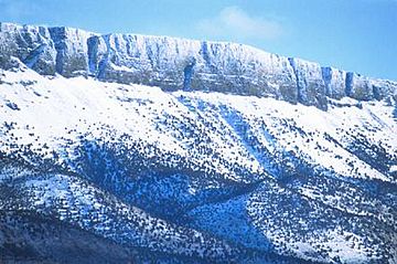
Abert Rim in the winter
|
|
| Highest point | |
| Elevation | 7,548 ft (2,301 m) |
| Prominence | 2,500 ft (760 m) |
| Geography | |
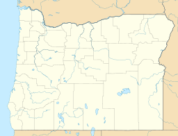
| Location | Lake County, Oregon, United States |
| Geology | |
| Mountain type | Fault-block escarpment |
Abert Rim is a huge cliff located in Lake County, Oregon. It is one of the tallest fault scarps in the United States. A fault scarp is a steep slope or cliff formed by a crack in the Earth's crust. This amazing cliff rises about 2,493 feet (760 meters) above the valley floor. Its top part is a sheer, 820-foot (250-meter) wall made of a dark rock called basalt.
Abert Rim stretches for more than 30 miles (48 kilometers). It goes from Lakeview in the south all the way north to Alkali Lake. This makes it the longest exposed fault scarp in North America!
How Abert Rim Was Formed
Abert Rim was created a very long time ago, during a period called the Miocene epoch. This was about 23 to 5 million years ago. Back then, huge amounts of hot, melted rock called lava flowed across much of eastern Oregon. This lava cooled and hardened into basalt rock.
Later, the Earth's crust started to crack and move. This movement caused large blocks of land to tilt. Abert Rim is the western edge of one of these tilted blocks. Lake Abert sits on top of another one of these blocks. This tilting and cracking created the dramatic cliff we see today.
Animals and Nature
Abert Rim is home to many interesting animals. In 1975 and 1977, Bighorn sheep were brought here from nearby Hart Mountain. You can often spot these wild sheep from the Abert Rim viewpoint along Highway 395.
The area is also a great place for birds of prey, known as raptors. Birds like the Ferruginous hawk are common here. They soar high above the cliffs, looking for food.
Lake Abert
Next to Abert Rim is Lake Abert. The Chewaucan River flows into Lake Abert from the south. However, the lake has no outlet, meaning no rivers flow out of it. Because of this, the water level in Lake Abert changes a lot. It depends on how much rain falls. About 140 years ago, the lake almost completely dried up! Lake Abert is one of the special lakes found in the Great Basin region.
History and Naming
The first time Abert Rim and Lake Abert were mapped was on December 20, 1843. This was done by an explorer named John C. Frémont. He named the cliff and the lake after his commanding officer, Colonel John James Abert.
Fun Activities
The southern part of Abert Rim is a very popular place for exciting air sports. People love to go paragliding and hang gliding here. This is because the warm air from the valley rises up against the cliffs. This creates strong air currents called thermals. Thermals are like invisible elevators that help gliders stay in the air.
This area used to be known as the hang gliding capital of the West. Even though paragliding is more popular now, it's still a fantastic spot for both sports. National free flight festivals are held here every year in late June and around the Fourth of July.
 | James Van Der Zee |
 | Alma Thomas |
 | Ellis Wilson |
 | Margaret Taylor-Burroughs |


