Jackson County, Oregon facts for kids
Quick facts for kids
Jackson County
|
||
|---|---|---|
|
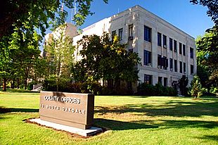
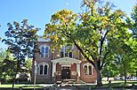
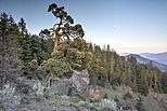
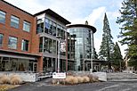
From clockwise: Jackson County Courthouse and Office Building, Medford Mormon Temple, Southern Oregon University's Hannon Library, Cascade–Siskiyou National Monument, Old Jackson County Courthouse
Jackson County Headquarters in Medford
|
||
|
||
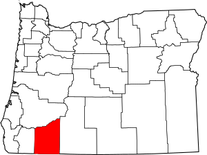
Location within the U.S. state of Oregon
|
||
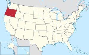 Oregon's location within the U.S. |
||
| Country | ||
| State | ||
| Founded | January 12, 1852 | |
| Named for | Andrew Jackson | |
| Seat | Medford | |
| Largest city | Medford | |
| Area | ||
| • Total | 2,802 sq mi (7,260 km2) | |
| • Land | 2,784 sq mi (7,210 km2) | |
| • Water | 18 sq mi (50 km2) 1%% | |
| Population
(2020)
|
||
| • Total | 223,259 | |
| • Estimate
(2021)
|
223,734 |
|
| • Density | 80/sq mi (30/km2) | |
| Time zone | UTC−8 (Pacific) | |
| • Summer (DST) | UTC−7 (PDT) | |
| Congressional district | 2nd | |
Jackson County is one of the 36 counties in the U.S. state of Oregon. In 2020, about 223,259 people lived there. The main city and county seat is Medford. The county is named after Andrew Jackson, who was the seventh president of the United States.
Jackson County is part of the Medford, Oregon, Metropolitan Statistical Area. This means it's a region with a large city and nearby areas that are closely connected.
There are 11 cities and 34 smaller communities in Jackson County. Medford is the largest city and has been the county seat since 1927.
Contents
History of Jackson County
Native American tribes like the Modoc, Shasta, Takelma, Latgawa, and Umpqua lived in the area that is now Jackson County for a very long time. In the early 1850s, other tribes like the Klickitats also moved into the region.
County Formation and Early Settlers
Jackson County was officially created on January 12, 1852. It was formed from parts of Lane County and other areas to the south. At first, it was much larger than it is today, including land that is now in several other counties.
In 1852, gold was discovered near Jacksonville. This brought many new settlers to the area. A new road also connected the county to California and other parts of Oregon, making it easier for people to arrive.
Conflicts and Relocation
The arrival of many new settlers led to conflicts with the Native American tribes who already lived there. These conflicts turned into a war in 1853, which lasted for several years. By 1856 and 1857, many Native American groups were forced to move to special reservations, like the Grand Ronde Indian Reservation and the Siletz Reservation.
Changes in County Seat
Jacksonville was the first county seat, starting in 1853. However, the gold mining there began to slow down. Also, a new railroad was built in the 1880s, but it bypassed Jacksonville. Instead, the railroad went through Medford, which was about five miles away.
Because of the railroad, Medford grew and became a busy center for trade. Jacksonville, on the other hand, started to decline. People suggested moving the county seat to Medford for many years. Finally, in 1927, Medford officially became the county seat.
Modern Community Efforts
In 2004, Jackson County started a program to help homeowners protect their houses from wildfires. This plan encouraged people to create a clear space around their homes to stop fires from spreading. By 2007, this plan became required for many landowners.
In 2007, the county's 15 public libraries had to close because of a lack of money. This was a very big library closure for the United States. However, the libraries were able to reopen later that year, though with fewer hours.
Geography
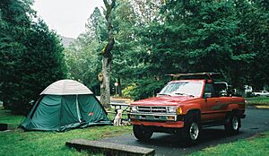
Jackson County covers about 2,802 square miles. Most of this area, about 2,784 square miles, is land. The rest, about 18 square miles, is water. A part of the Umpqua National Forest is located within Jackson County.
Bear Creek Watershed
Bear Creek flows entirely within Jackson County. A watershed is an area of land where all the water drains into a single river or stream. Many of the county's main cities, like Medford, Ashland, Phoenix, Talent, and Central Point, are located along Bear Creek. The creek eventually joins the Rogue River near the unique Upper and Lower Table Rock lava formations.
Neighboring Counties
Jackson County shares borders with several other counties:
- Josephine County (to the west)
- Klamath County (to the east)
- Douglas County (to the north)
- Siskiyou County, California (to the south, in California)
Protected Natural Areas
Several important natural areas are found partly or entirely in Jackson County:
- Cascade–Siskiyou National Monument
- Crater Lake National Park (part of it)
- Klamath National Forest (part of it)
- Rogue River-Siskiyou National Forest (part of it)
- Umpqua National Forest (part of it)
Population Information
| Historical population | |||
|---|---|---|---|
| Census | Pop. | %± | |
| 1860 | 3,736 | — | |
| 1870 | 4,778 | 27.9% | |
| 1880 | 8,154 | 70.7% | |
| 1890 | 11,455 | 40.5% | |
| 1900 | 13,698 | 19.6% | |
| 1910 | 25,756 | 88.0% | |
| 1920 | 20,405 | −20.8% | |
| 1930 | 32,918 | 61.3% | |
| 1940 | 36,213 | 10.0% | |
| 1950 | 58,510 | 61.6% | |
| 1960 | 73,962 | 26.4% | |
| 1970 | 94,533 | 27.8% | |
| 1980 | 132,456 | 40.1% | |
| 1990 | 146,389 | 10.5% | |
| 2000 | 181,269 | 23.8% | |
| 2010 | 203,206 | 12.1% | |
| 2020 | 223,259 | 9.9% | |
| 2021 (est.) | 223,734 | 10.1% | |
| U.S. Decennial Census 1790-1960 1900-1990 1990-2000 2010-2020 |
|||
2010 Census Snapshot
In 2010, there were 203,206 people living in Jackson County. About 88.7% of the people were white. Other groups included Asian, American Indian, and Black or African American people. About 10.7% of the population identified as Hispanic or Latino.
The average age of people in the county was about 42 years old. The average income for a household was around $44,142 per year.
Fun Places to Visit
Bear Creek Greenway
The Bear Creek Greenway is a special area along both sides of Bear Creek. It stretches from Ashland to Central Point. The most popular part is a paved path that cyclists and skaters love to use, especially when the weather is warm. This path will eventually be 21 miles long, connecting Ashland and Central Point.
Oregon Vortex
Jackson County is also home to the Oregon Vortex, a unique roadside attraction in Gold Hill. It's known as a "gravity hill." At the Vortex, you can see demonstrations of things that seem to defy gravity, like balls rolling uphill. Many people believe these are actually optical illusions, where your eyes play tricks on you.
Communities
Cities
Census-Designated Places
These are areas that are like towns but are not officially incorporated as cities.
Unincorporated Communities
These are smaller communities that do not have their own local government.
Former Communities
These communities no longer exist or are no longer recognized.
Economy
The main ways people make a living in Jackson County are through healthcare, agriculture, lumber, manufacturing, and tourism.
Jackson County has over 10,000 acres of orchards, where fruits are grown. It also shares the Rogue Valley and Applegate areas, which are known for their wine production.
A soft mineral called Soapstone is also mined in Jackson County. It is often used by artists for sculptures.
In 2021, the Jackson County Board of Commissioners noted that the county faced challenges related to certain types of agriculture.
See also
 In Spanish: Condado de Jackson (Oregón) para niños
 | Frances Mary Albrier |
 | Whitney Young |
 | Muhammad Ali |


