
White City, Oregon facts for kids
Quick facts for kids
White City, Oregon
|
|
|---|---|

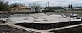
Josephson Skate Park in White City
|
|

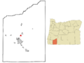
Location of White City, Oregon
|
|
| Country | United States |
| State | Oregon |
| County | Jackson |
| Area | |
| • Total | 1.86 sq mi (4.83 km2) |
| • Land | 1.86 sq mi (4.83 km2) |
| • Water | 0.00 sq mi (0.00 km2) |
| Elevation | 1,312 ft (400 m) |
| Population
(2020)
|
|
| • Total | 9,090 |
| • Density | 4,873.99/sq mi (1,881.60/km2) |
| Time zone | UTC-8 (Pacific (PST)) |
| • Summer (DST) | UTC-7 (PDT) |
| ZIP code |
97503
|
| Area code(s) | 541 |
| FIPS code | 41-81450 |
| GNIS feature ID | 1128971 |
White City is a community in Jackson County, Oregon, United States. It is called an "unincorporated community" and a "census-designated place" (CDP). This means it is a populated area that is not part of an official city, but the government still collects information about the people living there.
In 2020, about 9,090 people lived in White City. It is located about 9 miles (14 kilometers) north of Medford. It is also about 4 miles (6 kilometers) south of Eagle Point.
Contents
History of White City
White City has an interesting past connected to World War II. The area was once home to a large military base called Camp White.
What was Camp White?
Camp White was a major training center for the United States Army. It was built in 1942, right after the attack on Pearl Harbor. The camp was named after George A. White, a general from Oregon.
Thousands of soldiers trained here before going to fight in the war. It was a very busy place with many buildings and activities. After the war ended in 1946, the camp was closed down.
From Camp to Community
After the military left, the land and buildings of Camp White were used for other purposes. Some parts became industrial areas. Other parts were developed into homes and businesses. This is how the community of White City began to grow.
Geography and Climate
White City is located in southern Oregon. It covers an area of about 1.86 square miles (4.8 square kilometers). All of this area is land.
What is the climate like?
White City has a warm-summer Mediterranean climate. This means it has warm, dry summers. The average monthly temperatures in summer are not extremely hot. Winters are generally mild and wet. This type of climate is often found in places like California or parts of Europe.
Who Lives in White City?
The number of people living in White City has grown over the years.
| Historical population | |||
|---|---|---|---|
| Census | Pop. | %± | |
| 1980 | 5,445 | — | |
| 1990 | 5,891 | 8.2% | |
| 2000 | 5,466 | −7.2% | |
| 2010 | 7,975 | 45.9% | |
| 2020 | 9,090 | 14.0% | |
| Sources: | |||
Population and Families
In 2010, there were 7,975 people living in White City. These people lived in 2,431 households. A household can be a family or people living alone. About 1,865 of these households were families.
Many households (42.5%) had children under 18 living with them. About 53.2% of households were married couples.
Age of Residents
The median age in White City in 2010 was 31.6 years. This means half the people were younger than 31.6, and half were older.
- Almost 30% of residents were under 18 years old.
- About 9.4% were between 18 and 24 years old.
- Most residents, about 28.5%, were between 25 and 44 years old.
- About 8.5% of the population was 65 years or older.
Income and Cost of Living
In the years 2012-2016, the average yearly income for a household in White City was about $44,940. For families, it was about $48,503.
The cost of living in White City is generally lower than the average for the United States. In 2009, the cost of living index was 90.1, compared to the U.S. average of 100. This means things like housing and groceries might be less expensive here.
Parks and Recreation
White City is close to several natural areas and parks. These places offer opportunities for outdoor activities.
- The Oregon Department of Fish and Wildlife manages the Denman Wildlife Area. This area is split into parts north and south of White City. It is a great place for wildlife viewing.
- The TouVelle State Recreation Site is a park located along the Rogue River. It is a popular spot for fishing, picnicking, and enjoying the river.
- The Nature Conservancy protects the Agate Desert Preserve. This preserve is on the west side of White City. It helps protect unique plants and animals found in the area.
Transportation
Getting around White City and to nearby towns is quite easy.
- White City is located where two main roads meet: Oregon Route 62 and Oregon Route 140.
- Local bus service is provided by RVTD Route 60, which connects White City to Medford.
- For longer trips, the Southwest POINT bus service connects White City to other cities in Southern Oregon.
- Freight trains also serve the White City Industrial Park. This helps businesses move goods in and out of the area.
Important Facilities
White City is home to a major hospital for veterans.
- The main United States Department of Veterans Affairs hospital for southern Oregon is located here. This hospital provides medical care to military veterans.
Images for kids
-
Josephson Skate Park in White City
-
Location of White City, Oregon
See also
 In Spanish: White City (Oregón) para niños
