Lane County, Oregon facts for kids
Quick facts for kids
Lane County
|
|
|---|---|
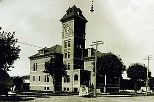
Lane County Courthouse in Eugene, built in 1898 and demolished in 1959
|
|
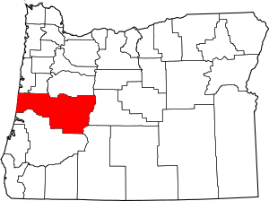
Location within the U.S. state of Oregon
|
|
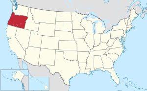 Oregon's location within the U.S. |
|
| Country | |
| State | |
| Founded | January 29, 1851 |
| Named for | Joseph Lane |
| Seat | Eugene |
| Largest city | Eugene |
| Area | |
| • Total | 4,722 sq mi (12,230 km2) |
| • Land | 4,553 sq mi (11,790 km2) |
| • Water | 169 sq mi (440 km2) 3.6%% |
| Population
(2020)
|
|
| • Total | 382,971 |
| • Estimate
(2023)
|
381,181 |
| • Density | 81.104/sq mi (31.314/km2) |
| Time zone | UTC−8 (Pacific) |
| • Summer (DST) | UTC−7 (PDT) |
| Congressional district | 4th |
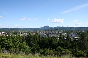
Lane County is one of the 36 counties in the U.S. state of Oregon. It is the fourth-most populated county in Oregon. In 2020, about 382,971 people lived here. The main city, or county seat, is Eugene. Eugene is also the second-largest city in Oregon.
Lane County is named after Joseph Lane. He was Oregon's first governor when it was a territory. The county is part of the Eugene Metropolitan Statistical Area. This is the third-largest city area in Oregon.
Contents
History of Lane County
Lane County was created on January 29, 1851. It was formed from parts of Linn County and Benton County. It was named after Joseph Lane, who was the first governor of the Oregon Territory.
When it was first made, Lane County was much bigger. It stretched from the Cascade Mountains to the California border. In 1853, people voted for the county seat. The "Mulligan donation" and "Skinner claim" areas won. These areas became the new county seat, which is now Eugene.
Early Settlers and Explorers
In 1846, Elijah Bristow and his wife, Susannah, were the first white settlers in what is now Lane County. They built a cabin near Pleasant Hill. They had traveled from California with other explorers. When Bristow saw the beautiful valley, he said, "What a pleasant hill! Here is my home!"
In 1852, John Diamond and William Macy led a group to find a shortcut for the Oregon Trail. This shortcut went over the Willamette Pass and was called the Free Emigrant Road. About 250 wagons with over 1,000 people used this new route. It was called the Elliott Cutoff.
When these travelers ran out of supplies, people in the Willamette Valley launched a big rescue effort. These new settlers greatly increased Lane County's population in 1853.
Changing Borders
Lane County's size has changed many times. In 1853, it gained land from Umpqua County, which gave it access to the Pacific Ocean. But in 1854, it lost all its land east of the Cascade Mountains to Wasco County.
There were also small changes to its borders with Douglas County, Linn County, and Benton County over the years.
Geography of Lane County
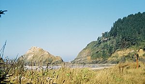
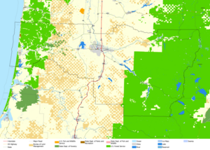
Lane County covers about 4,722 square miles. About 4,553 square miles are land, and 169 square miles are water. This means 3.6% of the county is water. Lane County is special because it stretches all the way from the Pacific Ocean to the Cascade Range. Douglas County is the only other Oregon county that does this.
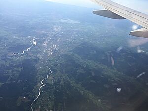
Parts of the Umpqua National Forest, Willamette, McKenzie, and Siuslaw rivers are in Lane County.
Neighboring Counties
Lane County shares borders with these other counties:
- Lincoln County (to the northwest)
- Benton County (to the north)
- Linn County (to the northeast)
- Deschutes County (to the east)
- Klamath County (to the southeast)
- Douglas County (to the south)
Protected Natural Areas
Several national protected areas are partly located in Lane County:
- Oregon Islands National Wildlife Refuge
- Siuslaw National Forest
- Umpqua National Forest
- Willamette National Forest
Population and People
| Historical population | |||
|---|---|---|---|
| Census | Pop. | %± | |
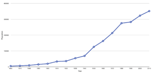
| 1860 | 4,780 | — | |
| 1870 | 6,426 | 34.4% | |
| 1880 | 9,411 | 46.5% | |
| 1890 | 15,198 | 61.5% | |
| 1900 | 19,604 | 29.0% | |
| 1910 | 33,783 | 72.3% | |
| 1920 | 36,166 | 7.1% | |
| 1930 | 54,493 | 50.7% | |
| 1940 | 69,096 | 26.8% | |
| 1950 | 125,776 | 82.0% | |
| 1960 | 162,890 | 29.5% | |
| 1970 | 213,358 | 31.0% | |
| 1980 | 275,226 | 29.0% | |
| 1990 | 282,912 | 2.8% | |
| 2000 | 322,959 | 14.2% | |
| 2010 | 351,715 | 8.9% | |
| 2020 | 382,971 | 8.9% | |
| 2023 (est.) | 381,181 | 8.4% | |
| U.S. Decennial Census 1790–1960 1900–1990 1990–2000 2010–2020 |
|||
2010 Population Data
In 2010, Lane County had 351,715 people. There were about 145,966 households. The population density was about 77 people per square mile.
Most people in the county were white (88.3%). Other groups included Asian (2.4%), American Indian (1.2%), and Black (1.0%). About 7.4% of the population was of Hispanic or Latino background. Many people had German, English, or Irish family roots.
About 26% of households had children under 18. The average household had 2.35 people. The average age in the county was 39 years old.
The average income for a household in 2010 was $42,923. For families, it was $55,817. About 16.7% of the population lived below the poverty line. This included 17.1% of those under 18.
Lane County is the fourth most populated county in Oregon. Its population grew slower than the three larger counties: Multnomah, Washington, and Clackamas.
2020 Population Data
In 2020, the population was 382,971. The racial and ethnic makeup was mostly non-Hispanic White (77.9%). Other groups included African American (1.1%), Native American (0.9%), and Asian (2.5%). About 6.9% of people were of mixed race. About 9.9% of the population was Hispanic.
Economy of Lane County
Lane County has a strong economy. In 2022, it had the fifth-largest economy among Oregon's counties. Its total economic output was $17.55 billion.
Tourism is very important to the local economy. In 2023, visitors spent $1.1 billion directly. Total travel spending reached a record $1.4 billion.
PeaceHealth Medical Group is the biggest private employer in Lane County. Other large employers include the University of Oregon, the Eugene 4J School District, and the U.S. Government.
Experts believe that in the future, the economy will shift. It will move away from timber and farming. Instead, it will focus more on services, making transportation equipment, printing, publishing, and high technology.
Communities in Lane County
Cities in Lane County
- Coburg
- Cottage Grove
- Creswell
- Dunes City
- Eugene (the county seat)
- Florence
- Junction City
- Lowell
- Oakridge
- Springfield
- Veneta
- Westfir
Census-Designated Places
These are areas that are like towns but are not officially incorporated as cities.
Other Communities
Many other smaller communities are in Lane County:
- Ada
- Alpha
- Alvadore
- Austa
- Belknap Springs
- Blachly
- Blue River
- Camp Creek
- Canary
- Cedar Flat
- Cloverdale
- Crow
- Culp Creek
- Cushman
- Deadwood
- Deerhorn
- Disston
- Dorena
- Finn Rock
- Glenada
- Glenwood
- Goldson
- Goshen
- Greenleaf
- Heceta
- Horton
- Indiola
- Inlow
- Lancaster
- Latham
- Leaburg
- Linslaw
- London Springs
- Lorane
- Low Pass
- Mabel
- Malabon
- McKenzie Bridge
- Minerva
- Mohawk
- Nimrod
- North Beach
- Noti
- Pleasant Hill
- Rainbow
- Riverview
- Saginaw
- Santa Clara
- Searose Beach
- Siltcoos
- Swisshome
- Tide
- Tiernan
- Triangle Lake
- Unity
- Vaughn
- Vida
- Walden
- Walker
- Walterville
- Walton
- Wendling
- Westlake
- Wildwood
Past Communities
Some communities that used to exist in Lane County are now part of other places or no longer populated:
- Alma
- Bethel, now part of Eugene
- Black Butte
- Bohemia City
- Divide
- Irving, now part of Eugene
- Luper
- McCredie Springs
- Natron
- Thurston, now part of Springfield
Education in Lane County
Lane County has many school districts that serve its communities:
- Alsea School District 7J
- Bethel School District 52
- Blachly School District 090
- Creswell School District 40
- Crow-Applegate-Lorane Sd 66
- Eugene School District 4J
- Fern Ridge School District 28J
- Harrisburg School District 7J
- Junction City School District 69
- Lincoln County School District
- Lowell School District 71
- Mapleton School District 32
- Marcola School District 79J
- McKenzie School District 68
- Monroe School District 1J
- Oakridge School District 76
- Pleasant Hill School District 1
- Siuslaw School District 97J
- South Lane School District 45J
- Springfield School District 19
See also
 In Spanish: Condado de Lane (Oregón) para niños
 | Victor J. Glover |
 | Yvonne Cagle |
 | Jeanette Epps |
 | Bernard A. Harris Jr. |


